|
Starling Gap was a little on the cold side this morning.
|
There is some good walking up around Warburton and a lot of it seems to slip under the radar a little bit. I’m not exactly sure why things are a little low key up here as the Mountain Ash forest with it’s ferny understory is generally fairly pretty country. Maybe the issue might be that most of the walking up here falls beyond the embrace of a National Park, and it’s true that occasionally the walker might come across the jarring sight of a logging coupe. For the most part though the walking is away from the logging operations and the historic old loggers tramways now make for very pleasant walking in a lot of cases.
 |
I started off following a section of the two day Walk into History.
|
The walk I did today utilised long sections of old tramway, a fair distance also following the promoted route of the Walk into History - I walk that I’ve written up before on my blog. Arriving at my setting off point at Starling Gap early this morning I was greeted….by reasonably heavy snow! Now this wasn’t totally unexpected, snow was forecast down to 400 metres today and Starling Gap sits at just under 800 metres. Having walked this track before and also having written up the Walk into History in the past I was kind of hoping for something a little different today, and it appeared that part of the plan had worked out for a change!
 |
Needless to say I barely broke the DSLR out from its dry bag today so the photos might have suffered a little.
|
After pulling on all my wet weather gear in the small picnic shelter I grabbed my pack and set off along the old tramway towards Ada No.2 Mill site. Now if anyone is expecting great photos today then your reading the wrong blog, all the photos on this walk were taken with my waterproof camera. It was just a matter of pointing the camera, wiping as much water and snow off the lens as possible and then shooting…there wasn’t much framing or thought going on this morning. While the photography was challenging the walking was relatively easy, the old tramway making for fairly quick and easy progress as I headed further east along the Ada River Valley in worsening weather conditions.
 |
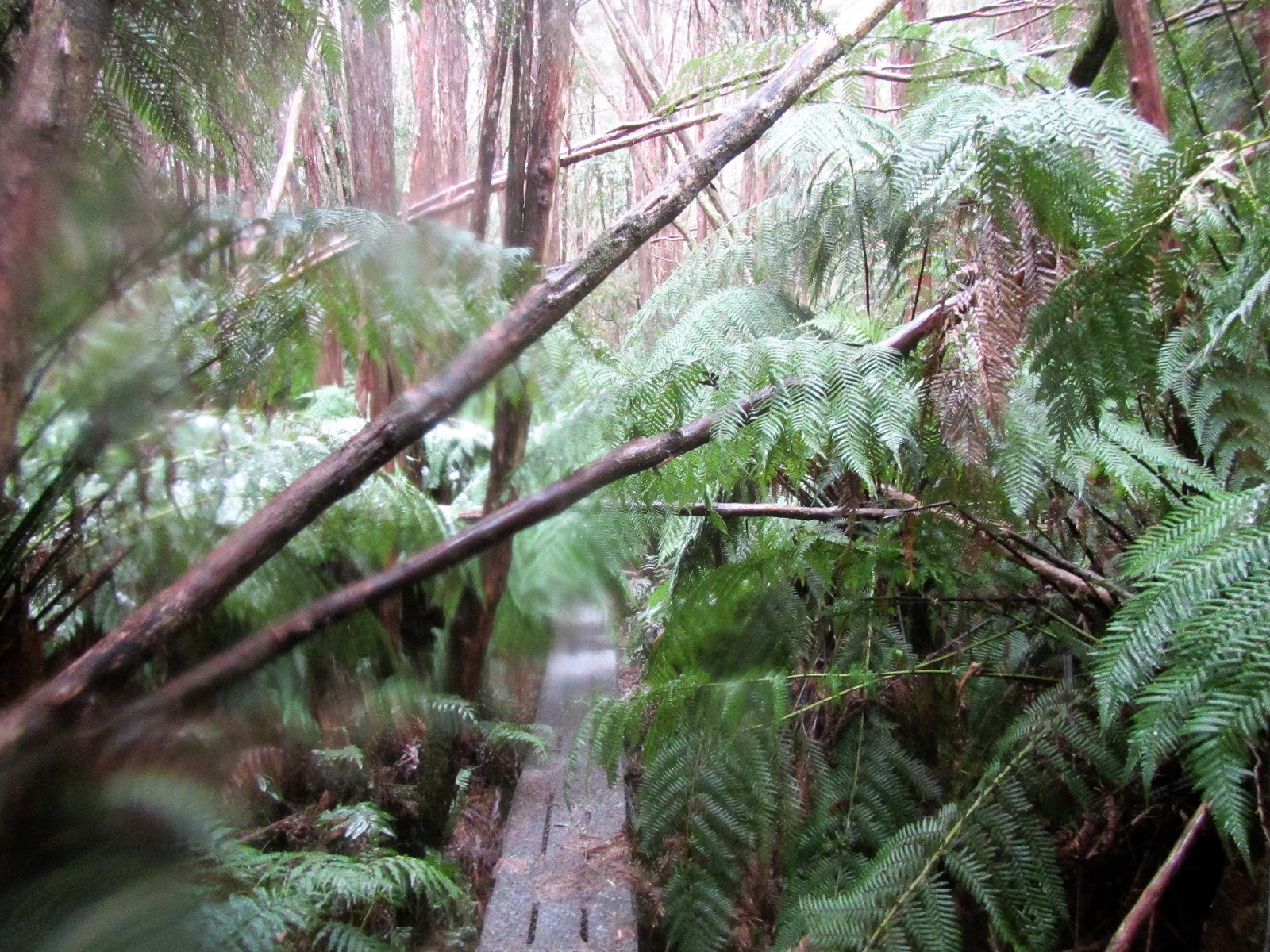
The snow laden vegetation was hanging over the track giving me a cold snow shower every time I pushed through.
 |
The old tramway is fairly obvious, especially where it goes through the old cuttings.
|
|
If you look closely on this old tramway you can see plenty of reminders of it’s history, there’s the cuttings, the occasional left over steel tramline and across some of the deeper gullies there is evidence of old trestle bridges slowly rotting away. With plenty of snow falling I was pushing my way through the large ferns that were now drooping down over the track laden with snow, although those same ferns also gave me shelter from the snow if I stood underneath them, so they weren’t all bad. I was now heading towards the lowest spot on my walk down at the Ada River near Ada No.2 Mill site and the snow was getting a little bit sleety, so when I arrived at the old mill site I didn’t linger too long. Walking in the snow is one thing but walking in freezing cold rain is another thing altogether in my opinion.
 |
The snow was getting heavier the further I walked.
 |
This track runs through a small protected corridor in the State Forest.
 |
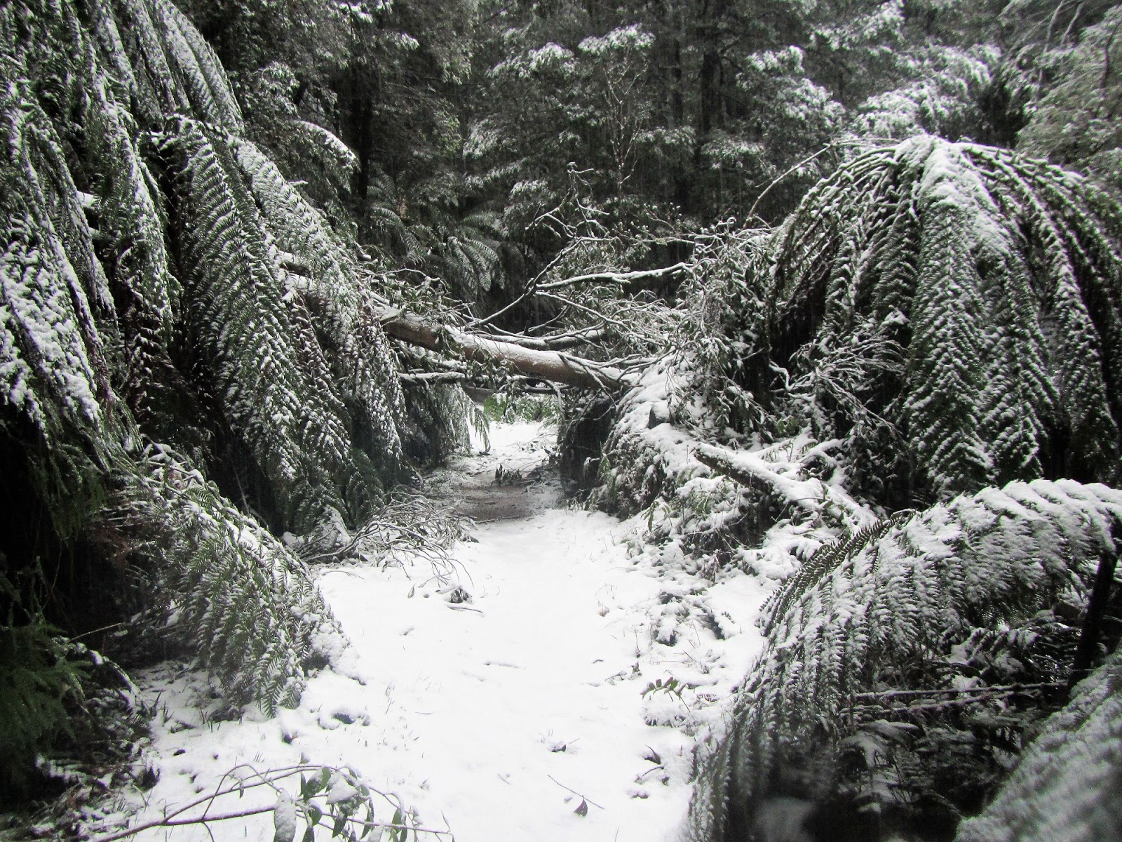
Ah yes, my personal favourite - fallen trees!
 |
It's definitely a pretty scene when under snow.
 |
One slightly dishevelled Feral Walker.
 |
Dropping into the gullies the snow thinned out a bit.
|
|
|
|
|
|
While it might of been a bit cold and wet the old Ada No.2 Mill site and the nearby Ada River are definitely worth detouring down to though, there is quite of bit of rusting machinery slowly being reclaimed by the bush around the camping area here. The remains of the old trestle bridge spanning the Ada River is also worth dropping down to check out, I’m thinking that this is an old pigsty type of trestle bridge although that is another Feral fact! The tannin stained tea coloured water of the Ada River was flowing a banka on this visit as well, which was unsurprising I suppose considering the weather!
 |
 |
There is a lot of old relics left over from logging times scattered about.
 |
Getting closer to Ada No.2 Mill site there are a few lengths of old railway line still on the ground.
 |
This old boiler at Ada No.2 Mill site is a bit of a feature.
 |
Ada No. 2 Mill Site.
 |
Ada No.2 Mill Site was the lowest point on today's stroll, the snow was barely settling at the camping ground.
 |
The remains of the old trestle bridge over the Ada River.
 |
| Things were a bit wild down near the Ada River. |
|
|
|
|
|
|
|
After my short detour down to the Ada River I climbed back up and started heading towards the New Ada Mill site. The weather had now deteriorated into what was almost blizzard like conditions and arriving at an old steam powered winch that was used for dropping logs into the Ada River valley I struggled to get a photo with the amount of snow coming down. The old winch and boiler make for an interesting spot, I was particularly interested to see the old wooden brake linings still on the winch. Leaving the old winch I continue climbing, thunder now reverberating through the mountains around me.
 |
Climbing away from the river I was soon back in the snow.
 |
I need to work out a plan for keeping the lens dry in these types of conditions.
 |
I'm guessing this old winch was used to winch logs down to the Ada River.
 |
The winch still has the wooden brake shoes in place.
 |
| The old boiler that powered the winch - I was in a full on snow storm now complete with thunder reverberating through the hills. |
|
|
|
|
Now I’d like to wax lyrical about New Ada Mill site but to be honest by the time I got there I was really just concentrating on getting back to the ute, the snow was now getting fairly deep on the ground as I headed for the highest point on my stroll at the spot I met Big Creek Road. The last section of the walk before emerging onto Big Creek Road was along an old logging road, now normally walking these old tracks can be a little ho hum but with the whole scene transformed into a winter wonderland by the fresh snow things were pretty good this morning. Although by the time I arrived at Big Creek Road the snow was mid shin deep so it wasn’t exactly easy walking.
 |
Heading towards New Ada Mill.
 |
New Ada Mill is around here somewhere - but I did't actually find it today.
 |
Finding this old road I followed it out onto Big Creek Road.
 |
Conditions were getting a little extreme now.
 |
| My footprints in the fresh snow, I love this type of walking! |
|
|
|
|
Arriving at Big Creek Road signalled the start of my fairly long descent back down to the ute at Starling Gap. Judging by the tracks in the snow there had been a couple of 4wd’s up here this morning, although it looked like they were slipping and sliding a fair bit. The 4wd tracks made my walk back down to the ute a little easier though as I was able to walk in their tyre tracks for the most part. The weather conditions were still pretty ordinary and walking down the road meant that I was a little more exposed now. Thankfully though it was only around an hour after meeting the road when I rounded a corner and spied the ute below me in Starling Gap, the sleet that I’d copped back near Ada No.2 Mill had got me a little wet and by now I was starting to get a little chilly.
 |
There are some massive old stumps up here, the old trees must of been huge.
 |
Meeting up with Big Creek Road meant that I'd topped out on my walk.
 |
There had been a couple of 4wd's along Big Creek Road - although t hadn't been easy by the look of it!
 |
| Big Creek Road. |
|
|
|
The Dirt.
According to my GPS I walked 17.8 kilometres and climbed around 355 metres on this Medium - Hard grade stroll. Now snow isn’t really a common occurrence up here but when it does get a good dump it transforms the scenery into a winter wonderland I think. Most of the tracks that I followed today are well signposted and clear, although the track from the New Ada Mill site to Big Creek Road wasn’t signposted - but then again any markers were probably well and truly covered with snow by the stage. I used a set of really old notes out of the second edition of Glenn Tempest’s Daywalks Around Melbourne book, as far as I know there are no more recently published notes for this walk.
Relevant Posts.
Big Pats Creek to Ada No.2 Mill, Walk into History, Yarra State Forest, 2017.
Ada No.2 Mill to Powelltown, Walk into History, Yarra State Park, 2017.
Reids Tramline Walk, Yarra State Forest, 2015.
 |
| Big Creek Road approaching Starling Gap. |
 |
| Starling Gap |
 |
| A fair bit of snow had obviously fallen since I'd set off earlier that morning. |
 |
| Heading back down to Warburton, conditions in the surrounding hills were still fairly inclement. |