Sunday, November 27, 2022

Bullock Gorge Walk, Idalia National Park - April 2022

Bullock Gorge Walk

After Sam and I had walked the nearby Wave Rock Track earlier in the morning we jumped back into the ute and bumped our way further into Idalia National Park to check out the Bullock Gorge Walk. Arriving at the carpark I expected to be dropping into a gorge almost as soon as I started walking, however after leaving the ute I found myself walking an almost level plateau on the Gowan Range. After walking the 'neck' of the plateau I arrived at a point where the track split and I jigged left - mainly due to the still fairly low sun in the east.

The track into Bullock Gorge featured a couple of fairly rocky sections - a soft roader would get through, however you'd be more comfortable in a high clearance 4wd I think (well, I would be anyway).

Finding a spot in the car park wasn't an issue today.

While I was starting to realise that there would be no gorge along this stroll (the gorge bit must refer to the country off either side of the plateau?) I was more than happy with the views that I was getting. The walk basically now traverses around the 'head' of the plateau, the track mostly kept fairly close to the cliff edges. The sparse open forest here didn't really present any difficulties if I wanted to reach the edge of the escarpment to check out the views or take another photo. The day was getting fairly warm by now so I was happy that I was able to get a little shelter from the trees and also a bit of a breeze across the plateau, looking down towards the plains disappearing into the distance I knew it would be a lot hotter when we got down there later this afternoon.

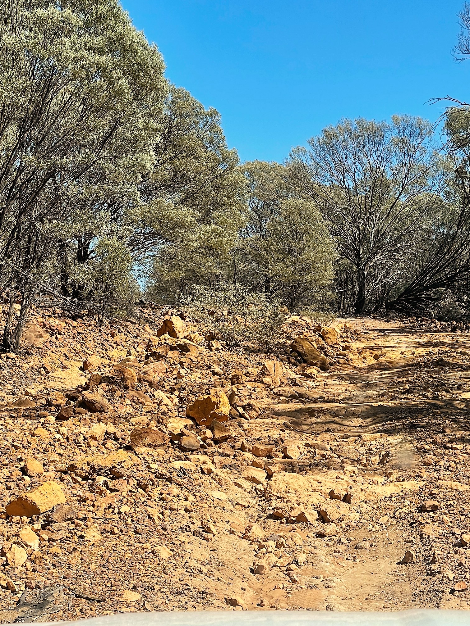
I had a short rocky section...

... before reaching the sandier woodland section. 

The views are a constant on this walk. 


Reaching the eastern edge of the plateau I wandered out onto a short ridge to get what was arguably the best views of the walk I thought as the country on both sides of me dropped away steeply. With Sam waiting at the ute I didn't linger too long here though, soon retracing my steps and then not much later re-joining my outward route again. Now retracing a walk isn't really a favourite, however I always find something new to look at and with the sun now in a slightly different position as well as the change of direction adding a different perspective. It was less than an hour since I'd left the ute when I arrived back this morning after what was another nice easy walk.

The track around the plateau was generally pretty obvious. 

Bullock Gorge Walk, Idalia National Park. 

Idalia National Park.

The Mulga gave me a bit of shade today. 

The Dirt.
According to my GPS I walked around 3.2 kilometres and climbed about 18 metres on this easy stroll. Apart from some very short sections of rocks this walk is all along a good surface which would make it doable for most people. I got information for this stroll from the QLD Parks and the Alltrails websites - although both offer only rudimentary information. This walk is a long way into the Idalia National Park and requires a long trip on rough dirt tracks - I'd recommend a high clearance 4wd here. I used my Alltrails Map along with my GPS topos on this stroll.

Relevant Posts.


Arguably the best view was a short detour to the east off the track.

The short and rough side trip was worth the effort I think. 

Sam's still sitting the shade. 


Thursday, November 24, 2022

Madja Boardwalk, Daintree National Park - May 2022

Oliver Creek empties into the substantial Noah Creek near the lookout at the halfway point of the stroll. It's croc central here so I was pretty happy to be up on the boardwalk and not down in the Mangroves.

Once we left Port Douglas on our FNQ road trip Sam and I headed up to Cooktown. Now we had some choices for our relocation, we could of headed inland through Mareeba and added 150 or so kilometres to our drive or we could head up the Bloomfield Track. Up until the day before we were due to leave Port Douglas the inland route was the only option as the Bloomfield Track was closed due to flooding, however with a few days of good weather the Bloomfield Track opened so we decided to take the shorter - but way more interesting route. What that meant was that instead of driving through the inland  tropical savannah country we headed up through Cape Tribulation and the Daintree National Park rainforest, which allowed us to stop and do a couple of short walks along the way. 

Crossing the Daintree River under grey skies.

We didn't see any crocs in the Daintree River this morning although they are definitely out there.

This walk starts right beside the Cape Tribulation Road.

The first little walk that we did was one called the Madja Boardwalk, this walk starts right beside the Cape Tribulation Road so we didn't have to deviate away from our journey north. We'd been in the tropics for a couple of weeks when we did this stroll so the humidity wasn't hitting us like a ton of bricks anymore, although jumping out of the ute we could still feel it. This walk heads into the rainforest for a couple of minutes before following Oliver Creek downstream through some extensive mangrove forests. As the name implies this walk was along a raised boardwalk which not only makes the walking very easy and comfortable, but also kept us well away from the Saltwater Crocodile habitat down in the mangroves.

Initially we followed Oliver Creek downstream...

... along the nice boardwalk.

The Daintree Rainforest.

There is so much biodiversity up in the Daintree National Park. 

I actually did a walk on this North Queensland trip where I had to walk through some long sections of Mangroves - I was pretty happy to be on the boardwalk and out of the mud on this stroll. 

Staghorn Fern - Daintree National Park.

After meandering along for around ten minutes we took a short side trip out to a lookout to the spot where Oliver Creek empties into the substantial Noah Creek, once again this looks like croc central so I was pretty happy to be three metres above water level on the boardwalk. Once we'd visited the lookout we re-joined circuit and started heading back towards the ute. Out walk back passing through yet more mangrove forest before the country again transitioned back to the typical rainforest flora of palms, pandanus and ferns. 

Noah Creek, Daintree National Park.

Madja Boardwalk, Daintree National Park.

Is everyone thinking the same thing - or is it just me?

Looks like this is another walk done wearing my Hiking Havaianas!

Mangroves on the Madja Walk - Daintree National Park.

The Dirt.
According to my GPS we walked around 1.2 kilometres and climbed 57 metres on this easy stroll. Obviously this isn't a hardcore bushwalk and if that's what you looking for then don't think about doing this walk - on the other hand if you don't have a lot time, you are not acclimatised to the humidity, or like me you don't mind an easy stroll every now and again then this walk is well worth doing. This walk would also be suitable for wheelchairs and prams I think. The highlight of this walk for me was obviously the Mangrove Forest, anytime I get to see mangroves up close I always seem to enjoy the experience. I used the notes and map out of the Woodslane book Best Walks around Cairns & the Tablelands along with my Alltrails App and my GPS today.

Relevant Posts.


Moving out of the Mangrove forest we re-entered the rainforest. 

Time to head off on our next little adventure. 


Sunday, November 20, 2022

Dubuji Boardwalk, Daintree National Park - May 2022

The Myall Beach Humpy.

This was the second walk that Sam and I did up at Cape Tribulation on our drive up to Cooktown. Once again we chose a nice easy stroll along what was mostly boardwalk. This walk starts at the signposted carpark and picnic area for Myall Beach near Cape Tribulation. Instead of heading off south along the boardwalk today, Sam and I first headed out to the wide open spaces of Myall Beach to check things out. Myall Beach is bordered on its northern end by a lush green headland - Cape Tribulation. This spot is a real bucket list place for a lot of people, especially ageing hippies like me and it still feels like there would be numerous people living off the grid in the dense rainforest around here.

We swung left towards Myall Beach beside the solar powered dunny. 

There were some nice sized old Paperbarks along here.

After passing through some Mangroves...

... we soon arrived at Myall Beach. 

Once again swimming wasn't on the agenda. 

That's Cape Tribulation. 

Looking south along the wide expanses of Myall Beach in the Daintree National Park. 

Myall Beach - Daintree National Park.

Checking out the water at Myall Beach - Daintree National Park. 

After enjoying the beach for awhile we headed back into the rainforest and after crossing a small tidal creek we swung south along what ended up being a very long section of boardwalk. Initially the boardwalk stayed very close to the mangrove lined creek as it meandered its way easily south. Like the nearby Marrja Boardwalk the Dubuji Boardwalk is an impressive piece of walking infrastructure, I particularly like the way the track builders built the boardwalk around some of the bigger trees, even splitting in half a couple of times so that trees could grow up through the middle of the boardwalk.

After leaving the beach Sam and I headed off around the boardwalk section of the stroll. 


We stayed close to the Mangrove lined creek initially. 

Dubuji Boardwalk. 


We had a tour guide for a bit of our stroll.

The track builders have done a good job of building the boardwalk around the bigger trees. 

Daintree National Park rainforest.

Fan Palms, Daintree National Park. 

After being led along the boardwalk by a Water Monitor for awhile our route started to swing back towards the carpark. The second half of this stroll was through mostly rainforest with the boardwalk now weaving through an assortment of palms. With the Cape Tribulation Road only 100 metres away it was a little surprising how peaceful and remote it felt along this section, we could hear the Flying Foxes more than we could hear the traffic for the most part. All to soon really we arrived back at the picnic ground and it was time to jump in the ute and head off up the Bloomfield Track on our next little adventure.

Daintree National Park. 

There are some big trees along this walk. 


There are some breaks in the canopy along the Dubuji Boardwalk which allowed for a few expensive views. 

Brush Turkey Mound. 

Strangler Fig, Daintree National Park.

Dubuji Boardwalk, Daintree National Park.

Back at the trail head - it was time to head off up the Bloomfield Track to Cooktown now. 

The Dirt.
According to my GPS we walked around 2 kilometres and climbed about 11 metres on this easy walk, this is another stroll that should be suitable for wheelchairs and prams I think. Myall Beach is a very pretty beach (as far as Queensland beaches go) although like all the beaches up here I wouldn't be going to far into the water as it's prime Saltwater Crocodile habitat, not to mention the Irukandji and Box Jelly Fish. If you only have time for one walk on a visit to Cape Tribulation then this is a good one I think as there is a fair bit of diversity packed into it's short length - everything from a beach to mangroves to rainforest. I used the notes and map out of the Woodslane book Best Walks around Cairns & the Tablelands as well as my GPS topos today.

Relevant Posts.


The Bloomfield Track had only re-opened a day ago.

While I'd call the Bloomfield Track a very easy 4wd track, it's still pretty steep in spots.

No worries we're all good. 

The Bloomfield Track was almost deserted this afternoon, we only passed half a dozen other 4wd's between Cape Tribulation and the Bloomfield River. 


Pelion Hut to Mt Ossa return, Overland Track - April 2010

Mt Oakleigh from the Pelion Hut heli pad. I think the mountain just visible in the mist in the distance is Cradle Mountain... ... the flat t...