Showing posts with label Cave. Show all posts

Sunday, May 28, 2023

Chambers Gorge Walk - December 2022


Looking back up to Mt Chambers - I'd climbed it earlier this morning.

I pencilled this one in for a swim on my return walk.

There was a lot of water (relatively speaking) in Chamber Gorge on this visit.

The gorge is fairly open and easy to walk through.

The scenery gets fairly epic through here.


Chambers Gorge.


This waterhole was probably the best swimming option on the walk, although I gave it a miss today because I wasn't keen to walk back all the way to the ute with muddy feet.


The little black dots on the scree are feral goats.


These indigenous engravings are in a side gorge running north off the main gorge.


Most of the engravings are near a small waterfall.

Mt Chambers from the side gorge.

It was stinking hot by the time I got back naer the ute so I enjoyed a bit of soak before the long dusty drive home.

I didn't have to worry about crowds skinny dipping out here!

Time to head home.

The Dirt.
According to AllTrails I walked about 6 kilometres and climbed about 113 metres on what I'd call an easy walk. Now, while I've called it easy it is all off track with no marking or sign posting - and it is a fairly hostile environment so that needs to be taken into account. You can walk through the main gorge for a fair while however eventually the country starts to flatten out and you'll be walking into the never never - I normally walk 2.5 to 3 kilometres each way and that seems to get the best of the scenery. The indigenous etchings are along a small side gorge just after the informal car park. I used my AllTrails map today.

Relevant Posts.

YouTube Video.


Tuesday, April 25, 2023

Alison Saddle & Pines Cave Circuit Walk - December 2022

Approaching Alison Saddle.

Here's some nice trail porn!

The walk felt surprisingly remote after passing through Alison Saddle.

Climbing fairly easily towards Pines Cave.

Pines Cave.

The ridge walk back as the sun set was pretty sweet as well!

The sun has just dropped behind the Elder Range.


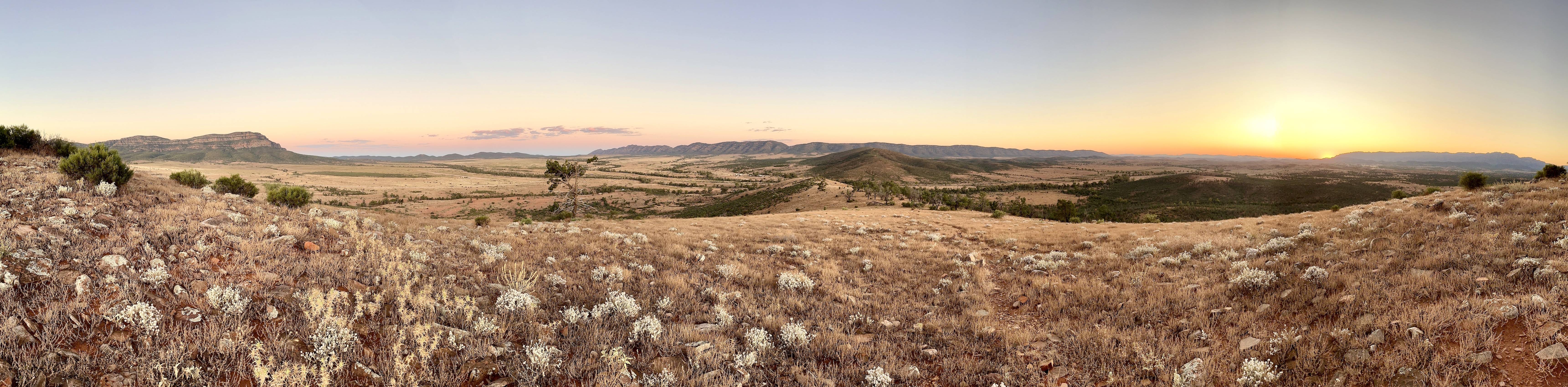
That's the southern wall of Wilpena Pound stretching into the distance.


Rawnsley Bluff as I dropped off Alison Saddle in the twilight.

By the time I got back to the ute it was pretty well dark.


The Dirt.
According to AllTrails I walked around 5.7 kilometres and climbed about 177 metres on this easy stroll. This track is within Rawnsley Park Station, so I'm guessing that you need to be staying there to access the walk - although you could try and rock up at the office and ask permission to walk it - I'm not sure what the policy is for non paying guests? If you are staying at Rawnsley Park then this is a good walk to consider at dawn and dusk I think as the light baths the surrounding country in a beautiful colours. Don't do the walk in the middle of the day if the weather is hot. I used my AllTrails map for this one.

Relevant Posts.

YouTube Video.


Thursday, October 13, 2022

Mulgowan Art Site Walk, Gundabooka National Park - April 2022

There is some really nice indigenous art in the caves up here. 


I didn't know a lot about the Mulgowan Art Site before our visit, I'd done a bit of googling to try and work out where abouts in the big Gundabooka National Park that I needed to go to start the walk. Thankfully when we arrived in the park this morning we found everything well signposted, not only that but the park also appears to have great facilities. Arriving at the carpark at the end of the Mulgowen Heritage Site Road we (yes, Sam was with me this morning) locked the ute and set off along the good track to see what we could see.

It can still be pretty warm up here in April so even though we visited in the NSW school holidays we weren't exactly over run with other punters.

Checking out the map before heading off.

I really enjoy walking in this kind of country. 

Our track climbed over a low hill...

...before dropping down and crossing Mulareenya Creek.

The track is marked with frequent track markers and in the spots where we crossed over large sandstone rock slabs the markers were welcome, although when we weren't walking on rock the track was pretty obvious. After couple of minutes the track started to climb over a broad low hill and while the hill was pretty small it still provided enough height for us to get a bit of a look at the surrounding country.

The track is very well engineered with a lot of dry stone paving and steps. 

Mulareenya Creek flows through a shallow gorge here.

Mulareenya Creek


After ten minutes the track dropped down to cross Mulareenya Creek, this creek was holding a good amount of water on this visit and I'm guessing that the semi permanent water is probably one of the reasons that the Ngemba and Paakandji people utilised the rock overhangs here. Climbing 10 metres above the creek level we arrived at the art site, no doubt the original inhabitants enjoyed the view down over the creek and out across the rocky ridges. There is a good selection of art adorning the walls and roof of this long overhang, although as is pretty normal the actual overhangs are fenced off to prevent people damaging the art. After checking out the art site Sam and I dropped down to the creek to explore a little before shuffling our way back to the ute to head off on our next little adventure.


Mulgowan Art Site.

Mulgowan Art Site.

I'm guessing that the creek was fairly reliable water point. 

I think this post might be a record for the percentage of shots with me in them!

There is a little bit to explore beyond the walking track here. 

Climbing the track back over the hill to the ute.

The Dirt.
According to my Alltrails App we walked 1.7 kilometres and climbed 31 metres on this easy stroll (my Garmin dropped a cog again so it's stats are wrong). I noticed that the NSW Parks folk rate this walk as a class 5 track - that seems a little like overkill to me as it is a good, although rocky track all the way. The only real information that I discovered in my extensive 5 minutes of research before we did this walk was on the NSW Parks website. I used my GPS topos and an Alltrails map that I created on this stroll.

Relevant Posts.


The hill is only low however it still allowed for a decent view - this is old grazing country.

Typical Gundabooka National Park scenery. 

Gundabooka National Park.

Alright, it's time to head off on our next little adventure. 


Pelion Hut to Mt Ossa return, Overland Track - April 2010

Mt Oakleigh from the Pelion Hut heli pad. I think the mountain just visible in the mist in the distance is Cradle Mountain... ... the flat t...