Thursday, July 30, 2020

Silvan Walk, Dandenong Ranges National Park - June 2020


After some good recent rain the bush was looking good.


After a couple of hours at work this morning I was looking for somewhere fairly close to home to go for a stroll today. Remembering I walk I did years ago up at Silvan I dug out Tyrone Thomas' old guide book checked out the notes... it all looked quite reasonable, maybe even better than reasonable considering the good soaking the bush has received over the last few months. Anyway, that's the rambling preamble on how I found myself parking in the small dirt overflow car park at Silvan Reservoir under overcast skies late on this Friday morning.


There is room for around a dozen vehicles here.


Pulling on my trail runners (yes, I'm using trail runners on some of the easier walks now) I set off down the wide grassy pipeline easement. There is a labyrinth of walking (and MTB) tracks through the bush around here with little in the way of signposting so it's always a little hit of miss on whether I end up on the exact track that I'm meant to be on, not that it really matters as it was just a matter of heading down hill to cross Olinda Creek. Once across Olinda Creek I climbed up onto a wide grassy road and headed south beside Olinda Creek.


I dropped downy this grass easement towards Olinda Creek.


This fence wasn't here last time I walked here I don't think - it's easy enough to skirt around though.


Dropping down to Olinda Creek on Grey Gum Track (I think).


I thought I was in Tassie for a minute.


Olinda Creek


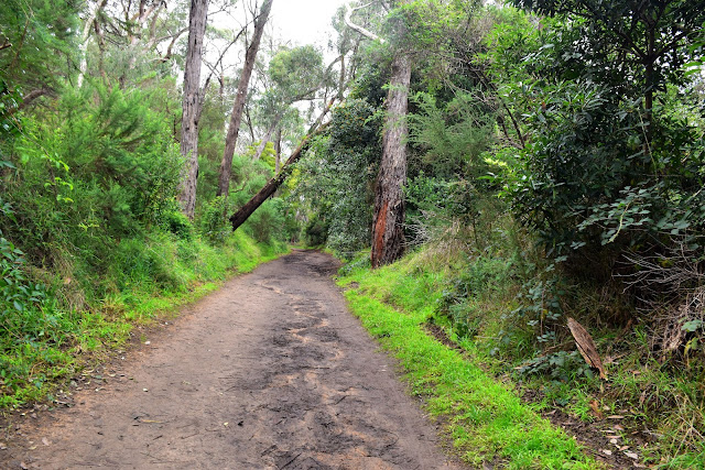
On this side of the creek the tracks are a bit better signposted although for the most part the names of the tracks on the signposts, my map and my GPS bore little resemblance to each other so I still had to concentrate a little. With Olinda Creek down to my left it was just a matter of heading south for awhile, whether I was on Road Number 13, 11, or 18 I'm not exactly sure. Heading south the only time I left the creek was were my track (road?) skirted above water treatment plant for Silvan Reservoir. The walk along here, let's call it Road Number 18, is very nice. While things were a little muddy under foot, the rain had given the ferns and bracken, along with the surrounding forest, a verdant green lushness that was doing wonders for my Corona addled brain.


Heading south along the Olinda Creek Valley.


Olinda Creek is beneath the ferns and bracken.


The rain had made the tracks a little soft and slippery however the scenery had benefitted.


After Olinda Creek and my track started heading west I arrived at a signpost that did match up with my map and GPS and I turned north up Road 13. My easy amble was over for awhile now as I climbed fairly steeply up Road 13. After avoiding a few roads off to the the right the climbing eased up a bit and Road 13 arrived at another junction. I now turned left (west) along what I think was Road 21, although once again things were a little vague on the ground. Road 21 climbed fairly gently west along the crest of a the forested ridge, every now and again I got glimpses through the canopy to distant cloud covered mountains however for the most part it was a forest walk. Keeping a close eye on my map I turned right (north) onto the un-signposted Richardsons Track and started to lose all the height that I'd gained. I'd broken my trekking pole on a recent walk and dropping down here on the greasy red clay track I was really missing them now, this is also one of the areas where I find the limits of my trail runners.


Road 13... time to start climbing.


Check out the size of this old stump... these trees must have been huge before they were logged. You can see the notch cut into the tree that the old loggers used to stand on.


Climbing Road 13.


I turned right here and started descending down the un-signposted Richardson Track.


Wet red clay meant that I had to be very careful whilst I dropped steeply down Richardson Track.


I was getting some glimpses through the trees to distant mountains. I'm thinking that this is Mt Donna Buang.


Safely down my steep and slippery descent I once again found myself back down in the Olinda Creek Valley and on a wide grassy road. Heading east and then south I eventually arrived at the walking track that I'd crossed Olinda Creek an hour or so ago, dropping down I crossed the Olinda Creek again and climbed up to a walking track junction. Now once again things got a little vague as I made my way back up to the car park. All I can say is that I mostly stayed left as I climbed through the forest until I heard the traffic on the nearby Monbulk Road, with the traffic noise signalling that I didn't need to climb anymore I started to contour the slope a little and take tracks that were heading south-east and then south-west before arriving back at the car park that I'd set off from a couple of hours ago.


Back beside Olinda Creek things were pretty easy again.


I even got some glimpses of blue sky now.


I followed a fairly vague collection of walking tracks once I was back on the Monbulk Road side of Olinda Creek.


The forest up here is a little drier than in other areas of the Dandenong Ranges National Park.


The Dirt.
According to my GPS I walked 9.4 kilometres and climbed 320 metres on what I'd call an easy-medium walk. Now I've waffled on a bit about un-named tracks and navigational conundrums however you shouldn't really get seriously lost here, Olinda Creek makes for a good reference point to regain your bearings. The Olinda Reservoir Grounds would make a nice spot for a picnic pre or post walk I guess. I used some old notes and maps out of Tyrone Tomas' 40 Bushland & Park Walks In Metropolitan Melbourne along with my GPS topos.

Relevant Posts.
Olinda Creek & Grey Gum Track, 2016.
Mt Evelyn Forest Walk, Dandenong Ranges National Park, 2016.


I used the traffic noise on the nearby Mombulk Road to guide me through the maze of tracks.
Eventually I arrived back at the top end of the car park - maybe on Messmate Track?

Sunday, July 26, 2020

Red Hill Rail Trail - May 2020

Autumn is a pretty good time for this walk.


After more than six weeks at home, only venturing out to work or buy groceries you might say I was keen to get out for a walk when our lockdown eased a bit. Unfortunately for me I firstly had to finish my week at work and then perform a bit of surgery on Sam's car which meant that my options for my first post Corona walk were a little more limited than I'd imagined they would of been. I'd actually considered this walk while we were on the lockdown however in the end I decided that it was best if I didn't blur the lines and decided not to drive anywhere for exercise, looking at social media it seemed that a lot of others didn't mind blurring that line though.


Setting off this morning I had to forgo my usual breakfast and coffee.


Normally this walk would of probably started with brekky and coffee at the Merricks General Wine Store however cafés still weren't open for anything other than take away yet. Wanting to avoid as many people as possible I set off around 7am today too, so that would of put a handbrake on my leisurely breakfast anyway. Anyway, after parking at Merricks I set off along the crush granite path beside Frankston Flinders Road and then Merricks Road, skirting around the Merricks Equestrian Reserve as I went. Once around the equestrian centre I arrived at the Rail Trail sign and from here on everything was pretty obvious as far as navigation goes.


I picked up this gravel path that skirted around the equestrian reserve.


It was an early start again today.


After skirting around the equestrian reserve I found this sign post beside Merricks Road.


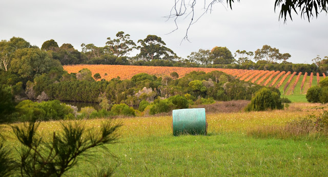
Heading west the rail trail mostly passes through a fairly bucolic landscape with vineyards, small farms and the occasional orchards being the order of the day for the most part. Still while it was lacking a bit in the wilderness stakes there was a certain joy de vivre just being outside in the fresh air this morning as the sun came up over the Mornington Peninsula. The rail trail gently climbs west for awhile before swinging north, climbing a little more before descending fairly steeply down to meet the end of Tonkins Road.


Early morning on the Red Hill Rail Trail.


I had been hoping for a blue sky morning....


The rail trail was pretty well deserted - initially at least.


Arriving at Tonkins Road I picked up the rail trail section of this walk. I'm thinking that so far I'd been walking old rural easements however between Tonkins Road and Red Hill the rail trail follows the alignment of the old Bittern to Red Hill railway. This old railway line was built in 1921 and operated until 1953 carrying mostly fruit to the Melbourne markets. Back then my grandparents actually owned a orchard at Red Hill, in those days apples, pears and strawberries were the most common products emerging from the Mornington Peninsula. Now days it appears that vineyards seem to be taking up most of the agricultural land.


Looking back towards Merricks - this walk has a very bucolic feel about it.


Climbing higher I got some distant views over Port Phillip Bay to the Dandenong Ranges.


The Mornington Peninsula is a very nice spot.... however I maybe biased!


It use to be mostly orchards up here - now days its mostly vineyards.


Once on the old railway alignment the walking was very easy as I shuffled along beneath an avenue of pines, slowly climbing until I arrived at Red Hill. Now while I'd missed my coffee back down in Merricks I was lucky to find a café in Red Hill open for takeaways. Sitting on a deserted bench at the site of the old Red Hill Railway Station enjoying my first real coffee in weeks life was pretty good, in a melancholy type of way!


Heading towards Red Hill on the actual old railway alignment.... the surface was getting a little cut up in spots.


I should of bought an apple for the locals.


Approaching Red Hill.


My signal to leave the rail trail.


The Red Hill War Memorial.


The highlights were coming thick and fast this morning.


Red Hill


There are normally a couple of choices for coffee up here.


This morning it was take away coffee for me though...it was still greatly appreciated.


After poking around Red Hill for awhile I grabbed my pack and set off back down the rail trail to Merricks. Now when imagining this walk in my head before I walked it I'd visualised long distance views across Westernport Bay all the way to Phillip Island under a blue sky, unfortunately I got overcast skies with limited views. I could actually see The Nobbies off Phillip Island, although the view was far from clear this morning. While the long range views were a little underwhelming the scenery up a bit closer was pretty sweet with the deciduous trees adding a bit of Autumn colour to the rural scene. It was around 11am when I arrived back at the ute this morning and while my first post Corona walk hadn't been an absolute stunner it was still a very pleasant little outing after being stuck at home for so long.


Finishing my coffee it was time to drop back down to Merricks.


The rail trail passes through a few shallow cuttings.


There aren't a lot of orchards left up here now.


Approaching Tonkins Road again.


Looking across Westernport Bay towards Phillip Island and The Nobbies.


Dropping back down to Merricks I shared the trail with a few more walkers now.


The Dirt. 
I walked 14.1 kilometres and climbed 342 metres according to my GPS on this mornings easy-medium grade walk. Now while this is a retrace the walk back does allow for a different perspective on things and on a nice day there are some great views across Western Port Bay to Phillip Island. This walk is all on pretty good gravel paths although the surface can get a bit cut up by horses and bikes if there has been a lot of rain. With cafés at both Merricks and Red Hill it would be a good walk to incorporate with a meal, well once we are allowed to eat in café again. There are some basic notes and maps floating around in both an Explore Australia book and also an old edition of Rail Trails of Victoria and South Australia. A Melway or google maps will probably get most people through safely though.

Relevant Posts.
Point Leo to Balnarring, 2015.


I could of been in the Scottish Highlands.


I skirted around the south-west side of the equestrian reserve.


Things were a lot busier when I returned!


Pelion Hut to Mt Ossa return, Overland Track - April 2010

Mt Oakleigh from the Pelion Hut heli pad. I think the mountain just visible in the mist in the distance is Cradle Mountain... ... the flat t...