Showing posts with label Rural. Show all posts

Saturday, June 24, 2023

Warren Gorge Circuit Walk - December 2022

I was off fairly early again today - getting the steepest climb out of the way before the day heated up too much.

Red rock and native pines - I was pretty happy with life.

Looking back towards Quorn from the walks high point.

Warren Gorge Walk.


The view down into Warren Gorge from the high point.

After getting the steepest climb out of the way I was left with a long gentle descent into and through the gorge.


The country surrounding the park is mostly pastural land.


Early morning in Warren Gorge.

There is a good, well amrked track for the length of this walk.

My best go at an arty shot today.

Down near the drive in camp the gorge gets quite spectacular.

It looked like the creek was pretty well dry - although I didn't need water, so I wasn't searching for it.

Warren Gorge.

Warren Gorge.

The Dirt.
According to AllTrails I walked around 5.3 kilometres and climbed about 186 metres on this fairly easy walk. I did the walk counter clockwise which got the steepest climb out of the way and left a fairly long gentle descent through the gorge to finish the walk off with. The track itslef is well marked and clear. Walk very early in the morning (or late in the day) if the weather is hot. There is an extensive drive in camp here if anyone wanted to make a weekend of it. I used my AllTrails map today. 

Relevant Posts.

YouTube Video.


Monday, June 19, 2023

Whisky Track to Bacchus Marsh, Lerderderg State Park - January 2023

My journey along Whisky Track continued this morning.

I'm about to drop steeply down to cross Whisky Creek - that's Mt Blackwood in the distance.

Back in my early walking days this use to be an off track route known only to a few bushwalkers.


Whisky Creek has cut quite a substantial gorge.

Whisky Creek.

After leaving Whisky Creek the climb up to Square Bottle Track was solid.


Once up on Square Bottle Track the going was pretty cruisey again.

Approaching Mt Blackwood the Lerderderg Track passes through a bit of rural land.


Looking down into Lerderderg State Park from Mt Blackwood.

Nice walking along Clifford Track.

There are some reasonable views down into Lerderderg Gorge from the Blackwood Ranges Track.

Dropping down to pass through Bacchus Marsh - my knees didn't need these!


The Dirt.
According to my AllTrails app I walked around 33.3 kilometres and climbed about 794 metres today on what I'd call a hard walk. The tracks through Lerderderg are mostly well signposted and marked. The Lerderderg Track through Bacchus Marsh is vaguely marked at best - AllTrails still shows the old route down to the railway station along the main street, there is a quieter route marked on the map which I used. I used my AllTrails app along with my Lerderderg Track topo map today.

Relevant Posts.
Previous day of this walk.

YouTube Video.


This is one of the rare cases where it's easy enough to complete a multi night walk utilising public transport in Victoria.

Saturday, May 6, 2023

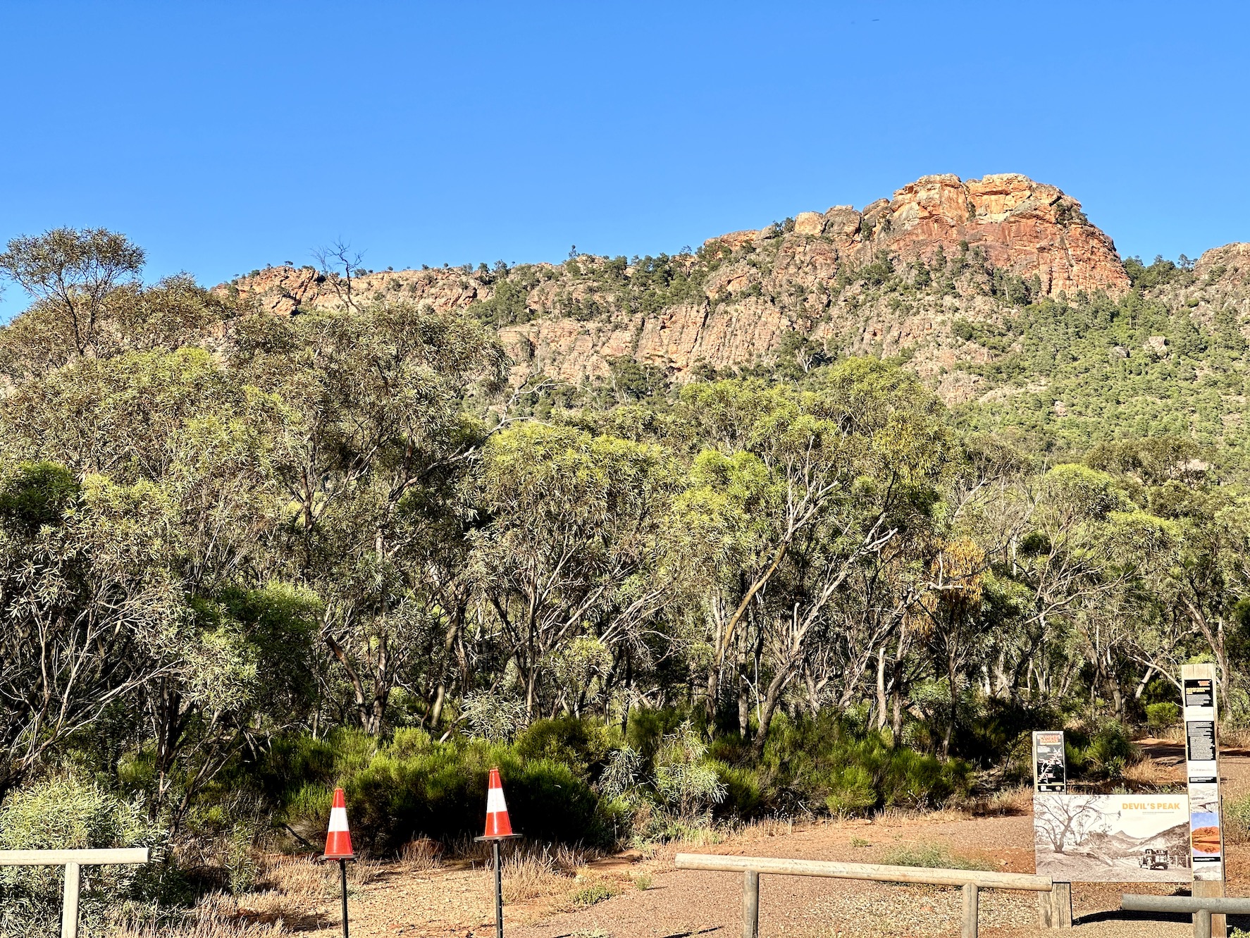
Devil's Peak Walk - December 2022


This walk starts just past the Elephant Dam....!

It all looks pretty reasonable from the car park.

The walk starts off pretty easily...

... before starting to climb in earnest through increasingly rocky terrain.


Devil's Peak Walk.

I climbed this rocky ladder as I headed for a saddle in the ridge line.

The marked (and AllTrails) route finished on this slightly lower summit.

Looking north towards Dutchmans Stern Conservation Park.

Devil's Peak.


Mt Brown.

That's Port Augusta at the head of  Spencer Gulf.


I don't mind this type of sandstone country.

This  gnarly old tree was in the saddle on the ridgline - it looks like a Snowgum to me?

The track is pretty well marked.

The country was in good nick on this visit.

Time to head back to Rawnsley Park for a swim.

It pays to have an off sider on this drive.

The Dirt.
According to AllTrails I walked around 2.6 kilometres and climbed about 247 metres on what I'd call a medium grade stroll. While the walk is short it packs a lot of climbing in - the first couple of hundred metres is actually pretty easy as the majority of the climb is done over the last kilometre to the summit. To reach the Alltrails summit will require some fairly easy scrambling. Go early or late if doing this walk on a hot day. I used the AllTrails map for this walk.

Relevant Posts.

YouTube Video.


I made a friend on this walk.


Pelion Hut to Mt Ossa return, Overland Track - April 2010

Mt Oakleigh from the Pelion Hut heli pad. I think the mountain just visible in the mist in the distance is Cradle Mountain... ... the flat t...