Looking back down towards Port Douglas and the Coral Sea from the Bracken Patch.
One of the walks that I'd really wanted to do on our FNQ road trip was the Devil's Thumb climb. After arriving on the coast up at Cairns I'd been thwarted a little with some unseasonal late April / early May rain though. Moving up the coast a little after a week didn't really help the rain situation unfortunately and then on our last day up here I got a forecast that sounded half reasonable - game on! Now I knew that this walk would be a tough one, a situation not helped by all the recent rain and the humid early May temperatures so I was keen to get going early, so I set off from the small car park this morning at around 7:30am - surely that would get me back down before dark.
I was on my way pretty early this morning.
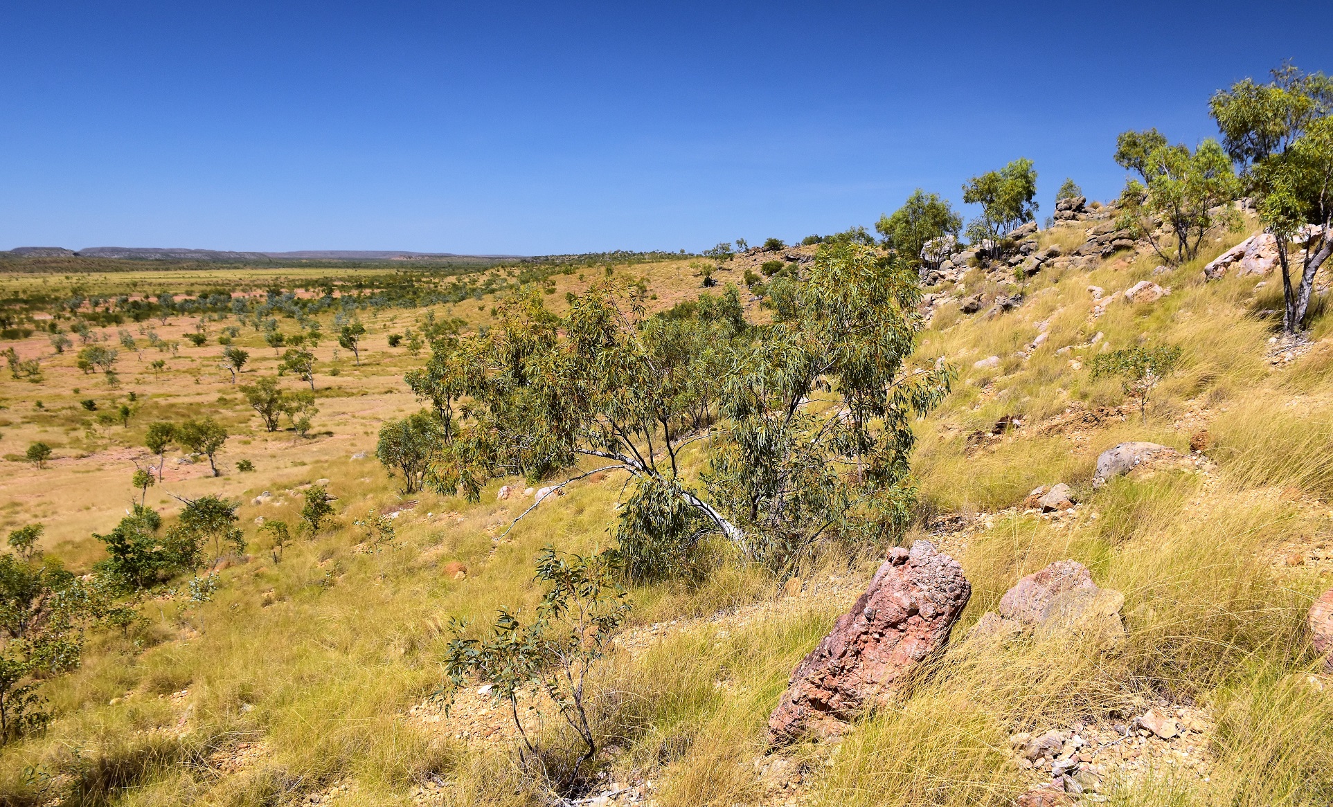
The initial bit of this walk is along an easement that passes between some private property and is a little convoluted as it weaves left and right, there are tapes and a few national park markers to follow though so it wasn't too bad. After ten minutes I made it to Little Falls Creek and after finding some rocks I was able to cross with fairly dry boots. Once across the creek I immediately arrived at the national park information board and officially started the climb - game on. The track actually isn't the steepest to start with, although down close to the creek it was a little messed up by feral pigs rooting around. It appeared to me as though this initial section more or less followed an old 4wd track route as I passed through two or three fairly substantial cuttings as I climbed - this might also explain the
almost reasonable gradient too.

The route to the start of the climb actually passes across the lawn of this property - there are enough national parks markers around so the navigation wasn't to bad, it did feel a bit wrong though!
Fording Little Falls Creek wasn't too much of a drama.
Once across Little Falls Creek the day's hard work began.
While the track was fairly steep the beautiful rainforest somewhat made up for the pain.
Judging by the cuttings I think I was following a very old 4wd track initially.
With an un-signposted pad dropping off the spur to the south to a waterfall my route left the remains of the old 4wd track and the climbing got seriously steep. From here to a spot called the Bracken Patch I climbed around 550 metres in around 2.5 kilometres, sometimes using tree roots and rocks as steps, sometimes just scrambling up the red clay. In spots up here the spur was broad and wide however in other spots the going was that acute that a tree or a rock would take up all the real estate on offer and I'd find myself edging around the obstacle. Now while I was absolutely ringing wet with sweat (imagine swimming fully clothed and that's how wet my clothes were) progress was still being made.

After avoiding the faint pad that drops to a waterfall the climb got rougher and steeper.
As I got higher I started to come across more huge boulders.
The climb up to the Bracken Patch was mostly along a rough track, when things got a little vague there was generally some flagging tape - although staying on, or very close to the spur's crest and keeping on climbing was really all it took.
Suddenly emerging out of the forest I found myself at the Bracken Patch. I'd heard about this spot before but actually being here was a magic experience. It's not just the fact that I'd suddenly got out of the somewhat claustrophobic rainforest, it wasn't just the absolutely jaw dropping views that stretched all the was back down to Port Douglas, it wasn't the fact that allegedly the steepest climbing was behind me now, and it wasn't just the amazing flora here, however combining all those things this place took my breath away.
My route suddenly emerged from the rainforest at a spot called the Bracken Patch.
The Bracken Patch is a large area of Coral Ferns mixed in with a few house sized black boulders.
The Bracken Patch, Daintree National Park.
That's Flagstaff Hill and Port Douglas at the end of the peninsula of land jutting out into the Coral Sea.
After climbing through the Bracken Patch and enjoying the view I was getting pretty cocky now, with the worst of the climbing done and only a couple of kilometres to go I figured that I'd soon be sitting on the summit. Yes, I was totally wrong! While the long climb was definitely over I now started the jungle gym section of the walk as the route (the track now was just a taped route for the most part) now negotiated numerous obstacles. Apart from the areas where I was was pushing through head high vegetation the biggest issue along here was a boulder the size of a block of flats, the taped route here actually split, with one option scrambling up a vertical three metre chute and with the other skirting around the edge of the huge lump of granite - now that all sounds simple enough when I 'm typing this up sitting at home nice and comfortable on the couch, however when I could only see a metre or two through the scrub while I was trying to disentangle myself from Lawyer Vines the navigation here was far from obvious.

There is a short section of aluminium boardwalk and stairs at the Bracken Patch that allow walkers to negotiate their way around a huge boulder - it felt a little odd to walk on this man made structure after all the rough walking that had proceeded it.
Leaving the Bracken Patch I thought that the hardest walking was over - I was wrong. The next couple of kilometres were vague, rough and scrubby. I was looking for clues (like the faded orange tape on the tree) along here.
Rough going up on the ridge.
Negotiating these huge boulder on the ridge made for the trickiest navigation of the day - there were tapes however they were marking a couple of different route options so it was very easy to get turned around.
Once past the big boulder labyrinth the route soon swung off the ridge and I started losing height as I dropped north into a high saddle... now normally losing height wouldn't fill me with joy, however I knew that I had to drop down a bit before gaining the Devil's Thumb (which sticks out the side of the mountain). Sure enough I soon passed through the high saddle and started climbing again and it wasn't long before some huge granite boulders started to materialise through the trees above me. From down here it seemed improbable that I'd be able to climb these monstrous rocks and to be honest the going wasn't easy. Arriving at the crux of the climb I was faced with a three metre vertical climb up some roots attached to a rock from which I transferred onto a dead tree that had ropes for protection. Once on the tree I walked across the tree using the rope to help balance before scrambling off the other side of the tree onto the Devil's Thumb - I'd made it!

Climbing away from the saddle on the last climb up to the Devil's Thumb.
The last pinch of the climb involved scrambling up these roots...
... onto this airy rope bridge / dead tree.
There was quite a bit of exposure on part of this crossing.
Devil's Thumb views.
Now I'd like to regale you with stories of far reaching views about now...but I can't. My time on the summit of the Devil's Thumb was spent lying on the rock watching the clouds swirl around me and while it wasn't a complete whiteout I couldn't see the coast. To be honest I wasn't really that disappointed though as I'd had a similar view from the Bracken Patch a couple of hours ago and I'm not greedy! With the weather up here now less than optimal and the time fast ticking away I figured that I'd better get going again if I wanted to get down before I ran out of light.
I snatched glimpses of the view as the clouds scudded through.
I was fairly shattered by now - and I was guessing that the descent wasn't going to be a lot easier.
Manal Jimalji (Devil's Thumb), Daintree National Park.
That's the ridgeline that I'd walked across from the Bracken Patch.
The coastline pretty well stayed hidden on my time up here.
Time to get up and start walking I think.
As I'd suspected the walk down wasn't a lot quicker than the climb had been, the going along the top looked completely different with the change of direction and a couple of showers of rain helped to make everything extra greasy. Arriving at the Bracken Patch I once again had a stunning view to check out (after I got back home I heard that the local indigenous people are thinking of banning the climb up to Broken Nose, if and when that happens then the Bracken Patch would make for a good destination in it's own right I think). Leaving the Bracken Patch I started the really steep section of the descent and this was slow going, I'd stashed water in a couple of spots on my climb up so I was able to mark off my descent in sections between my small water caches, however it was still after 5pm when I got to the bottom and forded Little Falls Creek again - arriving back at the ute at around 5:30pm after a very tough day out.
Alright... let's get off this mountain.
Negotiating the rainforest scrub along the ridge line.
All good - no scrub. Although the sloping wet and mossy rock presented its own issues!
If you look (very) closely you'll see the flagging tape marking the route.
Happy days! I'm about to break out onto the Bracken Patch.
Once back at the Bracken Patch again I got some longer views through the cloud.
That's Port Douglas in the distance.
As you can probably tell from the number of photos the Bracken Patch was my favourite bit of my walk today.
The Dirt.Both my GPS and my Alltrails App had trouble locating satellites beneath the dense canopy today although it looks like Alltrails must run some software that cleans up any discrepancies on the GPX file. I'm going to go with my Alltrails figures today and they were 14.6 kilometres along with 1229 metres climbing - my Garmin GPS figures were 10 to 20% over that (check out the interactive map and you'll see why). This is a very hard walk, I was walking for more than ten hours today and I didn't muck around much, only really stopping for a few minutes at the Bracken Patch and then around 20 minutes the Devil's Thumb. There is a reasonably obvious track up to the Bracken Patch, however from then on it's a taped route and while the GPS route is handy the going on the ground is that convoluted and claustrophobic that the GPS is a bit limited. The last section up onto the Devils Nose involves a rope bridge across a dead tree many metres above the ground so be prepared for that, there is also a bit of scrambling involved on this walk. After all that there is also the jungle to consider, when I did it in May the humidity was full on and I was soaking wet with sweat for most of the day, and speaking of the jungle there is a lot of very prickly and nasty plants that quite frequently crowd the track (the Lawyer Vines did my head in coming down in the late afternoon!). I used the notes and map out of the Woodslane book Best Walks around Cairns & the Tablelands as well as my Alltrails App and my GPS today.
Relevant Posts.
I'd stashed some water at a couple of spots on my climb this morning so me descent was punctuated with welcome stops at my water caches.
By the time I got back down to Little Falls Creek it was getting pretty dark.
Sam was waiting to pick me up at the trail head.
I'm pretty broken after what was a big day out.