Thursday, April 28, 2022

Papeete, Tahiti - September 2013

It's not all white sand and turquoise water in Tahiti. 

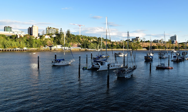
When I picture Tahiti in my mind I imagine turquoise water lapping pristine white sand beaches with numerous reefs beckoning just off the beach and indeed a fair bit of French Polynesia is like that. However after sailing into Papeete this morning it was fairly obvious that turquoise water and pristine while sandy beaches weren't going to feature much today. Papeete is the capital city of Tahiti and it's like a lot of these South Pacific cities in that it can feel a little rough around the edges. 

Papeete Harbour.

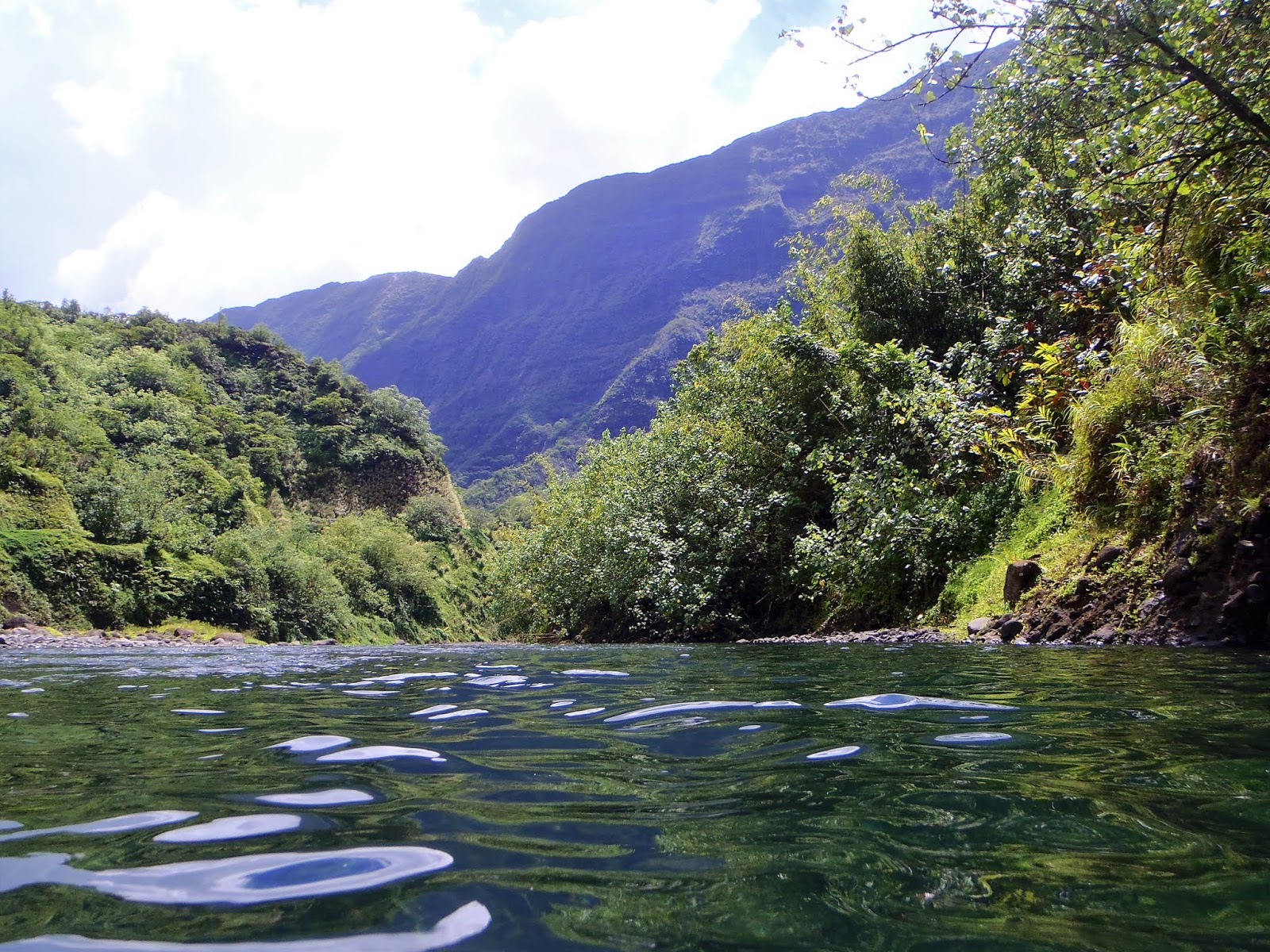
Luckily for Sam and I we were heading out of the city to explore the nearby Popenoo River Valley. This valley has a rough road running up it and we were lucky enough to be able to travel in the relative comfort of the tray of an old Land Rover Defender. The open sides allowing a cooling breeze as we swayed our way up the valley. After checking out Topatari and Vaiharuru Waterfalls we pulled over at a nice pool in the Popenoo River for lunch and a swim, life was pretty sweet!

Now this is the way to travel! 

I'm not 100% sure of the names of these waterfalls in the Popenoo River Valley.


We stopped to feed some Eels.

The hinterland of Tahiti is a ruggedly beautiful place.

Popenoo River Valley.

Popenoo River Valley.

Returning to Papeete in the early afternoon we stopped at Pt Venus to check out the black sand beaches complete with a few children enjoying the sand, although with little time left we didn't have time to drop onto the sand for any beach combing unfortunately. 


Popenoo River.

Popenoo River.

Great swimming in the Popenoo River.

Once back in town Sam and I headed back to the ship for a quick shower and change of clothes before we set off on foot to see what Papeete had to offer. With a population of only around 30,000 people Papeete isn't a huge by world standards however by South Pacific standards it's a decent sized city. I've found that the countries and cities in the South Pacific that have some French heritage are a little more developed than some of the other spots and Papeete was no different in that regard. It was easy to lose half a day exploring this small city, with its good selection of French inspired cafés and bars it's a pleasant enough place to hang out for awhile.


Looking towards Papeete from Pt Venus.


Tahiti's black sand beaches.


Looking east towards Popenoo from Pt Venus.

After checking out a small dock side market we returned to the ship in time for a sensational sunset over the jagged peaks of the distant Mo'orea, although it was framed by the industrial Papeete Harbour which dragged the oh wow factor back a couple of notches I think. With the sun setting behind Mo'orea, which incidentally was tomorrows destination, we settled in for another hard night on the ship (actually as I'm typing this up many years later as the Corona Virus causes all sorts of havoc I'm wondering if I'll ever enjoy this type of holiday again). After getting a few photos of Papeete by night as we sailed out of town we headed in for an early night, tomorrow in Mo'orea promised to be a good day.


Papeete's back drop is more impressive than the actual city I think.


Papeete Harbour


The island in the distance is Mo'orea - tomorrows destination.


The sun has gone down behind Mo'orea.


The Dirt.
We visited Papeete on a Princess Cruise. At the time I'm writing this cruise line has suffered a lot of negative press as the Corona Virus has decimated the industry, so it'll be interesting how the industry recovers. Obviously if you read my blog you'll notice that I don't mind the occasional cruise, a situation that might seem a little incongruous considering how much I love being on my own out in the bush. Cruising allows Sam and I to have a holiday together that we both enjoy, I get some forced downtime where I can catch up on my reading and at the same time we get to sample some amazing destinations around the world in relative comfort. Anyway, hopefully when things settle down in a couple of years Sam and I will again enjoy some more cruising although in the shorter term it looks like things will be a bit more local and at least in my case, will probably feature walking boots rather than fins.

Relevant Posts.


Papeete - there was a night market down on the wharf.

Sailing away from Papeete.

Sunday, April 24, 2022

Story Bridge ~ Goodwill Bridge Circuit Walk - January 2022

The Story Bridge is going to feature heavily in this post.

Here we go again, another bloody urban stroll... except this one is actually a pretty good one I reckon, actually it turned out to be one of the best walks that I've done with Sam in the last few years. This is another walk that we did while we were breaking our journey from Bundaberg to Melbourne up in Brisbane for a few days last Christmas. Once again Sam and I headed out into the humidity pretty late in the day today, hoping that the late hour would both take the edge off the heat while at the same time the changing light might help my photos a bit. After walking through the fairly quiet Brisbane streets we started this walk at the Botanic Garden gates at the end of Edwards Street and immediately headed to the Brisbane River where we walked the floating walkway north for awhile.

We started our evening stroll at the northern entrance to the Botanic Gardens off Edward Street.

Late afternoon on the Brisbane River.

The Story Bridge was in view for most of the walk.

Story Bridge

For the most part this walk stayed fairly close to the water.

Approaching the bridge we looped inland a bit to get onto the bridge walkway.

We now walked the beautiful riverside path north all the way to the Story Bridge. This path is a shared path it was pretty quiet this afternoon so we didn't really have to worry about being dive bombed by my lycra clad brothers and sisters and the path made for beautiful walking. The views over the river and of the ever looming Story Bridge in the early evening light meant that I was struggling to walk more than a few metres at a time without stopping to take yet another photo. After passing through the Eagle Street Wharf Precinct we soon arrived at the bridge, our route now heading inland and looping around to gain the walkway on the north side of the bridge. 

We crossed the walkway on the eastern side of the bridge.

The view downstream from the Story Bridge.

I got some love from the bridge climbers!

It's brutal... but I like it.

After descending from the bridge we passed beneath the road to reach the Brisbane River again at the Captain Burke Park. 

After crossing the Story Bridge we passed beneath the bridge and walked north down to meet the Brisbane River again, this time at Captain Burke Park near the Holman Street Ferry Terminal. Once we were back down near the river we started a fairly long (well relatively) walk south beside the river. With the sun now pretty well set, the light was constantly changing now and the walk along below the Kangaroo Point Cliffs was particularly pretty. The Brisbane council lights the cliffs up with some fairly subtle mood lighting and there was also the occasional rock climber scaling the coloured cliffs tonight. It wasn't just the Kangaroo Point Cliffs that was catching out attention though, the view back towards the lights of the Brisbane CBD also looking pretty sweet from this side of the river. 

Captain Burke Park.

Captain Burke Park.

Brisbane on a sultry summers evening.

Looking back across the river towards the CBD.


Some of the nocturnal locals were starting to come out. 

Leaving the cliffs Sam and I continued our journey south, passing beneath the Captain Cook Bridge before crossing back over the Brisbane River again this time on the Goodwill Bridge. Arriving back on the north side of the river near some old strangler figs that had been draped in fairly lights, once again a fairly simple thing but a beautiful effect. We now followed the Bunya Walk north beside the Brisbane Botanic Gardens to eventually arrive back at our start point at the botanic gardens gate at the end of Edwards Street. Wandering back up through the fairly quiet early evening CBD streets to our hotel I couldn't help but reflect on how much I enjoy these CBD early evening walks, Sam and I have done them in Melbourne, Singapore and now Brisbane and they always seem to make for memorable strolls.

The Kangaroo Point Cliffs.

The sun going down over the Brisbane River.

The Kangaroo Point Cliffs.

The Kangaroo Point Cliffs are a popular rock climbing spot.

The Kangaroo Point Cliffs.

The CBD was fully lit up by now. 

Kangaroo Point.

The Captain Cook Bridge.

They are sculptures...

Crossing back over the river on the Goodwill Bridge.

There are more great views from the Goodwill Bridge. 


The Dirt.
According to my GPS we walked around 7.9 kilometres and climbed about 115 metres on this easy walk, unfortunately I've lost my GPX file from this walk so I'll have to make do with a screen shot of my Alltrails map on here. Obviously being a city walk there were ample opportunities to stop for a drink or a feed along the route and also plenty of spots for a picnic. I suppose the only minor issue with the walk as we did it is that you need to be a little aware of your personal security when meandering along some of the quieter sections of the stroll after dark, Bunya Track was almost deserted as we walked north back up the river and it felt surprisingly remote considering we were in the Brisbane CBD - I never felt unsafe (I'm 6'3" and pushing 130kgs though!) however I'm not sure if it would be a good idea for Sam to walk along here on her own at night (that doesn't mean that I think that is a good thing - it's just an unfortunate fact of life). I used my Alltrails App and my GPS maps on this stroll tonight.

Relevant Posts.


Fairly lights on the fig tree on the north side of the Goodwill Bridge.

Stinging up some fairy lights is a pretty low tech thing - however the effect is beautiful. 

Returning along the Bunya Walk.

Bunya Walk.

Finishing up our stroll with another look at the Story Bridge.

I've lost my GPX file from this stroll so I'll make do with the screen shot off my Alltrails map.


Pelion Hut to Mt Ossa return, Overland Track - April 2010

Mt Oakleigh from the Pelion Hut heli pad. I think the mountain just visible in the mist in the distance is Cradle Mountain... ... the flat t...