Saturday, May 31, 2014

Dibbins Hut - May 1998

In May of 1998 we were planning our first trip over to do the Overland Track and needed a warm up walk to test out our wet weather gear. I'd walked up around Mt Hotham before and I wanted to show Sam some of the old huts in the area, so that's how we decided to head to Dibbins Hut for the night.

We only had two day window off work so had no room to move in relation to the weather, leaving the troopie at the Mt Loch car park we headed off into the snow showers. The day was already half over by the time we started walking, but we only had about eight kilometres to the hut. By passing Mt Loch our first stop was a Derrick Hut about four kilometres into the walk, the snow was starting to settle a bit but overall the walking was cold but fairly easy. Derrick Hut was built by the Wangaratta Ski Club in 1967 in the memory of Charles Derrick, a ski-tourer who died from exposure near here, he was attempting to ski from Mt Bogong to Mt Hotham in one day.
Derrick Hut on day one.
After having a quick rest in the hut we started our descent down Swindlers Spur, the snow gums in the swirling mist providing interest on the grey day. As we descended the 400 metres to Dibbins Hut the snow flurries turned to rain, not ideal as its much better to be cold and dry with snow falling than cold and wet with rain falling on you. I wasn't to concerned however as we planned to spend the night in the hut and after slipping and sliding down the steep track we eventually arrived in the beautiful valley through which the Cobungra River flowed.
Dibbins Hut.
Once in the hut we quickly got out of our wet clothes and set about making ourselves at home for the night. Dibbins Hut was built in 1987 to replace a hut that was built in 1917 which replaced an even older hut. The log construction of the hut was a bit on the draughty side so I quickly got the small pot belly stove going, whilst Sam organised our sleeping arrangements in the loft, sounds pretty flash hey, think rustic however and you will be closer to the truth. We spent the remainder of the day huddled around the stove reading and eating, in between showers I wondered over to the river to get some water, the valley looking very atmospheric with the cloud cloaking the surrounding mountains.
Dibbins Hut is a little on the draughty, rustic side!
I'd noticed the rain on the tin roof had stopped half way through the night and sticking my head out side next morning confirmed what I thought, the snow level had dropped down to the hut. After packing up we walked through a winter wonderland, as we climbed back up Swindlers Spur the snow got deeper and by the time we reached the shelter of Derrick Hut it was around 20 cm deep on the ground. After having a bit of a rest in the hut it was time to head on around the shoulder of Mt Loch, this section is very exposed and we got battered around in the wind a bit, we were certainly having a good warm up for the Overland Track. It was with some relief that we got back to the troopie and it fired first go, within a few minutes we were toasty warm and heading down the mountain to Harrietville.
Climbing back up to Derrick Hut, day 2.
Following the AAWT below Mt Loch.
Sam on the track near Mt Loch.

The Dirt
We didn't use notes for this walk but there are plenty of guide book authors who have covered this area. I haven't been back up here since the massive fires that have ripped through the area in the last decade but there would be lots of changes, mainly to the snow gums that really don't like being burn't, both huts have survived the fires so far! All up we walked about 8 kilometres each day, the track is well marked and signposted when not under snow, a pretty cruisey overnight walk.


Sam just loves the snow.


Back in the troopie with the heater on, all good.

Friday, May 30, 2014

Mount Jerusalem, Walls of Jerusalem National Park - March 2010


I'd always wanted to check out the Walls of Jerusalem National Park and this was my first opportunity. I was over in Tasmania to walk the Penguin Cradle and Overland tracks and had a day to spare, the weather looked like it might behave so I thought I'd have a crack at doing Mt Jerusalem as a day walk. I left Sam at our accommodation in Deloraine and was at the track head by 9:00am.
I was hoping that the dickheads would keep concentrating on the signs and not my car!
After locking the car and saying a silent prayer that it wouldn't get broken into, I set off in overcast but dry weather. Initially the track climbs fairly relentlessly and within about .2 of a second I was warmed up and sweating bullets. I was on a bit of a mission to get to Mt Jerusalem before a predicted cold change came through later in the day so I didn't pause at Trappers Hut on the climb.Once I was over the main climb on to the plateau I changed down a gear and settled into a nice pace.
Solomons Jewels with King Davids Peak looming up in the distance.
Second breakfast time near Solomons Jewels.
A Pademelon grazing near the tent platforms at Wild Dog Creek.
The track was well constructed and had some duck boards and stone work where needed, I had a beautiful walk across the alpine plateau passing many small lakes and tarns. The weather was looking OK so I pulled up at Solomons Jewels for my second breakfast, stretching out on the duck boards. Pushing on I crossed Wild Dog Creek where the official bush walkers camp is, disturbing a Pademelon munching on the grass. Passing through Herods Gate, Lake Salome came into view, I was now walking along a boarded track beside the lake in an amphitheatre of granite cliffs, luckily for me the surface of the track was good as I spent most of this section checking out the stunning views.
Lake Salome coming into view.
The boarded track around Lake Salome.
The saddle in the distance is Damascus Gate.
Mt Jerusalem taken through the saddle between The Temple and Zion Hill.
Pencil Pines.
I checked out the Pool of Bethesda on the way up to Damascus Gate, refilling my water bottle at a beautiful spring beside the track on the way up. From Damascus Gate the track dropped a little on its way to Dixons Kingdom Hut, passing through a beautiful Pencil Pine forest on the way, this was rapidly turning into one of my best days walking, everywhere I looked the view was awe inspiring. I was now within sight of the goal, Mt Jerusalem, from Dixons Kingdom Hut I climbed up to Jaffa Gate and then up a rocky route onto a reasonably flat plateau that makes up the summit of Mt Jerusalem. Once on the summit plateau I had an easy walk over the rocky track to the summit cairn
A small spring near the Pool of Bethesda.
The track passing by a beautiful Pencil Pine forest.
The Pool of Bethesda.
Looking south down an open valley from just over Damascus Gate.
I had lunch on the summit taking in the 360 degree view, the Walls of Jerusalem NP stretching out around me, everywhere I looked there were alpine lakes and tarns. The view back down to Lake Salome being particularly impressive. Heading back to Jaffa Gate I picked up the boarded track down to Dixons Kingdom Hut, the track crossed some damp ground with some beautiful and big cushion plants right beside the track. Stopping at the hut I took the opportunity to have a poke around, Dixons Kingdoms Hut is an old cattleman's hut and it is in a beautiful setting, right on the edge of a Pencil Pine forest.
Looking back towards Lake Salome from Mt Jerusalem.
A Wedgetail Eagle surfing the thermals from Mt Jerusalem.
The Walls of Jerusalem National Park stretching out behind me.
Leaving the hut I back tracked up to Damascus Gate, where I left the main track and headed up to the top of Solomons Throne. The route up to Solomons Throne was steep in parts but very do-able, at one stage passing through a bit of a chasm before popping out on top of the cliffs. The view from the top of Solomons Throne was once again stunning, I tried to burn it into my memory as I hopped around the rocks checking out as many of the views as I could, directly below me I could see my duck boarded track heading away beside Lake Salome before it disappeared out of sight at Herrods Gate.
Dixons Kingdom Hut.
Cushion Plants on the track down from Jaffa Gate.
Having a rest in the luxurious Dixons Kingdom Hut.
The clouds were starting to build as I descended of Solomons Throne so I thought I'd pick up the pace on the trip back, I managed to get back to Solomons Jewels before the rain started. I reckon I'm one of the hottest men alive, and I mean temperature hot, not Brad Pitt hot, if I have to walk in my rain jacket I risk broiling myself in my own sweat so I have to remove all my layers until I end up walking in thermal underwear and a goretex jacket. Luckily for me there were no small children or old ladies to scare as I continued down to Trappers Hut, having my last break inside the dry hut, I then headed off on the last descent to my car, arriving relieved to find all my windows intact. I was back in Daloraine for dinner with Sam before dark, all in all a great days walking.
The view from Solomons Throne,  my return route can be seen snaking its way down the valley.
On Solomons Throne, the weather is starting to close in a bit.
The chasm I ascended to gain the top of Solomons Throne.
The Dirt
The track up to Mt Jerusalem is well marked and well constructed, once you leave the main route however you quickly get into some remote, wild country. Including the side trip up Solomons Throne I did around 25 kilometres and climbed around 1170 metres for the day, the walk took me around  7 hours including short stops. I used the TASMAP 1:25,000 Walls of Jerusalem National Park map and notes from Day Walks Tasmania by John and Monica Chapman, I was using the first edition and it was walk 30.


Trappers Hut.

Sitting out of the rain in Trappers Hut.


One last look at Lake Salome with King Davids Peak towering above.

Sunday, May 25, 2014

Hanging Rock - 24th May 2014

We awoke to a grey day in Melbourne, I was pretty keen to go for a bit of a stroll to test out my ankle though, so we decided to head up to Hanging Rock near Woodend. According to my doctor I'd developed a stress fracture on my walk up in Carnarvon National Park that I did over Easter, and this was the weekend he said that I could start to exercise again. Hanging Rock would be a nice easy walk to test it out on.
Lunch in Woodend.
As is becoming usual for me we stopped at a cafe for lunch on the way, this time we chose a small cafe in Woodend called The Chocolate ..... yeah, that's right I've forgotten the name. The little cafe was populated by grumpy older women, not sure what that was all about but there weren't to many smiles to be shared, the staff however were charming. So after reading The Saturday Paper and polishing off a couple of ham, cheese and tomato toasties along with a couple of coffees, we eventually decided to leave the little cafe and head over to Hanging Rock.

Walking around the western end of Hanging Rock.
A ten minute drive later and we were there. Pulling on my boots I was a little apprehensive, I was a little bit over my ankle injury and I was anxious that it would be OK. The photos today are pretty average, the overcast sky meant that the polariser couldn't work its magic and I always have trouble getting a good shot in forests. First up we circumnavigated the rock, heading around in a clock wise direction, every now and again there would be a nice view to our right of the rocky ramparts towering above. 

We had a little blue sky to begin with.
Rocky turrets.
On reaching the east side of the rock we went down to check out the horse racecourse, there were plenty of Kangaroo's grazing on the in field, including one descent sized buck that I was a little wary of. The big roo seemed fairly unconcerned about me though, and continued his grazing. Leaving the racecourse we completed the loop at the visitor centre and started the climb to the summit, passing a sign that warned us about all the risks to life and limb that we would encounter on the 100 metre climb.

Hanging Rock racecourse, the rocky outcrop is The Camels Hump on Mount Macedon.
The big buck wasn't really too concerned about me.
The good news for me was that my ankle still felt good, heading up the track we took the steps option which took us under the Vampire Cliff before climbing steeply up some steps towards the Central Forest passing The Hanging Rock on the way.  We now rejoined the ramped path and followed it to The Saddle, from here the track got a little rougher as it made its way to the summit, following the route of least restrictions through the rock, near the top we had some more steps which I christened the Miranda Steps (Picnic at Hanging Rock anyone?). Soon after conquering the Hillary Miranda Steps we reached the summit, sharing the experience with some scouts, a birthday party, a glamour shoot, and some hardcore Japanese girls in four inch high heeled boots. 
How many ways to die?
Sam under The Vampire Cliff.
Heading up towards The Central Forest.
A Snow Gum near the summit.
There has been a local campaign to spare Hanging Rock from over development.
After jumping around the rocks for a few minutes to get a couple of photos we decided to head back down. The path on the way down was actually quite slippery and it would be easy to go arse up but we managed to make it down without incident. We paid our ten dollars at the cafe so we could get out the gate, chucked the boots in the back of the ute, and headed off on the drive home. All in all a good day, we were home before dark and my ankle survived unscathed.
Sam, heading down the Miranda Steps.
The path through the Central Forest.
The Dirt.
Hanging Rock is actually called Mount Diogenes, its about ten minutes from Woodend, which is less than an hour north of Melbourne. The route we did came out at 4.4 kilometres and 160 metres climbing on my GPS, not really hardcore, more of a family walk. We stopped for lunch in Woodend where there is a choice of restaurants, there is also a cafe in the grounds of Hanging Rock. There is a $10 per car entry fee which goes towards the facilities. We used the notes from the Tyrone Thomas and Andrew Close book 150 Walks in Victoria, its walk # 12, I think that the book is out of print but you should be able to pick up a copy online.

Saturday, May 24, 2014

Oberon Bay, Wilsons Promontory NP - Dec 2013

We had a long planned cruise with my sister planned for late December, early January 13/14, but before sitting on our bums for a couple of weeks we thought we'd do a walk first. The plan had been to spend a leisurely six days circumnavigating the southern section of Wilsons Promontory, however events didn't quite proceed as planned.
The start of the walk near the Tidal River visitor centre.
Watching the weather forecast in the week leading up to our walk I was becoming more concerned by the day, the forecast was for rain and showers every day of the walk, I could see that instead of an easy walk with a lot of basking on beautiful beaches we'd be spending a lot of time sheltering in a small bushwalking tent out of the weather, oh yeah, did I mention that it was our anniversary, hmmm....
We got glimpses of Norman Bay through the trees.
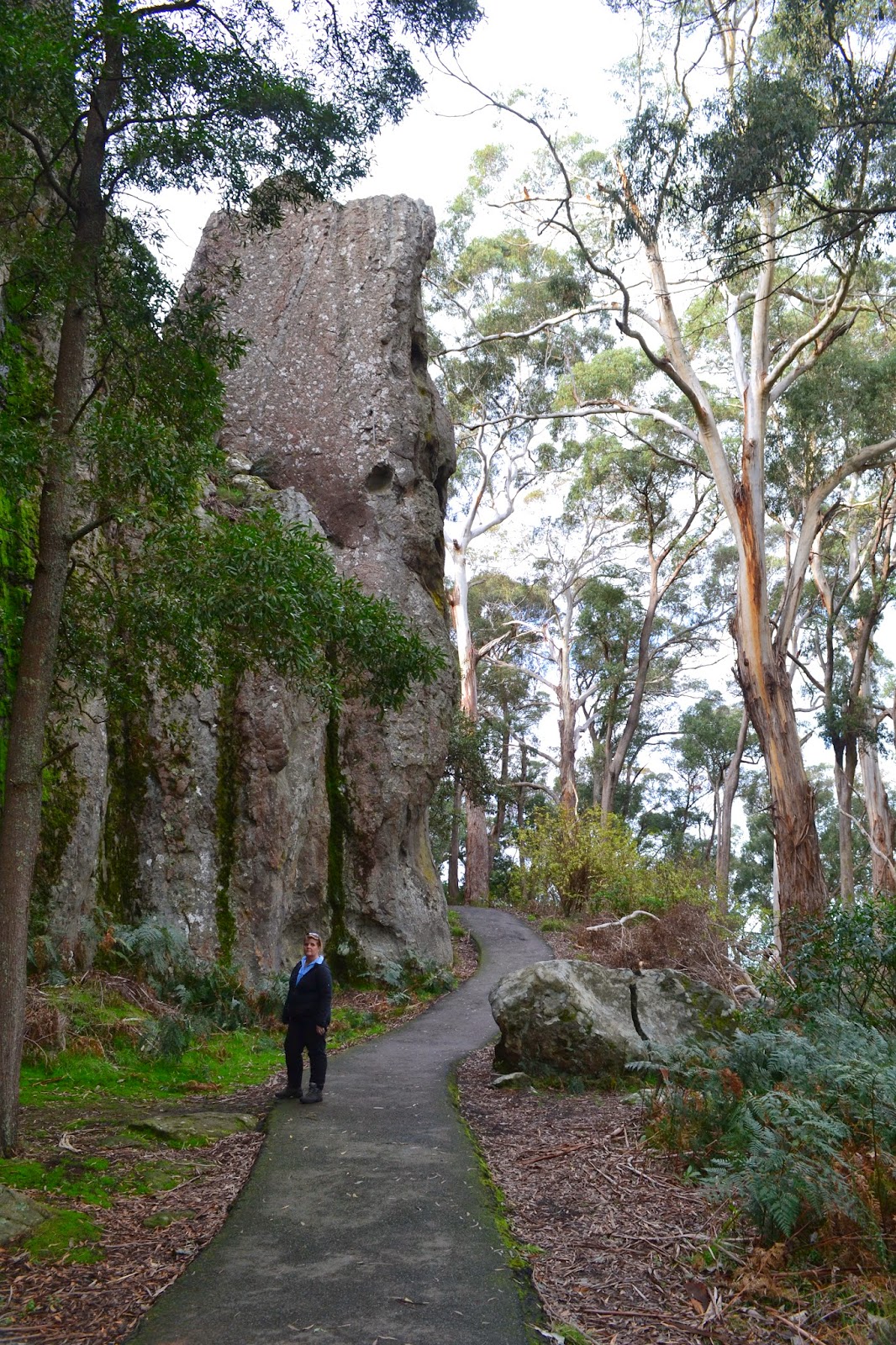
Sam, heading through the Tee Tree near the start of the walk.
After a bit of will we, won't we, we decided to head down to the Prom and at least start the walk and see if the weather improved. By the time we started the short walk over to Oberon Bay it was already late in the day and the rain was fairly constant. We made our way through the Tee Trees behind Norman Bay in the gloom, the occasional break in the trees giving us glimpses out to sea that only reaffirmed that it wasn't going to stop raining any time soon. Breaking out onto the very southern end of Norman Bay we quickly left the beach and headed out to Norman Point, dropping our packs for the side trip out to the lookout. Sam decided that it wasn't worth heading all the way to the lookout to check out more grey clouds but I pushed on anyway, Sam was right!
Looking back to Norman Bay from the track around Norman Point.
From the lookout on Norman Point.
Still smiling!
After retracing back to my back we continued on to Little Oberon Bay, normally one of the more photogenic of Wilsons Prom's beaches, I struggled to get a good shot today though, the situation wasn't helped by the fact that I was using my waterproof camera and not the DSLR (the DSLR wouldn't come out of it's dry bag for the whole trip!). I haven't walked in the Prom since the big floods that went through a few years ago and was amazed to see how much the landscape had changed, whole sides of mountains had been scoured away. To climb away from Little Oberon Bay now you have to traverse up and around a huge chasm that was never there before, the only good thing about the new scar was the creek that flowed down it provided another source of drinking water.
Little Oberon Bay.
A new bridge approaching Little Oberon Bay.
The new chasm running down the hill into Little Oberon Bay.
The one positive is that there is now another water point.
Less than 90 minutes after leaving Tidal River we set foot on Oberon Bay, once again we were faced with a massively scared landscape. Growler Creek had been scoured out and judging by the rocks, the bed of the creek was now about 30 cm lower that it used to be. The side of the mountain beside it looked like it had been deposited into Bass Strait. After crossing Growler Creek we made our way up the wide expanse of Oberon Bay into a howling gale, reaching the turn off to the campsite with some relief.
A wind squall ripping across Oberon Bay.
Oberon Bay.
It looks like half the hill above Growler Creek has been washed into Bass Strait.
The old height of the bed of Growler Creek is marked dark spot on the boulder.
Sam pushing into a southerly on Oberon Beach.
The camping spot at Oberon is well sheltered in the Tee Tree, we quickly got the tent up and Sam jumped in to get into some dry clothes. I decided that I may as well stay out in the rain and start to cook our dinner, for our 23rd anniversary we had homemade dehydrated spaghetti bol, with freeze dried hot apple pie for desert, washed down with a hot chocolate and Baileys. I've had worse! After packing everything away I stripped of a dived into the tent managing to keep most of the water and sand outside. We spent the evening reading and listening to the am radio, the weather forecast wasn't getting any more promising.
Our damp tent at the camping area at Oberon Bay.
Cooking up our anniversary dinner in the rain.
Warm and dry, happy 23rd anniversary.
After a beautiful nights sleep with the sound of the rain drops on the tent and a long sleep in whilst we waited for those rain drops to ease, we eventually had to make a move. It stayed fairly dry while we cooked up our porridge for breakfast but by now we were over the rain and had decided to pull the pin and head back to the truck. We quickly packed up between the showers, the decision to head back gave us a renewed focus, we now knew we would be dry in a couple of hours. Retracing our outward route was fairly uneventful, the showers continued all the way back to Tidal River, of which I was fairly happy, there's nothing worse than deciding to cut a walk short due to the weather and then having the weather change for the better as soon as you get to the car.
Next morning we packed up in between showers.
Growler Creek.
Rain drops in the tannin stained water of Growler Creek.
As we now had four nights up our sleeves we decided to head up to Mildura for a few days in the sun. So, in the end we did spend our days basking on the beach only not on at the ocean but on the Murray River.
The weather has cleared a bit as we approach Little Oberon Bay from the south.
A Wallaby above Little Oberon Bay.
The Dirt
You need a camping permit to camp out at the out stations on Wilsons Promontory, and I can now tell you that those permits aren't refundable. The Prom has been well and truly ravaged by flood and fire in the last decade and judging by what we saw on our aborted walk its going to take a while to get back to its old self.
The Tidal River - Oberon Bay walk is only around 12 kilometres return, a nice easy walk.

Approaching Norman Bay.
Sam, heading through the dunes behind Norman Bay.

Pelion Hut to Mt Ossa return, Overland Track - April 2010

Mt Oakleigh from the Pelion Hut heli pad. I think the mountain just visible in the mist in the distance is Cradle Mountain... ... the flat t...