Down in Hidden Gorge.

The Mambrey Creek day use area was pretty quiet when I shuffled off this morning.

The sign posting and information in Mt Remarkable National Park is generally top shelf.
Thankfully once I'd locked the ute and shouldered my pack the last 18 hours of manic activity eased off a bit and all I had to do was to walk. Leaving the carpark I followed the closed 4wd track up the Mambrey Creek valley for a few minutes before swinging left and starting a fairly long climb up onto The Battery. Whilst this climb goes on for a fair while the gradient and track itself are pretty reasonable really, and the scenery made up for the long up hill grind. Once I'd left the Red Gum lined Mambrey Creek I soon got into the drier native pines which always lift my spirits a bit, and the bonus this morning was that the dry open forest was allowing me to get some great long range views - the views west towards Spencer Gulf being a highlight.

After following the closed 4wd track up the valley for a few minutes...

... I swung left onto a walking track...

... and started the long climb up to The Battery.

I was now starting to get some glimpses of Spencer Gulf out to the west.

I'm quite partial to this type of country.

That's Spencer Gulf in the distance - pity about the flat and grey conditions.

I was climbing for a long time however for the most part it was all pretty easy - this was arguably the roughest section.

Looking up towards Port Augusta.
After climbing for around an hour I suddenly emerged from the bush onto a wide fire track which services the fire towers and telecommunication facilities on The Battery. This 4wd track made for fairly average walking, however I was only walking it for a short time before I swung right (east) off it and started dropping down the walking track towards Hidden Gorge (there is a water tank and small shelter at the turnoff on The Battery). I now progressively lost all the height that I'd gained so far that morning, although once again the gradient was pretty reasonable. Once down in Hidden Gorge the track became more of a pad as I followed the winding route downstream.


My walking track levelled off a bit just before I joined the 4wd track on The Battery.

Once up on The Battery I passed by a (locked) rudimentary fire lookout tower.

There's a small tank and shelter at the spot where the Hidden Gorge track leaves The Battery.

I was arcing around to drop down into Hidden Gorge below those cliffs.

Dropping fairly easily down the walking track into Hidden Gorge.

I'd already lost a fair bit of height since leaving The Battery.

Things are starting to get rougher now as I enter Hidden Gorge.

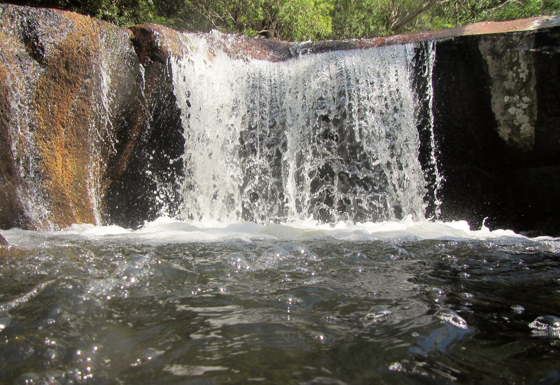
Hidden Gorge.
Being a gorge there was no real chance of going too far wrong in Hidden Gorge, however it did present an issue for me this morning. After rounding a corner I heard the unmistakable sound of bees and sure enough I spotted a bee hive in a dead tree pretty well smack bang in the middle of the narrow gorge... have I mentioned that I'm allergic to bees? Now normally when I encounter bees out in the bush I leave them alone and they seem to leave me alone, although unfortunately these South Australian bees mustn't have been at the table when that agreement was reached! Anyway, despite me trying to give them as much room as possible I managed to get stung before I'd even got halfway passed the hive... fuck me! After quickly getting out of the danger zone I dropped my pack, at the same time managing to discourage another bee that was also keen to share its sting with me. Digging out my antihistamines I scoffed 6 of them while at the same time glancing a little nervously at the sheer walls of the gorge and musing to myself whether or not the Inreach would actually work in this claustrophobic environment.

Whilst the walking gets rougher in the gorge there isn't much chance of going too far wrong when it comes to navigation.

I finally got a bit of sun as I made my way down Hidden Gorge.

Hidden Gorge.

Creek bed walking in Hidden Gorge.

Hidden Gorge.

More creek bed walking in Hidden Gorge.

There is one short section that requires an easy scramble in Hidden Gorge.
With my arm now swelling and throbbing a bit the rest of my journey through Hidden Gorge was fairly uneventful thankfully, with just the great scenery slowing me down now. It was around lunchtime when I finally emerged from Hidden Gorge at Hidden Camp on Alligator Creek. I now swung left (north) along what was initially a walking track, however it soon morphed into a 4wd track a few minutes after leaving the deserted camp. Once on the 4wd track I climbed a bit again as the track traversed the slopes of the surrounding hills, with Alligator Creek mostly a fair way below me in the valley to the west.

The scenery in Hidden Gorge is pretty special.

Hidden Gorge gets pretty constricted in spots.

Hidden Gorge.

Nice rock slab walking as Hidden Gorge starts to open up a bit.

Hidden Camp was deserted when I passed through today.

The Hidden Camp Humpy.

There are some more nice cliff lines north of Hidden Camp.
After around an hour of fairly unexciting walking along the 4wd track I arrived at the small water tank and shelter where Fricks Trail came in on my left. This was the first good water since I'd passed by the tank up on The Battery a few hour ago so I decided that it was time for a bit of a break. My arm was now fairly swollen and throbbing a little, however thankfully I wasn't suffering any other side effects from my run in with the bees, I still decided to scoff down another couple of antihistamines while I enjoyed my downtime though.

I walked this closed 4wd track from near Hidden Camp to Kingfisher Flat Camp. While the 4wd track wasn't the most interesting walk it did mean that I could crank out a few kilometres fairly quickly.

There is a water tank and small shelter at the eastern end of Fricks Track.
After leaving the tank at the end of Fricks Trail I walked through the deserted Kingfisher Flat Camp a couple of minutes later, there is a toilet and tank at this pleasant camping spot. Last time I'd walked at Mt Remarkable was in summer and it was stinking hot, on this visit hypothermia was more of an issue though. I'd been lucky so far today in that while it was cold and the wind was biting I hadn't had any rain, however shuffling up the 4wd track away from Kingfisher Flat I wasn't sure my luck was going to hold. Thankfully I had less than an hour to walk now though, so with one eye on the clouds in the mountains around me I walked with a little more urgency as I made my way north to the Blue Gum Flat Picnic Area.

A few minutes after leaving the tank at the end of Fricks Track I passed through Kingfisher Camp - there is another tank here.

The 4wd track walking continued between Kingfisher Camp and Blue Gum Flat.
Blue Gum Flat is at the end of the Alligator Gorge road access and the picnic ground has tables, a BBQ, a long drop ... and a tap. Now the tap is important as there was no water down at my Longhill Camp so this was my last chance to fill up for a fair while. After topping up my water I left Blue Gum Flat and dropped down the Ring Road (it's marginally better walking than it sounds) for a few hundred metres to cross the dry Alligator Creek and arrive at the deserted Longhill Camp. Longhill Camp is really just a patch of dirt in the bush with nothing in the way of facilities. Once I had the tent up I rehydrated some dinner, although there was no sitting around tonight as the rain had now caught up with me. Still, after a fairly full on last 36 hours I was pretty happy to crawl into the tent and drift off into a fairly deep sleep, the feeling of finally crawling into my quilt must be one of the best things about overnight walking I think.

This tap (with my trekking poles leaning against it) was the closest reliable water to my Long Hill Camp.

Roos grazing on the grass at the Blue Gum Flat Picnic Area.

Dropping down the Ring Road towards Long Hill Camp.
The Dirt.
According to my Alltrails App I walked around 17.5 kilometres and climbed about 636 metres on what I'd call a medium grade days walking. The tracks today were a mix of walking tracks and closed 4wd tracks, although the section through Hidden Gorge was more of a bushwalking pad (there is even one section that will probably require walkers to scramble a bit as they negotiate an old landslide). All the tracks today were extremely well sign posted and maintained. There are water tanks at the Hidden Gorge turn off on The Battery, at Fricks Track down near Alligator Creek and at Kingfisher Flat Camp. The closest water to camp was the tap at Blue Gum Flat (around 500 metres away). The Longhill Camp needs to be booked and payed for with the SA Parks people. I used my Alltrails App and my GPS topos today along with some old notes and map written by John & Monica Chapman.
Relevant Posts.

Apart from a cleared patch of dirt there aren't any facilities at the Long Hill Camp.

It's a little hard to tell however my arm isn't normally this fat!

Despite the bee sting I was still pretty happy with life.

There was now the occasional shower of rain passing through so I was into the tent pretty early tonight.

Unfortunately the GPS dropped a cog again this morning.