Showing posts with label Tasmania. Show all posts

Sunday, November 8, 2020

Windy Ridge Hut to Lake St Clair, Overland Track - April 2010

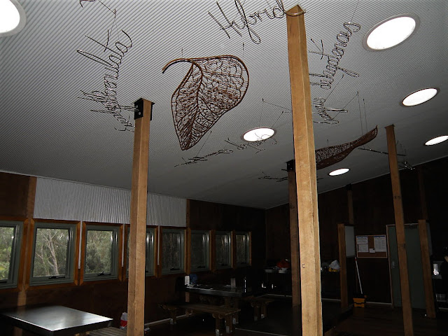
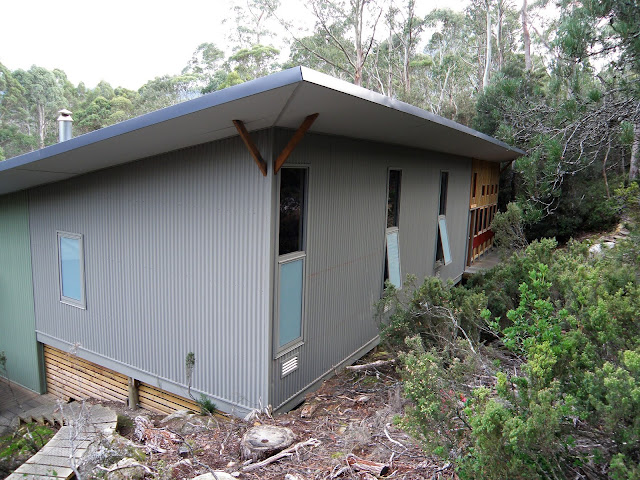
The new Windy Ridge Hut (well, it was new for me back in 2010!).


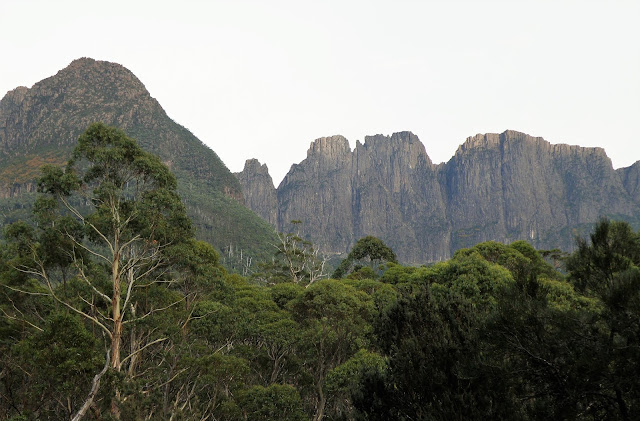
I once again I awoke to fine morning today, however the barometer on my watch was dropping quickly so it looked like a cold front was on its way. Breakfast was eaten admiring The Acropolis out the windows of Windy Ridge Hut, the sun turning the massive cliffs a fiery red. Once again Jess and Julie had decided to walk with me and we were off early as they had to hitch back to Hobart that night, I on the other hand had an appointment at the Derwent Bridge Wilderness Hotel with a big steak!

The view of The Acropolis and Mt Geryon over breakfast as Windy Ridge Hut.

Windy Ridge Hut was very flash.


The walk from Windy Ridge to Lake St Clair is mostly a gentle down hill ramble with no significant climbs, the Overland Track mostly passing through eucalypt forest and crossing wide button grass plains so it made for fast walking. As we got closer to the Narcissus River crossing, big black clouds started to roll in over Mt Gould and The Minotaur and it now became a race to see whether we would make Narcissus Hut before the storm hit. Crossing the swing bridge over Narcissus River the first big drops of rain started, so the last kilometre to the hut was covered at a cracking pace. Almost as soon as we stumbled in the door of the Narcissus Hut the heavens opened.


Once safely dry inside Narcissus Hut Jess got on the hut radio to ask if ask when the ferry would be able to pick us up, and it happened to be that the ferry was just about at the jetty as we spoke. So the packs went back on and we trotted the last 400m down to the ferry in the rain. The trip was coming to a rushed end however I'd been really lucky with the weather so I couldn't really complain. The trip across Lake St Clair was a rough one with white caps on the lake, I was content to sit there in the cabin, nice and dry, and take in the view of the storm rolling across Mt Olympus.


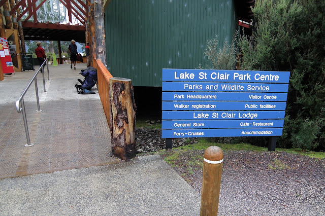
I've just arrived back at the Lake St Clair Visitor Centre and my Overland Track adventure was over. This was another walk that I did before I was putting anything on-line which goes some way to explaining why photos were a bit thin on the ground.


Once back at the visitor centre at Lake St Clair we headed for the café at the Lake St Clair Visitor Centre. After enjoying a coffee and a burger, it was time to say goodbye to my new friends as they had to start hitching back to Hobart, I was a little concerned about them hitching but they insisted that they would be OK. After exchanging email address's and a quick hug they disappeared down the road. Now I was left on my own, the rest of the day involved finding somewhere to stay in Derwent Bridge and getting to the pub for that steak that I had been dreaming about.


My friends Julie (on the left) and Jess enjoying our celebratory meal at the Lake St Clair Visitor Centre.


The Dirt.
I walked around 9.9 kilometres this morning and climbed bugger all, probably less than 20 metres I'm thinking on what was an easy days walking. Over the 6 days of my Overland Track walk I've walked around 87.1 kilometres and climbed about 3440 metres. The camping and hut options today were pretty well limited to Narcissus Hut. Having said that there is a beautiful side trip out to Pine Valley Hut that is best enjoyed over 2 or 3 days that not only allows time for you to climb onto The Acropolis and The Labyrinth but also provides a few camping opportunities as well near the Pine Valley Hut. Water was available fairly frequently again today. The ferry from Narcissus Hut to the Lake St Clair Visitor Centre has to be paid for (I can't remember the cost) and it can be organised by radio from Narcissus Hut. The visitor centre at Lake St Clair not only provides information and supplies but it also has a very nice café. The Derwent Bridge Wilderness Hotel is a great place to enjoy a meal after the walk.


The Overland Track is probably the most well known multi night walk in Australia, if you're after solitude its probably not for you although having said that its an excellent walk through stunning scenery on a surprisingly well graded and easy track. All of the big climbs on the Overland Track are on side tracks and all are worth doing if time, weather and fitness permit. If climbing any of the mountains be aware that some scrambling may be required, during this trip I observed tears on more than one occasion from people on the steeper, airier (is that a word?) sections. I didn't complete the whole track on this walk, the OT finishes at Cynthia Bay via a lake side walking track and adds about 15.8 kilometres  to the walk, if you have the time it is a pleasant walk and the small and rustic Echo Point Hut is particularly photogenic.

Relevant Posts.


I'm tired and smelly however I look pretty content with life!

Waiting for the bus at the Derwent Bridge Hotel. Try and make time to have a meal here when you finish the Overland Track if possible.
Wednesday, November 4, 2020

Pelion Hut to Windy Ridge Hut, Overland Track - April 2010

For the second morning I row I had a magic view out towards Barn Bluff from Pelion Hut.


Once again today dawned fine, and once again I had great views across the foggy Pelion Plains to Mt Oakleigh from the heli pad. I wasn't mucking around too much this morning as I'd had stayed two nights at Pelion Hut I'd decided to push onto Windy Ridge today and skip Kia Ora Hut, which meant I had a fair day infront of me. I had a bus to catch at Derwent Bridge in a couple of days and I was looking forward to a big steak with heaps of vegetables at the hotel... and maybe a cold frothy? So after a quick breakfast I packed my gear away, said my goodbyes and set off for Kia Ora Hut.

Mt Oakleigh from Pelion Hut.

This was my last (and as I type this, it still is my last) look across Pelion Plains.


First up this morning I climbed the Overland Track back up to Pelion Gap with Graham, the track to the gap is familiar to me now and it is a nice walk with a pretty gentle gradient as I climbed up the valley of Douglas Creek passing numerous cascades and waterfalls. When we got to Pelion Gap I stopped had a bite to eat and drink, Graham stashed his pack here and we said our goodbyes, he was climbing Mt Ossa and then staying at Kia Ora, I was pushing onto Windy Ridge. After leaving the gap I passed through Pinestone Valley, this is a particularly pretty section of the track and the gentle downhill gradient felt good after all yesterdays climbing.

Another sensational morning up at Pelion Gap.


By mid morning I was basking in the sun on one of the camping platforms at Kia Ora Hut. I'd certainly had got lucky with the weather on the Overland Track section of the walk, where as the preceding Penguin Cradle Trail walk had been done with precipitation on every day that I was on the track my walk, on the Overland Track I hadn't seen a drop of rain yet. Leaving Kia Ora Hut it was less than an hour before I got to Du Cane Hut, the most rustic and traditional looking hut on the walk I think. With Castle Crag and the Du Cane Range towering over the hut this is a very scenic spot to stop for awhile.  Taking off my shirt I laid it out on the heli pad to dry the sweat in the bright sun, I'd gone from wringing wet because of rain to wringing wet with sweat although I'd prefer the heat any day. I celebrated the glorious day by using my second last satchel of Tang and eating copious quantities of scroggin.


Morning smoko was enjoyed on one of the deserted camping platforms at Kia Ora Hut.

The view towards Mt Massif from Kia Ora Hut is pretty special.

The heli pad at Du Cane Hut was all the excuse I needed to stop for lunch...and get in some more shirt drying.


All too soon I decided that it was time to move on, the track from Du Cane Hut gently climbs up the valley of the Mersey River deep in the myrtle forest. There are two side tracks to waterfalls which are both worth a look along here if time and energy permit. I passed the Cradle Mountain Huts guided walkers at the turnoff to Hartnett Falls, they certainly smelled better than me. Guided walks are a bit of a contentious issue in national parks for some people, my personal thoughts are that the more people that enjoy these areas sustainably, then the more chance we have of preserving these areas forever. I have seen many people on these guided walks who would not have the skills or fitness to experience these places any other way, although there has to be a balance.

With Castle Crag towering overhead Du Cane Hut is another pretty spot.


By early afternoon I'd arrived at Du Cane Gap, the last point on the track that reaches over 1000 metres. I was getting a little tired by now so the gap was all the excuse that I needed to once again drop my pack and stop for awhile.  The eucalypts at Du Cane Gap largely block out the views, however you can still see cliffs Falling Mt and the Traveller Range towering over the gap. From Du Cane Gap the Overland Track got a little rougher as it descended through more Myrtle forest to reach the shiny new Windy Ridge Hut.

Du Cane Gap provided my last reasonable climb on the Overland Track. That's Falling Mountain behind me. I'm looking pretty rooted tired... must of been a solid day.


Arriving at Windy Ridge Hut I staked a claim on one of three bunk rooms (the snorers quarters) and went to explore the hut a bit more. The new hut is massive, it has a drying room, a huge communal area to cook and socialise and big panoramic windows facing out towards the huge cliffs buttressing The Acropolis. Having skipped Kia Ora Hut I was now pretty much in the bubble that started the Overland Track in so I was reunited with Jess and Julie. The girls had saved me a bit of salami so I off loaded all my extra scroggin to them, they seemed to like the trade and by now I was craving meat, a win win situation for everyone.  That evening was spent eating and telling tales and generally enjoying my last night on the Overland Track. Eventually I retired to the snorers quarters to read and then sleep the sleep of the contented.

The Dirt.
I walked 16.8 kilometres and climbed 550 metres on what I'd call a medium grade day's walking. Over the five days that I'd been trudging my way south on the Overland Track I've walked around 77.2 kilometres and climbed around 3420 metres. The track today was pretty well typical Overland Track standard, by that I mean no super steep climbs and a fairly well constructed pad. Camping is available at a couple of spots on the climb to Pelion Gap,  Kia Ora Hut, Campfire Creek at the start of the climb to Du Cane Gap and Windy Ridge Hut (once again check on the legalities of the camps away from the huts).  If anyone wants a roof over their heads then Kia Ora and Windy Ridge Huts are the only choices, Du Cane Hut is an emergency hut only. Water was once again pretty easy to find today. Once again I was using the House of Chapmans notes and maps out of their Cradle Mountain Lake St Clair & Walls of Jerusalem National Parks book.

Relevant Posts.


Sunday, November 1, 2020

Pelion Hut to Mt Ossa return, Overland Track - April 2010

Mt Oakleigh from the Pelion Hut heli pad. I think the mountain just visible in the mist in the distance is Cradle Mountain...

... the flat topped mountain a little further to the left is Barn Bluff.


Waking up today I decided to leave my overnight pack at Pelion Hut and climb Mt Ossa and Mt Pelion East as a day walk. Jess and Julie, who I'd climbed Mt Oakleigh with yesterday decided to climb Mt Ossa with me and then push on to Kia Ora Hut. Leaving Pelion Hut the girls set a cracking pace as we climbed up the Overland Track to Pelion Gap where we stashed their packs. Leaving packs at Pelion Gap is always a little fraught as the Currawongs have worked out how to open zips. I've found that the best way to defeat them is to place your pack cover over the pack and try and wedge the pack against a log or a rock, although then you have to be a little careful of the small furry ground based creatures chewing through your pack!

Mt Oakleigh and Cradle Mountain from Pelion Hut.

Looking across the foggy Pelion Plains towards the distant Barn Bluff.


Leaving the Overland Track at Pelion Gap the Mt Ossa Track skirts around Mt Doris and then heads via a scree slope up into a steep gully, towards the top it gets a little airy and it seemed to cause trouble for other people that we met climbing that we met when we were descending. After the gully there is a little more boulder hopping and then we broke out on the summit plateau. The plateau has the unusual sight of a large tarn on it. I was unable to resist ringing Sam and telling her that I was standing on the highest point in Tasmania. We were lucky again with the weather today, blue sky and sunshine with little in the way of wind is about as benign as the conditions get up here. With Mt Ossa being the highest mountain in Tasmania the views from up here are extremely good, with rugged mountain ranges stretching away to all points of the compass and no real sign of the land being modified by man (apart from the track itself) it was pretty easy to lose an hour up here.

The track to Mt Ossa climbs this gully between the two rocky outcrops.

There was always an excuse to stop and take things in on the climb.

The summit of Mt Ossa is a fairly flat plateau... complete with a substantial tarn.

Mt Ossa

It was third time lucky for me today as far as climbing Mt Ossa goes.

The pinnacle in the middle distance is Mt Pelion East... my afternoons objective.
 
It's wild country in every direction from up here.

Yes, I look pretty happy with life.

Mt Ossa


After retracing our steps back down to Pelion Gap we found that despite our best efforts the Currawongs had got into Jess's pack, she wasn't alone however as 3 or 4 other packs had also been opened and the contents were spread around. I had a bite to eat with the girls and then we said our goodbyes and they continued on to Kia Ora Hut while I headed off towards Mt Pelion East. The track to Mt Pelion East was very muddy to begin with, however once above the tree line the ground changed to sandstone and the mud was gone. Following the cairns got me to the climbing gully and from there it was a short scramble to the top. Finding a flattish rock to sit on I enjoyed the view from the small summit, now when I say small I'm talking in area not height, while there is not much flat ground on the small summit the position of the mountain meant that my lofty perch afforded a grandstand view of the surrounding country. 

Lake McFarlane
Dropping back down to Pelion Gap from Mt Ossa.

The alpine scenery was beautiful. 

The final scramble up onto Mt Pelion East was fairly airy. 

Mt Oakleigh in the middle distance. Barn Bluff on the left and Cradle Mountain on the right in the distance from the summit of Mt Pelion East.


Sitting up here on Mt Pelion East I soaked it all in with a certain sense of satisfaction this afternoon. I'd ascended over 1100 metres for the day which I thought wasn't bad for an old bloke and I'd finally got to climb Mt Ossa and Mt Pelion East, two mountains that had eluded me on all my previous visits due to heavy snow and ice. Scrambling back down from the summit I slowly meandered my way back to Pelion Gap and then down to Pelion Hut for another convivial night at the hut. 


With Mt Pelion East being a little out board from most of the other big mountains it provided a great view this afternoon.
The view from Mt Pelion East.


There aren't a lot of flat rocks on the summit of Mt Pelion East.

From Mt Pelion East.
Mt Pelion East


Arriving back to Pelion Hut I found that the only person that I knew was Graham, a horticulturist from Victoria, the bubble that I'd been walking in on the Overland Track section of this walk had moved on in the daily shuffle from hut to hut. There was only 6 of us at Pelion Hut that night so crowding wasn't a problem as I'm guessing the hut would sleep at least 50. I past the night talking to Graham about his native nursery back in Victoria in between watching the wildlife around the hut.

Time to drop down and head back to Pelion Hut.
I'm looking a little relieved now I'm down the steep bit.

Pelion Hut


The Dirt.
I walked 11.4 kilometres and climbed 1140 metres on what was a hard day on the track. Over the four days of my Overland Track adventure so far I've walked 60.4 kilometres and climbed 2870 metres so far. Now I've said that this was a hard day however I really need to clarify that a bit, while there is a bit of of elevation gain today the climbing is mostly pretty well graded... except for a bit of scrambling near the top of Mt Ossa and the final scramble to the summit of Mt Pelion East, scrambling up the final rocky chute onto Mt Pelion East was a bit more exposed than any of the other scrambling that I'd done on the Overland Track on this walk. There is water in a few spots on the climb from Pelion Hut to Pelion Gap and there are a couple of spots to camp (check o the legalities of this now days though), accommodation is either at Pelion Hut or over the pass at Kia Ora Hut. Once again I was using the House of Chapmans notes and maps out of their Cradle Mountain Lake St Clair & Walls of Jerusalem National Parks book.

Relevant Posts.


It was looking like it was going to be another cold night.

I'm thinking that it'd be a good idea to treat the water at Pelion Hut!

Thursday, October 29, 2020

Windermere Hut to Pelion Hut, Overland Track - April 2010

The view from Mt Oakleigh this afternoon. 

I woke early this morning, yes, one of the joys of everybody sleeping in the one room in a hut. After a quick breakfast I said my goodbyes and was on my way. The aim for today was to get to Pelion Hut, drop my pack and then make the climb Mt Oakleigh. This little side trip would make it a solid days walking and add an extra 10 kilometres and 500m climbing to the day. The mist was down again this morning and the first 2 hours walking provided only tantalising glimpses through the fog. Unfortunately the mist didn't clear until after I'd passed by the Forth River Lookout, so there would be no views today. 


The early morning sun was lighting up Barn Bluff as I left Windermere Hut this morning.

Early morning on the Overland Track.

I'm heading into the mist.


There is a lot of duck boarding over Button Grass plains on this section and it always makes for quick walking. When the sun started poking through the gloom it was lighting up the Button Grass in a golden glow, the wet grass glistening in the light. At the same time the Snow Gums were appearing like ghost apparitions in the mist, yes I couldn't think of many places I'd rather be.

Button Grass
The duck boards make for fairly quick walking.
Snow Gums in the mist.


After the quick walk across Pine Forest Moor it was time to drop down to Frog Flats where the Overland Track crosses the River Forth, this is the lowest section of the Overland Track. The track drops slightly over 200 metres, however it is very well graded. The bridge over the River Forth provides another traditional place to stop and have a drink, grab something to eat and prepare for the 160 metre climb up to the Pelion Plains. An hour after leaving Frog Flats I was at Pelion Hut and preparing for the next part of the days adventure.
Eventually I dropped out of the mist.

The Overland Track crosses the River Forth at Frog Flats. I'm thinking that this is the lowest point along the Overland Track.


While I was having a quick lunch at Pelion Hut a couple of friends from last night, Julie and Jess turned up and it was soon decided that they would climb Mt Oakleigh with me this afternoon. So after lunch we grabbed our day packs and set off to cross the Pelion Plains. After crossing Douglas Creek on a suspension bridge we took a left fork and headed across the Button Grass towards a slight saddle in the crest of Mt Oakleigh. The walk across the plains was damp (very damp!) so we took a bit of a meandering route to try and not get too wet, after jumping a deep creek and shimmying across a branch over another deep creek we reached the bottom of the climb. The climb up Mt Oakleigh is one of the more interesting on the Overland Track in my opinion. You have to pass through a wide range of environments, from Button Grass, to Eucalypt, to Myrtle, to Pandanis and Snow Gums before finally alpine grass. After reaching the summit ridge it was an easy walk to the west to some rocky pinnacles overlooking the Forth Gorge. On a good day like today the view from up here was absolutely breathtaking, standing on a pinnacle 100's of metres above the valley floor with the cloud swirling at my feet is another experience that has stayed in my memory over the years.


There is a good suspension bridge over Douglas Creek on the Arm River Track.


Heading across the rather damp Pelion Plains towards Mt Oakleigh.

The summit of Mt Oakleigh is a fairly flat plateau.


Mt Oakleigh


After a bit of a rest on the summit and numerous photos we started to make our way back down. Our walk back down was reasonably uneventful until Jess managed to fall waist deep in one of the creeks on Pelion Plains. Reaching Douglas Creek I figured that after 3 days it was time for a decent wash so I stripped off and jumped in... well it wasn't one of those lingering tropical waterfall plunge pool types of swims, I'm thinking I was in and out within thirty seconds! Pulling on my clothes it wasn't long and we were back in the hut feeling very fresh and clean. Pelion Hut is large hut, it sleeps about 60 people so I had no problem grabbing my own room this afternoon. I'm thinking that the hut is so big because it not only services walkers on the Overland Track but it is also at the end of the Arm River Track (a short cut into the middle reaches of the Overland Track) After cooking dinner the rest of the night was spent in convivial chat with with the other hut visitors before I settled into my sleeping bag for another early night.

I'm thinking that the true high point on Mt Oakleigh is that low ridge in the distance.


Mt Oakleigh

That's Pelion East on the left and Mt Ossa on the right.

Mt Ossa from Mt Oakleigh... tomorrows adventure!


The Dirt.
I walked 24 kilometres and climbed 720 metres on what I'd call a hard days walking. Over the three days of my Overland Track adventure I'd walked 49 kilometres and climbed 1730 metres. Pelion Hut is the only option today if you want to sleep under a roof (Old Pelion Hut is for emergencies only). Some people camp down at Frog Flats although I've never stopped there. I'm thinking that there was some scrambling on the climb up to Mt Oakleigh, there was also some pretty wet country as I made my way across Pelion Plains to the base of Mt Oakleigh. Water was generally fairly easy to find again today. Once again I was using the House of Chapmans notes and maps out of their Cradle Mountain Lake St Clair & Walls of Jerusalem National Parks book.

Relevant Posts.


Dropping back down to Pelion Plains. Pelion Hut is on the tree line towards the left of the photo.

Lake Ayr

Crossing Douglas Creek on my way back to Pelion Hut I decided to suck it up and have a quick swim. 


Pelion Plains

Pelion Hut to Mt Ossa return, Overland Track - April 2010

Mt Oakleigh from the Pelion Hut heli pad. I think the mountain just visible in the mist in the distance is Cradle Mountain... ... the flat t...