Showing posts with label Queensland. Show all posts

Thursday, March 16, 2023

Cabbage Tree Camp to Carnarvon Gorge Visitor Centre, Carnarvon Great Walk, Carnarvon Gorge National Park - April 2014


I was packed up and on my way pretty early this morning.

After the trauma with the bull ant and then the squealing and banging around of the pigs for the rest of the night, I was not overly upset to wake up early and get on the track this morning. I had a big day ahead of me today, apart from the walk I had a 600 kilometres road trip to meet some friends for dinner. With all that in mind I got up at 5am - packing up and eating brekky while the first light crept over the plains and lit up the cliffs below me.

At least the scenery compensated for my early start.


Right on 6am I started walking, now according to my elevation profile today's walk would be a 'piece of piss', a gentle downhill gradient all the way to the car, however a closer examination of my topo map showed something called the 'Demon's Ridge'! An even closer examination showed that I was going to be climbing up the Demon's Ridge not descending, now both the elevation profile and the topo map couldn't both be right so I had a sneaking suspicion that I'd be doing a bit of climbing after all.

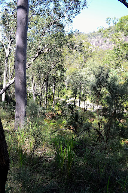
I was dropping down into that valley.

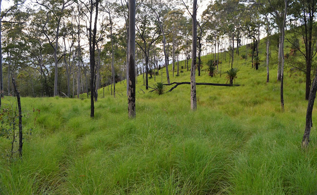
I was straight into a big descent and quickly found myself down off the Consuelo Tableland and onto Jimmy's Shelf. It appears that the track clearer hadn't made it this far as I found myself wading through waist deep grass, not really a problem except that it was now around 6:30 in the morning and the grass was soaking wet with dew, and consequently in about thirty seconds so was I. Slowly making my way over the head waters of North and South Arch Creek, which were both flowing strongly, I eventually found myself at the bottom of Demon's Ridge, I was definitely going up again.

The high and wet grass was making life a little uncomfortable this morning.


Thankfully I had my gaiters on this morning.

Climbing the Demon's Ridge wasn't too bad however as by now my pack was fairly light, behind me was The Ogres Thumb and in front of me was The Devil's Signpost. I think the early explorers were on the same drugs as the person who did the elevation profile on my map! I now did have a gentle descent however as the track kept fairly close to the edge of the escarpment, eventually depositing me onto the tourist track to Boolimba Bluff.


I was slowly making my way across to that bluff.


Stashing my pack I walked the last half a kilometre to Boolimba Bluff lookout, my last lookout for the trip. Boolimba Bluff provides a great view of the cliffs around the entrance of Carnarvon Gorge as well as the sandstone escarpment leading off to the south east. Still being fairly early I had the lookout to myself which was probably a good thing as I think by that stage I smelt a little ripe.

I'm dropping down to cross either North Arch or South Arch Creeks (hey, it was almost ten years ago!).

Both the creeks had good water in them.

It looked like the track clearers hadn't made it down here.


I now just had the descent off Jimmy's Shelf down to the gorge. Saddled up with my pack I quickly descended hundreds of steps and a couple of ladders as I was keen now to have a shower and get on my way over to Warwick. I passed quite a lot of day walkers puffing their way up the steep track, every time I went past someone I'd get a whiff of perfume or soap, I was hoping that my nose was super sensitive after being in the bush for six days and that there noses weren't quite so sensitive, however I suspect that the main topic of conversation for the day walkers on Boolimba Bluff that day would have been the smelly bloke with the big blue pack! Once in the gorge again I had a short walk to the first creek crossing, hopping across the stepping stones my walk was officially over.
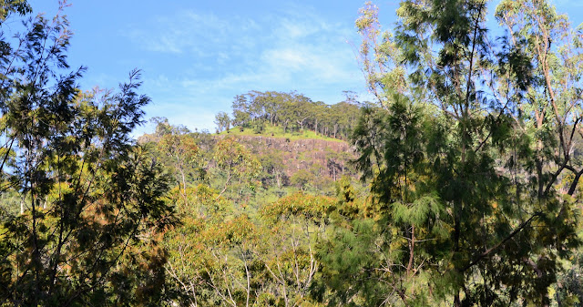
I was about to start climbing again.

This was my last water for the day.


Climbing Demon Ridge.

After signing out with the ranger I grabbed a quick shower and headed off on my drive to Warwick. 600 kilometres in 7.5 hours should have been do able, but I didn't count on the thousands of vehicles in the CSG and mining industry clogging up the Warrego Highway. Last time I was out this way I would go past a vehicle every kilometre or two, however now the highway is one continuous line of road trains and mining vehicles. I was passing twenty vehicles every kilometre. Someone's making a shit load of money out here, lets hope the environment survives the onslaught!  An hour late I finally pulled into my friends Paul and Rachel's place at Lake Leslie near Warwick. I had a wonderful night with some great friends, Paul's BBQ and Rachel's mums homemade apple pie going down particularly well after the freeze dried I'd eaten for the last 3 nights.

Now I was climbing I started to get some long range views again.


Boolimba Bluff views.


The Dirt.
I walked around 16 kilometres today and climbed about 323 metres on waht I'd call a medium grade days walking. I could of picked up water as I crossed North and South Arch Creeks however I wouldn't rely on them towards the end of the dry season. The track itself was fairly overgrown today although that is probably just due to me passing through very early in the walking season before many others have knocked the grass down. I used the Carnarvon Great walk topo map today - although the elevation profile was way out on the old edidition that I was using.

Looking into the start of Carnarvon Gorge from near Boolimba Bluff.


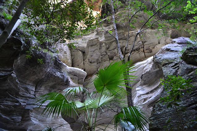
So what to make of the Carnarvon Great Walk? We'll first things first, its primary a forest walk, not a gorge walk. Having said that, the days that are in the gorge are spectacular. Coming from the south of Australia I found the forest walk interesting as to a large extent the vegetation was completely different to what I get around home. Once out of the gorge the track becomes a bushwalking pad, however it is adequately marked with arrows on the trees at critical spots and small signposts at track junctions. It looks like the rangers slash the grass when they can, however be prepared not to be able to see your feet for long sections, gaiters would be an advantage. There are a couple of sections of easy scrambling on the climb to Battleship Spur but nothing to taxing

The track from Boolimba Bluff back to the vistor centre was a class up from a lot of the great walk standard.

I'd left my pack at the great walk junction.
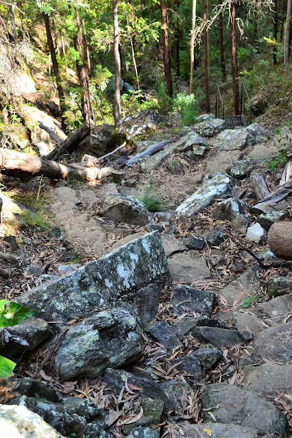
The Boolimba Bluff Track dropping steeply towards Carnarvon Creek.


I carried water for each days walking and filled up at the designated camping area's. I found some flowing water almost every day but I wouldn't rely on that as I was there at the end of their wettest season. As usual I carried a PLB and GPS as well as the Carnarvon Great Walk topo map and a compass. I have the 2009 edition of the map and the elevation profile on my map was way out, its probably been up dated on later editions. Apart from all that its a typical Australian walk, you need to be fully self sufficient with food, shelter and anything else you may need for six days.


Once leaving the Battleship Spur on day two I only encountered one walker until I started to meet day walkers on Boolimba Bluff near the end of the walk on day six. My mobile picked up a strong signal on the edge of the Consuelo Tableland at the end of day five, but lost it when I dropped down to Jimmy's Shelf and I didn't get a signal again until I neared Injune on the drive home. Unless you're with Telstra you probably wouldn't get any coverage. Overall I can say that I really enjoyed this walk.


Relevant Posts.

I can see Carnarvon Creek through the trees - the descent (and the walk) is almost over!
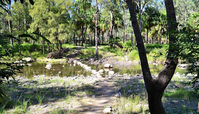
Crossing back over Carnarvon Creek to the visitor centre.

Time for a shower...and then the road trip!

Sunday, March 12, 2023

Foley's Spring Camp to Cabbage Tree Camp, Carnarvon Great Walk, Carnarvon National Park - April 2014


Early morning at my Foley's Spring Camp.

I had a bit of a restless night at Foley's Spring, I kept having dreams of a brumby trampling me while I was trapped in the tent! I did wake at one point with one fairly close to the tent, however after asking it politely to vacate the area it seemed to go and I was left in peace. It seemed on paper that I had a reasonably easy day coming up, so I didn't bother getting out of the tent until 8:00am.

Foley's Spring.

After the usual porridge for brekky I went back down to the spring to have a poke around, playing with my camera to get the effect of moving water. Unfortunately my photography is like a lot of things in my life in that my talent doesn't match my ambition! So after getting a couple of mediocre photo's I packed up and headed off.

Leaving Foley's Spring I ambled past the salt lick.

Climbing back up to meet the great walk.

I'd got lucky with the weather again today.

My first stop today was the usual camping area, Consuelo Camping Zone, this was the perfect place for a second breakfast and to top up with water. After a little break I headed off across the Consuelo Tableland. The walking today was the easiest since I'd left Carnarvon Gorge as the route tended slightly downhill for most of the day. I was starting to get a bit peckish when I spied the perfect lunch spot in a small copse of cycads as one of them had grown parallel to the ground for a couple of metres before making its break for the sun. The trunk made a perfect bench to sit and prepare my lunch on, I even had a conveniently placed trunk from another tree next to it that I could use as a back rest, this was the best seat I'd had since day one - yes, I'd been walking for enough days now that I was appreciating small luxuries!

The Consuelo Camping Zone.

There is a big underground water tank here.


After a leisurely lunch break I headed off towards Cabbage Tree Camping Zone arriving around 3 pm. I'd originally planned to camp here but the ranger suggested to push on for a while and camp where the ridge narrows and the views start, which sounded like a plan to me. Before heading off though I had a couple of chores to perform. The first was to get enough water to last for tonight's camp. The second was some emergency first aid on my shirt, it had worn through on my back and my pack was now rubbing on bare skin. This isn't the first time this has happened to me on a walk so I knew how to fix it - out came the 'gaffer' tape - definitely one of the most versatile items in my pack. After a bit of bush sewing the shirt was as good as new (well it would last another day).

Heading towards the Cabbage Tree Camping Zone along the great walk.


Double barrel cycads.

My lunch stop was sorted.

So after eating the last of my scroggin I headed off to my alternative campsite. I was now walking out onto the edge of the Consuelo Tableland and the country was dropping away very quickly to the north and the south. When I found a flattish patch of dirt I called stumps for the day and the view from my tent was extensive. I was looking to the south with North Arch Creek  200 metres directly below me, in the middle distance there was Carnarvon Gorge and stretching into the distance there were sandstone cliffs receding into the distance. Not a bad spot to watch the sun go down whilst I tried to digest another meal of freeze dried.


Before...

... and after😀

The ground around my camp had been badly rooted up by pigs, so I figured that it may get a bit noisy latter on... time would tell. Climbing into my tent I got my phone out and to my surprise I had good coverage and I was not only able to call my wife and tell her everything was OK, but I had a strong enough signal to get onto the net and check the bom to see what the weather was doing. After that I was settling down for the night doing a bit of reading when I felt something brush against my balls. Now while normally that would signify good times ahead I had a feeling that since I was alone in the tent there weren't any good times in the offering. Looking down between my legs with my head torch I saw a bull ant of about an inch long about to have a nip at a very sensitive part of my anatomy, F#*K!! I flicked it away with my fingers which really pissed it off, but I couldn't kill it as everything I grabbed in my tent was too soft to finish it off! Being 6'3" and having my pack in the tent with me there wasn't a lot of room to get away from the enraged ant either, everytime I looked away from it to try and find something hard to finish it off with I'd lose it in the dark, oh what fun. Eventually I found a new use for my Iphone...  bull ant dispatcher! It took a bit longer to drift off that night!

Soon after leaving the Cabbage Tree Camping Zone the country started to drop away.


The views from the cliff line beside my camp was extensive. 

My actaul camp site wasn't the best I'd enjoyed on the walk, however the views made up for it. 

The Dirt.
According to my rough calcultions I walked around 19 kilometres and climbed about 220 metres on waht I'd call a medium grade days walking. I picked up water at Foley's Spring and then again when I passed through both the Consuelo and Cabbage Tree Camping Zones. My camp was a kilometre or so past the Cabbage Tree Camp and it was pretty rough - just a flat patch on the pig rooted ground. The views from the edge of the escarpment made the water carry and the rough camp worthwhile though. I was using the Qld Parks Carnarvon Great Walk topo on this walk.

Relevant Posts.


I'd be dropping down there tomorrow morning.


Time for bed...

Pelion Hut to Mt Ossa return, Overland Track - April 2010

Mt Oakleigh from the Pelion Hut heli pad. I think the mountain just visible in the mist in the distance is Cradle Mountain... ... the flat t...