Showing posts with label Town. Show all posts

Monday, June 19, 2023

Whisky Track to Bacchus Marsh, Lerderderg State Park - January 2023

My journey along Whisky Track continued this morning.

I'm about to drop steeply down to cross Whisky Creek - that's Mt Blackwood in the distance.

Back in my early walking days this use to be an off track route known only to a few bushwalkers.


Whisky Creek has cut quite a substantial gorge.
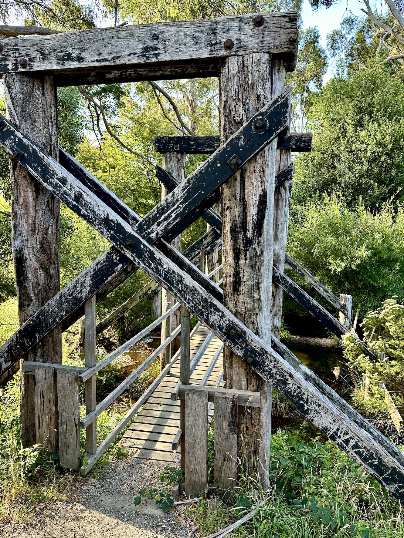
Whisky Creek.

After leaving Whisky Creek the climb up to Square Bottle Track was solid.


Once up on Square Bottle Track the going was pretty cruisey again.

Approaching Mt Blackwood the Lerderderg Track passes through a bit of rural land.


Looking down into Lerderderg State Park from Mt Blackwood.

Nice walking along Clifford Track.

There are some reasonable views down into Lerderderg Gorge from the Blackwood Ranges Track.

Dropping down to pass through Bacchus Marsh - my knees didn't need these!


The Dirt.
According to my AllTrails app I walked around 33.3 kilometres and climbed about 794 metres today on what I'd call a hard walk. The tracks through Lerderderg are mostly well signposted and marked. The Lerderderg Track through Bacchus Marsh is vaguely marked at best - AllTrails still shows the old route down to the railway station along the main street, there is a quieter route marked on the map which I used. I used my AllTrails app along with my Lerderderg Track topo map today.

Relevant Posts.
Previous day of this walk.

YouTube Video.


This is one of the rare cases where it's easy enough to complete a multi night walk utilising public transport in Victoria.

Sunday, June 18, 2023

Suckling Track to Whisky Track, Lerderderg Track, Lerderderg State Park - January 2023

The quiet 4wd Track walking continued this morning.

I followed Toe Rag Track for awhile - quite appropriate really.

Morning smoko was enjoyed down near the headwaters of the Werribee River.

Wombat State Forest.

At around 900 metres the historic Balt Camp was the walks high point.

There are some introduced trees near Balt Camp.

After leaving Balt Camp the Lerderderg Track started a long descent down to meet the Lerderderg River.

The Wombat State Park sections of the walk are normally more gentle than the Lerderderg State Park sections - although it still has it's moments!

Making the most of what views that I could get.

The last section of the walk into the Garden of St Erth was along an old water race.

I followed the mtb route into Blackwood as the walking track was closed.

The Feral Walker highly recommend a stop at the Post Office Cafe in Blackwood - especially if you are cranking out a 40 kilometre day!

Hiker trash indeed.

After leaving Blackwood I entered the Lerderderg State Park along Byers Back Track.

Byers Back Track.

A splash of colour in Lerderderg State Park.

Climbing Kangaroo Track in the early evening.

I camped just off Whisky Track tonight.

Yes, I'm reading for bed... 40 kilometres is a solid day for a fat, old bloke😉

The Dirt.
According to my AllTrails app I walked around 40.5 kilometres and climbed about 1022 metres on this hard day out. The Wombat State Forest section is slightly easier than the Lerderderg State Park section for the most part. The route into Blackwood along the Lerderderg River has been badly affected by wind storms and a fair bit of the track now appears to follow Lerderderg Road. Also the last section into Blackwood from the Garden of St Erth was also closed so I followed the bike route into town. The AllTrails route wasn't very accurate along the Byers Back Track section in Lerderderg State Park - it almost looked like a GPS had been flown down the gorge on a drone as the the GPX route was almost a straight line whereas the real track weaves in and out of numerous gullies. Leaving the Lerderderg River I climbed Websters Track - the old AllTrails route still shows the track going up Amblers Lane. The camp I used on Whisky Track is basic with no facilities or water, I carried water up from the Lerderderg River. Blackwood has a good pub (I was too early for a meal) and a great cafe called the Post Office Cafe - both good on a long day. I used my AllTrails app along with the Lerderderg Track topo map today.


Relevant Posts.

YouTube Video.


This was a big day out for me😂

Saturday, June 17, 2023

Daylesford to Suckling Track Camp, Lerderderg Track, Wombat State Forest - January 2023


The trail head for this one is pretty low key... it's in the bushes near the lake lookout on Bridport Street.

Leaving Daylesford was probably the trickiest navigation for the day.

The Lerderderg Track crosses this old railway bridge at Jubilee Lake on the way to Wombat State Forest.

Wombat Creek.

Walking the old railway formation in the early evening.


Once off the old railway formation I followed a series of these quiet 4wd tracks.

My bush camp off Suckling Track was a rough one however I still slept well after a pretty big day of work and travel.

The Dirt.
According to my AllTrails app I walked around 12.6 kilometres and climbed about 414 metres on what I'd call an easy days walking. The route out of Daylesford requires a bit of navigation as it isn't always way marked, once out of town things get easier. The camping off Suckling Track is just a flattish bit of ground on the bush - there are no facilities. I used my AllTrails app along with the Lerderderg Track topo map today - the map is fairly important as the AllTrails route wasn't always 100% accurate.

Relevant Posts.

YouTube Video.


Thursday, May 4, 2023

Emerald Lake to Belgrave - April 2023


I started this walk at Emerald Lake - very early on a chilly Autumn morning.


Instead of heading towards Belgrave I spent more than half an hour enjoying Emerald Lake.


Emerald Lake


Puffing Billy stops at the Lakeside Station just above Emerald Lake.


After eventually leaving the lake I followed a tourist track up towards Emerald. 

It felt like I was walking in Europe at times this morning. 


Making my way out of Emerald I followed some quiet suburban streets.


Eventually I swung off Avard Road and into the bush.

A lot of time today I was walking narrow corridors of native bush along creek lines with rural land not far away.


The section of the walk along Menzies Creek was a little over grown in spots.


Menzies Creek.

The walking infrastructure along Menzies Creek is starting to be reclaimed by nature.


I was following Sassafras Creek now.

The weather was sensational today.

Gently climbing along Sassafras Creek towards Monbulk. 


Climbing the Sassafras Creek Track.


Sections of this walk are still suffering from the effects of the big wind storm that ripped through in 2021.

Lunch was enjoyed at the Frank Irvine Reserve in Monbulk.

The section of track along Sassafras Creek between Monbulk and Kallista was a little clearer (mostly!).


Crossing Sassafras Creek again.

Sassafras Creek.

Afternoon smoko was enjoyed at the Kallista Tearooms - with all my friends😅

Leaving Kallista the sky started to cloud over for the first time all day.

I walked the short Margaret Lester Forest Track at Grants Picnic Area.

The Mountain Ash up here are stunning.

I was dropping down Coles Ridge Track towards Belgrave now. 

Mountain Ash.

Coles Ridge Track made for an easy way to finish off the walk.

Luckily I'd timed my arrival into Belgrave to see Puffing Billy shunting back and forth.

The Dirt.
According to my AllTrails App I walked around 22.2 kilometres and climbed about 714 metres on what I'd call a Medium - Hard grade days walking. The tracks on this one vary from easy tourist type tracks to some pretty rough and over grown bushwalking pads. At the time I did the walk there were also a few bridges still out as a result of the 2021 storms. There are a few opportunities along this walk to stop at cafes for a bite to eat, and the walk passes through numerous picnic areas for a picnic is also an option. This is a one way stroll so to do it as I did it either requires a car shuffle or the use of the Puffing Billy Steam Train. This walk was originally written up back in the Jurassic Period by Tyrone Thomas I think, I created a digital map which I used today on my AllTrails App today. 

Relevant Posts.

YouTube Video.


Pelion Hut to Mt Ossa return, Overland Track - April 2010

Mt Oakleigh from the Pelion Hut heli pad. I think the mountain just visible in the mist in the distance is Cradle Mountain... ... the flat t...