Tuesday, March 8, 2016

Anglesea Perimeter Walk~East - February 2016


Late last year an exciting event occurred in the feral house hold, I got myself a new walking guide book, yeah I read these guide books like some people read novels. It's nothing for me to read the same guide book cover to cover 5 or 6 times over the life of the book, I use it as form of escapism where by I imagine myself doing the walk described, using the description in the book to help me visualise the walk in my head. So picking up my new copy of Walking in the Otways from the house of Chapman I read it cover to cover and was looking forward to getting down there to do some walking, and then the fires started over Christmas, here we go again....... Now from what I can tell so far the fires in the Otways are no where near as bad as the still unfolding environmental tragedy in Tasmania, but they still roared through a lot of prime walking areas, which adds to the already large areas of Victoria that have been scorched in the last 10 years or so. So anyway with the need to drop some gear off to get fixed at Point Cook I decided to make the most of it and head down to the Great Ocean Road and christen my new book, not really knowing how many of the described walks have been effected I decided that I'd do a walk out of Anglesea, a fair way from what I believe was the main fire ground down at Wye River.
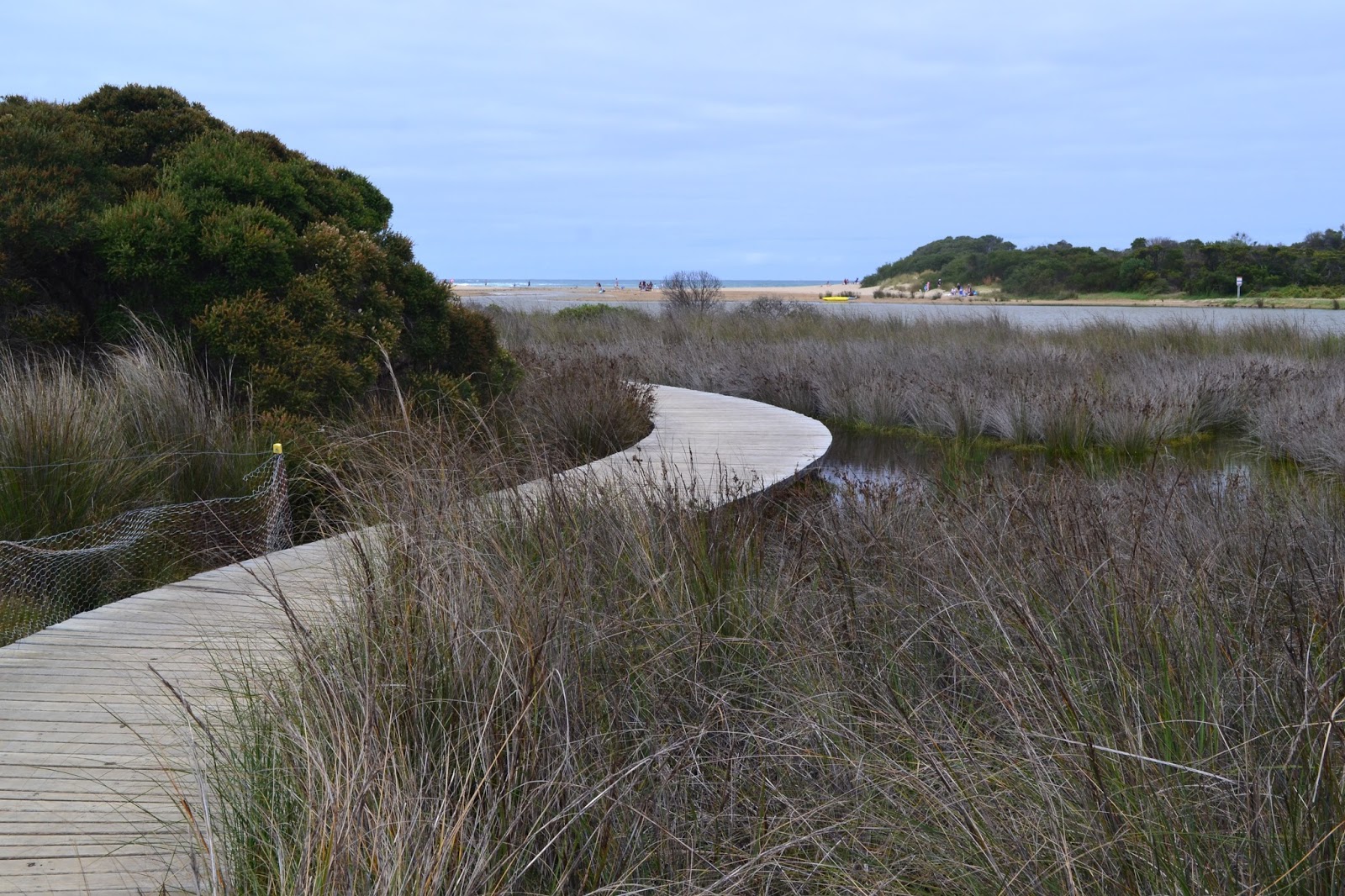
Anglesea Inlet.
Parking the ute at the visitor centre in Angelsea I shouldered my pack and headed off to walk the imaginetively titled Anglesea Perimeter Walk-East. After walking around 200 metres of the route I was seduced into making the short detour into Angelsea to find a cafe for lunch, and that's where I stayed for the next couple of hours, eating, drinking coffee and reading The Saturday Paper, yeah I was doing it tough again. The good news is that while I re-caffeinated in town the mornings grey and overcast conditions started to brighten up a bit and by the time I re joined the route there were patches of blue sky appearing above. While I walked down the eastern side of the Anglesea Inlet I looked across the water to the visitor centre, this had to be a record even at my sloth like pace, two hours after leaving the ute and it was still in sight.
A salt marsh on the eastern side of the inlet.

The walk along the inlet to the beach was actually a pleasant walk with parts of the track a boardwalk over the salt marshes. With the mouth of the inlet closed off to the ocean the water level in the inlet was quite high, in fact in spots it was lapping at the edges of the track. While Anglesea is part of the Surf Coast the beach at Anglesea is actually fairly family friendly for a surf beach, and there were quite a few families out enjoying the late summer day. I didn't spend long on the beach though, turning east I climbed up the old concrete boat ramp almost straight away, heading inland towards the cliff top track. The cliff tops track passes along the border of the Anglesea Caravan and Camping Park, a place were I spent quite a bit of time in my younger years. Passing the back of the caravan park I met up with the cliff track, this track is part of the long distance Surf Coast Walk and its had a bit of money spent on it with a good surface and signage. Now on paper you'd imagine that this section would be one long feast of views, and indeed that's pretty much what it used to be like, but now the crumbling cliffs have been fenced off so that I couldn't actually get very close to the edge of the cliff tops, so what looked good on paper was actually fairly underwhelming in reality, oh well..
Heading out to Anglesea Beach.
The cliff top section of the walk heads along the top of these eroded cliffs.
Tracking along between the Caravan Park and the cliffs.
There is no danger of falling from the cliffs now days.
That's Point Addis in the distance.
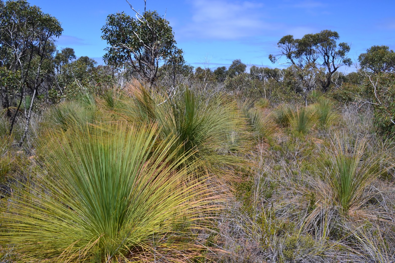
After a couple of kilometres my almost cliff side ramble ended and I headed inland climbing through Anglesea Heath, strangely while this bit of the walk didn't really appeal to me on paper the walking was a lot better than I expected on the ground. Even in late summer the heath had a few wildflowers out, and as I climbed higher up the dusty tracks the views that I'd hoped for from the cliffs started to open up along the coast. This is one walk that you need to keep an eye on your notes as the route takes its fairly convoluted route around town. Joining Don's Track I soon arrived at the highest lookout of the walk, 100 metres below me some of the locals were engaged in a friendly game of cricket on an oval, well friendly for Aussies anyway, I could still here the sledging up here!
The cloud started to clear a bit as I climbed away from the coast.

Looking out to Bass Strait from the lookout on Don's Track.
Anglesea with Point Roadknight in the distance.
Dropping down Don's Track I passed behind the ovals and then climbed up and crossed the busy Great Ocean Road, the route now zig zagged its way into the low hills behind Anglesea through a mixture of heath land and dry eucalypt forests. I was now getting close to the old Anglesea power station and open cut mine. The power station was owned by Alcoa and used to provide cheap brown coal powered electricity to their aluminium smelter at Point Henry in Geelong. With the old smelter at Point Henry shutting down Alcoa had no need for the old power station and tried to off load it, unfortunately for Alcoa (but fortunately for the environment) no one was interested in buying a power station burning brown coal so the station was closed down on the 31st August 2015.
The Perimeter Walk has a short section beside the Great Ocean Road through these Radiata Pines.
With the walk now featuring views of both the derelict power station and its accompanying open cut mine I was left to ponder who would pay for the rehabilitation of the site as I walked along beneath the power lines. We have an interesting public - private form of partnership happening in the mining industry in Australia, a partnership that I'm pretty sure most of the punters in Australia don't quite grasp, as for some reason the commercial media doesn't go near it.... Yeah the way it works is something like this, in Australia we privatise the profits from mining, and woe betide any government that tries to claw back a higher percentage of the profits from our resources, the mining industry will pass the hat around and mobilise poor and downtrodden mine owners like Gina, Clive and Twiggy and run the mother of all scare campaigns to enlighten us all  how they are only in it for the good of the country. The good news for those battling mine owners is that while the profits are most definitely privatised, the losses are socialised, yes quite often it's the tax payer that has to pick up the not insubstantial tab to rehabilitate the old mines, well you could knock me over with a feather but a lot of our fine upstanding corporate citizen miners have worked out that its a lot cheaper to walk away and forfeit their inadequate environmental bond than to actually rehabilitation the old mines. With over 50,000 old mines abandoned in Australia it seems as though this is actually a form of socialisation that appeals to the conservatives. At this stage we have to give Alcoa the benefit of the doubt and trust them as being good to their word when they say that they will rehabilitate the site, time will tell I suppose.
Black Wattle Track was probably the best walking on the track.
And Powerline Track probably the worst walking, that's the old power station and mine in the back ground.
Anyway, after skirting around the power station I found myself on the banks of the Anglesea River again, all I had to do now was to follow it downstream to The Great Ocean Road. By now the cloud that had been slow to burn off was basically gone, so it was a slow amble down the wide lazy river. The Anglesea River has been the site of quite a few large fish kills over the years and while in all probability its more to do with the mouth of the inlet closing up than it is the power station, it will still be interesting to see if the fish kills continue now the power station has closed. Today though the river was an idyllic location, there were kids swimming, people fishing and plenty of people on the calm water in their canoes. Soon after meeting the river I was walking through the outskirts of Anglesea, and after using the Great Ocean Road to cross the river I was quickly back at the visitor centre, in my ute and heading off home.
Anglesea River.

The Dirt.
I walked 12 kilometres on this walk and climbed 160 metres. This easy walk has been written up by the Geelong Bushwalking Club and has been edited and published by the Chapman's, its walk number 5 in the book. The walk was conceived and developed the environmental group ANGAIR and it takes the walker through an interesting cross section of the different eco systems around Anglesea. I actually only walked the eastern part of the Perimeter walk on this visit, there is an accompanying western section that I'll do at some stage. So if you find yourself down on the Surf Coast with 3 or 4 hours to kill this is a walk to consider, although I think it would probably be better in winter or spring.
Back at the Anglesea Visitor Centre, time to head home.


Saturday, March 5, 2016

Port Denarau, Viti Levu, Fiji - December 2012

Fiji has been in the news a bit lately hasn't it? With Cyclone Winston doing its best to trash the place, lives lost and property destroyed, my heart goes out to what in my opinion are the nicest and most welcoming people that I've met on my travels. Our visit in late 2012 was actually in the immediate aftermath of another cyclone roaring through, Cyclone Evan. We missed the cyclone by around one week but the clean up was still going on and the widespread destruction was very evident, I can only imagine what they are going through now.
Port Denarau.
We sailed into Port Denarau on Denarau Island, the murky mangrove waters surrounding the island not looking like they belonged to your typical South Pacific paradise, no doubt the colour or the water not helped by the debris washing out to sea in the aftermath of the cyclone. If you want to experience Fiji you need to leave Denarau Island, the island is home to a lot of flash houses, hotels, shops, and restaurants but is hardly typical of the real Fiji, if you just want to be pampered however then maybe Denarau is the go. We jumped on a bus and headed out of town on a day that I remember most for the stifling humidity which was also probably made worse by the recent rain after Cyclone Evan's visit. Leaving Denarau Island we headed through the outskirts of Nadi on our thankfully air conditioned bus, passing by the Sri Siva Subramaniya Swami Temple on the way.
The Sri Siva Subramaniya Temple in Nadi.
We were heading south down Queens Road towards the Sigatoka Sand Dunes, the journey down Queens Road whilst appearing quite close to the coast mostly travelled through agricultural land, with the water generally not in sight. Arriving at Sigatoka Sand Dunes we got out off the bus and were immediately bathed in sweat. There has been two occasions in my life so far where I've felt that the humidity was almost unbearable and both of the occasions have been in Fiji, the first time was here and then a little later on the same trip the humidity as we visited Savusavu was if anything worse. You have to admire the locals who were still smiling even though in some cases they were battling through without electricity, yeah I'm soft. Anyway we stepped out into the heat, the Sigatoka Sand Dunes were the first National Park declared in Fiji in 1989, the grey sand rising to around 60 metres high and stretching for around 5 kilometres along the coast.
The Sigatoka Sand Dunes National Park.
The dunes rise to around 60 metres.
The beach wasn't your typical Fijian postcard type.
There are quite a few marked tracks through the dunes and we headed down one of them in the direction of the coast, to a large extent the dunes are vegetated so don't expect your Sahara Desert experience here. The dunes go inland about one kilometre so we had a reasonable walk from the visitor centre, the beach itself is fairly unappealing for swimming unfortunately, the grey sand and drift wood still had its own appeal though, it just not what you see in the tourist brochures on Fiji. The National Park is also an archaeological site of some significance with pottery having been unearthed over 2,600 years old, and it is home to the largest burial site in the Pacific, so if you stumble upon any bones protruding from the receding dunes leave them in place. After checking out some of the pottery at the visitor centre it was with some relief that we again climbed aboard our air conditioned bus.
Back on the bus, have I mentioned that it was hotttttt.
After leaving the dunes we passed through the largest town on the Coral Coast, Sigatoka, this place is a major agricultural centre situated a little inland from the coast on the on banks of the large turbid Sigatoka River, with a population of around 9,500 people its a large town by Fijian standards. I'd heard of Sigatoka before this trip though, and not because of the nearby sand dunes, no Sigatoka is the home town of one of my favourite rugby players, Lote Tuqiri. The town is nick named rugby town and a quick Google search will show an honor call of famous Sigatokian (you like that, I made that one up myself) rugby players that have plied their trade around the world, must be something in the water.
Passing through Sigatoka.
The Sigatoka River, with the remains of the railway bridge.
Heading further down the Coral Coast to visit Kula Eco Park, we passed through the small town of Korotogo the road now hugging the coastline, this part of the island was home to quite a few, what looked from a distance anyway, fairly low key resorts. We headed into the eco park, now I'm not a huge fan of some of these places, but with the Kula Eco Park having the support of the National Trust for Fiji as well as plenty of other conservation agencies around the world I figured that the conditions for the animals couldn't be too bad. The park is home to a large captive breeding program and is 80% funded by gate receipts so its all for a good cause.
The Kula Eco Park.

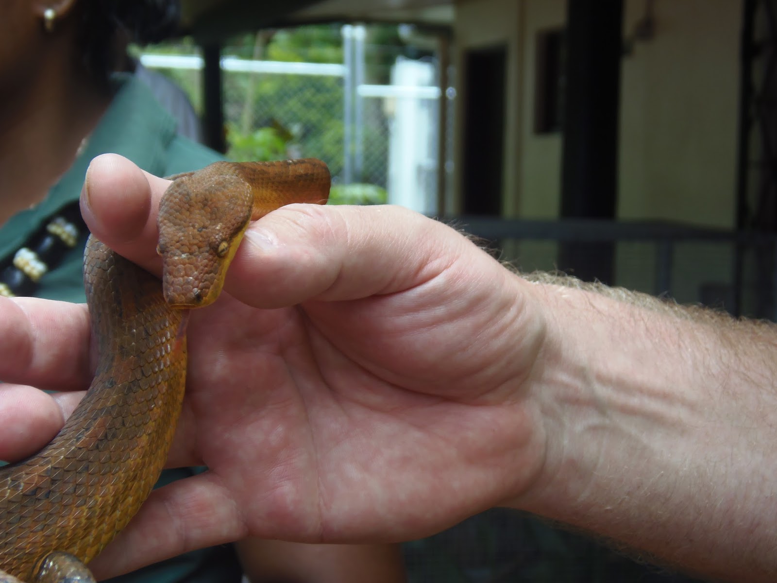
Yeah, I was down the front with the other kids!

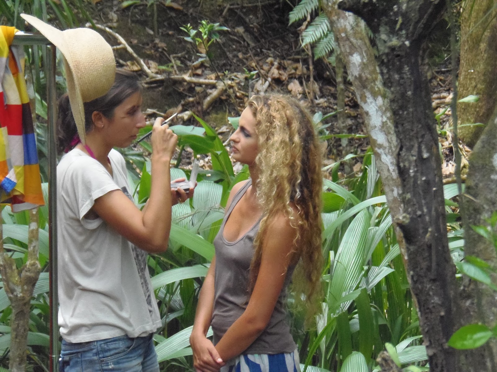
First up we headed for a bit of a reptile presentation, of course with reptiles on offer I was up the front with all the other kids. Unfortunately I can't recall the names of the lizards and snakes but they are beautiful creatures. The park features a lot of board walks, steps and walking tracks that mostly feature the native Fijian Flora and Fauna, although I'm not sure the ladies modelling for some kind of fashion shoot in the middle of the rain forest was a typical Fijian experience, but I enjoyed it anyway! After a couple of hours checking out the park we once again boarded our bus and headed back to the ship at Port Denarau, it had been a hot and sticky day but once again we had a good time checking out another small slice of Fiji and once again we had been impressed by the locals patience and good grace towards us, even as they were recovering from a cyclone.


Hey, we even stumbled onto the set of Fiji's next top model err actually I may be embellishing that a bit!
The Dirt.
It appears that a lot of the other punters off the ship didn't venture much past the Hard Rock Cafe in Denarau, but we had a really enjoyable day checking out the Kula Eco Park and the Sigatoka Sand Dunes, I'd recommend either of them. Once again we were cruising with Princess Cruises and we booked the bus trip on the ship, I can't remember the cost (the blog was years away) but it wasn't overly expensive.

Finally, the main reason I decided to write up this post now is because of the damage Cyclone Winston has caused in the last couple of weeks, the people of Fiji need our help so if you've got a few bucks to spare check out these two links, the Red Cross and Unicef, and consider donating. 

This cruising caper is hard work.

Sailing away from Port Denarau, Mt Koroyanitu in the distance.

Wednesday, March 2, 2016

Panorama Walk, Trephina Gorge Nature Park - December 2015

I'm going to start this post off with a question, what the hell is going on with our politicians, particularly our prime ministers? Do they receive a lobotomy when they get the keys to the lodge, f#@k me! We've had 4 different prime ministers here in Australia in the last 4 or 5 years and once assuming the office you'd swear their IQ dropped into single digits, repeating inane slogans over and over as if trying to train a dog. Initially I'd had high hopes for Turnbull, he seemed as if he might bring a bit of gravitas to the roll of PM. I was always pretty doubtful that he'd be able to keep the red neck hard right of his party under control, but I was hoping a few centralist policies might start to filter through, f#@k, he's turned into Abbott lite, complete with text book Abbott scare campaigns for the great un-washed. Where are the Curtin and Chifley's, the Whitlam, Hawke and Keating's, geeze I'm getting that depressed that I'd almost be happy with a Howard or Menzies....err maybe scratch the last two but you see what I mean, delirium (or maybe its dementia and I'm imagining all this) is starting to set in. I suppose it could be worse, we could have Trump although we had our own brush with populism with Palmer, yeah that was a successful experiment wasn't it (I can hear most of my Queensland readers turning off as I type this). Anyway with my monthly allowance of profanities now used up in one paragraph I'd better get back to crapping on about travel, as I've just insulted probably two thirds of my already meagre number of readers.

The Panorama Walk is yet another stroll in Trephina Nature Park out to the east of Alice Springs that I visited late last year. I did this short walk fairly late in the afternoon hoping the softer light would help my photo's a bit, you'll have to be the judge on whether that worked or not. The Panorama walk crosses straight over the wide sandy bed of Trephina Creek before climbing above the gorge on the opposite side to the Trephina Gorge Walk, unlike the gorge walk though the Panorama Walk, as the name suggests, continues to climb until you get, yeah you guessed it, a panoramic view.
The wax like trunk of one of the Red Gums lining Trephina Creek.
Looking back down towards the ute and gorge camp ground, that's Trephina Bluff towering above.


Continuing on above the gorge the track starts to climb up a ridge line to the high point of the stroll, the views from up here back down to Trephina Gorge are quite impressive, in the other direction the height allowing me to appreciate the interesting geology of Morder Pound. Crossing over the small summit I continued on down to a small saddle, the ridge that leads to Trephina Bluff towering above now, its rocky crest looking good in the late afternoon light.
Trephina Gorge from the lookout, the gorge walk follows the tops of the other side of the gorge.
Mordor Pound, a bit greener than usual this year.

On reaching an old gate the track turns back and heads into a side valley in the direction of Trephina Creek, the wetter soil in the valley supporting quite a few wild flowers along with a thicker covering of vegetation. In the distance ahead of me Trephina Bluff was guiding me back towards the ute and, after crossing the soft sandy creek for the last time today I was soon back and re-untited with Sam who was contentedly catching up on some reading while she waited for her recalcitrant husband.
On reaching this old gate the track turns and heads back towards the car park through a shallow valley.
The flora was a thicker in the valley.
There were plenty of wild flowers out (or is it a weed?).
Crossing the soft sand of Trephina Creek back to the car park.
Jumping back into the ute and heading back towards Alice Springs the setting sun made for some nice photos. I reckon Sam was starting to doubt that we'd ever get back to town as I'd scream to a halt in order to get another photo. After numerous photos of Ghost Gums, creeks, cows, roads and mountains we eventually arrived back in town way after dark on what had been another great day.
The recent flooding had made a bit of a mess of some of the roads.
One last photo of Trephina Bluff on the drive back to Alice Springs.
Another beautiful Ghost Gum.

The Dirt.
I walked 2.6 kilometres on this walk and climbed 108 metres, I suppose I'd class this as an easy walk although it is a bit rough under foot in places and it does involve a solid, if fairly short, climb. The Daly's have written this walk up in their Northern Territory book if you want some notes. This walk starts from near the gorge camp ground where you can normally get water. The start of the walk is accessible to 2wd cars most of the time, with the majority of the journey out from Alice Springs on bitumen. Like the Trephina Gorge Walk the Panorama Walk would be best very late or very early in the day, a perfect heart starter if your camped at the camp ground probably.

Late afternoon on the Ross Highway.
The Eastern MacDonnell Ranges at sun set.

Pelion Hut to Mt Ossa return, Overland Track - April 2010

Mt Oakleigh from the Pelion Hut heli pad. I think the mountain just visible in the mist in the distance is Cradle Mountain... ... the flat t...