Saturday, November 15, 2014

Woolleys Beach, Crib Point - November 2014

This will be a very short post, I'm still writing up my crazy guy journal so haven't been doing a lot of walking. After breakfast with Sam on Saturday I figured that I'd try and fit in a short walk in the afternoon to give me something to post. Wanting a quick walk meant that it also had to be reasonably close to home, it kind of defeats the purpose if I do a short walk but have a three hour drive to get there. So after consulting my library of guide books I decided to head down the Mornington Peninsula to Crib Point and do the Woolleys Beach walk.
This pretty much sums up what today's trail was like.
Parking at the picnic area near he old Crib Point jetty I basically headed along a sandy path southwards until I came to Stony Point Road, where I turned around and retraced my steps. The path led through lots of native bush  and although The Esplanade was never far away it felt reasonably remote. After walking for about five minutes I realised that I'd left my wallet in the ute so had to back track and get it, developing dementia will do that. Looking at the bright side I figured that at least the extra distance would add a bit of respectability to the stats for the walk.
Plenty of wild flowers.


A bit of native fauna.


Setting off for the second time I soon passed another picnic area, this one with an old boat ramp, however with the tide in Westernport Bay out about 100 metres you'd need a 4wd to launch anything here. The sandy track continued on inside the coastal bush, for a walk along the coast there were virtually no views as the route kept far enough inland and the topography was that flat that it didn't allow me to catch more than fleeting glimpses of the sea. There were a lot of wild flowers on display however so I spent a little time mucking around taking photos of them. There was also an Echidna that tried to bury itself in the soft sand when it heard me coming, I could only get a shot of his spiky bum as he pointed it towards me, the head being well and truly buried.
I'd like to caption the names of the flowers but I've got no idea!
My turn around point, I scrub bashed a little to try and get a view. No wonder I was eaten by sand flies
My turn around point, that's Stony Point Road through the gate, the pad on the left led into the scrub towards the water but there was no real view.
After passing by a few pads leading up to the suburban streets of Crib Point I got to the end of the walk at Stony Point Road, it was now a matter of turning around and retracing my route. I'm not a big fan of the retrace but I improved it a little by taking to the beach at the boat ramp and walking the last section along the beach, the eucalypt's lining the shore adding a bit of interest. Westernport Bay suffers a bit scenically compared to its neighbour Port Phillip Bay, but if you look closely there is enough to hold your interest, just don't do this walk if you want to have a swim as the mud flats aren't very conducive for that.


Looking down towards Stony Point from the boat ramp.
The Dirt.
I used the notes from walk number 63 in 'Walks of the Mornington Peninsula' by Ken Martin, he doesn't appear to have a web site so I can't link it. I walked a grand total of 6.4 kilometres and climbed a whopping 35 metres, its definitely a flat walk, I think most of those metres were me crouching down to take photos of flowers. As I write this the next day I'm scratching at about twenty sand fly bites so take some nuclear insect repellent with you, the little bastards are very hard to see so I didn't realise I was getting attacked at the time, oh well at least its good preparation for my up coming trip to New Zealand!


Walking the beach back to the ute.


The picnic area near the Crib Point jetty.

Looking out to Westernport Bay from the picnic area, it doesn't look to bad, does it?

Wednesday, November 12, 2014

Pago Pago, American Samoa - September 2013

The name Pago Pago, like Bora Bora conjures up an image in my mind of a palm filled Pacific paradise, and you'd never guess but the reality is not far off. While not quite as drop dead stunning as Bora Bora it was still everything you'd expect of a tropical paradise. We were there on a cruise in 2013 and spent an enjoyable day driving around the island checking it out. First up though we had to get to the rental car yard before the rest of the punters off the ship, Pago Pago isn't a huge city so there was only so many rental cars to go around. After successfully securing a RAV4 for the day we could relax and head off and explore.
The Sun Princess at port in Pago Pago Harbour.
First up we headed south west to Cape Taputapu, the road alternating between passing through idyllic villages with equally idyllic beaches or climbing steeply over rainforest clad ridges.  Once at the end of the road at Fagamalo we basically turned around and did it in reverse stopping at some of the stunning beaches we got back to Pago Pago just after lunch.
The road meandering towards Cape Taputapu.


It was a Sunday so Pago Pago was basically closed for the day so we then headed to the extreme eastern end the island of Tutuila. Making our way around Pago Pago Harbour we went passed the very popular Tisa's Barefoot Bar where it looked like most of the punters of the ship had got to. A bit further on the road passed a series of rock stacks, the crystal clear water completing the picture.
The coastal road runs along a series of beaches, climbing over headlands in between.


Each of the small villages featured  one of these community meeting places.
It didn't take long once we had left Pago Pago to lose all the people off the ship, they seemed to stay within a fifteen minute drive of the wharf. At Cape Matatula we were at the extreme eastern end of the island, from here the road rose steeply over another jungle clad ridge to the end of the road at Onenoa. From what I could see the village of Onenoa was more or less at sea level, the locals had built up a bit of a breakwater, come levy bank with some concrete, but every time there was a bit of a bigger wave the water surged onto the breakwater, which was also the road through the village, I reckon they'd take climate science a little more seriously over there than our current batch of flat earth politicians do here, losing your home to the ocean would do that I suppose!

You don't see these in Melbourne.


These rock stacks provided an excuse to stop for awhile.


Back tracking towards Pago Pago we then took the road up towards Rainmaker Mountain, the pass provided great views back to Pago Pago Harbour, our ship dominated the view of the harbour. Crossing the pass the road plummeted back down to sea level at Afono, from there we continued on to Vatia, the scenery on this side of the island was even more spectacular, one day I'll come back and explore a bit longer on foot. The road provided glimpses through the trees of turquoise water lapping into pristine bays lined with palm trees.


The view back down to Pago Pago Harbour from the Rainmaker Mountain Pass.

By now it was time to head back to Pago Pago with the car, we had a great day and got a good overview on what Pago Pago has to offer. Returning the car it was a five minute walk and we were back on board the ship. Once on board it was time for a quick change of clothes and then we headed to our usual spot on the ship to watch the scenery glide by as we sailed out of Pago Pago Harbour. A great day was topped of by a magnificent sunset as we sailed of towards our next port.

Rainmaker Mountain.


For these villagers sake I hope our flat earth politicians are right and climate change is just a big scientific conspiracy.
Our little RAV4.
The coast line on the north of the island in the National Park of American Samoa.
The Dirt.
We sailed with Princess Cruises, as usual they supplied a great value for money experience. American Samoa is a very religious country so if your there on a Sunday like we were don't expect much open. The island of Tutuila is small enough to be able to drive from end to end in a day, which is what we did, it gave us an opportunity to get a good overview of the place. Cruising may seem like a strange mix with my trekking and walking but I really enjoy kicking back every now and again, and it allows us to get a little taster for lots of places which we can then decide if we want to go back and spend more time at in the future.


The end of the road in the National Park of American Samoa.
Back in my usual cruising position.

The buildings are part of the local brewery.

Sailing away from the wharf, Pago Pago Harbour.


Leaving the island of Tutuila in American Samoa.

Another great Pacific sunset.


Saturday, November 8, 2014

Point Addis, Great Otway National Park - November 2014

I’ve been a little busy recently writing up a ‘crazy guy’ journal about a recent multi day walk in the Budawangs so my blog has been a little bit neglected.  Saturday promised to be a great day for the beach so I thought I’d head over to the Surf Coast and re do a walk that I’d done two or three times before, basically walking from Bells Beach to Point Addis along the coast and then completing the circuit on inland tracks.  After checking out the tides I decided to start at the car park on Point Addis Road just off the Great Ocean Road nice and early, this meant I would get to the Jarosite Headland with the tide still low enough to get around it.

About thirty seconds after leaving the car.
The inland section of the walk followed the Surf Coast Walk.
So, after locking the car I was off by 8 am, now 8 am is a time I’m normally contemplating my first coffee on most weekends but seeing that I had to get the tides right, and also the fact that the temperature today was forecast to get into the mid thirties I figured that the coffee and paper could wait until after the walk.  I’d gone around 100 metres however when I had a gear malfunction and I then spent the next thirty minutes re attaching the chest strap on my pack, so much for my early start. I walked the circuit clockwise from the car park at the top of Point Addis Road, this meant an easy start as the wide track contoured along the top of the Ironbark Basin in an easterly direction. Every now and again a break in the trees would give me a glimpse of Bass Strait through the trees, apart from that it was Ironbark forest and grass trees that had my immediate attention.

Looking down Ironbark Basin towards Bass Strait,
Ironbark trees.
A few grass trees along the track beside Jarosite Road.
After 40 minutes the track came to Jarosite Road, the Surf Coast Walk which I was following at this stage then headed straight down towards Bells Beach Southside more or less parallel to the road.  The country through here consisted of low wind pruned coastal heath which allowed plenty of views out to the ocean, eventually breaking out and following the road for the last couple of hundred metres to the Southside car park. There were a few surfers out this morning even though the swell was very small, after getting a photo from the lookout of the surfers I headed down to beach level and removed my boots, the next hour or so would be all sand.

Heading down to Bells Beach Southside.
Looking towards Point Addis from Southside.
Not much swell at Bells Beach today.
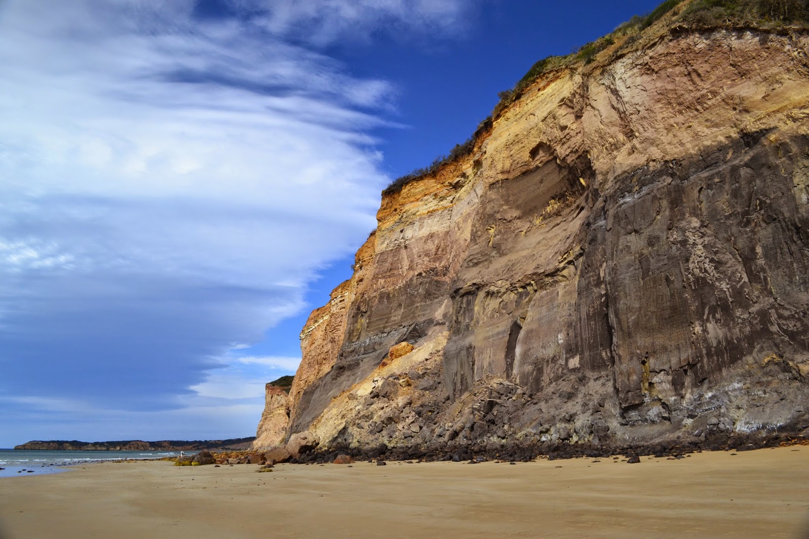
The beach along here to Point Addis featured soft cliffs, the soft clay erodes very quickly causing large sections of the cliffs to fall to beach level, it’s not a place to walk near the base of the cliffs, luckily with the tide fairly low and the swell small there was plenty of room on the wide beach. The constant erosion also gives the cliffs a fluted appearance, which along with the different coloured clay,  made for some good photos. The walking on the firm sand was easy and with me spending time splashing along in the shallows and taking lots of photo’s I didn't really notice the heat.

Plenty of firm sand made the walking along this section very pleasant.

Jarosite Headland.


Rounding Jarosite Headland I started to come across a few nudists, this is one of the few legal nude beaches close to Melbourne. So when in Rome I stripped off and went for a swim, it may have been a warm day but jeeze the water was cold, not ideal for the ego when skinny dipping! After drip drying it was time to pull on the shorts and head off again, I now headed along the length of Addiscott Beach, a beautiful white sandy beach backed by a long line of cliffs. The Jarosite Headland end of Addiscott beach appears to be the clothing optional end while the Point Addis end is the family friendly end, in between there appears to be around two kilometres of beautiful beach that is no man’s land.

Rounding Jarosite Headland onto Addiscott Beach.


Addiscott Beach, with Point Addis in the distance.
Arriving at the beach access steps near Point Addis I put the boots back on and attempted the small side trip to Pixie Cove, unfortunately I’d obviously procrastinated too long as the water was over the rock shelf stopping access to Pixie Cove without my going for another swim. Oh well, I suppose that means I’ll have to return and do it again one day. After my aborted attempt on Pixie Cove I retraced my route back to the beach access track on Addiscote Beach, climbing up the track the heat hit, the temperature climbing as I climbed the steps. By the time I reached my turn off the temperature in the Tea Tree was well into the 30’s.

Point Addis.
The cliffs around Point Addis.
This was as far around Point Addis I could get, Pixie Cove will have to wait for next time.
Sweating bullets I now followed the indigenous cultural walk that winds its way back along the length of Addiscott Beach, this time on top of the cliffs. The cultural walk has plenty of points of interest referring to how the indigenous lived off the land, by now though it was getting too hot to linger in the scrub for long so I pushed on to the first lookout on top of the cliffs. There are two or three lookouts along this section of track and as well as providing great views out to Bass Strait they also provided a bit of a breeze which took the edge off the heat. The track drops to the lowest section of cliffs before turning sharply to the north west and climbing back up to the car park at the top of the Ironbark Basin, the climb is very easy, only the last ten minutes requiring any real effort. Getting back to the car I jumped in and cranked up the air conditioner, the temperature read out in the car showing the outside temperature as 36 C, I love summer!
On the indigenous cultural walk above Addiscott Beach it was bloody hot.
Looking along the length of Addiscott Beach towards Jarosite Headland.
Point Addis.
Addiscott Beach, if you squint you may be able to see a couple of my nudist mates!
The Dirt.
I walked around 12 kilometres and climbed 185 metres on this walk, I'd rate this as an easy walk. I used the notes from 40 Great Walks in Australia by Tyrone Thomas and Andrew Close although I did the walk in reverse and used a different start point than their notes described, due to the tides. Parks Victoria will no doubt have a map and notes online.
Heading back up Ironbark Basin towards the car.
Time to get in and crank up the air conditioner.

Pelion Hut to Mt Ossa return, Overland Track - April 2010

Mt Oakleigh from the Pelion Hut heli pad. I think the mountain just visible in the mist in the distance is Cradle Mountain... ... the flat t...