Saturday, February 13, 2016

Point Nepean, Point Nepean National Park - February 2016

Last weekend we had some friends visit from interstate, I first met Deb and Greg when we walked to Machu Picchu in Peru together last year and with them coming over to Melbourne for a weekend I was looking for somewhere to take them on a bit of a stroll. After a bit of procrastinating in my mind I figured that a trip down to an old favourite in Point Nepean might be the go, and with a promised temperature of around 30C forecast the thought of a swim in one of the bay beaches sealed the deal. Now if there is anyone out there who regularly reads my waffle they'll know that I did a post about Point Nepean last year, but the area is constantly evolving as Parks Vic clean up the old military area, so I was reasonably confident that I'd find something new to photograph.
An old gun emplacement near Cheviot Beach looking out over Bass Strait.
So after breakfast at the great Merricks General Wine Store, a place where the food is much better than the name may imply, we arrived at the start of the walk at Gunners Cottage late in the morning. I was once again using Melanie Balls notes and map so after leaving the ute we crossed the access road that bisects the park and headed towards the Cheviot Beach lookout, on the way passing by an old firing range that still has plenty of signs warning us not to stray into the scrub in case we get blown up by some un exploded ordinance. As I mentioned in my last post about Point Nepean, Cheviot Beach is famous as the spot where our 17th Prime Minister Harold Holt went for a swim and never came back. No sign of Harold today but the wild beach was looking quite nice on this beautiful day, you could even kid yourself that it might have been a nice place to sit out the war at one of the nearby gun emplacements, although I reckon the salt water showers would have done me in.
Cheviot Beach, no sign of old Harold though.
Leaving Cheviot Beach lookout we meandered our way down to the tip of the Mornington Peninsula at Point Nepean. The walking down here is a mixture of dedicated walking tracks and the bitumen access track, the bitumen track is actually a lot better than may be imagined as there are views both out to Bass Strait and over Port Phillip Bay and the road is closed to all vehicles except for the bus that transports the punters down to the old fort. After passing a machine gun emplacement, cut into the tea tree covered dune with its great view down onto the bay beach towards Observatory Point, we made our way to the extensive concrete bunkers of Fort Pearce which itself has a great view, although it looks out over the wilder coastline of Bass Strait and not the calmer waters of Port Phillip Bay. From Fort Pearce to Fort Nepean the road runs along a narrow isthmus, the peninsula is that narrow at this point that you could almost kick a football from Bass Strait into Port Phillip Bay.
The view down from the machine gun emplacement to the bay beach, the Queenscliff ferry in the top of the photo.
Bass Strait from near Fort Pearce.
Looking towards The Rip from Point Nepean.

Rounding Point Nepean with its commanding views over The Rip, the narrow entrance to Port Phillip Bay, we checked out the extensive Fort Nepean. Every time I come to Point Nepean National Park I seem to find another new nook or cranny to check out and this visit was no different, instead of climbing the long concrete staircase up to the the tunnels we headed into the Engineers Building and climbed up a series of staircases past the gun emplacement that fired the first shots of WW1 against a German Freighter..... oh and a Tasmanian freighter in WW2. After a quick exploration of the labyrinth of tunnels that is Fort Nepean we started our return journey back to the ute, once again enjoying the beautiful coastal scenery.
The historic engineers building.
The engineers had a reasonable view too!
The first shot fired in anger in WW1.
Next stop on our walk was Eagles Nest with its many and varied gun emplacements all looking out over some picture perfect coastal scenery, the Mornington Peninsula now stretching out before us. By now though our thoughts were turning towards food (yeah, yeah I know, nothing unusual about that!) so we didn't linger to to long. I normally drop down onto the beach now and beach comb my way along to the old jetty at Observatory Point but unfortunately the beach and steps have been reclaimed by nature (Maybe something to do with dredging the Port Phillip Bay Heads?) so today we tracked along the coast slightly inland along Coles Track through the tea tree. 
Looking back up the Mornington Peninsula, Port Phillip Bay on the left, the slightly wilder Bass Strait on the right.
A beautiful Port Phillip Bay beach near Eagles Nest.

After a quick side trip out to the old cattle jetty, which confirmed that the bay was indeed looking good for a swim, we made our way back towards Gunners Cottage passing through an area that had been badly burnt in a bush fire a few years earlier, its skeleton like trees having their own stark beauty against the blue sky. Our last stop before arriving back at the ute was the old Quarantine Station Cemetery, the lonely graves dating back to the 1850's when the clipper Ticonderoga arrived from England rife with typhoid. Taking off the boots and climbing into the ute we headed to Sorrento for a (very) late lunch, before meandering our way up the Mornington Peninsula back home, stopping at a nice quiet beach in Mount Eliza for that long anticipated swim. I had really enjoyed playing tour guide for Deb and Greg, I reckon my backyard scrubbed up OK.
The Harold Holt memorial, looking out over Bass Strait.
Coles Track made for easy walking.
The old cattle jetty near Observatory Point.
We get the odd bush fire down at Point Nepean, most of the coastal scrub generally recovers well though.
The old Quarantine Cemetery.
The Dirt.
We walked 10.7 kilometres and climbed 214 metres today on this easy stroll. Point Nepean makes for a good day out, like I mentioned above I've visited many times over the years but I always finding something new to check out. The history of the place is well explained with interperative signs as well as a lot of audio recordings in the old installations. We roughly followed Melanie Ball's notes from Top Walks in Victoria and the notes along with the map are all that's needed, alternatively Parks Vic would have a lot of free stuff on line that you could access to complete the walk, you're not going to get lost at Point Nepean National Park. Finally, as I mentioned at the start of the post I actually wrote up a post about this National Park last year, if you want to check out some more photos here's the link to that post. 

I think the Mornington Peninsula scrubbed up alright today.


Wednesday, February 10, 2016

N'Dhala Gorge Nature Park - December 2015

N'Dhala Gorge is another lesser known attraction in the Eastern MacDonnell Ranges near Alice Springs, the local Arrente people called this place Irlwentye and the gorge is home to what amounts to an open air museum of petroglyphs. A petroglyph is a rock carving and some of the examples in this gorge could be as old as 10,000 years, although most are around 2000 years old. You don't have to be an expert to find the petroglyphs here as there are almost 6000 known engravings in the area. With its numerous overhangs and fairly reliable water holes, Irlwentye must have made for a fairly idyllic location for the local Arrente.
Heading out of Alice Springs on the Ringwood Homestead Road.
Getting to and from this walk is a bit of an adventure.
The track in from the south follows the Ross River.
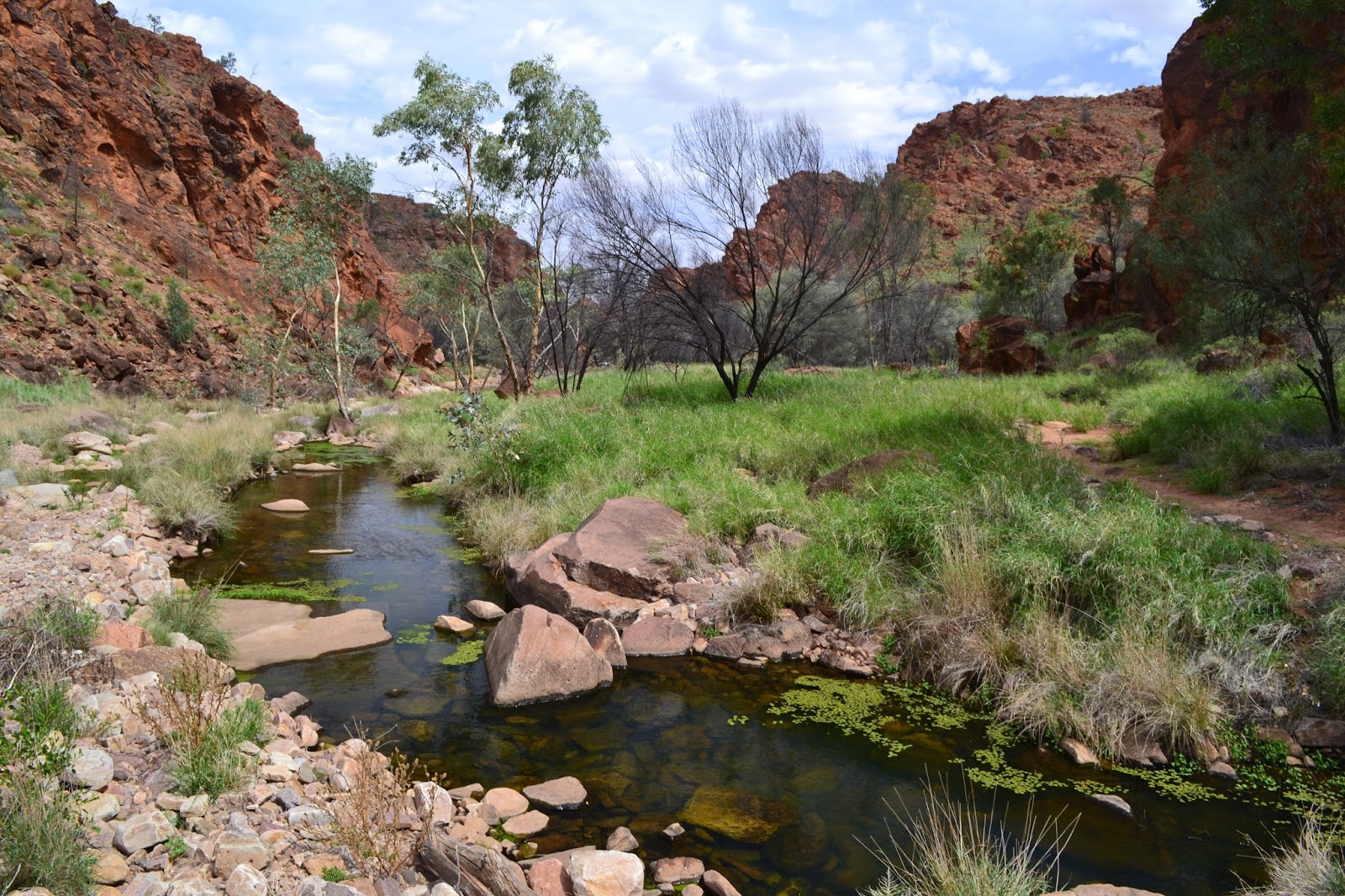
We, yes Sam accompanied me on this stroll, headed east out Alice Springs around lunchtime on another hot summers day. It's getting a bit repetitive but we've been here a few times over the years, so having a little local knowledge I decided to head into the park via a slightly different route and come in from the south off the Ringwood Homestead Road. Approaching N'Dhala Gorge Nature Park from here means following the Ross River north into the low ranges, cris-crossing the soft sandy river bed to find the path of least resistance through the encroaching rocky bluffs. On meeting the more common access track from Ross River Homestead to the north we then headed the last couple of kilometres to the car park.
The track into N'Dhala Gorge has plenty of these information signs.
Our first petroglyph.

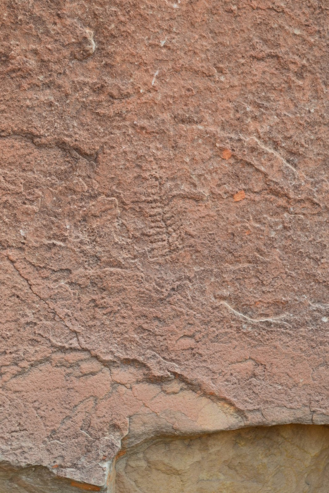
The walk into N'Dhala Gorge is a pretty straight forward affair, just wander into the gorge as far as you want before turning around and heading back. As we made our way into the gorge the track crossed the creek a few times, with all the recent rain Sam had to head bush couple of times to avoid wet boots on a couple of the crossings, I had decided to wear my Teva sandals so I quite enjoyed sloshing along the damper parts of the walk. As we progressed along the track the red bluffs of the gorge started to close in, and at the same time the sightings of petroglyphs became more common. There are two different types of petroglyphs in N'Dhala Gorge, some of the Petroglyphs were made by pecking away at with a sharp rock where as others were thought to be made using a blunter instrument, this has led to scientists suggesting that they may have been done over two different periods.
There was plenty of water around on this visit.


Sam stopped here while I headed up until the gorge started to open up.
With the jagged red walls closing in on us we arrived at a beautiful water hole, yeah another beautiful spot for a swim. In between soaking in the cool water I explored a little further through the gorge however soon the cliffs started to open up a bit indicating that I'd passed through the most spectacular section so I decided to rock hop my way back down to the waterhole. N'Dhala Gorge also features quite a few over hangs and small caves which would have made comfortable places for the local Arrente to camp, now days however most of these spots have been claimed by the local euros and rock wallabies and while the over hangs still provide great shelter the smell of animal urine means that I didn't linger in them for to long.

Hardcore walking:)
This petroglyph shows the Caterpillar Dreaming story.
After another cooling swim we started the easy walk back to the ute, retracing our outward route meant there was no danger of any navigational issues so we were able to concentrate on the rugged scenery. While we had been mucking around in the water the over cast skies had cleared a bit so my photos also correspondingly improved a bit. Reaching the dusty car park we jumped into the ute and headed north towards the Ross Highway, once again crossing the sandy Ross River numerous times. 
I think the circular petroglyphs depict water holes.


I came prepared for the creek crossings on this walk.

The Dirt.
We walked 3 kilometres on this stroll and climbed 64 metres, although the walk has a lot of scope to be shortened or lengthened, just turn around earlier or walk further through the gorge. John Day has written up this walk in his Northern Territory book. This little gorge is a great, but little known spot to view a large collection of indigenous art in the form of the petroglyphs, you just have to keep your eyes open and more and more seem to appear. The track into N'Dhala Gorge starts off pretty easy but eventually fades away completely as you pass through the gorge, the open rocky country still made for reasonably easy progress when the track finished. Like a lot of the other walks that we did in Central Australia this summer it isn't always possible to swim on this walk, we were very lucky to have a wet summer so all the water holes were full. I'd rate this walk as another easy one, and while it may be easy its still worth visiting this slightly off the beaten track spot. You will need a 4wd with a bit of ground clearance to get to the car park at the start of the trail as the access from both north and south require numerous crossings of the soft sand of the Ross River,  if you don't have a 4wd it may be possible to organise a lift in from the tourist resort of Ross River Homestead (maybe?).

Back at the trail head, there is a small camping area along with a long drop if you wanted to camp here.
Heading up towards the Ross River Homestead, the cattle had certainly been in a good paddock!


These brumbies were enjoying the good water and feed near the river.

Saturday, February 6, 2016

Daylesford & Hepburn Springs, Hepburn Regional Park - January 2016


A couple of posts back I mentioned how I thought that I was getting over a mystery ailment that had invaded my guts, well I was a bit premature in declaring that all was well. It turned out that I had about a week of feeling OK before the dreaded bug struck me down again, to make it even more annoying I had my relapse on a long planned weekend away in Daylesford to celebrate a special occasion, what do you do? Not much really but battle on I suppose (I feel like a politician asking and answering my own questions). Anyway after a couple of hours driving the porcelain bus I woke up feeling half human so, while Sam headed to the day spa, I headed off into the scrub on a reasonable length day walk carrying two weeks worth of toilet paper in my pack for the day.
Not bad, straight out the door and onto the walk.
Who's the dork with the poles...oh hang on.
I decided to do the Daylesford & Hepburn Springs Walk as written up by Mr Chapman in his Day Walks Melbourne book, the biggest contributing factor in choosing this walk was that I could wander out the door of our accommodation and I was more or less on the described route, well that and the fact that with Hepburn Springs about halfway through the walk I could always ring Sam to pick me up if I got too crook. Last time I walked here it was the middle of winter and it was very cold and wet, today was the other extreme and I was more worried about the heat. Picking up Chapman's route I headed around Lake Daylesford passing the rebuilt Boat House Cafe, normally worth a stop but seeing I'd only been walking for about 5 minutes I reluctantly gave it a miss this morning.
There was a little trail art on the initial section of the walk, always a good thing.
Leaving the lakeside path via Central Springs I quickly left the power walkers and joggers behind and set off along an extensive series of historic water races that would more or less deliver me to Hepburn Springs in a few hours. Following the north bank of the bone dry Sailors Creek the walking was easy along the flat path, the bush along here is of the dry eucalypt variety and in the middle of summer it was looking extremely dry indeed, I couldn't help thinking of how quick a fire would rip through here. 
Sailors Creek was a little on the dry side.
The water races that I was walking on are relics from the gold mining era, indeed the whole walk had reminders of early European settlement. A lot of the mineral springs were also discovered due to mining, the dry and dusty Tipperary Springs which were discovered  by gold fossickers over 100 years ago and were my next point of call. The water from these springs normally tests my stomach at the best of times so I didn't tempt fate today, but I did take a slightly dodgy photo of the actual springs, Parks Vic has spent a lot of money rejuvenating a lot of these old springs over the last few years so if mineral water is your go then this is the region to visit. Leaving the picnic area I climbed up onto another water race cut into the side of the steep valley of Sailors Creek, on the way passing some broken china, a remnant of the early settlers I suppose.
Mid summer and the country was looking very dry.
These old water races make for easy flat walking.
A small relic from the early European days.
Tipperary Springs.
From Tipperary Springs to Bryces Flat I walked the water races on the east side of the creek, the valley through here is fairly steep and at times the water race was almost cut into the cliffs high above the dry Sailors Creek. There is a lot of gold mining history on this section of the walk, at one stage the route passes beside the old Mistletoe Mine, the deep shaft covered by some steel mesh. After the old mine the track starts to cross some old sluicing gullies, these areas are massively eroded by the mining activity but nature is slowly reclaiming them and covering some of the scars.

Mistletoe Mine.

The trail crosses a few old sluicing gullies that are slowly being reclaimed by nature.
Bryces Flat.
Bryces Flat marks the spot where I left Sailors Creek and headed into Hepburn Springs along some quiet country roads. Walking along Bald Hill Road the scenery slowly changed from the dry eucalypt forest to hobby farms and country houses as I left Hepburn Regional Park and started to head through the out skirts of Hepburn Springs. I was a little surprised that at this stage of the walk, while I had no energy, I was still feeling OK, so I headed up the hill past some of the fine old buildings to get myself some sustenance, I couldn't go wrong with a piece of cake and a lemonade.....could I?
A ye olde bridge over Sailors Creek near Bryces Flat.
Wandering along Bald Hills Road into Hepburn Springs.
Villa Parma, 1864. Hepburn Springs.
The colourful European gardens in Hepburn Springs were a stark contrast to the dry eucalypt forest on the rest of the walk.
Hmm, to slow to get a photo of the cake!
The walk back to Daylesford from Hepburn Springs heads over some dry hills after passing by Sulphur and Soda Springs, climbing into the low hills was about the point that I started to feel really crook again, maybe that cake and lemonade wasn't such a great idea, who knew? Luckily the dry forest gave me a few excuses to stop, an old fence line and the Hepburn Reservoir being the most notable. After passing above the Hepburn Reservoir I strolled through a small pine plantation before striking out across the golden grassland on the out skirts of Daylesford. 
A few of the mineral springs at Hepburn Springs.

Hepburn Reservoir.
The rural scenery provided another contrast on what is a walk with a fair bit of variety, the golden paddocks shared by some cattle and a mob of kangaroos. As I was now approaching the out skirts of Daylesford I was now walking on a quiet bitumen road, but with a flat wide grassy shoulder it wasn't much of a problem, and it had the added benefit of allowing me to concentrate on keeping my arse cheeks tightly closed rather than concentrate on where I was putting my feet. I didn't linger walking through town with my strange gait, my focus now was getting back without embarrassing myself. Dropping down to the lake edge again I once again headed around the shore to our accommodation at the Lake House, very thankful that Sam was in the room and answered the door quickly, I'll spare you the rest!
He's a big boy.
The rural country on the out skirts of Daylesford.
The dry paddocks were shared by a mob of kangaroos.
Walking through the outskirts of Daylesford allowed me to get a couple of photos with some colour in them..
I've made it.
As I mentioned above this was meant to be a special weekend for us, so we booked at The Lake House in Daylesford. This is one of the group of the Luxury Lodges of Australia and is a very nice place indeed. We had a Waterfront Suite which included a cooked breakfast each morning and a meal in their 2 Chef's Hat restaurant on one night. Our room had a fairly private balcony that looked out across the calm waters of Lake Daylesford which was a great spot to sit and read, the bathroom came complete with a spa, and the king size bed was perfect for me. The other good thing for me was that they had good free wifi.....yeah I know its not really free when you're paying a motza for the room but its surprising how many of these expensive places still want you to cough up for wifi  in Australia.
Our room at The Lake House.
If you venture out of your room the grounds of The Lake House are also very nice, with everything from well manicured lawns that lead down to a series of small lakes with their resident ducks, to a ferny wet forest area complete with a cascading creek. The restaurant was also one of the best I've been to and was a great place to sit a watch the sunset while enjoying some fine food, I'd like to tell you about the cooked breakfasts but unfortunately I didn't think that they would be my best option! Oh yeah Sam tells me that the spa at the Lake House was worth every cent as well, apparently the shoulder massage was particularly good, hmm one day I must get myself a massage.
The day spa at the Lake House comes highly recommended by Sam.
Heading in for our complimentary flash dinner, I'm already clutching at my arse by the look of it!


Unfortunately Sam didn't get a photo of the main course, mainly because it was a shared meal of Salt Bush Lamb, and even accounting for me feeling like death warmed up I was still able to polish off the lamb fairly quickly!
The Dirt.
I won't go into much detail about The Lake House here as I've just crapped on about it, it's a great place to stay for a very special occasion although you're spoilt for choice for flash accommodation in Daylesford, you'll have to make up your own mind in the value for money stakes. I've just embedded a map and I noticed that the Lake House is described as a Posh lake-view option with fine dining, yeah I've always thought of myself as pretty posh:)
Like I mentioned at the start of the post this was another Chapman walk out of his Day Walks Melbourne book, its walk number 11 in the book. I walked 19 kilometres on this stroll and climbed 414 metres. I'd rate this as a medium walk. The cooler months are probably a better time to visit this area but the walk is do able in summer, although I'd pick a cooler day. Don't rely on the mineral springs for your water requirements unless you're confident they will agree with you, I've heard of people having some adverse reactions in the past.
Our balcony was the one on the right.
Sam's quite partial to Ducks.
The Lake House have extensive landscaped gardens, we walked through this wet ferny section to access our room, they've even created a cascading creek that flows down through the ferns under the boardwalk...very nice.


Pelion Hut to Mt Ossa return, Overland Track - April 2010

Mt Oakleigh from the Pelion Hut heli pad. I think the mountain just visible in the mist in the distance is Cradle Mountain... ... the flat t...