Sunday, July 22, 2018

Sorrento to Blairgowrie - July 2018

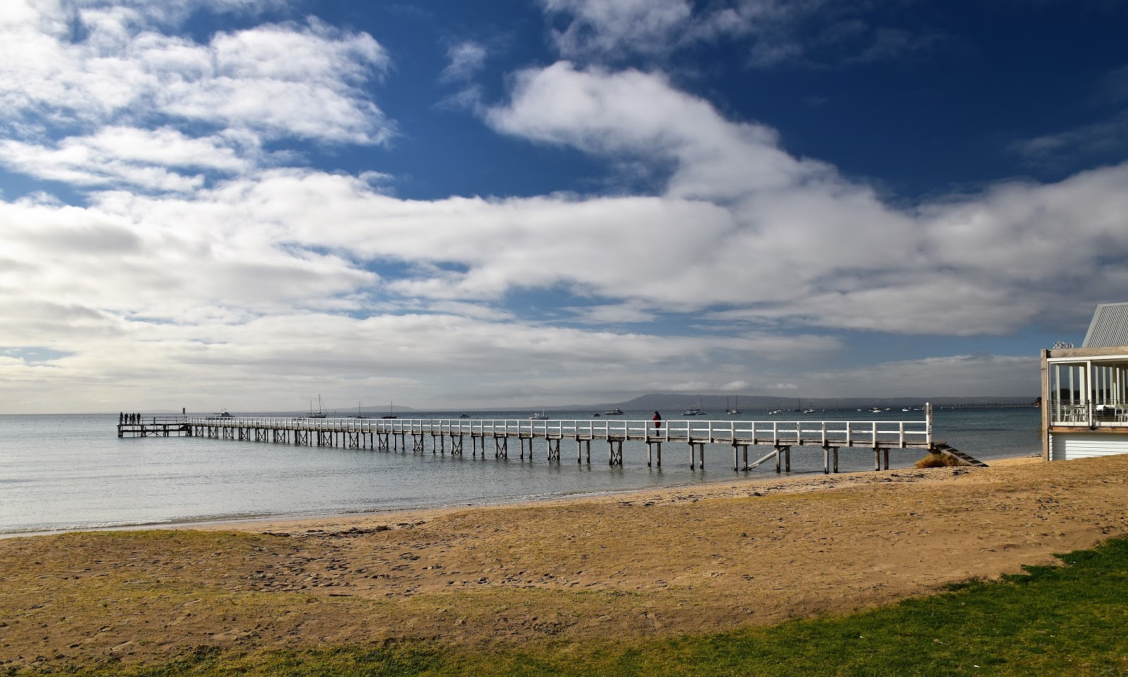
Looking across Port Phillip Bay towards Arthurs Seat. For a mid winters Melbourne day the weather was pretty good.
Last week's dose of man flu is hanging around unfortunately, I even pulled a sickie from work one day this week. I seem to have had a fairly rough trot health wise over the last couple of months, starting with my monumental mountain bike stack, of which I’m still getting over, and now this bloody cold. Over the next couple of weeks I’ll be putting myself to the test a little as I’ve got a ‘Feral Style’ walking trip planned up into New South Wales which will include a 4 day walk where the overnight temperatures have been dropping down to -6 for the last week, like I said that should test out all my ailments! Today though I was looking for something a little easier and a lot closer to home.
We parked near the ferry terminal in Sorrento.
My fall back option when it comes to ‘easy and close to home’ is generally a walk on the Mornington Peninsula, so today we decided to head down to Sorrento and go for a stroll along the coast to Blairgowrie. Parking the ute near the ferry terminal we had meandered our way a few metres towards Blairgowrie when we and our first extended stop for the day, Sea Shepherd had their tent set up on the foreshore and had volunteers down along the beach cleaning up all the plastic and cigarette buts. There are two charities that I regularly support and Sea Shepherd is one of them (Bush Heritage is the other) so it was good to stop for a bit of a chat this morning.
I'll get around to this walk one day.
Heading off again we followed the path above the beach passing the rotunda and the Baths Café in quick succession. The rough plan today was to follow tracks slightly inland of the beach up to Blairgowrie and then follow the waterline back to Sorrento in the afternoon after lunch. The only issue with this plan was that there isn’t a continuous, way-marked track along the foreshore, so the walk up to Blairgowrie was a little exploratory in a couple of spots as we disappeared into the coastal scrub only to find ourselves at a dead end. With the Point Nepean Road on one side and the water of Port Phillip Bay generally no more than a couple of hundred metres away on the other side, you can’t really get too bushed on this stroll. Following access trails today we headed through the Foreshore Camping Reserve generally keeping as close as possible to the cliff tops as we made our way along to Sullivan Bay, while we occasionally had to improvise a little when it came to the route, at least staying near the cliff tops was giving us some nice views out across Port Phillip Bay.
Sorrento Baths.
We followed a variety of paths through the foreshore camping ground.
If camping on the foreshore of Port Phillip Bay is your thing then I'm thinking this is a very nice piece of real estate to plonk your tent on.
After dropping almost to beach level as we passed behind Sullivan Bay we soon climbed a little again as we walked a short section past the very flash houses on Point Nepean Road, unfortunately these houses are all protected like Fort Knox with high fences around them, I did consider scaling a tree to practice my Feral Paparazzi skills but common sense (yeah, Sam’s common sense;) eventually prevailed. Jigging back towards the water after a hundred metres or so beside the road we headed to the Collins Settlement Site, this is the site of Victoria’s first European settlement back in 1803. Apart from a few old graves there isn’t a lot left over from the historic settlement, but Parks Vic have done a good job though with plenty of informative signs scattered around the area.
This is some of the priciest land in Victoria.
Looking back to Sorrento from the Collins Settlement Site.
Apart from 5 unmarked graves here is not a lot left over at the site of the old Collins Settlement. 
Looking across Cameron Bight towards the Blairgowrie Yacht Squadron - (squadron hey, that sounds pretty serious!).
With lunch beckoning we left the old settlement site and now dropped down to water level again at Cameron Bight, heading for the bright lights of Blairgowrie. Our walk now followed sections of track through foreshore camping areas again interspersed with a couple of sections on the shoulder of Point Nepean Road where flash boating clubs had taken up the whole coastal reserve. Being almost slap bang in the middle of winter Blairgowrie was pretty sleepy this afternoon so consequently we had no trouble finding somewhere to have a bit of a feed, eventually deciding on Fergie’s Blairgowrie Cafe which proved to be a good choice.
Cameron Bight
Blairgowrie in the middle of winter is fairy quiet spot.
It looks like I've just seen Putin's Pee Pee tape of Trump;)
With lunch finished it was time to start heading back to the ute in Sorrento. Like I mentioned earlier to make the walk into a bit of a circuit we and decided to walk back to Sorrento along the coast line, we’ll that was the plan anyway although I wasn’t overly confident that we’d be able to get around the cliff lines at water level, even with it being low tide. To start with though we had a long section of beach to follow as we headed north west along Cameron Bight, the weak winter’s sun not doing a lot to warm up the wind coming off Port Phillip Bay. After passing the Blairgowrie Yacht Squadron and the more low key Camerons Bight Boat Club we arrived at Eastern Sister, our first cliff line.
I've almost got this one done in day walk sections, the whole walk in one go will have to wait until I retire I think.
Blairgowrie Beach
The Blairgowrie Yacht Squadron.
We had some good news here though in that it looks like coastal erosion has necessitated the need to build a sea wall around this bluff and not wanting to waist an opportunity they have built a walking track on top of the new sea wall. Now while coastal erosion which is no doubt exacerbated by climate change isn’t normally a good thing I suppose you've got to grab small positives where you can, yeah I’m a glass half full kinda guy! So the first bluffs were successfully rounded at sea level and after negotiating all the private jetties and walking the length of Sullivan Bay we arrived at Western Sister.
The very recently opened Dorothy Houghton Walk skirts around the cliffs of Eastern Sister.


Western Sister doesn’t have a flash new sea wall protecting it so it feels a little more natural. Looking at the bluff from Sullivan Bay I was doubtful that we’d get around this one with dry feet and that feeling didn’t change as the cliffs started to tower (relatively) over our heads. We decided to head as far as we could and if it looked dodgy we’d retrace our route back to Sullivan Bay and take our inland track back. These crumbling sandstone cliffs are pretty dodgy really so we more or less walked with the water lapping at our boots staying as far as possible way from the base of the cliffs. After passing through a little rocky choke on the point, the coastline towards Sorrento came into view and it looked like we’d get through at sea level after all. With Sam striding off into the distance and me wandering along at my usual sloth like pace we made our way past the Sorrento Sailing Couta Boat Club and within ten minutes or so we were once again back at the ute, happy after another nice little walk.
Private jetties on Sullivan Bay.
The cliffs of Western Sister need to be rounded at sea level.
Sorrento has just come back into view.
The Dirt.
According to my GPS we walked 9.6 kilometres and climbed 239 metres on todays easy walk, I’m thinking the distance sounds about right but the climbing seems a little optimistic? We parked at Sorrento near the ferry terminal which was no drama in winter with all day parking allowed, in summer it’s two hours only though. We ate at Fergies Blairgowrie Café for lunch, the coffee and burgers were nice and the service was good. The only walking notes that I know of for this walk are by Ken Martin in his ‘Walks of the Mornington Peninsula’ book. This was a nice little stroll and proved to be pretty much everything I needed to warm up for some more serious up coming adventures I think.

Relevant Posts.
Mornington Peninsula Coastal Walk, Mornington Peninsula National Park, 2015.

Sorrento Sailing Couta Boat Club.
Finishing the walk under a moody late afternoon sky.

Thursday, July 19, 2018

Mt Juliet, Yarra Ranges National Park - July 2018

This was the story of today's walk really.
I’ve driven past the start of this walk literally 100’s of times over the decades but I’ve never got around to pulling over and actually climbing this mountain. My interest was again piqued recently when Mr Fiasco featured it on his great blog, I remember commenting that the summit cairn would look good with a dusting of fresh snow. So…with some fairly average weather predicted and the snow level down to the 900 metres I figured that this was my chance to climb this 1085 metre mountain (actually the signpost on top of the mountain says its a little higher than my map) and maybe get to see the cairn covered in snow.
This all looks pretty easy.
Arriving at the tiny informal car park beside the Maroondah Highway at 8am this morning I wasn’t surprised to find no other cars about. After pulling on my boots and locking the ute I set off the deceptively easy Road 3, under a grey brooding sky. To be honest though the weather was a lot better than I’d hoped for, the forecast rain hadn’t really arrived and wandering up Road 3 I was getting a little hot in my wet weather gear. Road 3 heads up a valley through the restricted Maroondah Dam Catchment Area, the only place you are able to walk here is along this track and you have to return the same way.
Like a lot of these old closed roads in the Maroondah Dam Catchment, Road 3 makes for good walking.
Road 3 doesn’t sound very inspiring but it’s a little better than maybe imagined, the towering Mountain Ash forest that line the grassy firebreak are simply stunning, even more so for the fact that these forests were totally wiped out back in 1939. Twenty minutes after leaving the ute though it was time to leave the wide Road 3 and start up the walking track towards Mt Juliet. Like the road, the walking track starts off innocently enough climbing only marginally steeper than the road initially. Gaining a little height I was now able to look back over my shoulder and see some very dark clouds closing in on me from the direction of Mt St Leonard, maybe I’d get my hoped for snow after all.
The walking track is well sign posted.
Mt Juliet Walking Track.
I started to get a few glimpses through the trees as I climbed, but it's not really a walk to do if you are after long range vistas.
There were a few trees down but for the most part the track was clear.
Thankfully the walking track was fairly clear of encroaching scrub as it wasn’t long before the dark clouds caught up with me and I was now climbing in fairly solid rain. The walking track actually levelled off for a hundred metres or so at one stage and I remember thinking to myself that this wasn’t a good omen, with over 900 metres to climb over around 4 kilometres I’d probably already walked 2 kilometres and only gained 100 metres or so, I was starting to wonder just how steep the next couple of kilometres would be. Trudging upwards I didn’t have to wait very long to find out how steep things would get, my short level section finished and I was suddenly edging my way up what appeared to be a muddy wall.
No it's not a black and white photo.
Climbing steeply into the sleet.
Needless to say there was a lot of stops on this climb, although with the DSLR safely stashed in it’s dry bag for most of the walk the photos were mostly taken with my little water proof camera, so the quality is nothing to shout about. This climb was one of the slipperiest walks that I ever done, the slick muddy track now awash with water, for anyone who’s ever walked the Kokoda Track then the steepness and grip co-efficient of this track this morning was pretty similar to Kokoda, actually I couldn’t help think that this walk would be good training before a trip to Papua New Guinea.


If you squint you might make out the sleet against the dark bark on the tree.
Slogging ever upwards I eventually started to pass through some sleety showers and by the time the track eventually levelled off there was proper grown up snow showers passing through, unfortunately the snow wasn’t settling though. A few minutes after the gradient finally eased off I arriver at the summit cairn and while there was a little snow coating the moss covered rocks on the cairn it was pretty meagre really. Now I’d climbed over 900 metres to see some snow so I decided as the day was still early I’d stop for awhile and see if the passing snow shower would get a bit heavier, sitting down on the lee side of the cairn I settled into wait for awhile.
There wasn't much snow but it was bloody cold and wet.

Eventually, with hypothermia a real chance, I decided that enough was enough and it was time to shoulder my pack and start my return journey. Being fairly wet and miserable by now my mood wasn’t helped by the need to descend so slowly on the steep ground, even with my cat like reflexes (dead cat, that is) I still managed to go arse over a couple of times on the descent, although with the track being so steep I didn’t have far to fall. With the feeling slowly returning to my fingers the track eventually started to level out a bit and at the same time the weather start to improve a little, the snow having given way to sleet, then rain, and now just the occasional shower.
I waited in vain on the summit for at least 30 minutes hoping that the sleet would turn to snow.
Going back down was easier than the climb, but only marginally so.
Arriving back down at Road 3 the walk was as good as over as I set off down towards the car park. Back on the wide dirt road I was once again able to relax and enjoy the forest a little, the walk down here largely runs parallel to Mosquito Creek but unfortunately it’s well hidden in the scrub and you wouldn’t even know it was there. The other thing that you wouldn’t know is close by is the busy Maroondah Highway, it was only really when I was 100 metres or so from the ute that I started to hear the traffic. Arriving back at the ute at 12:30 I quickly changed out of my wet gear and headed down to Healesville for a hot coffee, happy enough after another nice walk, although I’ll still have to go back one day and see that cairn covered in snow.
There wasn't a lot of grip on this stuff.
I've just emerged out of the scrub back onto Road 3.
The Dirt.
I walked around 8 kilometres and climbed 943 metres on this medium-hard grade walk. While the walk is only short it is very steep, the closer to the summit the steeper it gets. The ground is mostly dirt so in wet conditions it can get very muddy and slippery. Unfortunately there is no real view from the summit (so I’m told, all I could see was cloud today) but there are a few glimpses through the trees in the direction of Mt St Leonard on the climb. The only published notes that I know of for this walk are out of John & Marion Siseman’s old book Melbourne’s Mountains, the book dates back to 1993 though and is well out of print. To be honest though you shouldn’t really get lost on this stroll, all you have to do is retrace your outward route.

Relevant Posts.
Monda Track, Toolangi State Forest, 2017.
Morleys Track, Yarra Ranges National Park, 2017.
Mt St Leonard, Yarra Ranges National Park, 2015.
Road 3
Another nice walk coming quickly coming to it's end.....I've got unfinished business on Mt Juliet though.

Pelion Hut to Mt Ossa return, Overland Track - April 2010

Mt Oakleigh from the Pelion Hut heli pad. I think the mountain just visible in the mist in the distance is Cradle Mountain... ... the flat t...