 |
| Balcombe Estuary slowly making its way into Port Phillip Bay. |
My usual routine on Fridays is to finish work by around lunch time and then spend the rest of the afternoon sitting in my cafe of choice drinking coffee and maybe typing up a post, good for the blog but not so good for my fat guts! So last Friday I decided to try a different routine, instead of sitting on my ever widening bum all afternoon I decided to make the most of the beautiful day and go for a walk. Now I love driving but I hate suburban traffic so that meant that I'd have to do a walk close to home, so after a quick squiz at the map I decided to head down to Mt Martha to revisit an old favourite and then check out a section of track that I'd never walked, before walking back to the ute along the coast, a circuit that looked to be around 10 kilometres.
 |
| The starting point of my walk, Balcombe Estuary Recreation Reserve. |
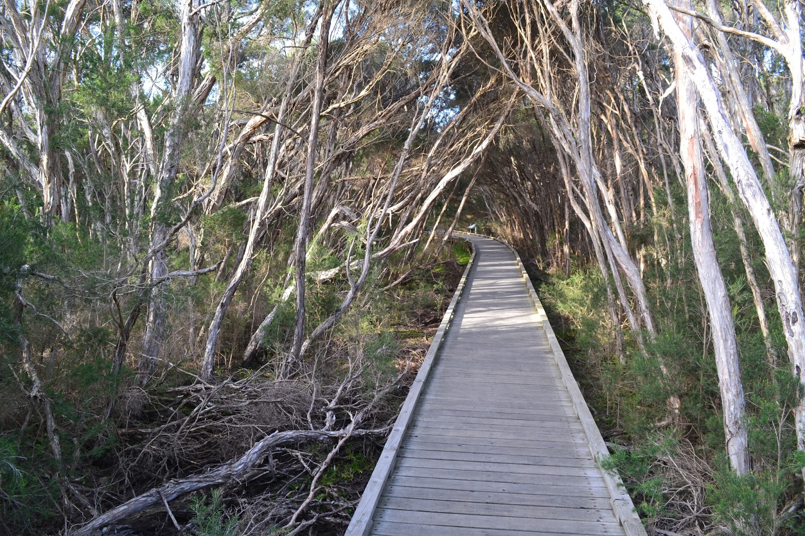
Parking at the catchily named Balcombe Estuary Recreation Reserve I shouldered my pack and headed up the estuary toward the Briars. The walk up Balcombe Estuary is mainly along an extensive board walk and while the Paper Bark and Tea Tree salt marshes were pretty dry today the boardwalk section still makes for great walking. With the blue sky and a late afternoon sun I found myself stopping frequently to try and capture the essence of the place. The boardwalks passes numerous lookouts over looking the still, dark water of the estuary, some of the locals making use of the estuary access to fish for bream.
 |
Balcombe Estuary, Mount Martha.
 |
There are long sections of boardwalk on this stroll.
 |
Lots of opportunities to gaze out over the still water of the estuary as well.
|
|
|
Eventually the estuary becomes Balcombe Creek and the track crosses to the north side for a few hundred metres before once again crossing back to the south and walking some more boardwalks. Crossing under the busy Nepean Highway the track enters the Briars Park, today though I wasn't going all the way to the historical homestead, instead after a bit more duck boarding I crossed over Balcombe Creek for the last time and started up Harrap Creek Trail. I'd noticed this trail last time we walked down here and was interested to see where I would end up.
 |
I got a beautiful Autumn afternoon for this walk.
 |
There may not be any track notes but you want get lost on this stroll.
 |
Balcombe Creek above the estuary.
|
|
|
Harrap Creek Trail headed in a general northerly direction along, yeah you guessed it, Harrap Creek. The track was another well formed easy path, initially passing through a section of native bush which was looking good in the late afternoon sun. After crossing the suburban Craigie Road I was suddenly walking through well manicured parklands on concrete paths. Now this isn't my favourite type of walking and I'm not going to embellish it by telling you how much I enjoyed it, but at least the section up to Bentons Road was more or less in a native bush corridor. Once I met up with Bentons Road I headed west into the setting sun towards the bay, the best I can say about my couple of kilometres along Bentons Road was that at least I had a footpath to walk on, the easy walking allowing me to watch the people rushing past in their cars on their way home from from their working week, everybody seemed to be in a hurry to get to wherever they were off to.

|
 |
Harrap Creek Trail.
 |
The first section of Harrap Creek Trail passes through lots of native bush.
 |
Before passing through more manicured parkland.
 |
 |
| Bentons Road was a little uninspiring. |
|
|
|
|
|
Reaching the bay near a beer barn from my youth, the Dava Hotel, I turned south and headed back along the coast towards Mount Martha. This was another section of the walk that I hadn't walked before and it was really good walking. The track passes through extensive coastal scrub and keeps quite close to the cliff tops, and with the sun now slowly sinking into Port Phillip Bay the light was suddenly pretty good to take photos. There are numerous lookouts along here with views down towards Mount Martha and Arthurs Seat in one direction and Snapper Point with the high rises of the Melbourne CBD in the other direction. When the boat sheds started to come into view below me I dropped down to beach level and meandered my way along the soft sand, the numerous colourful boat sheds adding to the scene.
 |
The final coastal section made for good walking.
 |
The sun was getting low now.
|
|
I was starting to get a little tired by this stage of the day, I'd been on the go since 6am that morning and had so far managed to fit in 6hrs of work, a thirty kilometre mountain bike ride and now a ten plus kilometre walk. So with the soft sand sapping the last of my remaining energy I was happy to see the Mount Martha Yacht Club which signalled that I was getting very close to the end of the walk. Leaving the beach I climbed up to the Esplanade and crossed the mouth of the estuary on the road bridge, using the bridge to support the camera I got a couple of long exposure shots in the now very murky light before walking the last few metres back to the ute. It was with some relief that I slipped off my boots and settled into the comfortable seat for the short drive home.
 |
Snapper Point.
 |
The late afternoon light on the coastal cliffs near Mount Martha.
|
|
The Dirt.
I walked 11.2 kilometres on this adventure and climbed 75 metres on this easy walk. I've deliberately been a little more descriptive of this walk as there are no published notes for the route, your best bet for navigation on this walk is probably the relevant page in the Melways. It's a walk of four parts really, the board walk through the salt marshes beside Balcombe Estuary being the best bit in my opinion. The section up Harrop Creek was OK as well, the road bash along Bentons Road was pretty ordinary though. The final section back to Mount Martha along the coastline is very good, so the walk finishes off on a high. Finally I've written up a walk from the Briars to Mount Martha back when I first start the blog
here's the link to that post if your interested.
 |
| There are plenty of boat sheds along the beach section. |
 |
| My last shot of Balcombe Estuary. |


No comments:
Post a Comment