Wednesday, November 30, 2016

Baldrys Circuit, Mornington Peninsula National Park - November 2016

Now we are living in the post truth Trump world (PTTW)I reckon blogging is going to get a lot easier. It now looks like opinion, if you say it often enough, becomes fact, well at least for a large section of the American (and our) population. So anyway here is the post truth start to this post.....cue the harp music......After parking the Ferrari Sam and I set off to walk the Baldry Circuit, dressed in our latest walking gear, incidentally all supplied gratis due to all the bushwalking shops now being so overjoyed when I darken their doorways that they give me free stuff. As is usual in the PTTW the track wasn't to crowded, in fact once again we were only sharing the walk with a group of nubile Swedish back packers who judging by their walking apparel must be sponsored by wicked weasel (google it if you dare), Sam seemed to be happy enough though maybe because it appeared that Magic Mike had been cloned and they were all jostling for position with my Swedish friends. With no insects or climate change to worry about in this PTTW we had no messy insect repellant or sunscreen to spoil our pristine skin today, and now that we both have finished the Hawaiian Ironman in record time our trim taught bodies didn't even raise a sweat today. Jumping back in the Ferrari after our walk Sam and I headed home via the chemist, who now dish out viagra instead of those glucose jelly beans, for a full debrief.....along with some Magic Mikes and a couple of Swedish back packers.......oh fuck there's that bloody harp music again.

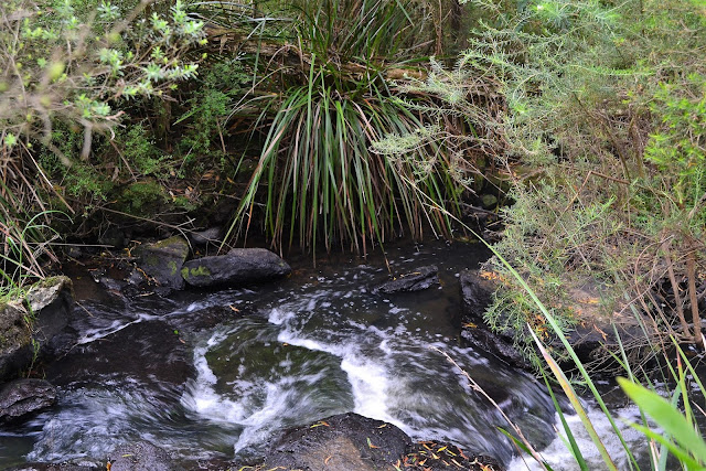
Main Creek

Well what did you make of that first paragraph, this fiction stuff is fun! In the grey, dreary, Feral world (GDFW) though everything wasn't quite so awesome. We were actually meant to be doing a walk over in the wild west today but hit our first snag as we drove out the driveway, hearing that a truck had broken down in the tunnel that we need to take to get through the city meant that the plan was quickly changed and I turned south down Peninsula Link instead of north. With Melbourne's traffic worse than a lot of developing countries that I've travelled through (and way more ill tempered) it just wasn't worth rolling the dice trying to get through the city. The Mornington Peninsula was a good consolation prize though, and after consulting my guide book of choice today, the 2nd edition of Daywalks Around Melbourne by Glenn Tempest we headed down to Flinders to walk the Baldry Circuit. Quite appropriately in my GDFW we arrived at the car park to be greeted by grey skies and the occasional light shower scudding through.


As is common in my GDFW I have done this walk a few times before, probably at least ten times I would of thought, now you must be thinking that this must be a pretty good stroll, well actually there isn't a lot happening on this stroll. The real reason that I've walked it so often is that it's easy and it's close to home which means that if I'm looking for something to do for a couple of hours this spot is a go to place. Leaving the ute we headed off into the scrub, straight into the scenic highlight of the walk, the amble along Main Creek. With our wet spring Main Creek had a good flow today and I spent a bit of time scrambling around the slippery rocks trying to get a good photo, the good news there was that the many kangaroo trails made my off track excursions fairly easy.
Sam's striding ahead while I scan the scrub in the forlorn hope that a Swedish back backer might appear....
It was a real monochrome kind of day today.

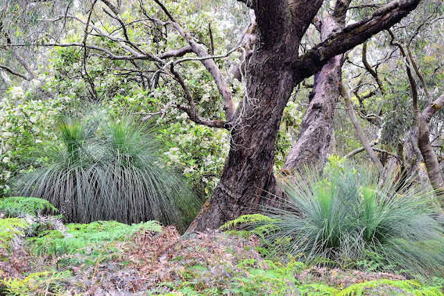
After contouring along the hill for awhile above the creek we eventually arrived at an intersection, here we turned north along the long distance Two Bays Walking Track. With Sam setting a cracking pace (keen to get to Flinders for some retail therapy), I was dropping further and further behind as I mucked around trying to find something other than a grass tree to take a photo of. The Two Bays Walking Track section climbs easily for half a kilometre or so before coming to another intersection, it was now time to turn east and complete the circuit. Heading back towards the ute the route now crossed a couple of gullies which did at least allow me to photograph some ferns in the damper gullies. Ten minutes later and the sound of a car on Baldry Road signalled our imminent arrival back at the ute, our easy stroll was coming to it's end, oh yeah there were no Swedish back packers or Magic Mikes to come home for a debrief with us today so Sam and I settled for lunch in Flinders. I'm to old for all that other stuff anyway;)
I'm pretty happy with this, I managed to take this shot holding the DSLR in my left hand.
The wetter gullies had a few larger ferns.

The Dirt.
We walked 4.1 kilometres and climbed 144 metres on this easy stroll. Like I mentioned earlier we used Mr Tempest's notes out of his Daywalks Around Melbourne book, I've got a fair idea that this book is out of print now, Mr Tempest is now concentrating on smaller, more area specific guides I think. I took the piss out of this walk a bit but it's quite a pleasant little stroll really. This little patch of remnant bushland on the Mornington Peninsula provides a good spot to escape the summer crowds that flock down here, and after the stroll you can then go and join them in any number of great restaurants and cafes on the peninsula.
Relevant Posts.

The tracks here are all well signposted and marked.


I couldn't finish the post without another grass tree.

Saturday, November 26, 2016

Walhalla Train, Tram, Trail ~ Walhalla Historic Area - November 2016


The Walhalla Goldfields train arriving at Thomson River Station, quite a pleasant start to my stroll really.
I have a plan (which is more than the American voters seem to have at the moment), yep, late next year I'm going to wander into the bush, hopefully to emerge six weeks later in Canberra. 'Well that's really nice' I hear you say, but what's that got to do with a walk in Walhalla, well Walhalla marks the spot that I'm going to be disappearing into the bush to begin my walk. So anyway over the next twelve months I'll be walking a few short sections of my big upcoming stroll, mainly to suss out a few logistical issues by getting an idea of what things look like on the ground, I'll be doing numerous food drops as well as booking some accommodation in Mt Hotham and Thredbo and the food drops in particular need a fair bit of planning. Apart from going for a nice stroll today I was keen to check out the accommodation options in Walhalla as I'm going to need to stay somewhere the night before I set off, I reckon six weeks in a tent is enough.
Thomson River Station.
As is fairly common for me this stroll is one I've done more than once over the years, but the train section at the start was all new to me, and who doesn't love a train journey? With the train leaving the Thomson Station at 11:40am it wasn't exactly an alpine start today, I was at the Thomson River Bridge around forty minutes before the train was due to leave so had plenty of time to wander around to find a good spot to get a photo of the train. With the train moving at just above Feral walking pace it was easy enough to get a couple of shots of it as it crossed over the Thomson River on its way to the station and then still make it to the platform in time for my trip into Walhalla.
The old train snaking its way through the steep sided Stringers Creek Gorge on my journey into Walhalla.
The little tourist train was a nice way to start my days adventure, the surprisingly rugged little Stringers Creek Gorge seen through the open sided carriages as the train rattled and groaned its way along the steel rails through the gorge. Arriving into Walhalla I wandered up the road (there really is only one) towards the main section of the town. My first objective on today's stroll was to check  out the historic Walhalla Cemetery, I could see its white picket fence on the side of the  hill above me and after investigating a few side tracks I found the track leading up to the cemetery. With flat ground being a little rare around here the early settlers had to be a little imaginative, leveling the top of a hill for their cricket ground and also terracing the cemetery into the steep sides of the valley. With Walhalla being predominantly settled by gold miners it was unsurprising to find a fair few of the 1300 people buried at the cemetery had passed away a a fairly young age, incidentally the oldest known burial at the cemetery dates back to 1866.
Walhalla Cemetery is terraced into the side of the hill high above town.
There is not a lot of flat ground in Walhalla.
After visiting the cemetery I meandered my way up the valley of Stringers Creek towards the main section of town. Up to my left the steep sides of the valley were home to some huge mullock heaps left over from the mining days, with the narrow valley floor home to all the old buildings, with the old fire station straddling the creek in the tight confines of the valley. Passing the old Bank of Victoria vault which over its life stored around $1,400,000,000 worth of gold, I wandered on to check out the Star Hotel which is my choice for accommodation before my walk next year, mainly because its front door is only a few metres from the start of the Australian Alps Walking Track and I'm pretty lazy.
The Bank of Victoria vault.
The hillsides above town are sometimes covered in mullock heaps.
The old fire station......
Is actually built over Stringers Creek.
Next to quaint in the dictionary there is probably a picture of Walhalla.
The Star Hotel. The Australian Alps Walking Track starts it's journey to Canberra a few metres from the front door.
Continuing up the valley I walked north as far as the old school almost buried underneath the mullock heap from Long Tunnel Extended Mine. I crossed Stringers Creek here and after checking out an old quartz crusher I climbed up the access road to the mine. You can do underground tours at the old Long Tunnel Mine if you've got the time, but I gave it a miss today though and set off on my long tramway walk. From the entrance to the mine I would be following old tramways all the way back to the ute. The tramways around here were pushed through the bush to feed the insatiable appetite that the mines had for timber, with the tramways having to extend further and further into the surrounding hills as they denuded the hills closer to the mines, these old tramways that make for some very nice walking nowadays.
The original Walhalla School.
Quartz Stamper below the mullock heap at Long Tunnel Extended Mine.
The rest of today's stroll was along a series of these historic tramways.
Once on the contouring tramway I started my journey south, now sidling high above Stringers Creek. Initially I had quite a few views down to Walhalla, the historic town being just as pretty from up here. Passing another old mine I once again met up with thee AAWT coming up from the valley below. The route now leaves the outskirts of Walhalla and starts its journey to the Thomson River Valley along the steep sided valley of Stringers Creek, having travelled up here by train a couple of hours ago it was interesting to be walking in the opposite direction probably around a hundred metres above this mornings route, I actually managed to see the train as it passed by, way down in the gorge. After passing in and out of a few ferny gullies I eventually arrived at Mormon Town Track, this 4wd track marks the spot where I left the valley of Stringers Creek and started to follow the bigger Thomson River Valley.
Passing another old mine site.
The views down to Walhalla from the tramway were very impressive on this beautiful day.
Next years objective......
High above Stringers Creek the old tramway ducked in and out of a few of these lush valleys.
My route now headed north, still on the AAWT, up above the Thomson River. Initially at least the river isn't really in view at the bottom of the steep valley, although there was still plenty to hold my interest. The track starts off passing through sections of dry euclyptus forest which doesn't sound that exciting, but with extensive views of the surrounding bush fire scarred mountains and their verdant green re-growth. After passing through an area of grass trees the route started to make its way in and out of a few ferny gullies, a couple of them with their own little water features, it was along here that I got my first views down to the river and it was also along here that my next objective came into view, the Poverty Point Bridge. It was interesting to see how the bush was re-vegetating along here, the Black Saturday fires did some serious damage and it was good to see a lot of the flora coming back, only the larger trees were still struggling a bit, giving the surrounding mountains the appearance of being covered in stubble. 
Crossing Mormon Town Track my route swung north along the eastern side of the Thomson River.
The Thomson River was a long way down in the valley though.
There were a few ferny glades to enliven my tramway walk.
My first look at the distant Poverty Point Bridge.

Poverty Point Bridge marked my final change of direction on today's stroll, it was here that I left the AAWT and headed south along the opposite side of the Thomson River. Poverty Point Bridge is another relic left over from the mining days, the bridge now is a vital piece of walking infrastructure which allows walkers to safely cross the Thomson River without getting their feet wet. There is an information sign at the bridge giving a few facts and figures about the bridge, the most interesting being that the hand rail was only put in in 1976, hmmm....... OH+S obviously wasn't as much of a concern in ye olde days!
The bush fire scarred mountains above the Thomson River.
Hmmm, no handrails would sort you out!
Poverty Point Bridge marked the spot that I left the Australian Alps Walking Track.....for now.
The route along the western side of the valley was a little rougher than the route along the eastern side, but it was pretty cruisey really. Being fairly late in the afternoon and in a steep sided valley meant that I was now walking in the shade, while the day hadn't been too hot it had been hot enough that I was glad not to be in the direct sun for awhile. Apart from a couple of nice waterfalls I spent most of my time on this section trying to do photographic justice to the sun drenched eastern side of the valley, although my skills behind the lens meant that most of the shots look a little over exposed. Nearing the ute the route makes a final climb up to a 4wd track, the first real climb I'd done since leaving Walhalla a few hours ago, not that it mattered much as I just had a few hundred metres down the dusty track and I was back at the Thomson River Station Carpark and my ute. The good thing (for me) walking to the east of Melbourne meant that two hours later I was pulling into the driveway back home.
With the east side of the valley still sun drenched it was challenging for photographs, well for me anyway.
This stream cascaded for thirty or forty metres down the steep sided valley.
The Dirt.
I walked 16.7 kilometres today and climbed 141 metres on this stroll. I'd call this a medium grade walk but only because of the length, the route is very well defined and maintained and once you climb up to the tramway in Walhalla it's almost flat. This is an interesting walk, it features a lot of history, some nice places to eat, and some great mountain and river scenery. The Walhalla Goldfields Railway operates a few times a day into and out of Walhalla from the Thomson River Bridge on weekends. The train I caught left the Thomson River Station at 11:40am arriving into the historic town thirty minutes or so later, it cost me $15 for the journey. I used Melanie Ball's notes and map on today's walk out of Top Walks in Victoria, which along with my GPS maps is all I really needed.
Relevant Posts.

The final 4wd track back to the ute was a little uninspiring....but it was only a couple of hundred metres.

Thursday, November 24, 2016

Clifton Gardens ~ Bradley Head, Sydney Harbour National Park - October 2016

Its a little hard to believe that we are only a handful of kilometres from our biggest city.
Sin City put on her best face for today's stroll, with the blue skies, sunshine and the beautiful harbour there wasn't a lot that even I could find to whinge about. I did this walk the day we arrived back from Papua New Guinea, with Sam electing to head to the shops and check out some galleries I was flying solo again, not an unusual occurrence for the Feral walker. I'd been reading about this walk for years as it features in some of Tyrone Thomas' old walking guides, but on my many trips north over the years I'd somehow never got around to walking it. So, as I mentioned, with good weather predicted for this Tuesday I decided to catch the ferry over to Taronga Zoo and go for a bit of an amble around the leafy suburb of Mosman.
Not a bad view for these guys.

Sam and I had actually visited the zoo a few weeks previously, so when the ferry docked at the wharf today I was soon saying my metaphorical goodbyes to all the other passengers and slipping into the bush. I picked up a track heading west along the coast towards Little Sirius Cove, the path was another of those typical in the Sydney coastal region, sometimes walking sandstone slabs, sometimes board walks and sometimes just plain old dirt. Walking along here with the harbour sparkling on one side of me and the odd wild animal noise coming from Taronga Zoo on the other side of me was a bit of a surreal experience, oh yeah, and when I focussed a little further out there was the Opera House and the high rise buildings of the Sydney CBD, like I said, surreal.
I wish getting to the start of all my walks was this beautiful.
The route along here is squeezed between the zoo and the harbour.
That's Little Sirius Point.
After checking out a bit of a lookout and an overhang at the end of Little Sirius Point I started heading towards the sand in Little Sirius Cove, along here I arrived at a signposted track to Curlew Camp that wasn't mentioned in my notes or map (when you use notes that are about 150 years old it pays to walk with an enquiring mind!). So being a curious kind of bloke I wandered down for a bit of a look, it turns out this was an artists camp from the late 1890's, a kind of out-station for the famous Heidelberg school of artists, both Roberts and more commonly Streeton spent time up here...who knew. There isn't much left of the old camp except for a bit of carving in some of the sandstone, the views no doubt are what attracted the artists though and they are still great.
Little Sirius Cove from near the site of the historic Curlew Camp.
There isn't a lot left of the Curlew Artists Camp.
The beach at Little Sirius Cove was pretty quiet today.
Continuing on I soon arrived at the crescent of sand that is the beach at Little Sirius Cove, this place was dead quiet today, a couple of dog walkers, a girl sunbathing, and a couple of mums walking their dogs in the park was the extent of the action here. I was now heading away from the water for awhile as I made my way across the headland through the very flash suburb of Mosman. The locals in Mosman were a little suspicious of the slightly dishevelled Feral walker though, first I got swooped a couple of times by an irate magpie and then I got stalked by a lady in a 7series BMW. Yeah, walking up the steep Lennox Street admiring all the beautiful houses something didn't feel right, turning around I noticed a black BMW with tinted windows idling along behind me with the well dressed lady busily taking photos of your Feral correspondent with her phone, hmmm. Now I was pretty sure that this lady wasn't snapping shots of me for her private collection so I figured that the best thing to do would be to go over and say hello. Using every ounce of Feral charm that I could muster I managed to convince her that I wasn't casing the joint, although having convinced her that I wasn't a crim I them had to reassure her that the suburb wasn't going to be over run with all my Feral followers keen to follow in my footsteps, yeah right, all three of them!
Making my way through the leafy streets of Mossman I had to survive a few of the locals that weren't overly keen to have the Feral walker in their suburb.
Not quite Inca standards but still pretty good, this was beside the steps climbing up to Lennox Street.

Crossing Bradley Head Road I started my zig zagging descent back down to the water at Chowder Bay. Chowder Bay was a fair bit busier than Little Sirious Cove had been, there were a few kids swimming and plenty of people picnicking on the extensive lawns backing the beach. I was now going to be following the coastline all the way back to to the wharf, the first objective I had was Chowder Head and once again I was back on the sandstone. Every now and again the houses of Mosman were visible above me but surprisingly, more often than not it was just me in the bush with beautiful views of the harbour through the trees. The other somewhat surprising thing was that there was virtually nobody on these tracks, the lack of other walkers meant that there was a bit of wildlife around in the form of bush turkeys, kookaburras and an assortment of lizards.
Chowder Bay.
Making my way around Chowder Head, there are plenty of spots to view the harbour through the trees.
There are still some houses in Mossman that require a bit of a reno.
If you squint you might see a kookaburra in the shadows, it was the best I could do today.
Heading around Taylors Bay it appears that not a lot of people actually work in Sin City, well judging by the number of expensive boats anchored just off shore anyway. Apart from the boats the other thing that struck me about Taylors Bay was the beautiful aqua marine water and white sand beach, being only a couple of kilometres from the centre of of our biggest city it was a stunning natural scene. I was now starting to make my way around Bradley Head, while the headland blocked my views of Sydney I now had views out to the Sydney Heads. Bradley Head was the home to a military fort that dates back to the 1840's and that was the next spot that I got to. The old fort is marked now by a large flag pole and a series of monuments to navy ships that have been lost at sea over the years.
There were some nice boats anchored in Taylors Bay, although my other photos will have to go straight to the pay per view section of my blog!
Looking back down toward Sydney Heads as I walked around Bradley Head.
The walk was now coming to its conclusion as I made my way back to the wharf, however what I thought would be a little under whelming on paper was actually pretty good walking on the ground. The track passed above some beautiful little sandy coves in its last kilometre before meeting up with road almost opposite the bottom entrance to Taronga Park Zoo (only an exit nowadays I think). All that was left now was to wander down the foot path, jump on the ferry and head back to the hotel in Sydney. Settling into the hotel I glanced out the window to see the ship that we'd been on for the last three weeks sailing out of Sydney Harbour, our holiday was coming to an end.

Another local stopped today hello.
Bradley Head turned out to be a great spot to walk.


There are a few of these beautiful beaches on Bradley Head.
The Dirt.
Like I mentioned earlier this walk was written up by Tyrone Thomas, I used the notes and mud map out of the first edition of 120 Walks in New South Wales, the book dates back to 2000 so its well and truly out of print, you maybe able to pick one up second hand somewhere. I didn't have a GPS for this stroll but according to Mr Thomas I walked around 6 kilometres, I'm guessing the total elevation gain would be in the vicinity of 150 metres. This is an easy walk with some great coastal scenery as well as a chance to check out some of the flash houses in Mossman.
Relevant Posts.

The historic Taronga Park Zoo, I think this bottom gate is an exit only nowadays.

Back at the hotel I watched the ship that had been home for the last three weeks make her way out of Sydney Harbour. 

Pelion Hut to Mt Ossa return, Overland Track - April 2010

Mt Oakleigh from the Pelion Hut heli pad. I think the mountain just visible in the mist in the distance is Cradle Mountain... ... the flat t...