Before Sam and I headed off to New Guinea on our cruise we had a few spare days up in Sydney. The day before I did this walk we had done the extremely popular Spit Bridge to Manly walk, with Sam off shopping today I was looking for a quieter walk. After consulting Mr Chapman's Day Walks Sydney I decided to jump on a train and head down to Cronulla and do the walk from Kurnell to Cronulla. My main memories of Kurnell were visits to the refinery when dad was driving tankers, it wasn't a spot that I immediately associated with a bushwalk, although driving down from Cronulla To Kurnell in a taxi it was obvious to see that a lot of the heavy industry had disappeared.
 |
| No shortage of Kookaburras here. That rocky bar in the back ground is where Captain Cook first came ashore, I can imagine him being welcomed by the Kookaburras actually. |
Saying goodbye to the taxi driver at the entrance to Botany Bay National Park I shouldered my pack and headed off on my days adventure. My first point of interest that I was keen to check out was the site of Captain Cooks Landing but before I could get there I couldn't resist getting a photo of four Kookaburras chilling out in a tree, an unusual sight that I've never seen before. One Hundred metres further on I got to the small rock bar that marks the site of the landing where they established the first European settlement in Australia. Apparently there were two of the local indigenous people here when Cook's party came ashore, these blokes weren't too happy at the arrival of these pasty white blokes in their bright clothes and preceded to tell them to bugger off back to their boat (although maybe not in that exact language). In a sign of things to come however the visitors decided that firing a shot over the heads of the men might get them to welcome their visitors, when that didn't work they decided to fire at the legs of one of the men, when that still didn't worry him they reloaded and tried again, the third shot having its desired effect and we haven't looked back since, hey.....
 |
The landing site for the first European settlement in Australia.
 |
Sir Joseph Banks was the botanist on the first fleet.
 |
| This small creek provided fresh water to the first fleet and the infant settlement. |
|
|
After passing a monument to Joseph Banks, a botanist on the first fleet who must of thought he'd landed on another planet I came to a small creek. This creek was the source of water for the infant settlement as wells for the First Fleet. Soon after crossing over the small creek I swung up passed the visitor centre, heading across the extensive lawns of the picnic area. Crossing over Cape Solander Drive I now picked up an inland track called Maru Track, this old management track climbed over a small hill passing through a nice section of native bush before gently dropping back down to once again meet the quiet Cape Solander Drive. Following the sealed park access for a couple of minutes I then dropped down to Yena Picnic Area, I was now gazing over the wild Tasman Sea instead of the calmer water of Botany Bay where I started the walk.
 |
The wide open manicured spaces below the Botany Bay National Park visitor centre.
 |
After leaving the visitor centre I headed inland for a short stretch passing through a nice section of forest.
 |
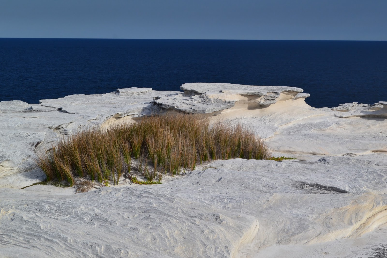
| Arriving at Yena Picnic Area I checked out the rock shelves below the car park, from now on I'd more or less follow the coast all the way to Cronulla. |
|
|
For the rest of the walk the wild coast would would never be far away. After exploring the rock shelfs below the picnic area I wandered back up the access road and re joined Cape Solander Drive, this sealed road was virtually traffic free today and it allowed for numerous views over the low coastal scrub out to sea. The road ends at Cape Solander and from here the walking would get a bit rougher, dropping down the steps onto the top of the cliffs I came across a piece of A4 paper explaining that the walking track was closed for maintenance, hmmm. Not actually sure which track the Parks people were referring to I decided to push on (actually I would of pushed on anyway), initially following the open tops along the cliffs until I got to a large gorge, this must be Tobias Gap.
 |
Cape Solander Drive was ok walking as there was virtually no traffic.
 |
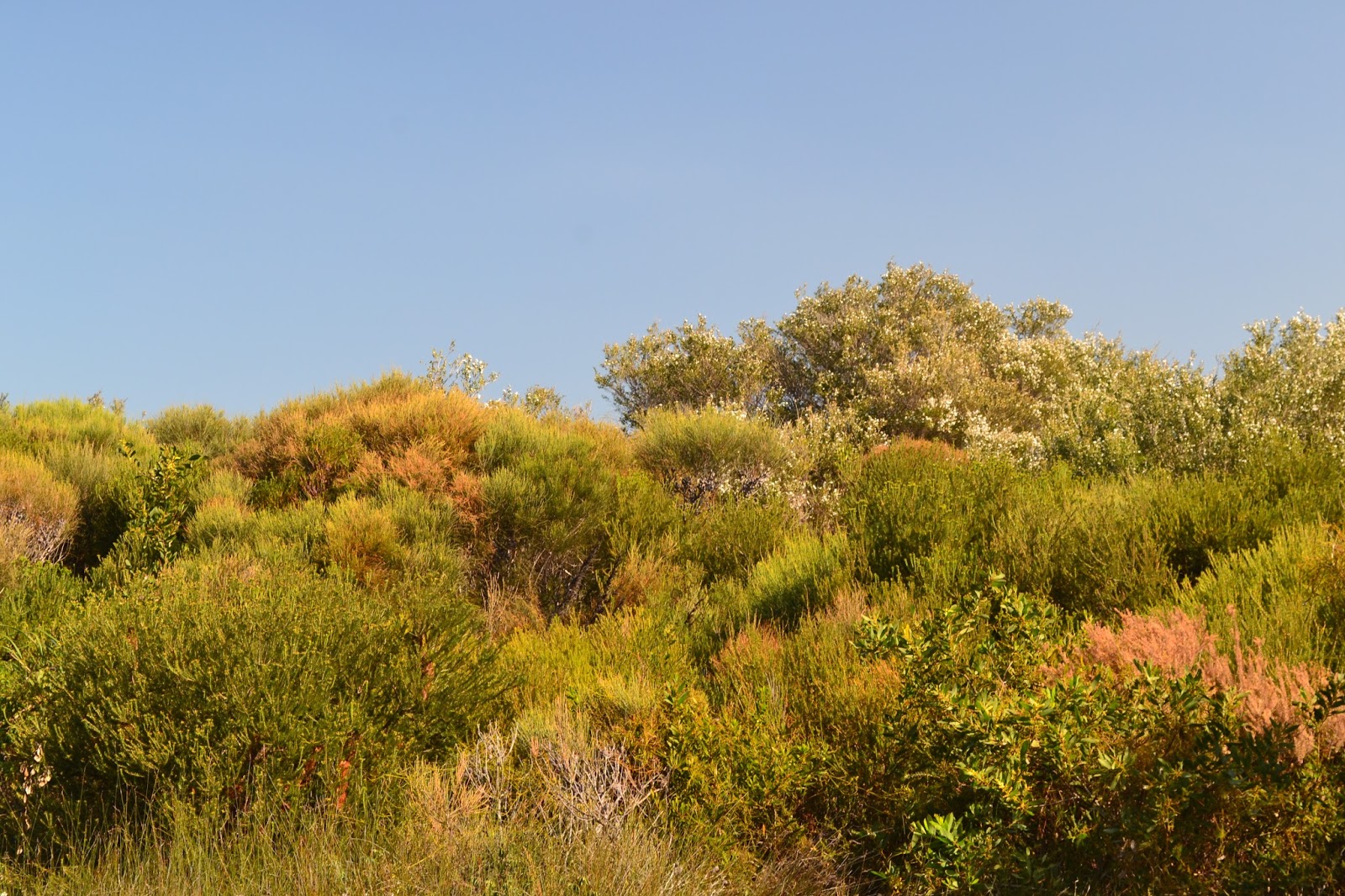
There was plenty of coastal heath land on offer today.
 |
Reaching the end of Cape Solander Road at Cape Solander I started off along the cliff tops.
 |
The Botany Bay National Park steeple chase.....maybe.
|
|
|
|
I had to head into the coastal heath for a while at Tobbigai Gap to by pass the actual gorge, once inland a bit I could see that it was my track that Parks were doing maintenance on as there were a lot of building materials scattered around, there was no maintenance happening though. There appear to be a few options along here as far as tracks go but I generally stayed as close to the tops of the cliffs as practicable, sections along here were a lot rougher than I had imagined they'd be, I quite often had to find my way through some serious muddy spots. The wet open heathland was a perfect spot for wild flowers though and I was able to practice my macro shots trying to capture the diversity of the flora. While the tracks along here were a little on the rough side I was in no danger of getting bushed, I basically kept the ocean to my left and headed towards the Cape Bailey Lighthouse which stood out like an ever approaching beacon ahead of me.
 |
Approaching Tobbigai Gap I had to skirt inland around a deep gorge.
 |
The industrial side of Kurnell was never to far away but for the most part you wouldn't know it was there.
 |
The walking got a little rougher after passing Tobbigai Gap.
 |
 |
I wasn't really expecting this, but it wasn't to bad really.
 |
The wet heath land was a great spot for wild flowers though, so there was a pay off for the mud.
|
|
|
|
|
|
The lighthouse was a bit of a non event though, in fact I'd go as far as to say don't bother with the short side trip, the bush stops any real view and the automated light is unfortunately defaced with graffiti. Leaving the lighthouse my route once again took to the exposed cliff tops, now with the high rise buildings of Cronulla visible in the distance, the very far distance! Hmm looks like it'd be touch and go whether I finished this walk in the daylight. Leaving the extensive cliff tops I crossed a series of small coves, climbing over small heath covered headlands on what I presume to be old fisherman tracks.
 |
Cape Baily Lighthouse was little bit of a non event I reckon, no view and daubed in graffiti.
 |
 |
This is the view back towards Sydney from around half way up the lighthouse side trip, best to turn around here and head back to the main track.
 |
Looking south down the coast.
|
|
|
|
Boat Harbour is a ramshackle collection of beach shacks, a slightly unusual sight considering that I was less than 20 kilometres from the Sydney CBD. From here to Cronulla it was a bit of a beach stroll, although initially it was fairly tough going as the eastern end of Cronulla Beach is open to 4wd's and they had cut the soft sand up a lot. After passing out of the 4wd zone and with the tide slowly receding the beach walking started to get a bit easier, and once I started to meet a few local dog walkers I knew I was getting close to the end. After a 7 kilometre beach walk I was pretty happy to arrive at the end of Cronulla beach just as the sun slipped beneath the horizon, washing the sand off my feet I pulled on my old boots and headed through town to the train station, gee I wish I could fund this lifestyle all the time!
 |
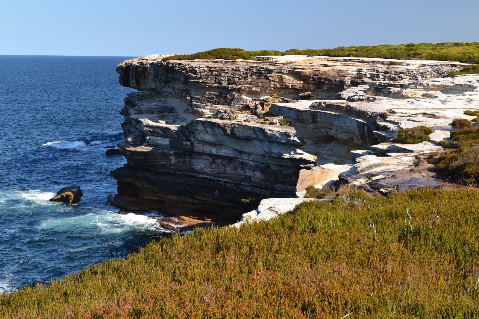
These sandstone cliffs make for nice photos..well I think so anyway!
 |
I love the different texture of the rock.
 |
 |
| An old Holden red motor I think, they're were a few of these rusting automotive burial sites as I made my way towards Boat Harbour. |
|
|
|
The Dirt.
My old GPS was cactus when I did this walk so I'll give you the stats from my notes, the distance is 14.3 Chapman kilometres and the metres climbed is 75 Chapman metres. I also think I agree with Mr Chapman in relation to this being a medium grade stroll, the track was a lot rougher than I anticipated but obviously that could change with the intended maintenance.....maybe. Now as you've probably worked out I used the notes out of John and Monica Chapman's
Day Walks Sydney book. This walk was a surprise in more than one way, as I've mentioned it was a little rougher than I anticipated, also it took me longer to walk than I thought it would, the beach section at the end seemingly going on for a long time which was probably because the high rise buildings were in sight for the length of beach. Having said all that though I think this is a bit of a hidden gem, the coastal scenery was superb in spots, if you had mentioned that you were going for a walk in Botany Bay National Park I wouldn't have associated that with beautiful coastal scenery in my head, until now.
Relevant Posts.
 |
| The little cove that is Boat Harbour, there is a ramshackle village backing onto the water but I thought it best to respect the peoples privacy and not take to many photos there....what with the sound of banjos wafting around in the breeze an all! |
 |
| The section of Cronulla Beach around Boat Harbour is open to 4wd's so it makes for some tough walking around high tide. |
 |
| Cronulla Beach. |
 |
| I've just arrived at Cronulla, perfect timing really. |


No comments:
Post a Comment