After our Northern Territory adventure we tried to escape the rain by heading east, all the way to the coast. On the way across the continent we dropped in at a park that Sam and I hadn't visited for around twenty years, Blackdown Tableland National Park. I remember Blackdown Tableland as being a bit off the radar back in the day, but it must of left a bit of impression on me as I've always wanted to go back. Back then the the access road was rough dirt all the way from the Capricorn Highway, but now a good bitumen road takes you to the top of the tablelands which makes access fairly easy, once up on the tablelands the road is still dirt but it's OK for a conventional car with care. There is also a 4wd only loop which we did twenty years ago, but you can visit most of the main attractions without two diffs.
 |
| Yaddamen Dhina Lookout was a little on the grey and murky side first up this morning. |
Our first objective today was to revisit Yaddamen Dhina Lookout, to be honest though the grey overcast conditions meant that the lookout was a little underwhelming this morning. With a washed out sky we decided to head off on the Goodela Walk and re visit the lookout later in the day. The walk to Goodela (Two Mile Creek) contours for awhile before gently descending down the creek line. Initially the good track passes through some fairly open dry country passing by numerous large rocky sandstone outcrops, the rocky outcrops are a bit of a feature of walking in Blackdown Tableland National Park I think.
 |
 |
These rocky outcrops are a feature of Blackdown Tableland National Park.
|
|
Fifteen minutes or so after leaving the carpark we met up with the creek and from then on we gently followed it downstream to where it plunges off the plateau. Once tracking along beside the creek the track is a little steeper but it's still fairly gentle as far as a bush walk goes, there were a few steps and bridges to ease or way. The creek was home to a lot of ferns and with a bit of water trickling down it made for very pleasant walking with plenty of opportunities to watch the water trickling down over the sandstone slabs. Ten minutes or so after starting down the creek we arrived at the top of the falls, now while there wasn't a lot of gushing water plunging off the abyss there was enough to make for a reasonable photo.
 |
Once across the creek the track follows it gently down stream.
 |
There are plenty of spots that you can get off the track to check out the creek.
 |
Before eventually we got to the spot where Two Mile Creek tumbles off the plateau.
|
|
|
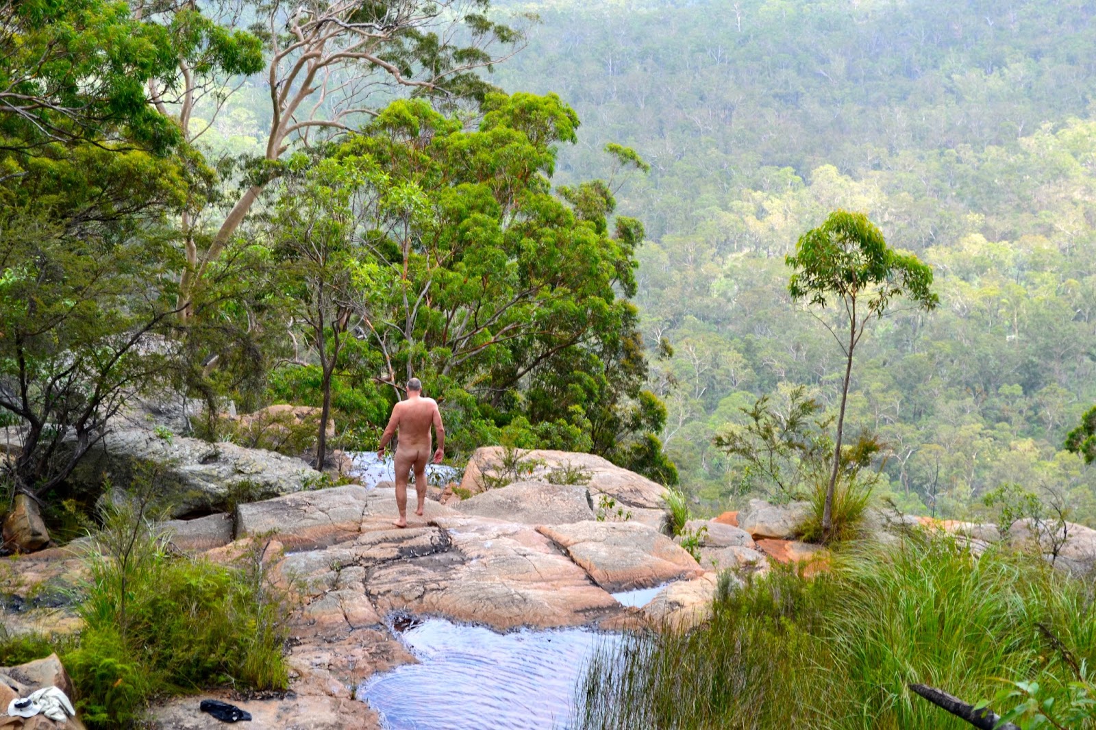
Having never seen a pool of water that I didn't want to swim in I was soon scoping out the plunge pool below the falls, quickly working out a way down I left Sam at the top and did a bit of off-piste work until I emerged onto the rock slabs below the falls. With no one around to scare except for Sam I stripped off and waded in, I love this wild swimming as much as I love the walking, the only thing that would have made it better would have been a bit of blue sky, oh yeah and if I could of talked Sam into climbing down to join me would have been a bonus, but as I've mentioned before not only does she have the looks but she also has the brains in the relationship too!
 |
I reckon that pool looks good for a bit of wild swimming.
|
After drip drying for a bit on the warm rocks I pulled my boots (and clothes) back on and climbed back up to where Sam was waiting. Our walk back to the ute was a little slower, not just because we were walking back up but because the sun was making its first sustained appearance for the day, so the retrace wasn't as boring as they sometimes can be as I was able to abuse my polariser a bit. After the best part of a week of cyclonic rain in the Northern Territory it was quite a pleasant novelty to look through the view finder and see a vivid blue sky. Arriving back at the ute I ducked back down to the lookout and while the view was pretty good I decided to come back again on our way down off the tableland later that afternoon, the Yaddamen Dhina Lookout photos you see around this paragraph somewhere are a result of that late afternoon visit, fuck I'm getting anal as well as old!
 |
Heading back up to the ute the sun made a belated appearance.
 |
Can someone tell my the name of these trees, they are everywhere up here.
|
|
The Dirt.
We walked 4.8 kilometres on this easy stroll and climbed 78 metres. This walking track was really well maintained (actually they were on all our walks in Blackdown Tableland National Park). There isn't actually a track to the plunge pool at the bottom of the falls but if your OK with some easy scrambling then it's easy enough to find your way down. These falls would be best seen on a sunny day after some decent rain, the park was a little dry on our visit but what do you do, you can't control the weather. As far as I know there aren't any published walking notes for this walk, I just used the
very basic notes off the
Qld Parks site.
Relevant Posts.
 |
| I went back three times to get these photos.... |
 |
| Yaddamen Dhina Lookout |
 |
| I think the late afternoon visit was a good call. |


No comments:
Post a Comment