 |
| Dinner Plain Creek |
I'm now well underway in planning and organising my Australian Alps Walk which is penciled in for spring this year. Now apart from up-dating a bit of gear and buying plenty of freeze dried food I'm also sussing out food droop spots and places to stay for a couple of days when I'm on my walk. Mt Hotham is where I plan to rendezvous with Sam for the first time since leaving Walhalla a couple of weeks earlier, so I was looking for somewhere to stay to chill out a bit and at the same time being a pleasant enough spot for Sam to enjoy an couple of days away. From previous experience I knew that Mt Hotham is a bit of a ghost town after the ski season closes so I decided to head up for the day a check things out with Sam and at the same time I figured that I could fit in a stroll. The good news was that I found somewhere nice to stay for a couple of days that is within easy walking distance of the AAWT, the bad news for me though was that Mt Hotham was completely socked in when we arrived. Thankfully though while we enjoyed lunch at the General Store the gloom lifted enough that I figured that it would be worth heading down the road a bit to Dinner Plain and going for a bit of a walk.
 |
| Dinner Plain was pretty quiet this Saturday. |
Parking the ute at Dinner Plain I set off back up the track beside the Great Alpine Road for a couple hundred metres before turning down a fire track called Dinner Plain Track that skirted the western boundary of the alpine village. This dirt road would be my ongoing route for the next 4 or 5 kilometres as I made my way out to Precipice Plain. Initially the main interest on Dinner Plain Track was checking out the flash houses and lodges, but as I headed further south the Snow Gums and small grassy snow plains were what gained my attention. Dinner Plain Track is a nice easy walk all the way out to Precipice Plain, the gently descending fire track and wide grassy verge offering me plenty options to walk on a softer surface.
 |
Dinner Plain Track heads down the western side of Dinner Plain.
 |
Snow Gums were a feature of today's ramble.
 |
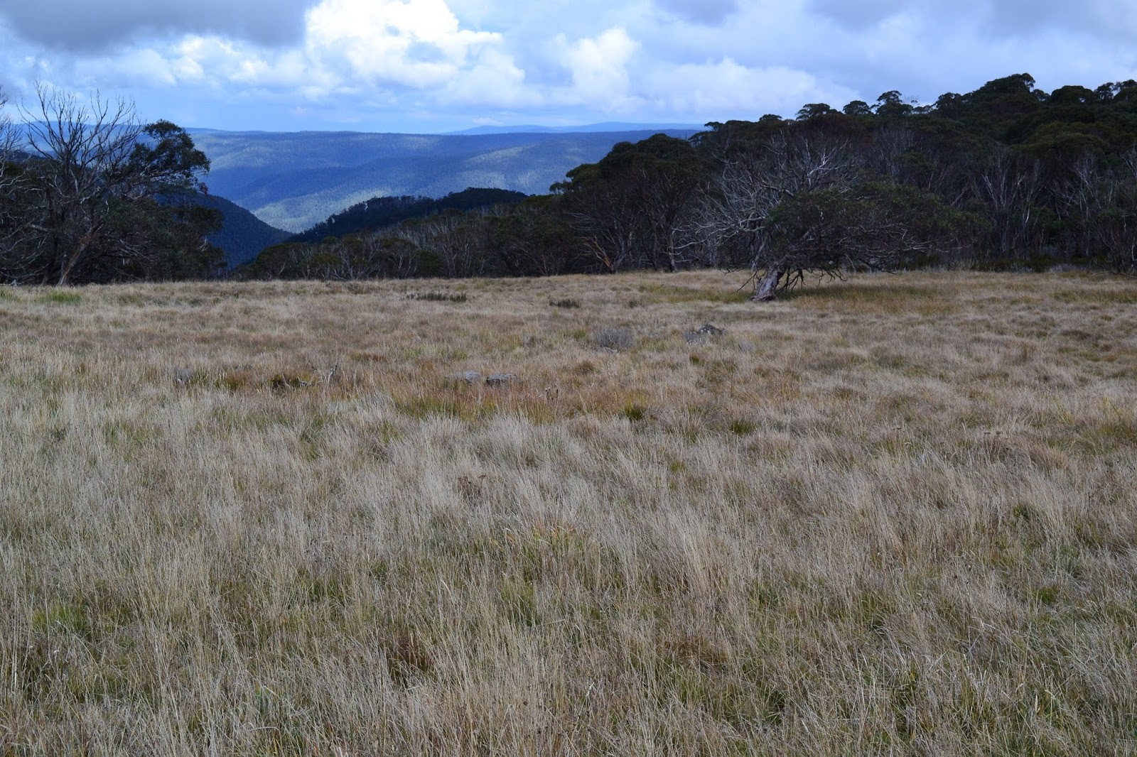
Dinner Plain Track passed through a couple of these nice snow plains.
 |
| Dinner Plain Track. |
|
|
|
Now I'd been wondering if identifying the turn off to the un official lookout at Precipice Plain would be easily spotted so I was keeping a close eye on the map, as it turns out it was easy to spot as there is a very old car park and sign marking the spot to head a short distance across the snow plains to the cliff edge. Even on this overcast day the view from the cliff tops was worth the effort, looking back I could see a couple of the buildings at Dinner Plain poking through the snow gums on at the distant ridge and ahead of me, out over the precipice I could see the mountain ranges receding into the distance.
 |
| The old car park was easy enough to identify. |
 |
Precipice Plain Lookout.
|
With Sam waiting for me back at Dinner Plain I didn't linger too long at Precipice Plain, just stopping long enough to have a quick drink and take a few photos before shouldering my pack again and heading back up Dinner Plain Track. The walk today more or less follows the boundary between the national park and the state forest so for some of the distance I shared my stroll with some local bovine population, with winter coming it won't be long before the local cow cocky rounds them up and takes them down to lower pastures I suppose.
 |
There were some cattle still grazing up here.
 |
 |
Climbing back up Dinner Plain Track towards Dinner Plain, the gradient was fairly gentle.
 |
| Meeting up with the Carmichael Falls Track I headed down for a look. |
|
|
|
With the buildings of Dinner Plain coming into view I decided to take the side track down to Carmichael Falls. The track down to the falls is more your typical bush walking track instead of the dirt road that I'd been following so far this afternoon, so it made for a nice change. Descending gently through beautiful snow gums I could hear the burbling Dinner Plain Creek cascading down beside me for a lot of the distance, although for the most part it was out of view. After one last descent down a couple of switchbacks, which was a little steeper than what had come before I arrived at the large lookout, the structure looking a little out of place in my eyes. With us being at the end of a dryish spell I wasn't expecting a lot from Carmichael Falls but they were actually pretty good, the falls drop around 25 metres of the Basalt plateau and they were flowing reasonably well today. After filing this spot away in the dark recesses of my brain for a return visit after winter I set off to climb back up to Dinner Plain Track.
 |
The Carmichael Falls Track is more of your traditional bushwalking track.
 |
Carmichael Falls
 |
| There's a fairly substantial lookout at Carmichael Falls. |
|
|
I punctuated my climb back up with a short excursion to check out a small waterfall higher up Dinner Plain Creek. This little un-marked waterfall is actually way prettier than the main falls in my opinion, while no where near as high as the main falls the water here cascading down over moss covered boulders looked very good. These falls do require a bit of off piste work to get the best angles though so be careful on the wet, slippery rocks if you check them out. After clambering around wet rocks for awhile I figured that it was time that I got back to Sam, climbing back up through the alpine forest I was soon back on Dinner Plain Track. Not a lot happened on the rest of my stroll back to be honest, for me the main interest was whether I would make it back to the ute without getting rained on, the good news was that I succeeded on that count. After throwing my sweaty boots into the back of the ute we settled in for the long drive home, interestingly the northern slopes of the Great Dividing Range were still cloaked in heavy cloud as we descended.
 |
Like the rest of the walk the climb back up to Dinner Plain Track was pretty gentle.
 |
This little waterfall is un-signed, it's on Dinner Plain Creek above Carmichael Falls.
|
|
The Dirt.
I walked 12.6 kilometres and climbed 440 metres on today's medium grade stroll - I'm a little dubious on the metres climbed figure but that's what the GPS says, the distance is pretty spot on today though. This is a nice walk if you find yourself in the area, there isn't a lot in the way of information around though. I picked up the free brochure Mt Hotham & Dinner Plain Tracks & Trails at the General Store on Mt Hotham, I also had some notes and a mud map out of one of Tyrone Thomas' old book 70 Walks in Victoria's Bright and Falls Creek District. Along with my GPS maps these notes and maps were adequate for this stroll, although don't head out if the weather looks like it might turn ugly and always take wet weather and safety gear.
Relevant Posts.
 |
| Passing through the nice Alpine scrub just before I got back onto Dinner Plain Track. |
 |
| Another nice stroll coming to it's end, that's the Great Alpine Road on my left, Dinner Plain is on the other side of that copse of snow gums ahead of me. |


No comments:
Post a Comment