On my recent visit to Tarra-Bulga National Park I decided to drop down Tarra Valley Road and check out Cyathea Falls. I'd spent the previous few hours wandering around the area closer to the visitor centre up at Balook, but with a couple of hours of daylight left I decided to check out this little waterfall before heading home. After safely making my way down the incredibly narrow and windy road I pulled into the Tarra Valley Picnic Area to find it almost empty. After re-setting the GPS I took couple of photos of the picnic area surrounds, before then heading off through an archway into the wall of greenery on my way to the waterfall.
 |
 |
The very wet Tarra Valley Picnic Area.
 |
| It's a very grand start to the walk, the stone work is starting to resemble an Inca ruin. |
|
|
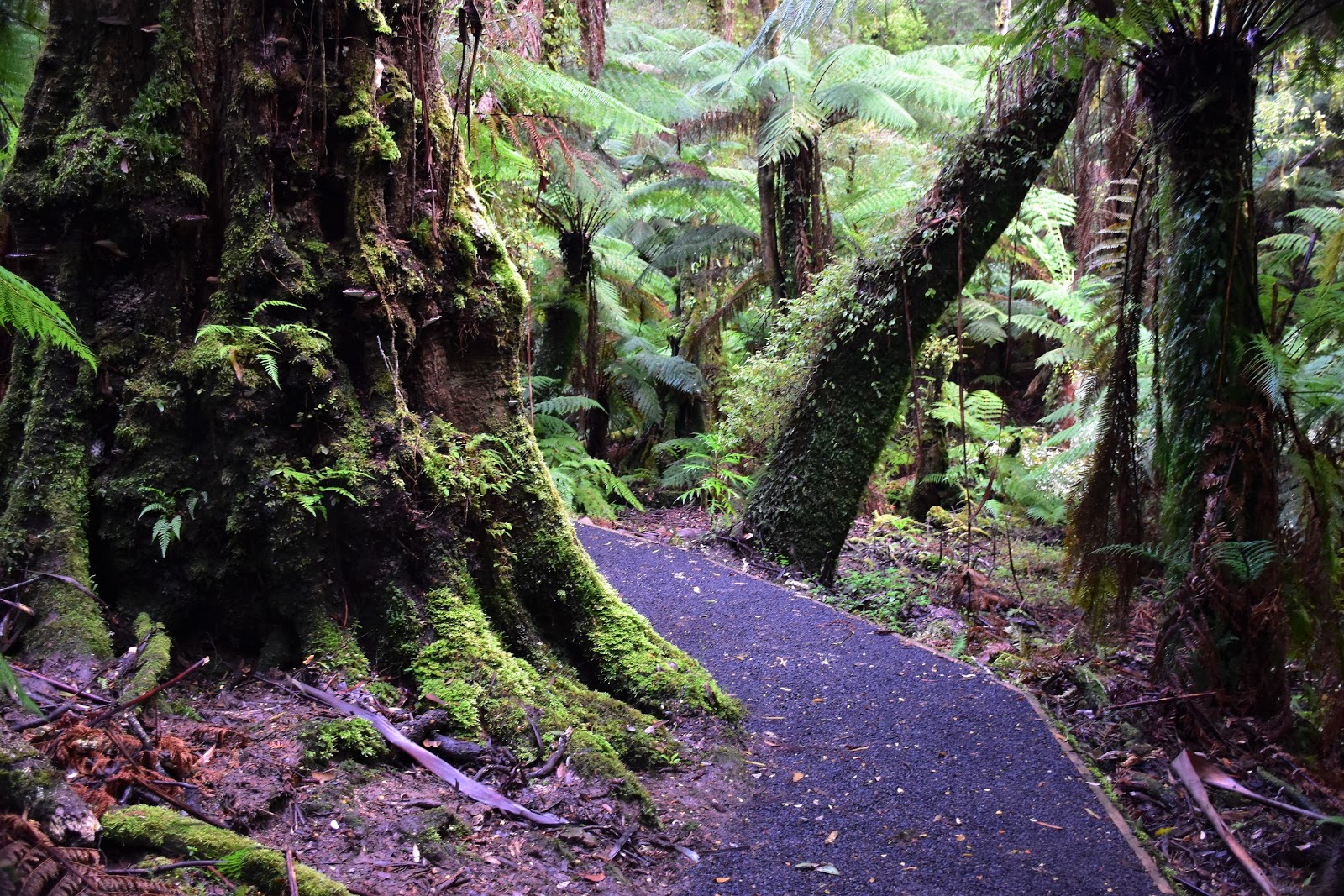
Now once again this post is going to be very heavy on the photos I think, the walk is less then 3 kilometres long (well less, actually) but the cool temperate rainforest is absolutely beautiful. Now while I'm as interested in trees as the next bloke, the rainforest through here really impressed me today. After leaving the picnic area the track heads up stream along the Tarra River for a few hundred metres, crossing and re-crossing it on good bridges . After a few hundred metres the track divides, I took the imaginatively named West Track to the falls and would return to the car park via the East Track. West Track climbs a bit up the steep sided valley of Tarra River, the track staying in the dripping wet rainforest but at the same time allowing for glimpses through the dense canopy of the huge mountain ash trees that were towering above higher up the hill.
 |
To start with I followed the infant Tarra River up stream for awhile.

 |
| I decided to head along West Track on the way up to the falls, there was no particular science in that decision though. |
|
 |
Above the rainforest I was getting glimpses of the towering mountain ash.
|
|
|
After the track curves around eastwards it contours high above another damp gully for awhile, this spot is particularly good for getting good photos of the dense covering of ferns down closer to the creek. Eventually I met up with the East Track and took the short side track up to Cyathea Falls. Now Cyathea Falls aren't exactly huge, in fact visiting towards the end of one of Victoria's driest June's ever there was just a trickle dribbling down the rock slabs. Apart from the fact that there wasn't much water to be seen it's also pretty hard to get a clear photo of the waterfall, the view being partially obscured by ferns and with me being a stickler for rules (?) I thought it was best not to go off piste to get a good shot.
 |
If ferns float your boat then you need to consider this walk.
 |
 |
 |
| Cyathea Falls was just a trickle today. |
|
|
|
Retracing my route a bit I headed back down East Track towards the car park, East Track was another beautiful walk and there were plenty of excuses to stop and try and get another photo, each one I was sure would capture the essence of this place. Actually you might notice that my average speed was pretty slow on this stroll, that's not because of any difficulties with the track or the terrain, no it's more to do with me aimlessly wandering around checking out the verdant green forest. East Track is slightly shorter than West Track and it wasn't long before the loop was complete and I was walking the last few metre back up to the ute, climbing back up the steps to the car park the with the archway framing the scene it almost felt as though I was entering a cathedral.

|
 |
 |
 |
| Like West Track, East Track makes for very easy walking. |
|
|
|
The Dirt.
I only covered 2.4 kilometres and climbed 55 metres at an average speed of 3 kph on this very easy stroll. This is a very nice little stroll if you appreciate rainforest and cascading creeks. The paths themselves are also very well constructed and easy to follow, the walk is suitable for young children and the elderly, although there are quite a few steps particularly on West Track. Cyathea Falls would be best seen after some good rain I think, they were a little under whelming today I thought. Now if you do visit the falls it would be possible to climb onto the rock slabs beside the falls to get a photo without ferns in the way... but the area is signposted as a revegetation area, now how much vegetation is ever going to grow from these bare rock slabs is a little debatable, so I guess you have to do what your conscious tells you here. This walk was written up by John & Lyn Daly in their Take A Walk in Victoria's National Parks book. Parks Vic also have enough free information online to complete this walk safely with.
Relevant Posts.
 |
| The forest was literally dripping wet this afternoon. |
 |
| Climbing back up to the ute, the archway framing the scene. |


No comments:
Post a Comment