On our top end trip back in 2004 I had a couple of days up my sleeve before meeting Sam in Darwin, so what to do? Not too keen to be sitting around Darwin on my own I decided that I'd head out to Kakadu for a couple of days, after a day spent lazing in the Gunlom infinity pool I decided that I'd better get out and do some walking. My walk of choice was the Barrk Sandstone Walk which basically circumnavigates Nourlangie Rock, visiting the less well known Nanguluwur Gallery area on the way. So, after a restful night in Jabiru I headed down to the Nourlangie Rock Car Park and pulled on the boots.
 |
| They don't call this walk the Barrk Sandstone Walk for no reason. |
If you think this post is a little on the anaemic side it's because the blog wasn't even a twinkle in my eye when I did the walk, hence I didn't take a lot of photos. Setting off it's only a couple of minutes until I got to the first highlight, the Anbangbang Gallery. This is a superb indigenous art gallery, one that I've visited at least five times over the years, makes you wonder why I didn't take a photo really? After enjoying the art, not to mention the cool breeze and the shade, I continued on up past Gunwarddehwarde Lookout leaving the main tourist track shortly afterwards I followed a rough bushwalking pad up to a waterfall. This place flows nicely in the wet but in early May there was just enough water trickling down for me to quench my thirst.
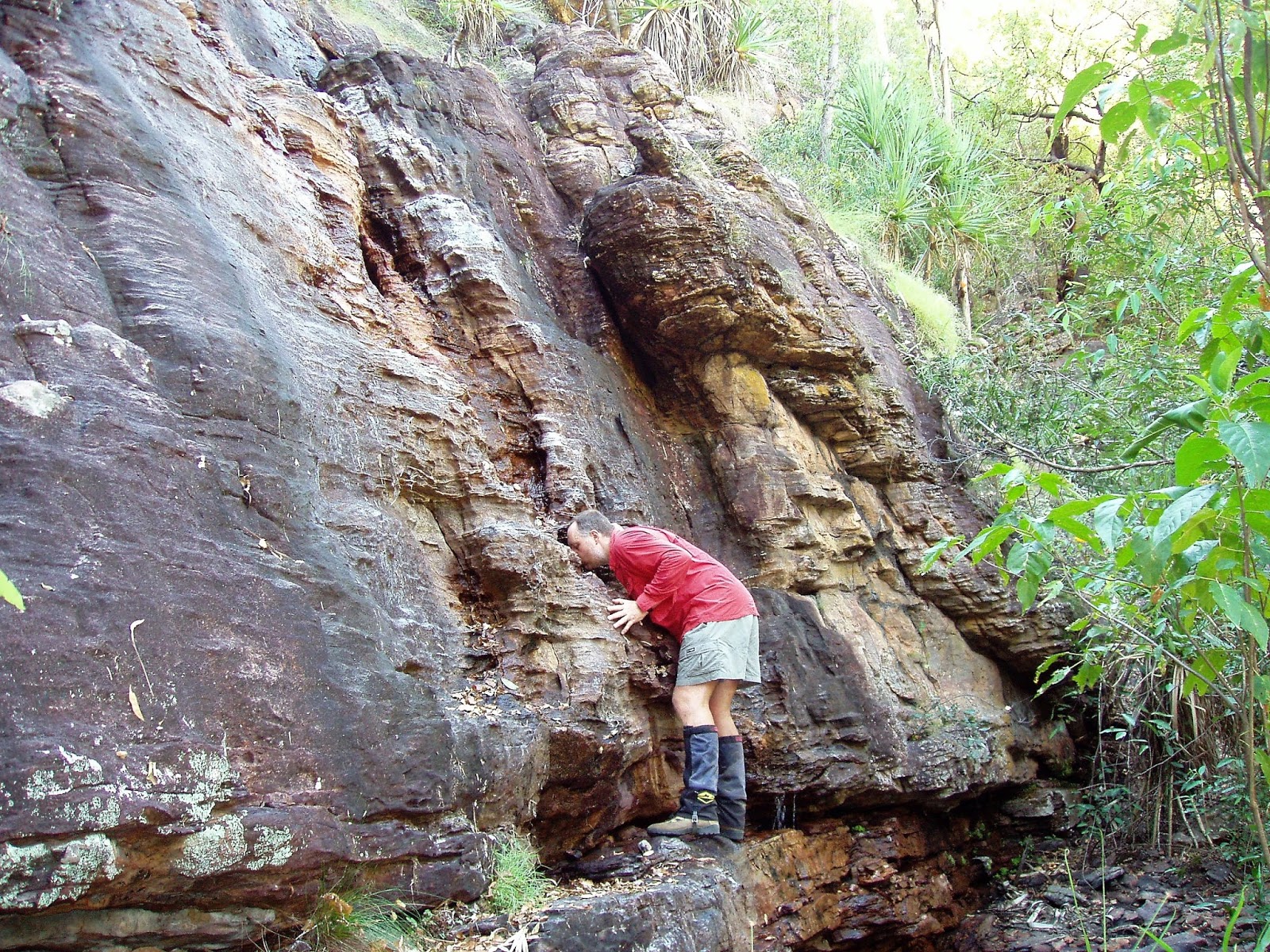 | ||
This waterfall only really flows good in the wet, there was still enough water to have a drink today though.
|

Leaving the waterfall the track climbed up steeply until I popped out on a kind of plateau above the waterfall. The view from this spot is one of the best on the walk as it looks down over the Kakadu flood plains. From here on the track twists and turns as it makes its way firstly through a labyrinth of sandstone pillars and rocks, the good news today was that the route was fairly straight forward as the high grass that grows during the wet season had largely been flattened by the Knock 'Em Down storms. I've been through here in the middle of the wet and it's a vastly harder walk. Eventually I started descending a rocky gully back down to the low country and started tracking along with the escarpment now on my left as I headed towards Nanguluwur Gallery. This gallery is less well known than the Anbangbang Gallery on the other side of the rocky complex but, but maybe because of that it's a great spot to sit a savour the art for awhile, and at least back in the day more often than not you'd be on your own.
 |
| Looking out over the Kakadu floodplains. |
After resting at the gallery for awhile I once again set off towards the Troopie. The route now climbs back up onto the rock, eventually topping out in a spot that not only gave me a great view down to the flood plains but also of the massive cliffs that buttress Nourlangie Rock. I now dropped down through a damper area, this section of the track through here is a bit of a handful in the wet season, with two metre high grass and boggy ground. With the wet season over and done with the track today wasn't too bad and soon enough I noticed the access road through the trees which signalled my imminent arrival back at the car park.
 | ||
Nanguluwur Gallery features a large selection of X-Ray art.
|

The Dirt.
Not only was this walk way before the blog but it was also way before I stared to use a GPS so I'll have to give you the stats from my notes. According to my notes the walk is 12 kilometres long, altitude gain isn't listed but I'd guess it at around 400 metres. I have two sets of notes for this walk with one rating it as a medium grade and the other a hard grade, I'd go with medium in the dry season. Speaking of notes this walk is written up by the Daly's in Take A Walk In Northern Territory's National Parks as well as Lonely Planet's Walking In Australia. This is by far the longest marked trail in Kakadu, all the other marked routes are on the very short side. It is very possible to walk off track in Kakadu but there are a lot of hoops that you have to jump through to get a permit, I've always found it all a bit daunting trying to line up all the ducks, especially from thousands of kilometres away in Melbourne, I think my off track epics in Kakadu will have to wait until I retire unfortunately.
Relevant Posts.
 |


This comment has been removed by a blog administrator.
ReplyDeleteThanks, that was a really cool read! click here now
ReplyDelete