 |
| Mt Feathertop from near Red Robin Gap on Machinery Spur. |
I’ve looked at this circuit over the years but have never got around to actually walking it. Coming in at over 20 kilometres, with around 1000 metres of climbing involved I’ve never really had enough time up my sleeve while I’ve been up at Mt Hotham, to do the walk. After aborting a planned 4 day walk on the high plains at the start of November I finally found myself at Mt Hotham with a day up my sleeve. After warming up the day before walking the Brabralung Trail and pulling up alright, and with the weather predicted to co-operate I decided that today was going to be the day.
 |
| A slightly dishevelled Feral walker about to set off. |
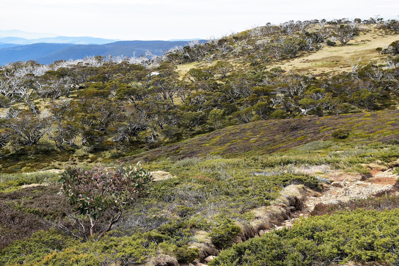
This walk starts at the Mt Hotham Beach, known in some circles as the Mt Loch Car Park, before heading off along the AAWT. After saying goodbye to Sam I set off along the fire track towards Mt Loch, this section of the walk follows a high ridge through the ski resort, it’s not a flat section of track though as it passes over a couple of high knolls and through some saddles. Climbing out of Derrick Col I arrived at a track junction, the track on the left is the Machinery Spur Track and would be my return route later today. Climbing a little more I passed behind the last ski lift and set off down the open snow grass slopes towards Derrick Hut.
 |
Mt Feathertop was a bit of a constant on today's stroll.
 |
Following the AAWT towards Derrick Col, that's Mt Loch in the middle of the photo.
 |
Looking across the Razorback towards the distant Mt Buffalo.
 |
Looking back towards Hotham Heights.
 |
| The route today was very well signposted. |
|
|
|
|
Whereas the fire track walk across Derrick Col at the start of the walk isn’t really a favourite of mine this walk down to Derrick Hut along the eastern extremities of the Mt Hotham Resort is a good one. With the AAWT crossing a few small rills of water and with a few remnant snow drifts still around, and frequent views of Mt Loch, Mt Feathertop and Mt Hotham I was in a good headspace this morning. Arriving at Derrick Hut and finding it deserted I dropped the pack for awhile and checked things out, last time I’d found myself here was on my AAWT walk and the hut had been a pretty busy spot so I didn’t really hang around for long. Derrick Hut is named after Charles Derrick a ski tourer who died near Derrick Col back in 1965, the hut was built in 1967 and is the first place that you can stay after leaving the Mt Hotham Resort Area.
 |
There was still a bit of snow about on this visit.
 |
The tin roof of Derrick Hut is just visible in the Snowgums.
 |
Derrick Hut
 |
| Derrick Hut is pretty basic on the inside but the view out the windows is pretty special. |
|
|
|
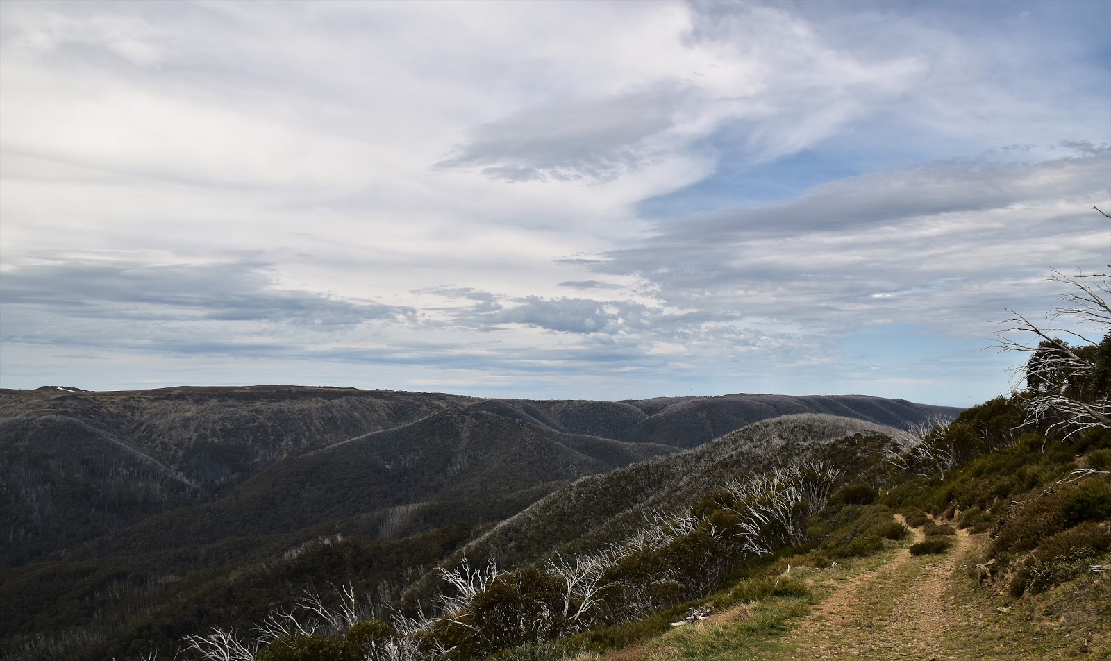
After poking around the refuge hut for awhile I set off again along the AAWT, heading down Swindlers Spur. This use to be a really nice walk before the fires and it’s still not a bad stroll, but the bleached skeletons of dead Snowgums are nowhere near as pretty as mature living ones use to be. Swindlers Spur is a bit of a roller coaster higher up but once it starts it’s final descent down to the Cobungra River it doesn’t muck around. While the final descent is pretty steep there has been a lot of work done on this section of track with lots of steps and a few switch backs helping progress.
 |
Dropping down Swindlers Spur through the dead Snowgums.
 |
Feathertop was still looming large, that's Machinery Spur in the middle distance.
 |
When Swindlers Spur starts to drop it drops pretty quickly.
 |
| Jaithmathang |
|
|
|
Arriving on the banks of the Cobungra River I took the short side trip up to Dibbins Hut, another spot that I didn’t really linger at on my AAWT stroll. Like Derrick Hut, Dibbins Hut was deserted today so I spent a little while poking around checking things out, Sam and I had spent a snowy night in this hut many years ago so I was interested to see if anything had changed. It turned out that everything was pretty much as it was a couple of decades age, I even managed to smack my head on the low door frame just like old times! This little hidden valley is a very pretty place and the open grassy flats are a great spot to camp, even though I was only a couple of hours from Mt Hotham it always feels very remote down here.
 |
I'm about to arrive down in the Cobungra River Valley.
 |
Dibbins Hut
 |
This beautiful little valley makes for a great place to camp.
 |
| The Cobungra river near Dibbins Hut. |
|
|
|
After crossing the Cobungra River I climbed a little towards Cobungra Gap, it was now that I’d leave the long distance AAWT and head off along some lesser walked tracks. First up I followed a walking track down towards the Red Robin Battery, this track is initially benched into the side of a steep hill and it’s really good walk. With a few glimpses across towards the Bogong High Plains and the snow speckled Jaithmathang, and a nicely descending track I was still feeling pretty content with things. After awhile the walking track morphs into and old fire track and the forest turns to Mountain Ash, the fire track now descending a little more seriously to arrive at the old gold battery. The old Red Robin Battery was built to service the nearby Red Robin Gold Mine and is private property although I got a bit of a look at it from the fire track just before I dropped the last few metres down to meet the West Kiewa Logging Road.
 |
After crossing the Cobungra River I had a short climb up the AAWT to Cobungra Gap.
 |
I was heading to Machinery Spur.
 |
The track traverses the side of a steep hill which allowed for a few views.
 |
This benched walking track is a nice little walk.
 |
Eventually the walking track morphs into a fire track and starts to drop down through Alpine Ash.
 |
| This is as close as I got to the Red Robin Battery. |
|
|
|
|
|
West Kiewa Logging Road sounds serious but it’s just a 4wd track really, turning left onto the old logging road it marked the spot where the hard work started for the day with a pretty much continuous 600 metre climb in front of me. The climb starts off pretty easy though as West Kiewa Logging Road gently climbs up a valley beside the bubbling stream, after crossing a bridge over the stream though the climb got fairly steep and stayed that away for quite awhile. Really it was just a matter of putting my head down and shuffling on upwards on this section of the walk and somewhat surprisingly I seemed to be gaining height fairly quickly without too many stops. With the views improving as I gained height I shuffled around a corner and arrived at the historic Red Robin Mine.
 |
Climbing up West Kiewa Logging Road.
 |
After awhile the fire track crossed this stream and started climbing pretty solidly.
 |
| Gaining height I was again starting to get some nice views through the trees. |
|
|
The Red Robin Gold Mine is now heritage listed and is the only working alpine gold mine left in Australia apparently. Gold was found here in 1940 by an old timer named Bill Spargo, a name that pops up occasionally around this area. The old Red Robin Mine is an interesting place to poke around for a little while, and while the mine shaft is locked up the surrounding area has enough rusting machinery scattered about to keep me interested. Now file this in the not exactly legal but handy to know file, the old mine has an open shelter that would prove very handy if you find yourself up here in what are fairly frequent inclement conditions.
 |
The historic Red Robin Mine is an interesting spot to potter around.
 |
The mine shaft is locked up but this shack looks like it would provide some shelter in bad weather.
 |
| The old mine is heritage listed. |
|
|
Leaving the old mine the Machinery Spur Track climbed even more steeply up a couple of switchbacks to arrive on the crest of Machinery Spur at Red Robin Gap. This would of been a great place to stop but every time I tried to find a spot to sit down I was immediately attacked by armies of ants. So instead of a relaxing break snoozing in the sun on the grass, I wandered around the gap a little while I had a bite to eat, the open grassy slopes allowing for great views across to the Bogong High Plains. Leaving Red Robin Gap to the ants I continued on, now climbing a bit more gently towards Mt Loch. The next two kilometres is the best bit of todays walk I think, I was now walking along the crest of Machinery Spur and with only a sparse covering of Snowgums the views were incredible, particularly across the Diamantina River to the Razorback.
 |
Leaving Red Robin Mine the track climbs fairly steeply via some switchbacks up to Red Robin Gap.
 |
The view from Red Robin Gap across to the Bogong High Plains.
 |
That's Mt McKay in the distance (Falls Creek).
 |
Mt Jim
 |
From Red Robin Gap the walking was sublime.
 |
Looking back down Machinery Spur.
 |
| Mt Lock is getting pretty close now. |
|
|
|
|
|
|
Arriving at the short spur track to the Mt Loch summit I headed up for a bit of a look. It’s probably been 25 years since I’ve climbed his easy summit, Mt Loch is one of those spots that I always seem to be heading past on my way to more exotic locations and when I return I’m generally too tired to be bothered with this little summit. It’s only a climb of around twenty or thirty metres from the Machinery Spur Track but the view from the cairn is a good one, with Mt Loch being fairly centrally located there seems to be a great vista no matter which direction I looked, Mt Hotham, Mt Feathertop, My Buffalo, the Bogong High Plains and the Razorback all easily in view. After giving Sam a call to let her know I’d be back at car park in less than an hour I set off on the final leg of today’s walk.
 |
There's a rough pad up to the cairn.
 |
It's amazing that these hardy trees can eke out an existence in these spots.
 |
Mt Loch with Machinery Spur and Mt Feathertop in the background.
 |
| I'm looking pretty happy with myself. |
|
|
|
Dropping off the summit I followed the Machinery Spur Track for awhile before heading cross country to short cut a big loop in the track. Meeting the fire track again I was now back on the AAWT dropping down into Derrick Col, following the same undulating ridge walk that I headed out along this morning. After one last climb I arrived back at the Mt Loch Carpark, happy to see Sam there waiting for me with a cool drink after what had been a solid day.
 |
Mt Loch
 |
Mt Loch
 |
After a short off piste section I met up with the mornings outward route.
 |
| One last look back to Mt Loch. |
|
|
|
The Dirt.
According to my GPS I walked 21.9 kilometres and climber 1084 metres on today’s hard stroll. Now while I have rated this as a hard walk strangely enough it was nowhere near as hard as I’d thought it may have been and I’m not sure why. Maybe it was the fact that virtually the whole walk was on easy to follow tracks that were clear of scrub, maybe it was because that even though there is a lot of climbing involved it’s never stupidly steep, whatever the reason I did it relatively easy today, managing to complete the walk well under the quoted Chapman hours. Speaking of Chapman I used the notes out of his Day Walks Victoria book, it’s walk number 39 in the second edition of the book. Tyrone Thomas has also featured this walk in some editions of his old books. This is a nice, interesting walk with plenty of historical interest as well as many fine views but it’s a walk that you need to be careful about, the whole walk is subject to extreme weather.
Relevant Posts.
Mt Hotham to Cope Hut, AAWT, Alpine National Park, 2017.
Dibbins Hut, Alpine National Park, 1998.
Mt Hotham to Mt Bogong, Alpine National Park, 1992.
 |
Mt Feathertop from the AAWT near Derrick Col.
 |
Walking the AAWT back to the Loch Car Park.
 |
| The stubble like dead Snowgums are now feature of the slopes of Mt Hotham unfortunately. |
|
|
 |
| Back at the beach. |


No comments:
Post a Comment