 |
Nice walking above Grahams Creek.
|
With the weather cooling down a little I figured that it was about time to head over to the Brisbane Ranges National Park for a bit of a stroll. Walking over here can be pretty hot in the warmer months but Autumn, Winter and Spring are all fairly enjoyable, normally. Today I decided to do a walk called the Three Creeks Walk as written up by Glenn Tempest, and while I’ve walked all these tracks before I don’t think that I’ve ever linked then together in the particular sequence that Mr Tempest has.
 |
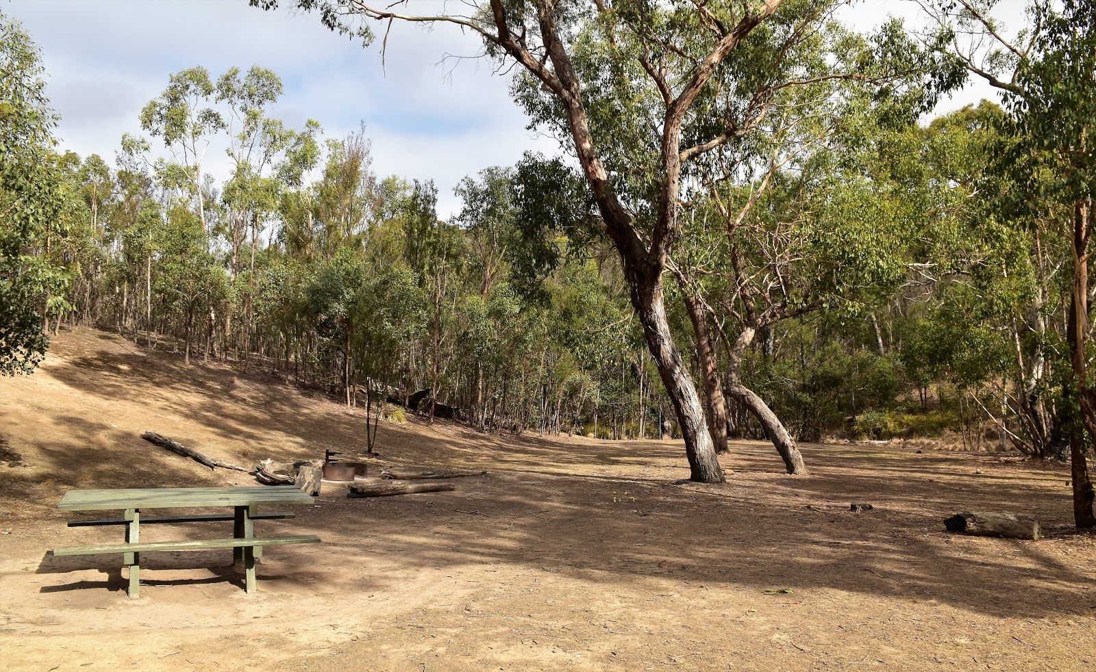
The Crossing Picnic Ground first thing this morning.
|
As is pretty stock standard for me the hardest navigation for the day was actually finding the start of the walk. After my GPS had taken me on a long, circumnavigation of the Brisbane Ranges I managed to miss the minor Hut Road and ended up a couple of kilometres away in Steiglitz. Retracing my way back out of town heading towards Meredith, I eventually found my dirt road heading into the scrub (there may even of been a national park signpost in the scrub on the other side of Meredith-Steiglitz Road - possibly). The rough Hut Road dropping my down at the deserted Crossing Picnic Ground after a couple of minutes.
 |
My track headed bush between these two roads.
|
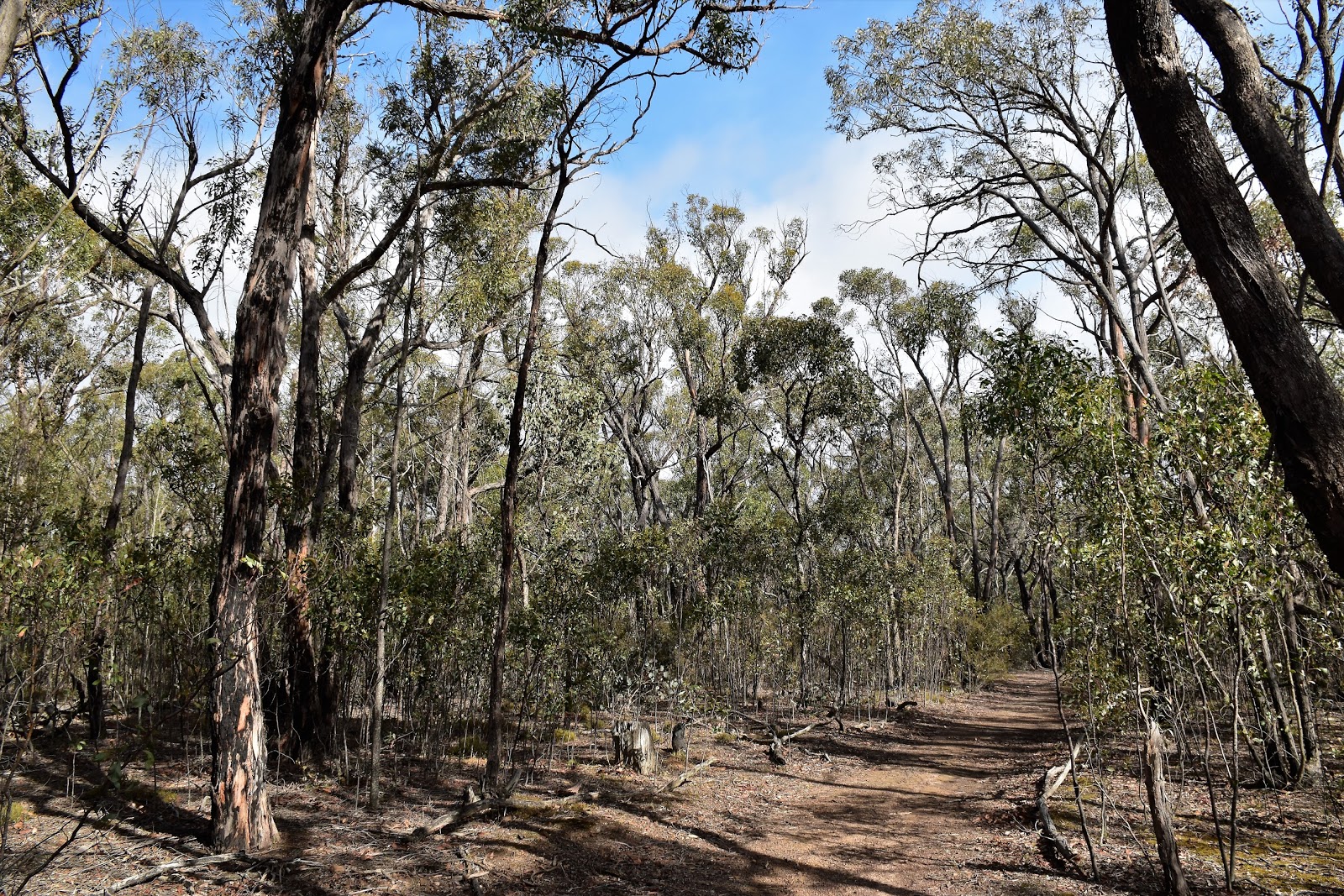
Walking in the Brisbane Ranges can be a little like painting by numbers, there is generally a lot of the ‘turn left for 150metres, turn right for 1 kilometre, turn left climb over the small hill’ type of walking. So leaving the ute this morning I was straight into the painting by numbers walking as I had to avoid a track to the left, a track to the right and pick up a middle track. It was all pretty strait forward though (so long as I kept an eye on my map) and I was soon heading up the bone dry Yankee Gully, along a section of the long distance Burchell Trail.
 |
The walk along Yankee Gully is a nice one.
 |
There is old gold mining history everywhere along here.
|
|
Yankee Gully is a walk that I’ve featured before on my blog, although with a so many Yankee Gullies in our old gold mining areas I’ll have to check out the old post to see if it was the same spot. Parks Vic have done a fair bit of work along here putting in numerous information signs explaining the old gold mining history of the area and I didn’t have to walk far before stumbling onto yet another old mining site slowly being reclaimed by the bush.
 |
Yankee Gully was dammed in the old mining days.
 |
Mullock heaps at the site of the old Bernhardt Mine.
 |
Yankee Gully
 |
These old Calcining Pits were used to extract the gold from the rock.
 |
There isn't much left of the old Battery Site down in Yankee Gull.
|
|
|
|
|
Eventually my track left Yankee Gully and started a fairly easy climb up to cross the gravel Durdidwarrah Road on top of a broad, timbered ridge. Immediately after crossing Durdidwarrah Road I arrived at the site of the old Alliance Mine, climbing the old mullock heaps here gave me some distant views, although the grey overcast sky meant that things weren’t that impressive really. After a quick poke around the old Alliance Mine area I headed off towards Friday’s Picnic & Camping Ground, the walk once again following a convoluted series of short tracks.
 |
Reaching the old Alliance Mine Site on Durdidwarrah Road I spent awhile poking around....you never know what you'll find....
 |
The views from the mullock heaps at the Alliance Mine Site were the most extensive of the walk.
 |
Heading towards Fridays Picnic & Camping Ground.
|
|
|
With bits of toilet paper fluttering in the breeze I arrived at the busy camp ground just as a very light shower scudded through. Heading straight through the camp as quickly as possible I picked up Durdidwarrah Road for a short section, it’s not that I don’t like people it’s just that….. err actually, I don’t like people! After a couple of minutes walking along Durdidwarrah Road I headed down Saw Pit Gully Road and started the fair descent down towards Sutherland Creek. The
go dropping down here is to try and pick up the very old alignment of an old road which not only gets you off the gravel road but also cuts out a bit of distance. Once on the old track things are pretty well strait forward enough, but picking it however requires a bit of concentration as it’s covered in small saplings.
 |
Friday's Picnic & Camping Ground was pretty busy this morning.
 |
Leaving Friday's Picnic & Camping Ground I followed Durdidwarrah Road for a few minutes.
 |
Picking the spot this old track leaves Saw Pit Gully Raod requires a little concentration.
 |
I'm about to emerge onto Pine Track down on Sutherland Creek.
|
|
|
|
Picking up Pine Track down on Sutherland Creek I headed up and over a ridge before once again the fluttering of toilet paper in the breeze, signalled my arrival at the Old Mill Walkers Camp. Now I’m not sure what the issue is with the toilet paper up here, there are perfectly good toilets at both of the camps that I walked through however it appears that some people are not using them and leaving the their toilet paper to flutter around the surrounding scrub. It reached peak stupidity at Old Mill Camp though as I decided to check the level in the water tank so I could put an update on an online bushwalking forum. Being a poly tank it was a little hard to use the knock on the side, sonar method to gauge the water level so I had a peak into the tank inlet to see if I could see any water. While I couldn’t see the water level in the tank what I did see was toilet paper in the water tank inlet, now how it got there I can only speculate but what was obvious was that it had been there during yesterday’s rain as the toilet paper was now sodden….for f#*k sake.
 |
Leaving Pine Track I dropped down Furze Track to Old Mill Walkers Camp.
 |
The inlet for the water tank at Old Mill Walkers Camp...wtf!
 |
Breaking out my under utilised (ask Sam) Feral cleaning skills I cleaned up the tank inlet as best I could....it might be best to treat the water if you're camping down here for the next few months.
 |
Old Mill Walkers Camp.
|
|
|
|
After doing my bit of un-planned water tank cleaning I set off on my stroll again, leaving the deserted Old Mill Camp to the grazing Wallabies. The climb up Furze Track was probably the steepest pinch of the walk, but it’s a very short climb really and soon I was crossing back over Durdidwarrah Raod (again!) and starting a fairly long gentle descent back down into Yankee Gully (yes, again!). There were two highlights on this section of my stroll, the first one being that the sun came out for a bit of a look (yep, it was that kind of walk) and secondly I visited the old Century Mine. The Century Mine is one of the better preserved old mines that I visited today, the open shaft protected by a metal grill and a small tin shed.
 |
Eventually I left Old Mill to the locals and shuffled on.
 |
Grass Trees on Furze Track.
 |
Crossing back over Durdidwarrah Road...again.
 |
One of the highlights of this mornings walk...the sun came out!
 |
Another highlight is the well preserved Century Mine.
 |
Century Mine.
|
|
|
|
|
|
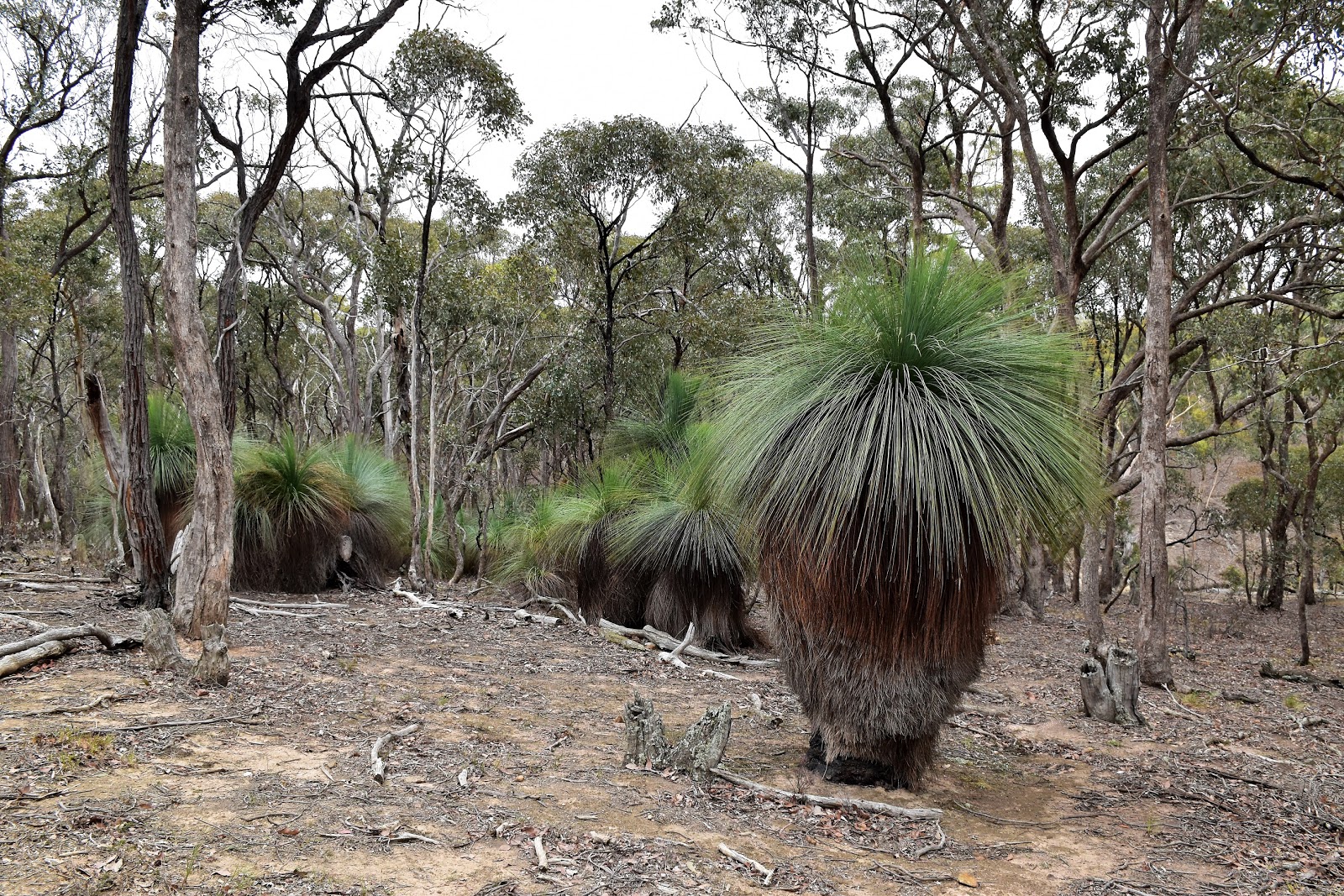
Crossing over the parched Yankee Gully on an interesting section of boardwalk I once again climbed for a short while before dropping gently towards my third creek, Grahams Creek. The walk almost touched cleared farmland along here as it followed a rustic old fence line above the creek. For me this next section of the walk is the best walking of the day, the old 4wd track deteriorates into a rough walking track that heads through a beautiful forest of Grass Trees before dropping down a very rocky slope towards Grahams Creek.
 |
The boardwalk across Yankee Gully tested me.
 |
There was still a bit of wildlife around, although nowhere near as much as there normally is up here, I'm guessing because things are so dry at the moment?
 |
Dropping gently down to my third creek along Banksia Track.
 |
No Banksia's, but plenty of Grass Trees.
 |
Banksia Track morphs into a walking track above Grahams Creek.
 |
I followed an old fence line for a few hundred metres....
 |
....before dropping down a rough section of track through some more beautiful Grass Trees.
|
|
|
|
|
|
|
Once meeting the Back Track it was back to the paint by numbers walking as I first climbed and then descended to Grahams Creek Picnic Ground before crossing a dry ford and picking up and climbing another old track. After climbing this old track for awhile I emerged onto a freshly graded Box Track, the main interest along here being whether or not I’d make it back to the ute before another shower would pass through, well that and the ubiquitous Grass Trees. After dropping down Box Track for a few hundred metres the ute soon came into view through the trees, the picnic area a lot busier now than it had been earlier this morning.
 |
After crossing the bone dry ford at Grahams Creek Picnic Ground I picked up this old track.
 |
Heading towards Box Track.
|
|
The Dirt.
I walked 14.9 kilometres and climbed 465 metres on this medium grade stroll. If mining history is your thing then this is a walk worth considering, you don’t have to look hard to find all sorts of relics slowly being reclaimed by the bush. The country itself is predominantly dry, open Eucalyptus forests with the occasional welcome section of Grass Trees. Visiting at the (hopefully) tail end of a long dry spell all of the Three Creeks were bone dry today, I’m thinking Spring is probably the best time to visit if you want to see any running water. Like I mentioned earlier, this walk was written by Glenn Tempest in his
Melbourne’s Western Gorges book. Mr Chapman, Mr Thomas, Mr and Mrs Daly and Julie Mundy have all published walking notes for the Brisbane Ranges National Park, Parks Vic also have a lot of free stuff online.
Relevant Posts.
Yankee Gully, Brisbane Ranges National Park, 2014.
Sutherland Creek, Brisbane Ranges National Park, 2018.
Little River, Brisbane Ranges National Park, 2013.
 |
| Box Track had a few things to keep me interested. |
 |
Dropping down Box Track, the Crossing Picnic Ground has just come into view.
|


No comments:
Post a Comment