 |
The Kungsleden stayed down low for most of today's walk - it wasn't without it's attractions though!
|
After re-charging my mind, body and gadgets at Kvikkjokk over night, I was once again looking forward to continuing my journey northwards on the Kungsleden. It wasn’t an early start this morning through, first up I had to wait for breakfast, although with breakfast starting at 7am that was hardly onerous. With brekky consumed it was time to pack up, say goodbye to new friends and hit the road!
 |
| Leaving Kvikkjokk this morning. |
The Kungsleden actually heads north through an outbuilding of the fell station (check out the photo to see what I’m clumsily trying to describe). Once away from the fell station the Kungsleden was pretty easy walking for awhile as it tracked along high above the Gamájåhkå River, before striking out to the north east away from the river and starting to climb a little, passing a large boulder with an overhang on the way which would provide some shelter in crappy weather. Speaking of weather (yes, yes I know I’m always waffling on about the weather - but when you are living outside it’s pretty important!) today was looking pretty reasonable, I was mostly walking under blue skies….although I didn’t have to look to far to see some threatening clouds. After around twenty minutes or so the climb eased off and I found myself walking across the usual boggy grassy plains before arriving at the Sydney Harbour Bridge. Well maybe not the Sydney Harbour Bridge, but there was a vague similarity I think.
 |
The walking was very easy first up this morning.
 |
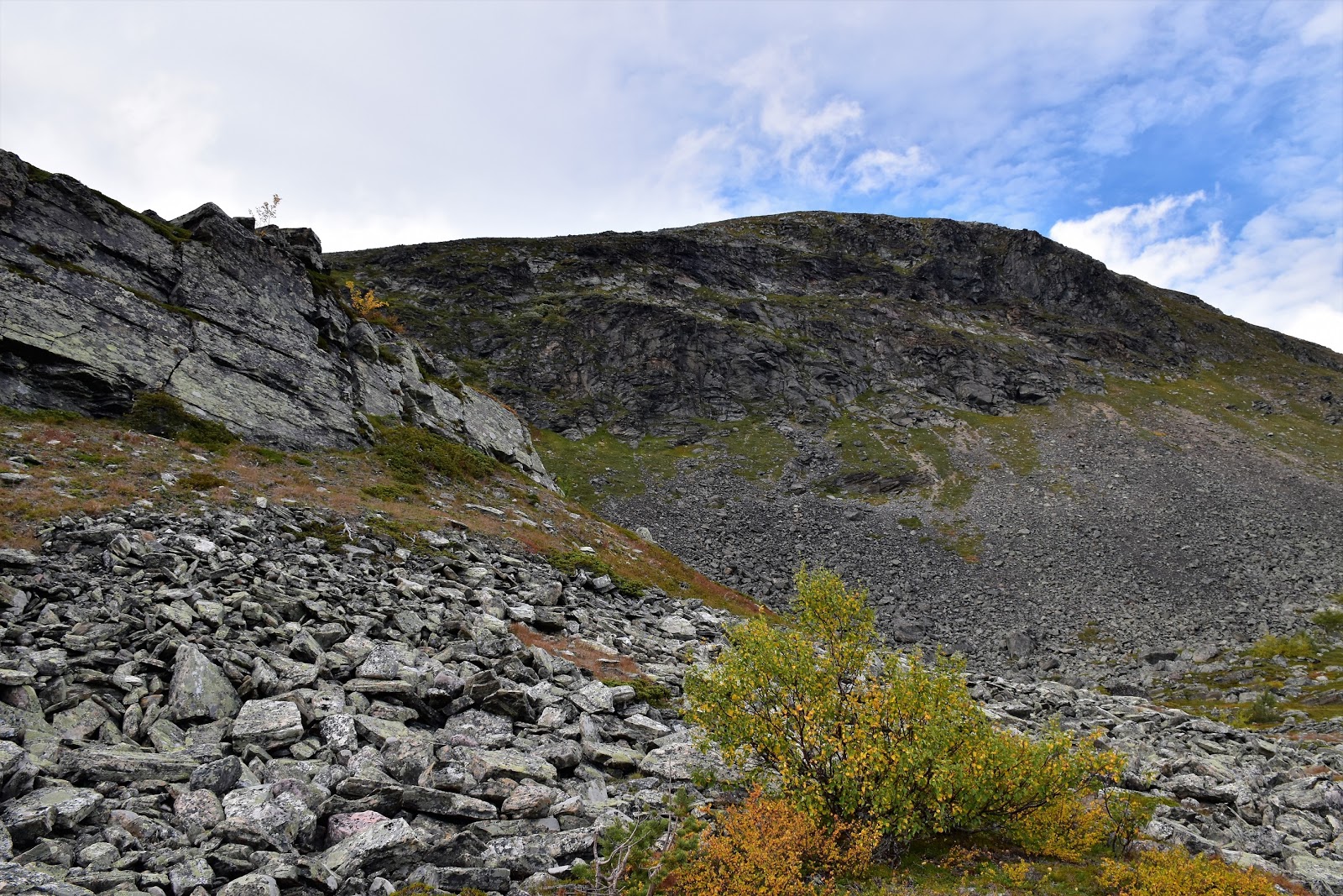
Heading away from the Gamájåhkå River the Kungsleden started to climb a bit.
 |
I'm thinking that this overhang might provide a bit of shelter in dodgy weather.
 |
I crossed the usual boggy plains....
 |
| ...before arriving at the Sydney Harbour Bridge. |
|
|
|
|
On paper today had looked like it would be a fairly easy day, with no huge ascents or descents. However I should of been a little bit suspicious when I’d looked at the map to see the Kungsleden was traversing around a couple of large lakes, experience had told me that these lake side strolls could be incredibly rough, and so it was today. With Stuor Dáhtá Lake starting to appear in the distance through the Birch the Kungsleden got rough, real rough, and things would stay like that for a long time. Eventually my now very rocky track arrived beside the lake, at least I had some nice views to check out for awhile as I shuffled along for awhile.
 |
Kungsleden
 |
Generally the weather was pretty good today.
 |
The Kungsleden got a bit rocky now....
 |
....and stayed that way for the best part of the rest of the day.
 |
Stuor Dáhtá Lake
 |
 |
| The Kungsleden gets pretty close to the lake in a couple of spots. |
|
|
|
|
|
|
Reaching the end of Stuor Dáhtá Lake the Kungsleden passed through a Reindeer enclosure before striking out towards the next lake, Sjábttjakjávrre Lake, the quality of the track staying pretty ordinary. Now when I say ordinary it wasn’t really that bad, it just required a fair bit of concentration stepping on uneven rocks for kilometre after kilometre, progress was a little on the slow side as it was impossible to walk with an even gait, it definitely wasn’t dangerous or anything like that. It was just after lunch time today when I arrived at the short side trip to the Pårte Stuga.
 |
Tjoallta Mountain
 |
Passing into the Reindeer enclosure.
 |
It doesn't take a lot to make me happy!
 |
Have I mentioned the rocks?
|
|
|
|
The Pårte Stuga is situated on a little peninsula jutting out into Sjábttjávrre Lake and even though it was too early to stop for the day or that the stuga dosen’t have a shop, I still decided to drop in and check things out anyway. After dropping my pack the stuga made for a pleasant spot to sit and have lunch, there looked to be plenty of camping on this little peninsula and with easy water access, not to mention the water views I guess that Pårte would make a nice spot to stay. Although with Pårte only being around 15 kilometres away from the temptations of Kvikkjokk it might tempt south bound walkers to keep going I’m thinking.
 |
Sjábttjakjávrre Lake
 |
Time for a late lunch.
 |
 |
| Another place that I'd love to spend time exploring...one day. |
|
|
|
After my late lunch at Pårte I once again set off north on the Kungsleden. I now started a fairly long climb up onto the high open fells again. Now I’d been thinking that the rough and rocky walking might of eased a little as I climbed towards the open tops, yeah I’d been wrong! The rough rocky walking continued all the way up until I was well above the tree line. Still things were pretty good really, once above the trees the usual stunning Kungsleden long range views opened up around me. After passing through a pass between Favnoajvve and Huomnásj Mountains I crossed an incredibly rocky scree covered slope, the views down towards the huge Rittak Lake really slowing me down.
 |
 |
Kungsleden
 |
Passing by another beautiful little waterfall.
 |
Climbing up higher....
 |
....conditions under foot were still on the rough side.
 |
| Pårte is back down on the shore of that lake in the distance - hey I have been making some progress after all! |
|
|
|
|
|
I was starting to think about camp now that I was above the tree line, although open plateau didn’t have a lot of protected sites. I’d pencilled in the Jåkkejågåsi River as a likely looking spot on my map although when I arrived I found a couple of big groups already setting up camp so I decided to keep going. I was now heading towards the Jågge emergency shelter and to be honest I wasn’t that keen to camp down there. The emergency shelter was in the Birch forest so I was guessing that mozzies could be an issue and also these emergency shelters tend to attract walkers to them and being a solitary man (thanks Mr Cash) I’d prefer to be on my own. Luckily before the Kungsleden started it’s descent down to the emergency shelter I found a nice soft grassy shelf just off the track. With extensive panoramic views down to the Rittak Lake below me and Tjaktjajávrre Reservoir a little further away up the valley this was a magic spot, although one you would only want to use if the weather was co-operating a little.
 |
Sarek National Park
 |
I'm thinking that this is Favnoajvve - although that's a Feral fact.
 |
Rittak Lake
 |
It looks like the Reindeer like the view too...
 |
| After crossing one last section of scree the Kungsleden got a little easier on the ankles. |
|
|
|
|
The Dirt.
I walked 28.4 kilometres today and climbed 841 metres on another fairly hard day on the Kungsleden. Over the 12 days of my Kungsleden journey so far I’ve walked 298.3 kilometres and climbed 7592 metres. There was a fair bit of camping around today, although down low things can be a little wet and up high things were a little exposed. If a bed is needed then the Pårte Stuga is the only option. A couple of hours after leaving Kvikkjokk this morning the Kungsleden got rough and rocky and pretty well stayed that way until I was an hour from my camping spot. Once again I used Cicerone’s
Trekking The Kungsleden book along with my GPD topo maps.
Relevant Posts.
Previous Day on the Kungsleden, 2019.
Day 1 on the Kungsleden, 2019.
 |
| They look a little funny without their antlers don't they. |
 |
| I had a substantial bridge to cross the Jåkkejågåsi River. |
 |
| My camp way above Rittak Lake was a stunning one - but fairly exposed. |
 |
I even had a convenient kitchen rock.
|


No comments:
Post a Comment