 |
Today was the day that I left the high mountains behind.
|
Waking up today on what was going to be my penultimate day of walking the Kungsleden I was greeted by a dry, partly cloudy morning. With my camp last night above Alisjávri Lake being fairly exposed I found that the wind had kept my tent fairly dry, so for one of only a couple of occasions on my walk I was able to pack up fairly dry tent. With only around 30 kilometres to go now I was fairly sure that I’d finish my walk tomorrow, the only real unknown left was where I’d camp tonight, I had the shorter easier option of Abiskojaure and the longer and harder option of Nissonjokk to choose from.
 |
I was able to pack up a dry tent this morning, something that had only happened a couple of times on my Kungsleden journey.
 |
My journey along Alisjávri Lake continued first thing this morning.
|
|
Earlier on my Kungsleden walk I’d sometimes been packed up and walking before 6am but now I was up north and the nights were quickly lengthening, 7am was my more normal time to set off. 7am was still early enough that I’d normally have a couple of hours pretty well to myself on the track though. So setting off first thing this morning I pretty well had the Kungsleden to myself for awhile as I continued to shuffle my way along the western shoreline of Alisjávri Lake. The Kungsleden along here was not only fairly level but also pretty easy when it came to rocks and other assorted obstacles. Maybe because it was getting fairly late in the season or maybe because there wasn’t a surplus of camping spots but whatever the reason I didn’t pass many tents this morning either.
 |
Alisjávri Lake
 |
Early morning on the Kungsleden.
 |
There wasn't any other walkers about first thing this morning but I wasn't lonely.
|
|
|
After half an hour or so I past the spot where Alisjávri Lake cascades down through a rocky choke to become Rádujávri Lake. Apart from the stunning turquoise lakes I was also enjoying what I was guessing would be my last day surrounded my snow capped mountains this morning, while the mountains were now a little further away they were still mightily impressive to me. The light this morning was a little on the strange side too, if I’d been back home I’d have been thinking that their was a few bushfires burning in the surrounding area as the atmospheric conditions were a bit on the hazy side, being well north of the arctic circle I don’t think the haze was caused by smoke though, so I’m not sure what the go was?
 |
The Kungsleden breaks out onto the shoreline in a couple of spots.
 |
Rádujávri Lake
 |
Rádujávri Lake
 |
The big mountains were starting to get a bit further away.
 |
Kungsleden
 |
 |
| I'd been walking down this valley since lunch time yesterday. |
|
|
|
|
|
|
On reaching the northern end of Rádujávri Lake the Kungsleden veered away from the next lake in the chain, Áhpparjávri Lake, and started to head across a high valley. The track itself now got a lot rougher as I headed away from the lakes, I was back walking on an uneven rocky surface again, not that I was too worried as the rocks were pretty dry and the there was virtually no climbing involved. After passing through another Reindeer fence and shuffling past another small Sami settlement down in a shallow valley to the left of me the Kungsleden started drop gently into a steeper valley, the headwaters of the Šiellajohka River rushing through a gorge below me.
 |
Overhead conditions.....
 |
...were somewhat variable early this morning.
 |
I was aiming for a valley between the two peaks in the middle of the photo.
 |
I passed another small Sami settlement.
 |
 |
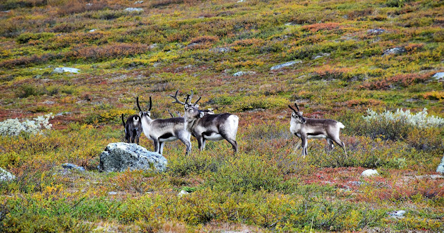
I'd met more Reindeer than other walkers so far this morning.
 |
The Reindeer never seemed overly concerned with me though.
 |
| Eventually I started to drop down beside the headwaters of the Šiellajohka River. |
|
|
|
|
|
|
|
Eventually, with Abeskojávri Lake coming into view in the distance way down in a valley below me, the track started to descend a bit more seriously. I was now dropping down towards the suspense bridge that would safely get me across to the other side of the Šiellajohka River, the upper part of this descent dropping through an area of open country before eventually I descended into the trees. Once below the tree line it was only a few more minutes of steeply descending before I arrived at the river. There is a toilet and lots of camping on the eastern side of the Šiellajohka River however I was more interested in finding a rock to sit on beside the cascading water to enjoy my lunch.
 |
Kungsleden
 |
There always seems to be a convenient rock to park on the Kungsleden.
 |
Garddenvárri Mountain.
 |
 |
That's the Šiellajohka River cascading through the gorge below me, Abeskojávri Lake has just come into view in the distance.
 |
The Kungsleden dropped steeply in parts to cross the Šiellajohka River.
 |
| Šiellajohka River |
|
|
|
|
|
|
It was with some reluctance that I shouldered my pack again after lunch, sitting on a rock in the warm afternoon sunshine definitely had a certain appeal to me today. The Kungsleden now started to swing around into a big broad valley, a valley that I was guessing that I’d be following all the way into Abisko sometime tomorrow. Not long after leaving the Šiellajohka River the Kungsleden crossed over into the Abisko National Park, what that meant for me was that my days of camping wild and free on the Kungsleden were now over, my camping options between here and the end of the walk at Abisko were either at the Abiskoaure Stuga or the official Nissonjokk Campsite.
 |
Šiellajohka River
 |
I'd be back below the tree line for the rest of my Kungsleden journey now.
 |
Easy...but slow walking on the Kungsleden.
 |
No wild camping from here on.
 |
| Kungsleden |
|
|
|
|
It was still fairly early in the afternoon when I arrived at the turnoff to the Abiskoaure Stuga. I’d already pretty well decided to keep walking to Nissonjokk this afternoon, however with plenty of time still up my sleeve (and the bought or a cold drink) I decided to go in and check out the stuga. The Abiskoaure Stuga is situated at the southern end of the vast Abeskojávri Lake and would make for a very pleasant spot to spend a night or two, apparently quite a few walkers head in for the night from Abisko so it can be quite a popular place. After buying a drink and a packet of my customary Kungsleden afternoon snack, some jam filled biscuits, I enjoyed a bit of a break sitting in the sun chatting to some other walkers.
 |
I went left here over the bridge to Abiskojaure Stuga.
 |
Abiskojaure Stuga
 |
Enjoying the afternoon sun on the deck while chatting to other walkers from around the world...I'm gunna miss the Kungsleden.
|
|
|
After filling my stomach with biscuits and my soul with great conversation I reluctantly grabbed my pack again and set off on the rest of the afternoons hard work. After retracing my route back out to the Kunglseden I turned left and started the long walk up the length of Abeskojávri Lake. The Kungsleden now walked between the lake on one side and the brooding black cliffs buttressing Giron Mountain on the other side, with the sun now getting fairly low the scenery was once again pretty sweet this afternoon.
 |
Heading for Nissonjokk beside Abeskojávri Lake.
 |
 |
Abiskojaure Stuga receding from view.
 |
Double barrel boardwalks this afternoon on the Kungsleden.
|
|
|
|
The walking was not only fairly scenic now but it was all pretty easy as well as the Kungsleden followed long sections of double barrelled boardwalks, no doubt built to allow ATV to get closer access to Abiskoaure Stuga. So with the nice light and pleasant scenery my walk up to Nisonjokk was a fairly slow one this afternoon, it was only after leaving the lake and starting to track down the Aiskojåkka River that I sped up a little, although this wasn’t really because the scenery was any less impressive, but more the fact that it was starting to look like I might not make it to Nissonjokk before dark.
 |
Giron Mountain.
 |
Abeskojávri Lake
|
|
Well to cut a long and boring story short I did end up making it to the Nissonjokk Campsite before dark and soon found a patch of ground that wasn’t to rooty to get the tent up. My camp at Nissonjokk was second only to my rough camp way back at Rávgga when it came to averageness I think, the damp claustrophobic forest not doing a lot for me, although I’d definatelly been fairly spoilt with some of the absolutely stunning spots that I’d camped at on my long journey up from Hemarvan I think. The biggest positive about Nissonjokk for me was that I got to share it with the lovely young lady that I’d first met back at Sälka a few days ago, it was nice to share my last night with someone who had experienced the same things as me over the journey.
 |
It was another afternoon of slow progress as I took photo after photo.
 |
 |
It was about now when I started to think that I might not make it to Nissonjokk before dark.
|
|
|
The Dirt.
I walked 22 kilometres and climbed 55 metres on what I’d call a medium grade days walking on the Kungsleden (the stats today are a combination of figures from my GPS and those calculated from my map). Over the 20 days of my Kungsleden journey so far I’ve walked 442.2 kilometres and climbed 10,574 metres. The track today was a story of two parts, the walk down to Abiskoaure Stuga from Rádujávri Lake was a pretty rough and slow one however the walk from Abiskoaure Stuga to Nissonjokk was pretty easy. The main camping spots today before entering Abisko National Park were around the spot where the Kungsleden crosses the Šiellajohka River, as I’ve mentioned once inside the national park the camping options were limited to those around the Abiskoaure Stuga and then those at the official Nissonjokk Campsite. Nissonjokk was a little dark, damp and rooty for my tastes but like I said the Kungsleden had pretty well spoiled me so far, so maybe my opinion isn’t worth that much here. Once again I used Cicerone’s
Trekking the Kungsleden guide book along with the topo maps on my GPS.
Relevant Posts.
Day 1 on the Kungsleden, 2019.
Previous Day on the Kungsleden, 2019.
 |
| Nearing Nissonjokk the Kungsleden got close to the Abiskojåkka River... |
 |
| ...very close! |
 |
| The official Nissonjokk Campsite. |


No comments:
Post a Comment