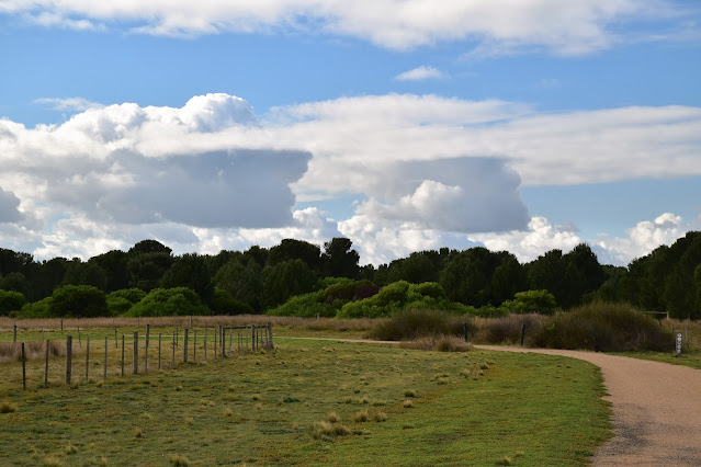
Looking across the Cheetham Wetlands towards Melbourne.
I set off from the beach car park in the Point Cook Coastal Park this morning - there are numerous car parks here.
Parking the ute I set off this morning under grey and overcast skies, something that seems to be way to common in Melbourne in winter unfortunately. Leaving the car park I headed across the picnic area towards the coast before swinging east along a sandy 4wd track that runs parallel to the coast. The walking along here is fairly average however there was still the occasional water or city views to keep me interested. Point Cook is also the home to a RAAF base and I'm guessing that was where the Bi-Plane came from that entertained me as it flew overhead. Thankfully this inland 4wd section is pretty short and the sight of the big Radiata Pines soon signalled my arrival at the historic Point Cook Homestead.
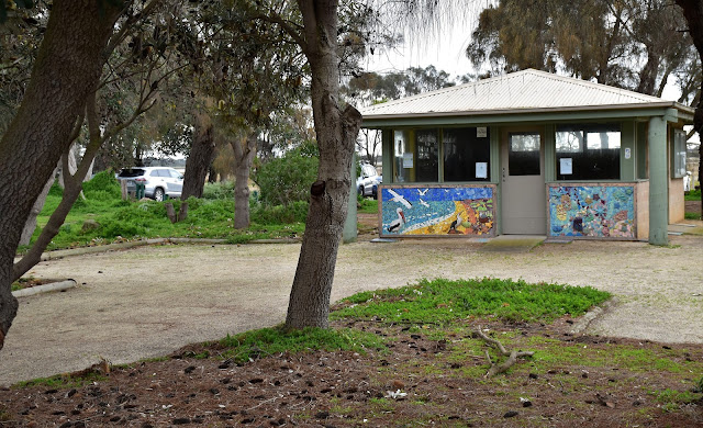
Leaving the ute I headed through the picnic area towards the beach...
... before swinging east along this old 4wd track.
Looking across Point Cook Coastal Park towards the Melbourne CBD.
The 4wd track runs parallel to the beach.
The Point Cook RAAF base is close by.
Point Cook homestead was built back in 1857 by the same family that built the nearby Werribee Mansion. Now normally you have to pay to wander around the old homestead however today I arrived to find the place deserted - from my untrained eye it looks like Parks Vic are doing a bit of a renovation. Whatever is going on at Point Cook Homestead it was possible to head in and meander around the grounds this morning, although the old buildings themselves were all well and truly locked up. After poking around for awhile I set off on the next leg of my journey, I was now making my way across to The Tower in the nearby Cheetham Wetlands.
Point Cook Homestead.
Norfolk Island Pines are always a bit of a give-away that I'm approaching an historic site.
Point Cook Homestead.
The old bluestone stables at Point Cook Homestead.
Point Cook Homestead.
To get to The Tower I shuffled north along the old homestead access road before swinging east along the access road for the Cheetham Wetlands. Passing through the car park I followed a signposted 4wd track out towards The Tower which was now looking like a prop out of Mad Max out in the wetlands. After flowing the 4wd track for five minutes or so I headed east again onto a signposted walking track that meandered it's way across some salt flats on a boardwalk to The Tower. Climbing The Tower I got the most extensive view that I'd get on this stroll although with The Tower being only 5 or 6 metres above the surrounding land its wasn't a tough climb. It's probably due the pancake flat surroundings however this modest structure actually provides for quite a nice view, particularly across the wetlands and over towards the buildings in Melbourne's CBD. Looking away from the wetlands towards the sprawling houses of Point Cook provides a bit of a hint at the environmental pressures this little park is under though.
Leaving the homestead I shuffled up the access road passing by some more wetlands.
After passing through the carpark for Cheetham Wetlands I followed this gravel access road up towards The Tower.
The ever sprawling houses of Point Cook are getting pretty close to this little park now.
Heading across the wetlands towards The Tower - looks like a structure out of Mad Max to my eyes.
Cheetham Wetlands from The Tower.
Cheetham Wetlands salt flat.
Cheetham Wetlands.
Leaving The Tower I back tracked back over the wetlands towards the 4wd track, instead of following the 4wd track back towards the car park I shuffled along the wide grassy break beside the Cheetham Wetlands fence. Arriving at a gate I slipped through and picked up a sandy track running through a nice grove of native pines east towards Point Cook. Arriving on the coast Point Cook was just to the south of me, apart from the sandy point the other notable feature of this spot was the number of water birds enjoying the calm water here, actually Cheetham Wetland and Point Cook Coastal Park are a bit of a twitchers paradise I'm thinking.
Heading away from The Tower I retraced my route back towards Point Cook.
Instead of walking the gravel access road I followed the fence line south.
Native Pines - Point Cook Coastal Park.
I was now following a sandy 4wd track east towards the coast.
Point Cook Coastal Park.
The Melbourne CBD - this time from Point Cook.
The view from Point Cook.
After making my way around Point Cook I started trudging my way along the soft sand back towards the ute. While the sand was soft the scenery made the effort worthwhile I think, initially I passed by the Point Cook Homestead Precinct again before striking out west along a long and fairly deserted section of beach back towards my finishing point. While this section can seem a little desolate (especially in the grey conditions I had this morning) I actually enjoy these monochrome and slightly harsh landscapes. After a couple of kilometres of solitude my beach walk came to its end when I started to meet a few fisherman out enjoying their morning, the fisherman signalling the spot to head inland across the low coastal dune and back to the ute.
There are a lot of waterbirds that either stop in... or call the Point Cook Coastal Park home.
It was pretty well a beach walk back to the ute now.
Looking backwards Point Cook.
Port Phillip Bay - on a beautiful Melbourne winters day!
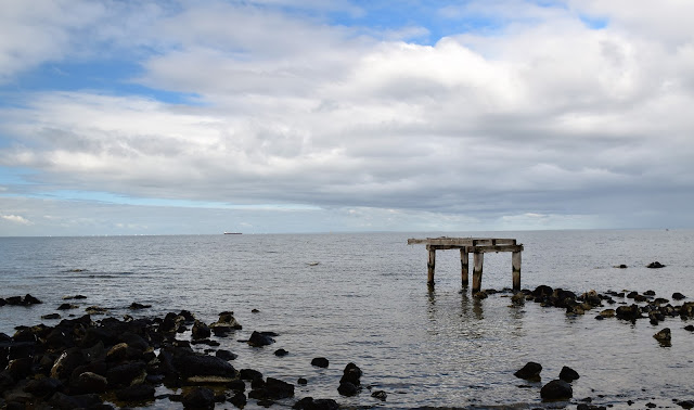
There isn't a lot left of the old Point Cook Homestead jetty anymore.
The old homestead is only a few metres from the beach.
The Dirt.
According to my GPS I walked around 9 kilometres and climbed around 86 metres (seems a little optimistic!) on what I'd call an easy walk. This walk is a good stroll if you are interested in bird life or, on a completely different tangent, Melbourne's pastoral history. Most of the walk is on fairly good walking tracks and 4wd tracks, although there are some long sections of soft sand to negotiate. As far as I know the Point Cook Homestead is a pay per view set up, although when I shuffled through on this visit there was no one there and no signs up to keep the punters out without paying, although the old buildings themselves were locked up. I used some notes out of the House of Chapmans book Day Walk Victoria this morning along with my GPS topos.
Relevant Posts.


No comments:
Post a Comment