Saturday, September 19, 2015

Cradle Mountain, Cradle Mountain National Park - May 2007


Crater Lake.

While I was Tasmania back in 2007 I did quite a few day walks, although with the blog years away it appears that I didn't actually take that many photos, and a post without photos would be pretty boring. After completing the very easy Dove Lake Circuit the day before I was keen to ramp up the degree of difficulty a bit, in all my visits to Cradle Mountain I'd actually only climbed to the summit once, so with the weather looking promising I figured that today would be a great day to get up there again.
The Wombat Pool.
I decided to head up from the Dove Lake car park via Lake Lilla and the beautiful little Wombat Pool. The Wombat Pool is another spot that has great memories for me, years ago my mate Dave and I had battled our way up here from Ronny Creek in a fairly severe blizzard, finding a little shelter near some Pencil Pines we stopped for a moment to regroup when out of the corner of my eye I noticed some movement in the partially frozen pool. Standing still in the driving snow we were rewarded by the sight of a platypus frolicking in the shallow water, it was one of those moments that has stayed with me forever. Today, however it was all blue sky and sunshine, but alas no platypus.
No snow at the Wombat Pool today.
From the Wombat Pool I climbed up to the high saddle on the ridge between Crater Lake and Dove Lake, joined The Overland Track and climbed my way up the fixed chain to Marions Lookout. If you're doing The Overland Track, Marions Lookout gives you your first grand stand look over Dove Lake as well as marking the spot where most of the climbing is complete on day 1. Leaving the lookout I headed across the open country towards Plateau Creek, my attention now on the looming Cradle Mountain, the flank of the mountain dark and brooding in the changing light.
Crater Lake from the saddle below Marions Lookout.
Climbing towards Marions Lookout.
Crater Lake.
Lake Lilla from Marions Lookout.
The brooding flanks of Cradle Mountain.
Cradle Mountain from Cradle Plateau.
Plateau Creek.
Passing through the milling day walkers at Kitchen Hut I started the ascent, like a lot of climbs in Tasmania the ascent route on Cradle Mountain requires a little bit of easy scrambling. Initially though its just a solid climb up towards a boulder field. Once on the boulders you have to be a little careful as some of the boulders are the size of cars, following the poled route over a small saddle the route drops steeply into a gully on the east side of the peak. This gully can be really dodgy if there is much lingering snow but today it was all sweet, crossing the gully I scrambled up the last steep section and arrived at the surprisingly roomy and flat summit. The views south along the route of The Overland Track had me wishing that I was heading out for a few days instead of returning to my nice room at Cradle Valley, Barn Bluff looked particularly stunning and close at hand, ah well, there is always next time!
Dove Lake from the climb up Cradle Mountain.
Looking down to Kitchen Hut from Cradle Mountain.
Looking north east from Cradle Mountain.
Barn Bluff from Cradle Mountain, you can just make out The Overland Track crossing Cradle Cirque.
Waterfall Valley from Cradle Mountain.
The summit ridge.
Climbing down through the boulder field.
By the time I'd returned to Kitchen Hut it was getting late in the afternoon so I decided to use the quickest route off the mountain, The Face Track and then the link track that passes by Lake Wilks to the Dove Lake Track. The route down is not very far but it does require some more easy scrambling, especially the link track as it descends to Lake Wills, the track descends some rocky bluffs that has some people sliding down on their bums. Before I reached the Lake Wilks Track though I had to traverse The Face Track under the towering cliffs of Weindorfers Tower, this is a great track that is cut into some very perpendicular country, made even more spectacular today by the late afternoon sun lighting up the golden fagus. 
It was getting late when I started out across The Face Track.
The Face Track with the cliffs of Weidorfers Tower above.
Late afternoon light on The Face Track.
Weindorfers Tower from Lake Wilks.
Little Horn from near Lake Wilks.
Safely down The Lake Wilks Track all I had to do was make my way around the eastern side of Dove Lake. I'd done the Dove Lake Circuit yesterday and finished in fading light, today however I'd be finishing in the dark. Finishing in the dark isn't as bad as it sounds however as the track is superbly engineered and the rapidly fading light gave the scene a whole new dimension. Making my way along the lake side path watching the clouds in the sky reflected in the lake, hearing the occasional splash from a platypus and having it completely to myself, it was the perfect end to a great day walk.....well that and a beer with my lamb shanks back at the pub!
It was getting late by the time I got down to Dove Lake.
Last light on Cradle Mountain.
That's the Boat Shed on the other side of Dove Lake.
Almost back at the Dove Lake Car Park.
The Dirt.
I walked around 10 kilometres on this walk and climbed around 720 metres. I'm not sure if the walk has been written up the exact way that I did it but John Chapman and Tyrone Thomas have written up a multitude of walks around this area and you can mix a match using their notes and maps, or just grab a Cradle Mountain Day Walks map and make it up as you go. I'd rate this walk a medium walk, although some people may be put off by the easy scrambling. All the tracks I used today are well defined and signposted.


Tarns on Cradle Plateau.

Wednesday, September 16, 2015

Bungonia Gorge, Bungonia State Recreation Area - November 2006

In late November 2006 my mate Dave and I decided to head up to New South Wales for a weeks walking holiday, one of the places we walked was in the Bungonia State Recreation Area. Apart from the catchy name the park is famous for the fairly impressive Bungonia Gorge as well as the mighty Shoalhaven River which flows through it. On our walk we planned to visit both these features and also spend a night camped on the banks of the Shoalhaven, before climbing back up to the troopie. 
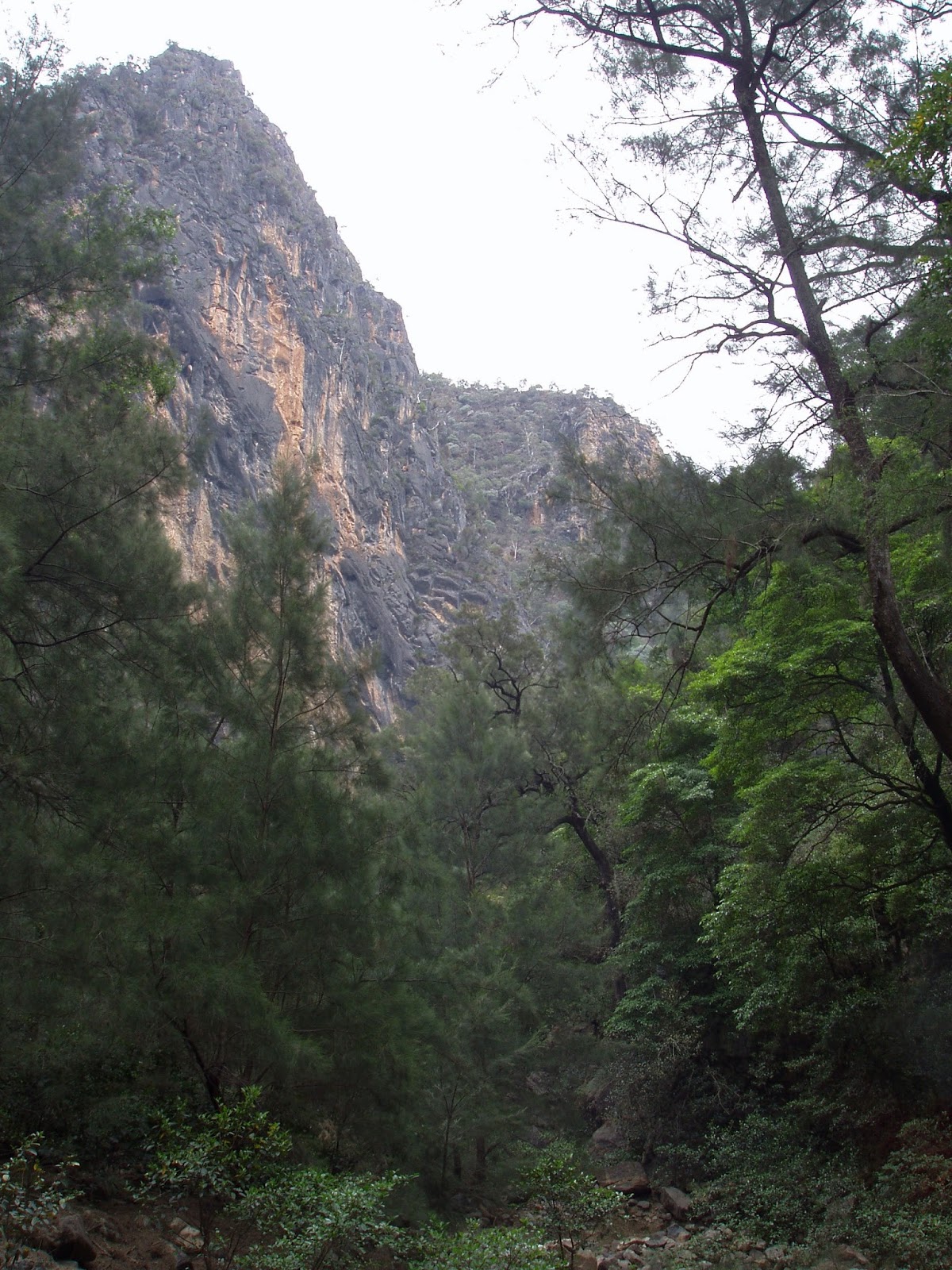
The huge cleft of Bungonia Gorge from Red Track.
There are plenty of grass trees in the dry forest above the gorges.
Day 1              Shoalhaven River / Bungonia Creek Bush Camp             14 kilometres
We left the troopie on a grey humid day, with virtually no climbing on the cards for today we weren't to worried about the heat though. Of more concerning to us was to time our walk along Bungonia Creek to avoid the blasting in the quarry above us, as rocks were known to shower down into the creek, the park's people close the track when blasting is due to occur. First up today though we had to descend into Bungonia Creek and that involved a very steep and slippery descent down the imaginatively named Red Track.
Heading up Bungonia Creek towards the gorge.
Scrambling through the labyrinth of boulders on Bungonia Creek.
With some relief we finally reached the banks of Bungonia Creek, stashing our packs we headed off on a side trip up to check out the stunning Bungonia Gorge. On paper this looked like a fairly straight forward walk upstream, however the bed of Bungonia Creek back towards the gorge consisted of a jumble of house sized boulders that had to be climbed over, under or around, making for slow going. The boulders eventually thinned out a little and got a little smaller and we entered the gorge, with the walls of the gorge towering over 100 metres above us we took in this stunning place, we felt like we could almost touch both  sides of the gorge with our arms outstretched. Apart from being caught in the gorge in a flood you also have to be careful down here in strong wind, with the shear walls towering over 100 metres directly above your head its not unknown for debris to rain down on unsuspecting walkers in the gorge below.
Easy walking through a forest of casuarina saplings.
Bungonia Gorge, the grey skies and crap photos aren't doing any favours to the scenery on this post.
Heading back down through our boulders.
We didn't have to worry about wind though today but rain on the other hand appeared a real possibility. After retracing our route through the labyrinth of boulders we grabbed our packs and set off down Bungonia Creek towards the Shoalhaven. The first obstacle was to get through the blast zone, the next obstacle was to walk past the beautiful emerald green swimming holes in Bungonia Creek. Reaching the junction of Bungonia Creek and the Shoalhaven River we set up our tents on a small riverside beach, the next objective for the day was a quick swim to wash off the accumulated sweat and grime. After our quick swim we set off to explore the Shoalhaven up towards Louise Reach, the weather had deteriated by now and we walked in constant light rain in our wet weather gear, Dave's poncho was perfect for the warm rain, my gortex jacket not so perfect. The banks of the river provided easy walking though and we made our way along through groves of casuarinas. Reaching Barbers Creek we refilled our water bottles and turned around and headed for camp for an early night in the tent caching up on some reading.
Our camp on the Shoalhaven River.


Dave's in his poncho and ready to set off exploring, I'm still swimming by the look of it.

Exploring down towards Louisa Reach in the light rain.
Filling the water bottle at Barbers Creek.
I reckon its almost tent o'clock Dave.
Still raining and the clouds getting lower, time for bed.
Day 2                  David Reid Car Park                 8 kilometres         22 kilometres total.
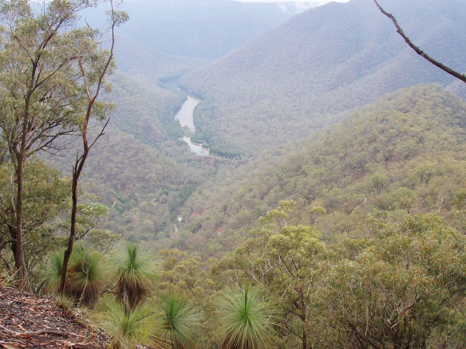
We woke to another warm and humid day although at least the rain had stopped for the time being. Packing up camp we started up White Track on what was a fairly tough climb, the initial section after leaving the river in particular was a steep and slippery affair. Stopping frequently and sweating profusely we slowly made our way towards our high point at Mt Ayre. Some compensation for the effort and discomfort were the views though, as we climbed higher the views up and down the steep sided valley that the Shoalhaven River flows through became more impressive, I'd love to do this on a  nice blue sky type of day...one day.
The view back towards Bungonia Gorge on the climb up White Track.
You can just make out the river through the trees.
The Shoalhaven River.
Reaching Mt Ayre we then followed the undulating track back towards the car park. The forest up here away from the creeks consisted mainly of dry eucalyptus with the occasional grass tree. Less than three hours after leaving our camp on the river we arrived back at the troopie, smelly and sweaty but happy with our Shoalhaven adventure.
The steep climb up White Track.
Almost there Dave.
The Dirt.
I can't remember who's notes we used on this walk, I think they may have been from one of Tyrone Thomas's Bushwalking in New South Wales books (maybe?). This walk is only short but its rough in a few places, the climb out is also a bit of a ball breaker, so I suppose I'd rate it as a medium walk. Unfortunately the weather didn't really cooperate our trip but if the sun was out and the weather was warm this would be a sensational trip if you like to combine swimming with your walking, as I do.

  
The Shoalhaven from near Mt Ayre.


Tuesday, September 8, 2015

Lake Dove Walk, Cradle Mountain National Park - May 2007

I bet you've never seen this shot!
Due to the magic of that inter-web thingy, by the time you see this post we should be walking our way across the Scottish highlands. Looking for something to write about so that I would have something to post in my absence I came across some photo's I'd taken way back in 2007, now it wasn't the age of the photo's that appealed to me but it was the fact that the walk was in Tasmania. Tassie seems to be very under represented on my blog, shit I've got more posts about New Zealand or Peru at present than I do about Tasmania. As far as I'm concerned Tasmania is 'the duck's guts' when it comes to bushwalking in Australia, the little island is as close as we get in Australia to a walkers paradise. I've done more than my share of walking down there over the years but a lot of my trips were pre digital camera's so the photo's, when I can actually find them, aren't that great. So finding these shots on a CD languishing at the bottom of a draw full off assorted crap I thought I'd rescue them and at the same time do a quick post on one of the easiest and most scenic walks in the country.
There's a reason you've seen this shot before and that's because it drop dead gorgeous, the golden brown on the flanks of Cradle Mountain is the fagus.
I started this walk at my normal time, that is around three hours later than I should of. Stopping to get the money shot of Cradle Mountain towering over Dove Lake and its much photographed boat shed, I did remember thinking that setting off at 4 in the afternoon in late Autumn was cutting it pretty fine in the daylight stakes, although I wasn't overly concerned as the lakeside track is very easy and I figured that I might get some sunset shots. The track occasionally breaks out onto little beaches, the crystal clear waters of the lake tempting you to dip a toe, or maybe throw off your clothes and jump in (er..maybe that's just me).
Another pristine little beach.

Climbing up the only moderately challenging section of the whole walk.
After a bit of lakeside walking the track comes to the only bit of climbing on the whole walk, climbing over a promontory protruding into the lake below Marions Lookout. The section of track that climbs over this small spur was the roughest on the whole walk, although I use the term 'rough' relatively as its still a very well engineered track. The top of this little rise gave me a nice view of The Honeymoon Islands in Dove Lake with Little Horn towering above in the clear blue sky. Dropping down the far side of the spur I was in the magical Ballroom Forest, a beautiful section of track that passes through a primordial Beech Forest, I'm not sure why but it doesn't appear as though I took any photo's in here, I guess I'll have to go back! 
The Honeymoon Islands.
With Little Horn towering above.
Marions Lookout.
The track now reaches a cantilevered section of boardwalk that is screwed into the shear cliffs, apart from the stunning views of Dove Lake, now almost directly underneath, the other interesting thing on this section was getting close to the fagus, its leaves turning a gold colour in the late Autumn. The fagus certainly added a lot of colour to the million shades of green of the surrounding trees. 
A closer shot of the fagus taken from the boardwalk attached to the rock.
Yeah, I liked it so much why stop at one shot.
Little Horn and Weidorfers Tower taken from near where The Face Track  meets The Dove Lake Track.
Passing the Lake Wilks Track plunging down from the towering bluffs of Weindorfers Tower above I'd officially turned the corner and was now heading back towards the car. It was now starting to get a little dark as the sun went down behind The Cradle Plateau on the other side of the Dove Lake, so as I made the very short climb up to Glacier Rock I turned to get a couple more shots of Cradle Mountain still lit up by the late afternoon sun with Dove Lake shaded by The Cradle Plateau. After checking out Glacier Rock the track once again returns to the lakeside again, giving me one final opportunity to take another sunset shot before arriving back at the car and heading to the pub, a perfect end to a beautiful walk.
Late afternoon on the short climb to Glacier Rock, this shot featuring a hand rail!
A few metres further on, this one featuring the walking track!
The Dirt.
I walked around 5.5 kilometres on this ramble with around 110 metres of climbing. Like I said earlier this is one of the finest easy day walks in Australia in my opinion, and it can be done by almost anyone as there is very little climbing and the track is extremely well engineered. My photo's don't really do it justice, at the time I did this walk I probably didn't even know what a blog was, let alone was considering doing one. I think I just used the Cradle Mountain Walks map, all the tracks are well signposted so you would be really struggling to get lost on this stroll. As far as walk notes go both Tyrone Thomas and John Chapman have written up this walk.

Finally the last one, this one with no crap in the foreground, yay!


Friday, September 4, 2015

Mt Remarkable Gorges, Mt Remarkable National Park - October 1999

Apathy seems to be creeping back in and I haven't been for a walk this week, as I write this up on Saturday night there's a slim chance that I might break with tradition a go for a stroll tomorrow, but I wouldn't bet on it. I like to have at least one day a week where I can just chill out and re charge for the week ahead, and Sunday is my day of choice for kicking back. My Sundays normally consist of breakfast with Sam down in Mornington, before returning home and watching Insiders, Offsiders and Landline on the ABC, then the afternoon is spent doing a few chores around the house, getting my bike ready for the week, and maybe writing up a post for my blog or my Crazy Guy journal. Instead of walking this Saturday I sat and watched the showers come in from the south west, kidding myself that I might head out late in the afternoon if the weather cleared, I'm definitely getting old and boring! What I did do though was go through the feral archives and consequently I've dug out some photo's of a walk Sam and I did in the Mt Remarkable National Park 15 years ago, so I'll have a go at a bit of a retro post.

Day 1                            Teal Dam Camp                    21 kilometres
We arrived at Mt Remarkable National Park two days before the national park's people close the park for overnight walking for the summer so I wasn't expecting to see a lot of walkers. Parking at Mambray Creek there was only one other car in the small walkers car park, even the large Mambray Creek Camp was more or less empty. After signing in and grabbing our permit we were soon making our way up the management track along Mambray Creek, the walk made more interesting by short sections of walking track that broke up the road bash. Less than an hour after leaving the car we met Alligator Creek coming in from the left, from here on the walking improved a lot. We would now follow the valley of Alligator Creek all the way to camp for the night, initially red bluffs crowded the track as Alligator Creek twisted and turned its way generally north, the track crossing and re crossing the dry creek.
Sam, on the track near Hidden Camp.
Bypassing the track to Hidden Gorge (tomorrows return route) we soon arrived at Hidden Camp and once again met up with a management track which we would now follow most of the way to camp. The dirt management track provided for fairly easy side by side walking and as we proceeded northwards the valley opened up a bit (or maybe we climbed a bit) and we got some extensive views of the rugged surrounding semi arid ranges. Passing the deserted Kingfisher Camp and Dam we continued our journey northwards, it was now early afternoon and the day had heated up nicely, although from what I recall it wasn't overly hot. On reaching Blue Gum Flat we turned down another fire track and dropped down to the bush camp at Teal Dam, which at that time consisted of a patch of dirt and nothing else. 
There's a Wallaby in there somewhere.
After setting up camp we headed off on a side trip to explore Alligator Gorge, initially we followed the management track which headed towards the top of a long ridge known as The Battery. Just before actually cresting The Battery we doubled back on a walking track that headed down to the northern entrance of Alligator Gorge. Once in Alligator Creek it was just a matter of rock hopping our way down the dry creek, the walls of Alligator Gorge close in until they are almost within an arm's span. Luckily today the creek was fairly dry so there was no need to wade any deep pools, I'd been here years before when it was necessary to wade sections of the gorge. After completing our navigation of Alligator Gorge we climbed up to the Blue Gum Flat Picnic Area where we filled our water bottles from the tap before returning to our small tent for another relaxing night.
Alligator Gorge.
The rarely seen 'Rock Surfing Idiot'.
All our gear had to go into the plastic bag as there was no room in the tent, Teal Dam Camp.
Day 2                       Mambray Creek           16 kilometres       37 kilometres total.
We woke next morning feeling remarkably refreshed, probably something to do with us being fifteen years younger than today, now days it takes my about two minutes for my muscles to remember how to stand on two feet after crawling out of my tent, I must look like pre historic man as I stagger around trying to get my balance now days. Today was a bit warmer then yesterday but it still wasn't overly warm, we had got lucky with the weather on this walk, the management tracks would be hard work if the temperatures got into the thirties. Today we retraced our steps back Hidden Gorge, and like yesterday the management track provided for an easy ramble, also like yesterday we didn't see another person the whole way.
Plenty of red bluffs and native pines near Hidden Gorge.
Reaching the Hidden Gorge Track we headed into the gorge, the red bluffs and native pines started to tower overhead, the walls of Hidden Gorge closing right in. In one particularly narrow spot we disturbed a large Brown Snake, with not much room for him or us to retreat we kept a close eye on him as he slithered along the walls of the gorge looking for an escape. Eventually Hidden Gorge opened up a bit and we left the superb walking of Hidden Gorge and slowly climbed onto The Battery for some more stunning walking.
Walking through Hidden Gorge the walls close right in.
Probably not the best spot to come across a large Brown Snake.
The Battery is a long, high, reasonably flat ridge that runs from near Mambray Creek all the way north to past Alligator Gorge, it provides a grand stand view over Spencer Gulf, if your driving south along highway 1 south of Port Augusta glance to your left just before the highway crosses Mambray Creek and the flat topped mountain range is The Battery. We now followed The Battery gently downhill enjoying the far reaching views over the gulf, the last sting for our walk was a short climb up The Bluff which towers above Mambray Creek and effectively marks the end of The Battery. After taking in our last great view from The Bluff we descended steeply down to Mambray Creek, disturbing a mob of kangaroo's and a few emu's on the way. On reaching the car all that was left to do was sign out, have a cold shower in the camps showers and then head off on the twelve hour drive home, life was good!
Looking north over Spencer Gulf towards Port Augusta.
The Dirt.
We used Lonely Planet's Bushwalking in Australia notes for this walk, they were out of the third edition of the long running series, this edition was written by John and Monica Chapman. We also used the 1:50,000 topo maps Melrose and Wilmington. The walking  in Mt Remarkable is through a semi arid mountain range, so water and heat are the two biggest concerns, back when we did the walk there was permanent water at both Mambray Creek Camp and Blue Gum Picnic Area so water wasn't that much of an issue. The park was closed to multi day walk on the 1st of November back in 1999, so I assume the situation today is the same, you can still get some very warm temperatures outside the closed season so check out the forecast before heading off on any long walks, it really wouldn't be much fun marching along the management tracks in stinking hot weather and there usually aren't any places to have a swim and cool off. The tracks we used were all well signposted and fairly easy to follow, I guess I'd rate this as a medium walk.

Looking across Spencer Gulf towards Whyalla. 

Pelion Hut to Mt Ossa return, Overland Track - April 2010

Mt Oakleigh from the Pelion Hut heli pad. I think the mountain just visible in the mist in the distance is Cradle Mountain... ... the flat t...