Tuesday, November 8, 2016

Kurnell to Cronulla, Botony Bay National Park - September 2016


Before Sam and I headed off to New Guinea on our cruise we had a few spare days up in Sydney. The day before I did this walk we had done the extremely popular Spit Bridge to Manly walk, with Sam off shopping today I was looking for a quieter walk. After consulting Mr Chapman's Day Walks Sydney I decided to jump on a train and head down to Cronulla and do the walk from Kurnell to Cronulla. My main memories of Kurnell were visits to the refinery when dad was driving tankers, it wasn't a spot that I immediately associated with a bushwalk, although driving down from Cronulla To Kurnell in a taxi it was obvious to see that a lot of the heavy industry had disappeared.
No shortage of Kookaburras here. That rocky bar in the back ground is where Captain Cook first came ashore, I can imagine him being welcomed by the Kookaburras actually.
Saying goodbye to the taxi driver at the entrance to Botany Bay National Park I shouldered my pack and headed off on my days adventure. My first point of interest that I was keen to check out was the site of Captain Cooks Landing but before I could get there I couldn't resist getting a photo of four Kookaburras chilling out in a tree, an unusual sight that I've never seen before. One Hundred metres further on I got to the small rock bar that marks the site of the landing where they established the first European settlement in Australia. Apparently there were two of the local indigenous people here when Cook's party came ashore, these blokes weren't too happy at the arrival of these pasty white blokes in their bright clothes and preceded to tell them to bugger off back to their boat (although maybe not in that exact language). In a sign of things to come however the visitors decided that firing a shot over the heads of the men might get them to welcome their visitors, when that didn't work they decided to fire at the legs of one of the men, when that still didn't worry him they reloaded and tried again, the third shot having its desired effect and we haven't looked back since, hey.....
The landing site for the first European settlement in Australia.
Sir Joseph Banks was the botanist on the first fleet.
This small creek provided fresh water to the first fleet and the infant settlement.
After passing a monument to Joseph Banks, a botanist on the first fleet who must of thought he'd landed on another planet I came to a small creek. This creek was the source of water for the infant settlement as wells for the First Fleet. Soon after crossing over the small creek I swung up passed the visitor centre, heading across the extensive lawns of the picnic area. Crossing over Cape Solander Drive I now picked up an inland track called Maru Track, this old management track climbed over a small hill passing through a nice section of native bush before gently dropping back down to once again meet the quiet Cape Solander Drive. Following the sealed park access for a couple of minutes I then dropped down to Yena Picnic Area, I was now gazing over the wild Tasman Sea instead of the calmer water of Botany Bay where I started the walk.
The wide open manicured spaces below the Botany Bay National Park visitor centre.
After leaving the visitor centre I headed inland for a short stretch passing through a nice  section of forest.
Arriving at Yena Picnic Area I checked out the rock shelves below the car park, from now on I'd more or less follow the coast all the way to Cronulla.
For the rest of the walk the wild coast would would never be far away. After exploring the rock shelfs below the picnic area I wandered back up the access road and re joined Cape Solander Drive, this sealed road was virtually traffic free today and it allowed for numerous views over the low coastal scrub out to sea. The road ends at Cape Solander and from here the walking would get a bit rougher, dropping down the steps onto the top of the cliffs I came across a piece of A4 paper explaining that the walking track was closed for maintenance, hmmm. Not actually sure which track the Parks people were referring to I decided to push on (actually I would of pushed on anyway), initially following the open tops along the cliffs until I got to a large gorge, this must be Tobias Gap.
Cape Solander Drive was ok walking as there was virtually no traffic.
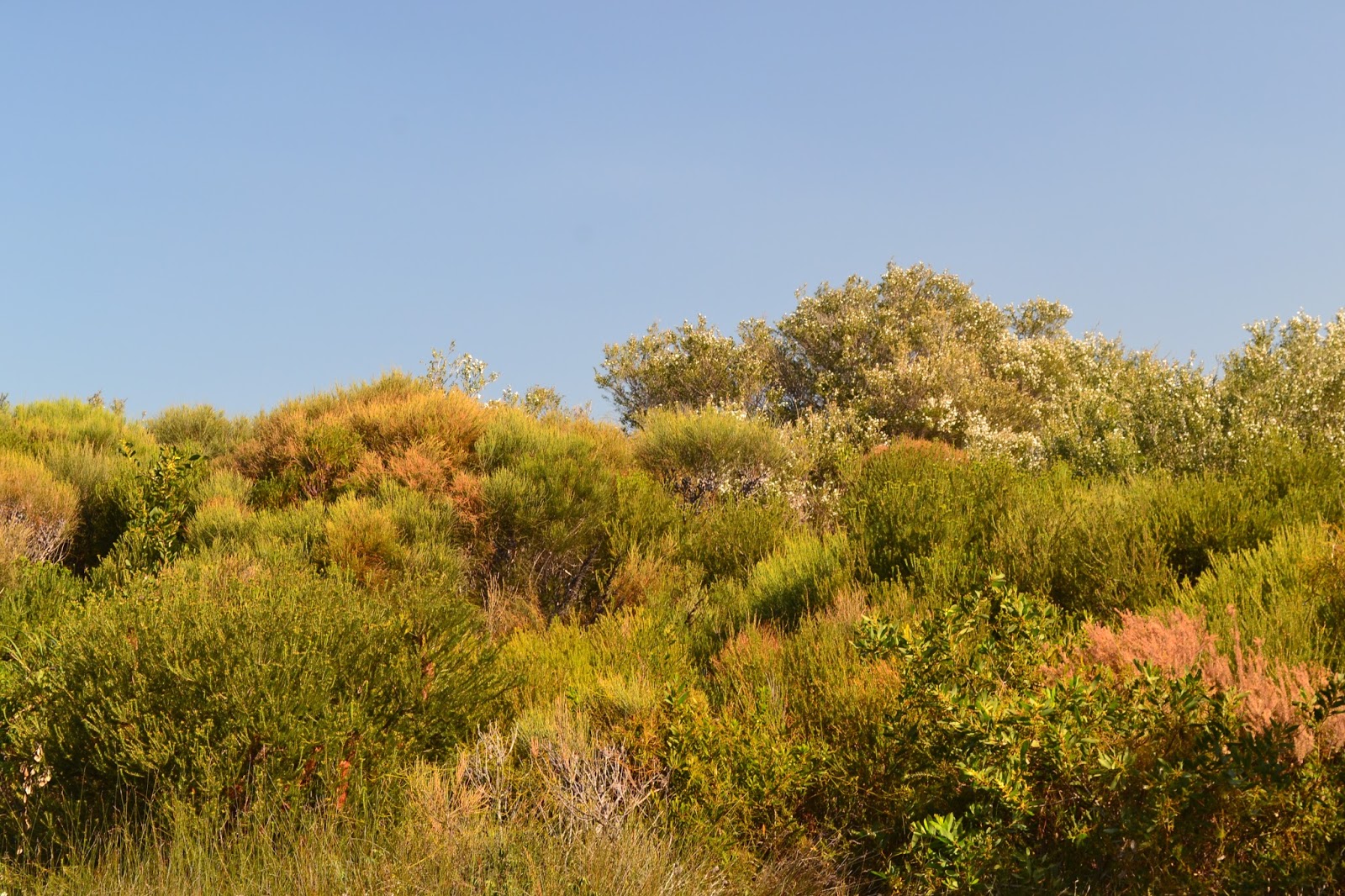
There was plenty of coastal heath land on offer today.
Reaching the end of Cape Solander Road at Cape Solander I started off along the cliff tops.
The Botany Bay National Park steeple chase.....maybe.

I had to head into the coastal heath for a while at Tobbigai Gap to by pass the actual gorge, once inland a bit I could see that it was my track that Parks were doing maintenance on as there were a lot of building materials scattered around, there was no maintenance happening though. There appear to be a few options along here as far as tracks go but I generally stayed as close to the tops of the cliffs as practicable, sections along here were a lot rougher than I had imagined they'd be, I quite often had to find my way through some serious muddy spots. The wet open heathland was a perfect spot for wild flowers though and I was able to practice my macro shots trying to capture the diversity of the flora. While the tracks along here were a little on the rough side I was in no danger of getting bushed, I basically kept the ocean to my left and headed towards the Cape Bailey Lighthouse which stood out like an ever approaching beacon ahead of me.
Approaching Tobbigai Gap I had to skirt inland around a deep gorge.
The industrial side of Kurnell was never to far away but for the most part you wouldn't know it was there.
The walking got a little rougher after passing Tobbigai Gap.
I wasn't really expecting this, but it wasn't to bad really.
The wet heath land was a great spot for wild flowers though, so there was a pay off for the mud.

The lighthouse was a bit of a non event though, in fact I'd go as far as to say don't bother with the short side trip, the bush stops any real view and the automated light is unfortunately defaced with graffiti. Leaving the lighthouse my route once again took to the exposed cliff tops, now with the high rise buildings of Cronulla visible in the distance, the very far distance! Hmm looks like it'd be touch and go whether I finished this walk in the daylight. Leaving the extensive cliff tops I crossed a series of small coves, climbing over small heath covered headlands on what I presume to be old fisherman tracks. 
Cape Baily Lighthouse was little bit of a non event I reckon, no view and daubed in graffiti.
This is the view back towards Sydney from around half way up the lighthouse side trip, best to turn around here and head back to the main track.
Looking south down the coast.

Boat Harbour is a ramshackle collection of beach shacks, a slightly unusual sight considering that I was less than 20 kilometres from the Sydney CBD. From here to Cronulla it was a bit of a beach stroll, although initially it was fairly tough going as the eastern end of Cronulla Beach is open to 4wd's and they had cut the soft sand up a lot. After passing out of the 4wd zone and with the tide slowly receding the beach walking started to get a bit easier, and once I started to meet a few local dog walkers I knew I was getting close to the end. After a 7 kilometre beach walk I was pretty happy to arrive at the end of Cronulla beach just as the sun slipped beneath the horizon, washing the sand off my feet I pulled on my old boots and headed through town to the train station, gee I wish I could fund this lifestyle all the time!
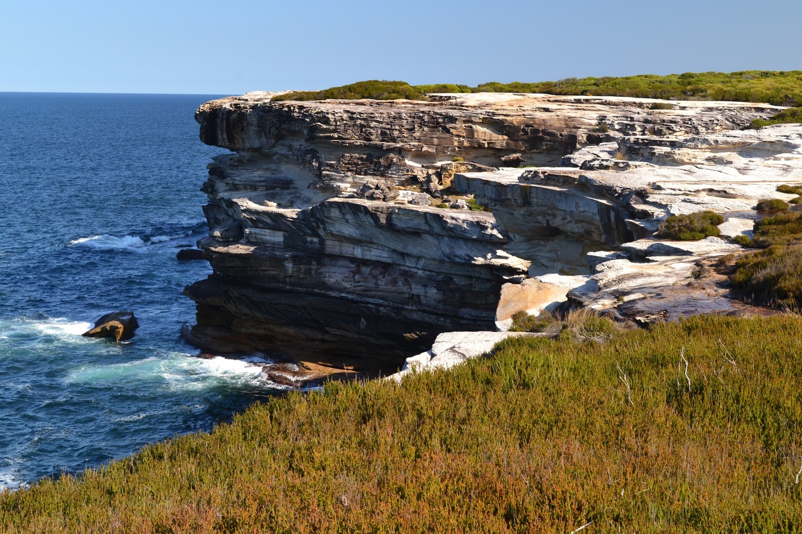
These sandstone cliffs make for nice photos..well I think so anyway!
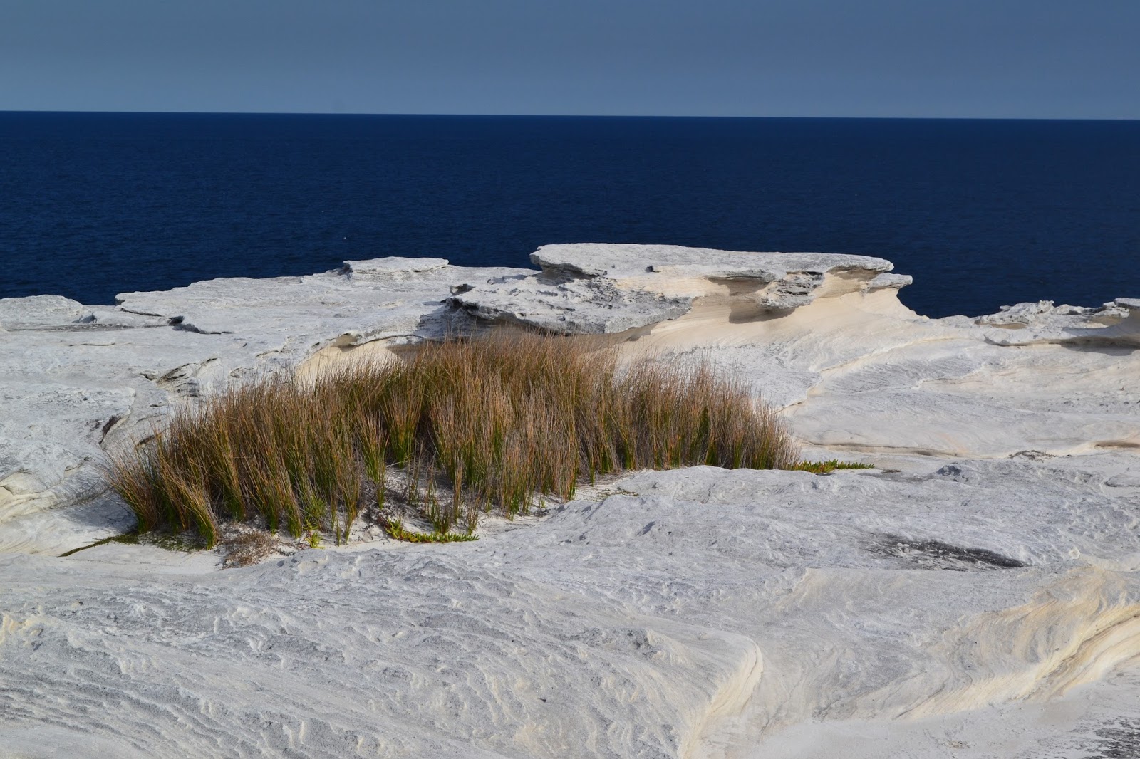
I love the different texture of the rock.
An old Holden red motor I think, they're were a few of these rusting automotive burial sites as I made my way towards Boat Harbour.
The Dirt.
My old GPS was cactus when I did this walk so I'll give you the stats from my notes, the distance is 14.3 Chapman kilometres and the metres climbed is 75 Chapman metres. I also think I agree with Mr Chapman in relation to this being a medium grade stroll, the track was a lot rougher than I anticipated but obviously that could change with the intended maintenance.....maybe. Now as you've probably worked out I used the notes out of John and Monica Chapman's Day Walks Sydney book. This walk was a surprise in more than one way, as I've mentioned it was a little rougher than I anticipated, also it took me longer to walk than I thought it would, the beach section at the end seemingly going on for a long time which was probably because the high rise buildings were in sight for the length of beach. Having said all that though I think this is a bit of a hidden gem, the coastal scenery was superb in spots, if you had mentioned that you were going for a walk in Botany Bay National Park I wouldn't have associated that with beautiful coastal scenery in my head, until now.
Relevant Posts.


The little cove that is Boat Harbour, there is a ramshackle village backing onto the water but I thought it best to respect the peoples privacy and not take to many photos there....what with the sound of banjos wafting around in the breeze an all!
The section of Cronulla Beach around Boat Harbour is open to 4wd's so it makes for some tough walking around high tide.
Cronulla Beach.
I've just arrived at Cronulla, perfect timing really.

Saturday, November 5, 2016

Saddle South of Moscow Peak to Limestone Road, The Cobberas, Alpine National Park - October 2016


My third day in the Cobberas didn’t start off in the way I may have envisaged. I’d checked the weather forecast before going to bed last night and it was for late rain and storms with high winds. Figuring that I’d be safely back at the ute by mid afternoon I envisaged a relaxing sunny morning, breaking camp slowly while I enjoyed a leisurely breakfast, before making my way down to the ute, maybe with some clouds starting to build up to my west to add a bit of drama to my photos. However, around 4am something woke me from my slumber, in my sleepy haze I could of sworn that someone had shone a torch into the tent, but weirdly everything was pitch black now. A few seconds later my foggy brain suddenly cleared as a clap of thunder, which sounded like a shotgun being discharged next to my tent, had me wide awake. I guess the weather was arriving early!

I spent the next two or three hours snoozing, waking every now and again when the rain got heavier, thankfully the lightning and thunder had moved on though. By around 8am, with the rain showing no real sign of stopping I figured that I may as well pack up and start walking out. Packing up in the rain is never much fun but at least today I was heading back to the ute, so after pulling on my wet weather gear in the tent it was just a matter of climbing out into the elements and stuffing everything into the pack. Normally if I’d been staying out for a few more nights I would have been a lot more careful keeping the wet gear separated from the dry. With camp packed up and after scoffing down a quick breakfast it was time to head off into the wet scrub.


About to leave camp, hey I'm still smiling!
With today being basically a re-trace of day 1 it would normally be a pretty easy walk, but being off piste and raining meant that being familiar with the route wasn’t going to help me a great deal. First up I had to sidle beneath Moscow Peak until I met the spur coming up from Cowombat Track, I decided to drop a little lower on the sidle today in the hope that I’d drop below some house sized boulders that I’d had to find my way through on my journey across. To be honest I’m not sure if dropping a little lower helped or not, I seemed to miss some of the rockier stuff but at the same time the scrub seemed a little worse…and now it was wet.


Tracking along below Moscow Peak.
Once I locate my spur I'm heading down into that valley.


After a hard half hour or so I eventually met up with my descent spur, once on the spur it was a matter of following the spur back down. Now while the broad spur made it easier to pick my way up missing the worst belts of scrub, it made it a little harder to navigate on the way down. With the top of the spur fairly wide I had to stop and check a few times to make are I hadn’t wandered to far north, it wouldn’t of been a disaster but it would of added to my time in the rain. Speaking of rain though, the showers were definitely thinning out as I descended, I was actually starting to see a few breaks of blue sky through the trees.


The wide open spaces near the top of the spur.
Even with the inclement weather there was still plenty to hold my interest.
Lower down the spur the scrub gets a bit thicker in spots.
Hey hey, I started to get a few patches of blue sky by the time I got to the bottom of the spur.
I've just emerged out of the scrub onto Cowombat Track, that must have been a giant horse that left its calling card on the track beside me.


Eventually I emerged out of the scrub onto Cowombat Track, all I had to do now was to walk the easy 6 kilometres back to the ute. The track was a little on the greasy side after all the rain and I could see where a few walkers had been slipping and sliding on some of the short sharp descents and ascents but for the most part it was an easy amble that allowed me to look around a bit. The showers had almost stopped now and the weather was almost balmy, I would finish the walk in just my ice breaker top (luckily no other unfortunate walker had to witness that!). While the day was getting a bit warmer the wind was definitely picking up and I was nervously watching the tops of the trees thrashing about in the wind above me, there wasn’t a lot I could do though, just keep shuffling along and hope for the best really. Arriving back at the ute on Limestone Road I found another ten cars parked up on the side of the road, I assume most of the punters must of headed along the AAWT towards Cowombat Flat as I hadn’t seen a sole in three days. After throwing all my wet gear in the back of the ute and having a bit of a wash I jumped in and started the six hour drive home, a drive that was enlivened by two fallen trees across the Great Alpine Road and then huge storms once I got a little closer to Melbourne, but that’s another story I suppose.


Cowombat Track near where I popped out of the scrub.


Cowombat Track form one small section of the Australian Alps Walking Track.
Stony Creek.

The Dirt.
I walked 9.9 kilometres today and climbed 336 metres. Once again while the walking, as far as off track walking goes, wasn’t to hard it’s still harder than most on track walking so I suppose I’ll rate it hard. As I mentioned navigation wise it was actually harder descending the spur than it had been ascending it a couple of days ago, in my experience this is fairly common. Once on Cowombat Track the walking is easy which made for a pleasant finish to my stroll. Over the full three days of this walk I covered 30.7 kilometres with around 18 kilometres of that completely off track. Over the course of the three days I also climbed 1458 metres complete with a few short sections of scrambling, with the scramble up Cleft Peak being the most exposed. I used a few notes out the House of Chapman’s Australian Alps Walking Track book and carried the Suggan-Buggan 1:50,000 topo map. For the most part though I was just making it up as I went along. This three day walk was a wild little stroll, one that I’ll definitely revisit at some stage in my future, it was great to visit a spot that appears largely untouched by man.
Relevant Posts.
Day 1 of this walk.
Day 2 of this walk.

There was still a bit of weather around.
Another great little adventure coming to its end.


Wednesday, November 2, 2016

Cleft Peak, Mount Cobberas Number 1, Moscow Peak, The Cobberas, Alpine National Park - October 2016


The view from Cleft Peak was worth the effort.
My second day up in the Cobberas involved a bit of a circuit around some of the higher peaks in the area. Luckily for me I had a beautiful sunny, blue sky kind of day for it. So after breakfast I pulled on the boots, loaded my pack with all the essentials for half the day and headed off. I’d pulled up pretty well after yesterdays walk, the only slight issue I had was with a couple of hot spots on my feet, but you gotta expect that I suppose as I haven’t warn these boots for months and when I last did I was a few kilograms lighter.

The day started with another off track ramble, this time up towards Middle Peak.
My first objective today was to climb to the ridge that connects Cleft Peak to Cobberas Number 1, once again the spur I was climbing was pretty open so the walking was pretty good, the ground was nowhere near as rocky on this climb as it had been around Moscow Peak yesterday which also helped. I was aiming for Middle Peak although I started to sidle north before getting to the very top and came out on the ridge top just to the north of Middle Peak. Once on the crest of the ridge Cleft Peak was very close at hand but the walking was fairly slow.

Sidling around beneath Middle Peak on my way to Cleft Peak.
Between me and Cleft Peak was a series of rocky outcrops that had to be either climbed over or skirted around which made for reasonably slow progress, there was nothing to hard as Cleft Peak was always in sight but it still required concentration. Closing in on Cleft Peak I could see that there was actually three rocky outcrops with the centre one appearing to be the highest, I could also see that it would require a bit of an exposed scramble. Climbing a grassy gully I first of all headed for the easier northern most outcrop with my pack, with this outcrop only marginally lower than the main summit it provided for a great view and was easily climbed, the view north to the Main Range was particularly good.
Cleft Peak, the highest spot is on the rocky outcrop on the right.
There was still plenty of snow on the Main Range.
That's Mount Cobberas Number 1, taken from the slightly lower northern summit of Cleft Peak.
After climbing the sightly lower northern most peak I dropped the pack and headed up the middle peak which from what I can tell is the summit of Cleft Peak. This climb involved a couple of easy scrambles with a fair bit of exposure, the first scramble up onto a sloping ledge and the second one up a gully off the ledge to gain easy access to the summit. It pays to scout the second scramble out a bit as the first gully that I came to was a lot more of a committed scramble than the next one along the ledge. Once on top I sat down for awhile and took it in, unfolded in front of me I could see my whole route around to Cobberas Number 1, the height of my view point flattening out the route a little deceptively. To the east I could see the snow covered Bogong High Plains and Mount Bogong but my eyes were drawn to the north. With Moscow Peak, Cobras Number 2, and Mount Pilot all lined in front of the snow covered Main Range it was a great spot to sit and soak up the wilderness, yeah so many places to visit and so little time!
Cleft Peak, I climbed up to the sloping ledge to the right, avoided the first obvious gully, climbing the second gully above the small patch of snow grass.
The Pilot with the Main Range in the distance.
My ongoing route curving around to Mount Cobberas Number 1, it all looks pretty easy from up here!
Moscow Peak in the middle distance, I was camped above the open grassy area in the snow gums on the left of the photo.
After taking it all in for awhile it was time to make a move and head over to Cobberas Number 1. The scramble back down was thankfully uneventful and I grabbed my pack and headed off along the broad ridge, firstly back towards Middle Peak and then down to a saddle between Middle Peak and Mount Cobberas Number 1. This grassy saddle was a superb spot, there were even a few rills of water trickling west so at the moment it would make for a great campsite. Leaving the saddle I aimed to the south of a large rocky outcrop I could see on the ridge that leads to the Cobberas Number 1. The climb was probably around 100 metres but the scrub was once again fairly sparse and I was easily able to make my way around any of the thicker sections.


There was no shortage of mature snow gums today.

Arriving onto the flat plateau like ridge that leads to Mount Cobberas the scenery went up another notch, this flat area was comprised of snow grass with a scattering of huge boulders littering the ground, mixed in with all this was a large number of beautiful mature snow gums. These snow gums are twisted and contorted into all sorts of weird and wonderful shapes and I never get sick of them. The flat tops made walking really easy and it got even easier when I met the walking track that comes up from Native Dog Flat, making the last couple of hundred metres to the summit a bit of a cake walk. To get right up to the trig on Cobberas Number 1 involves almost circling the rocky summit before scrambling up an easy rocky ramp, the final section up to the trig was a shimmy up a 1.5 metre rock face, although probably the toughest bit of the scramble was finding a spot to park my fat arse on the tiny summit!
The easy rocky ramp that leads to the summit of Mount Cobberas Number 1.
The final short scramble was a little exposed.
The view back towards Cleft Peak from the tiny summit of Mount Cobberas Number 1.
There isn't a lot of room up here.
Mt Bogong and the Bogong High Plains in the distance, there was a fair bit of snow on them as well.
It was well passed midday when I started back down towards camp, of which I had to pass through on my way up Moscow Peak. It was a beautiful walk back down to camp, with the route now being fairly familiar to me and the gradient generally down hill it allowed me to relax a little more and take in the beautiful scenery. After a quick bite to eat at my camp I grabbed the pack and headed off towards Moscow Peak. From what I could tell looking at my map it appeared that the highest point was the peak just to the north-east of a shallow saddle on the summit ridge, so I aimed to meet the crest of the ridge at the saddle.

A Copperhead Snake looking for a feed of frogs near the sphagnum moss swamp.
To reach the saddle I had to head north from my camp, once again the flora didn’t give me to much trouble but the ground is certainly rockier in the vicinity of Moscow Peak. As I climbed up towards the shallow saddle on the ridge I had to navigate my way around quite a few huge boulders, once again utilising a few brumby pads eased the way a little. It was a little surprising to see where these brumbies get to, a couple of times I’d be perched on some rocky outcrop only to look down and see the brumbies had left their calling card. Moscow Peak is a little lower than the other hills I’d climbed that day but being slightly remote from the Cleft Peak mount Cobberas Number 1 complex that I’d spent the morning on, it still provided a great spot to sit and take it all in. The craggy Mount Cobberas Number 2 seemed very close indeed with The Pilot half hidden behind it. Sitting up on Moscow Peak in the late afternoon sun I was pretty content with life.
Mount Cobberas Number 2 with The Pilot behind it, from Moscow Peak.
The ridge line on Moscow Peak.
There are some serious rocky outcrops on Moscow Peak.
All good things come to an end though and eventually I had to head back down to camp. With a couple of hours daylight left I once again chilled out a little, doing a little reading while cooking dinner and enjoying the last bit of warmth from the setting sun. Before the sun made its final dip below the horizon I crawled into the tent, grateful again to be off my feet after what had been a fairly long day for me. As soon as the sun set I was quickly forced into the sleeping bag as the temperature dropped, although that was no real hardship and once again sleep came quickly for me.

Looking back across to Cleft Peak from Moscow Peak.
Mount Cobberas Number 2.
The Dirt.
I walked 11 kilometres today and climbed 634 metres. I suppose I’d rate this as a hard day again although the ratings for this walk are very subjective. Reading through the narrative I seem to mention that the climbing and scrub aren’t to bad, and as far as off track walking and scrambling go that is true, but if you compare it to walking on a track its a lot tougher, hence the hard rating. If you are an experienced younger fitter person you’d probably be shaking your head at the hard rating, likewise if you have only ever walked on tracks you’d probably be thinking this is pretty tough, so anyway I’ll go with the hard rating. Apart from my camp I also had Telstra coverage from all the peaks today. Cleft Peak requires a reasonably exposed scramble so keep this in mind although the view from its other peaks is almost a good. Apart from a few hundred metres todays route was entirely off track with no track markers or cairns.
Relevant Posts.
Day 1 of this walk.
Day 3 of this walk.
The sphagnum moss swamp is the head waters for Moscow Creek.
Time to rest my tired bones.


I'm buggered if I know how to pin a spot on the map, I was camped in the trees to the west of the open spot.
Pelion Hut to Mt Ossa return, Overland Track - April 2010

Mt Oakleigh from the Pelion Hut heli pad. I think the mountain just visible in the mist in the distance is Cradle Mountain... ... the flat t...