
Late afternoon on the Goulburn River.

You won't have trouble getting a park out here!
Leaving the ute I set off heading east this afternoon, firstly balancing my way across a dilapidated bridge spanning an anabranch of the Goulburn River before picking up an old 4wd track that within ten minutes had me meeting up with Thompson Track (another 4wd track). Turning left (north) I now spent the best part of an hour trudging up Thompson Track in the afternoon heat... and it was fairly warm. Where as Melbourne had been cool and grey, up here I was walking beneath blue skies and sunshine so I was pretty happy with life. On this walk I'd be walking the Goulburn River Floodplain for the whole walk and while the country lacked a little in the topography stakes I still enjoy this type of walking, and following Thomson's Track north this afternoon beneath the blue sky watching the mobs of Roos grazing in the dry open forest I was reminded of why I enjoy it so much.

My days first obstacle was this anabranch of the Goulburn River.

I had the remains of an old bridge to make the crossing a bit easier.

Once across the creek I set off along a series of 4wd tracks - some were named and some were not.

Walking the flood plain.

There are a lot of Roos up here.

Thompson Track
After almost an hour I swung east off Thomson Track and took an un named 4wd track that passed through the levee bank to arrive onto the bank of the Goulburn River opposite an irrigation pumping station. Irrigation is the reason that I'd figured that I'd be a chance for a swim in the Goulburn River, you see with the river supplying water to Victoria's Goulburn Valley food bowl it means that they let a constant stream of water out of Eildon Dam over summer so the river never really gets too low (unlike a lot of Australia's inland rivers). I hadn't pencilled this spot in for a swim however on dropping down to the water I could see that swimming would be OK here - it was too early in the walk for me to jump in through so after checking things out at water level I grabbed my pack and set off on the longish walk up stream.

There is evidence that these flood plains have been used for grazing as well as timber harvesting over the years.

This is as far downstream (north) that I got on the Goulburn River this afternoon. It looks like swimming would be possible here.
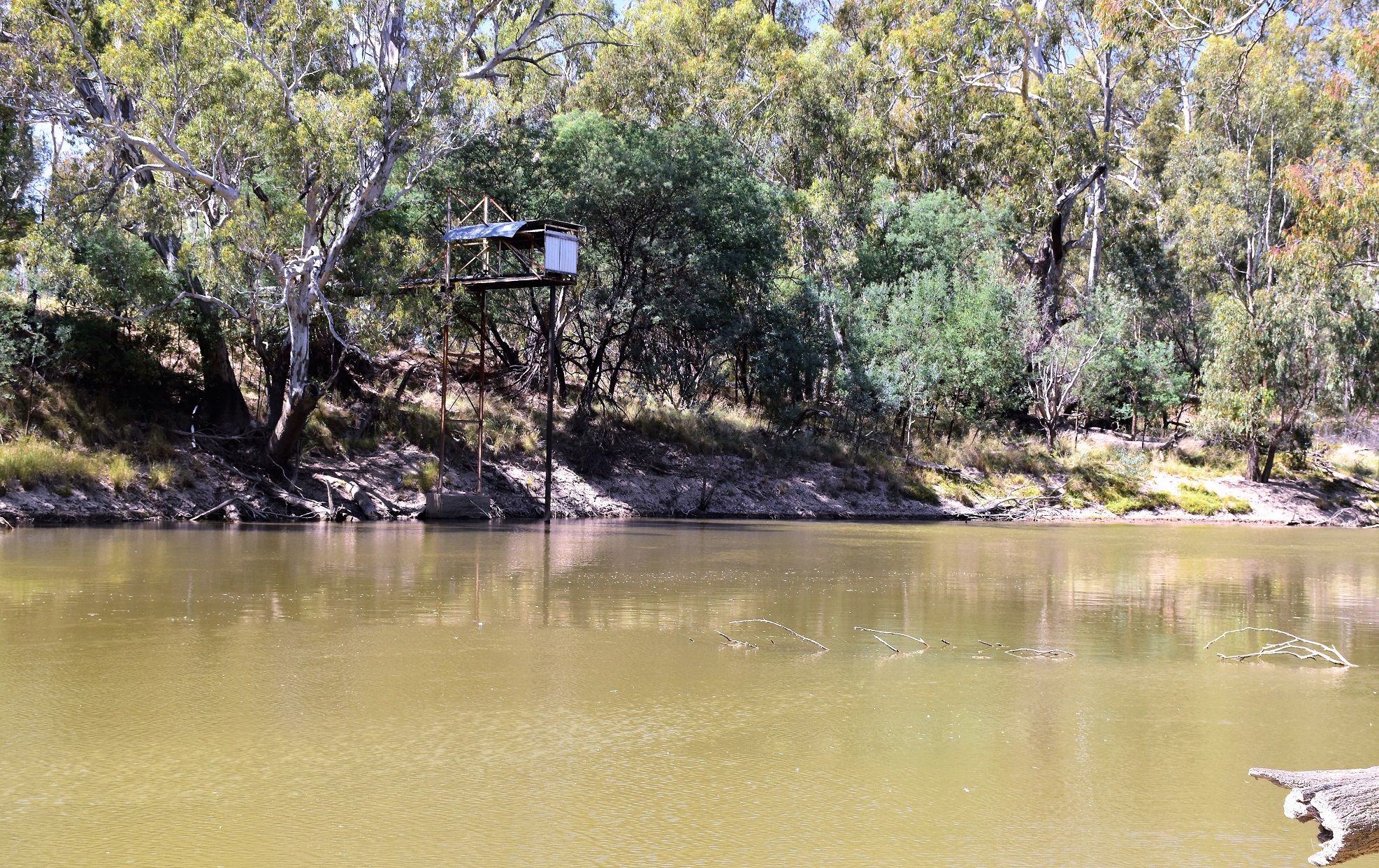
There was an irrigation pump opposite my first beach. Irrigation is the reason that the river flows well through summer as water is continuously released from Eildon Dam - it's also the reason that the flood plains are drought stressed as the river doesn't have big floods any more.

I now followed a series of informal tracks and off piste sections up stream for a couple of hours.
The rest of my walk consisted of either walking quiet 4wd tracks or just heading across the fairly open country. Heading south now, down stream, I initially followed a 4wd track between the levee bank and the river, this 4wd drive track giving me good river views in many spots. I was now heading for a big looping bend in the river where my Google Earth investigations had me thinking that there might be a small beach...yeah, nah! After an easy off track detour I arrived at the bend to find a fairly steep muddy bank with no sign of a sandbank and while you could swim here I suppose, it would of been far from elegant! So after writing it off as experience I set off up steam towards the second bend that I'd identified... and this time I got lucky.

On my walk up stream I was generally pretty close to the river.

Off piste and heading towards a river bend to check things out.

The off piste stuff was very good - except for a couple of belts of thistles.

I walked the old levee bank a couple of times.

The second bend that I checked out had a small beach - it was time for a swim.
My second river bend did indeed have a sandy beach to allow easy water access and it also came complete with a huge flock of Corella's wheeling around the blue sky. Actually I think the Corella's were a little toey with me as I may have set up for my swim beneath the big old Red Gums that that they call home. The swimming here was quite good - although as I've mentioned before, in the unlikely event that anyone decides to follow in my footsteps then consider your own ability before jumping into the water. With the afternoons sweat and grime washed off (for the time being) I emerged dripping from the water to pull on my dusty clothes and set off again into the late afternoon heat.

Goulburn River

Soaking in the Goulburn River.
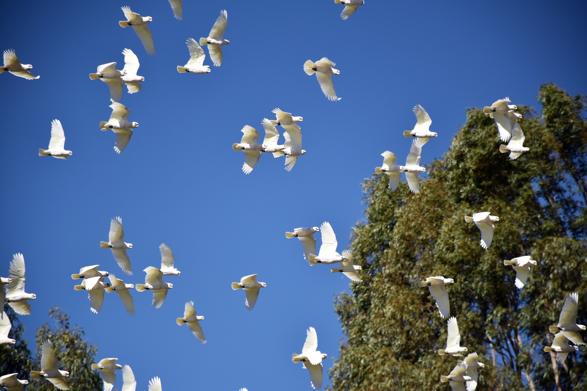
The Corella's kept me entertained while I enjoyed my swim.

I'm thinking that I might of been using their beach!

Eventually the Corella's settled in the trees on the other side of the river (over my shoulder).

I'm guessing a bit, however I suspect that the Corella's may call these two big old Red Gums home (my swimming spot was beneath them).
I was now continuing my walk up steam and for the next section of the walk I basically stayed near the river bank and headed across country. After heading out to check out a big peninsula in the river I shuffled my way further upstream to yet another big bend in the river, although unlike most of the other bends that I'd checked out today this bend was convex from my viewing point (I hope I haven't got my convex's and concave's mixed up!) so I was able to get a panorama, fish eye type of photo with the river stretching off in both directions.

Heading up stream after my swim I followed sections of the levee bank again.

The old levee has been breached in numerous places - they obviously aren't expecting any big floods in the near future.

Heading up the river off piste again. The two blokes fishing in the tinny were the only people that I saw this afternoon.

This probably isn't the best representation, however judging by the remaining stumps and dead trees there must of been some huge Red Gums up here before European settlement.

Late afternoon on the Goulburn River.

There are some flash houses on the opposite side of the river in spots.

This is about as far south along the river that I got this afternoon.

I was going for the fish eye effect here - with limited success.

Heading back towards the ute in the late afternoon along Carson Track.

After meeting Thompson Track I headed off across country again.
The Dirt.
According to my GPS I walked around 12 kilometres this afternoon and climbed about 140 metres (which seems highly optimistic!) on what I'd call a medium grade stroll, I'd really only class it as medium grade because of the off track walking, if you want to avoid the off piste stuff then the walk can be completed on 4wd tracks. This type of country is very typical of our inland areas although private rural land quite often stops access to a lot of this type of country. Swimming in these inland rivers require a lot of caution, you need to be able to deal with strong currents, deep water and snags. I got onto this walk from one Tyrone Thomas' old books 150 Walks in Victoria. I used his mud map and notes (although only loosely followed his route) along with my GPS topos. Somewhat unusually for me I also spent a bit of time researching this walk on Google Earth before setting off as well.
Relevant Posts.

The ute has just come into view - my navigation wasn't too bad!

The old timers have ring barked some of the big Red Gums here - maybe they did that to help fell them? That's a total guess though.

It was pretty late in the day by the time I got back... I've just got to get across the anabranch now.

I'm not actually sure if there was water in the creek or not - I wasn't overly keen to wade in and find out though.


