Sunday, November 22, 2020

Wilson Botanic Park Walk, Berwick - October 2020

Waterlilly Lake, Wilson Botanic Park.


With Melbourne still locked down it was time for yet another Corona Walk this morning. With my bubble now out to 25 kilometres I cast my eyes a little further afield and settled on this little park in Berwick. I'd noticed this place before however had never really considered stopping here as I always seemed to be heading further afield searching out what I considered more exotic walking locations, with my gaze now focused a lot closer to home I figured that this morning was the right time to check out Wilson Botanic Park. Arriving at the park entrance at 6:55am I had to spend 5 minutes sitting in the ute sipping my coffee this morning while I waited for the park gates to open, yes about the only positive to all these restrictions is that my travel time to my walks has been greatly reduced! With the gates opening right on time at 7am I soon had the ute locked, the GPS reset, and set off to see what this little park had to offer.

Walking beneath the Rose Arbor was a nice way to enter the park.


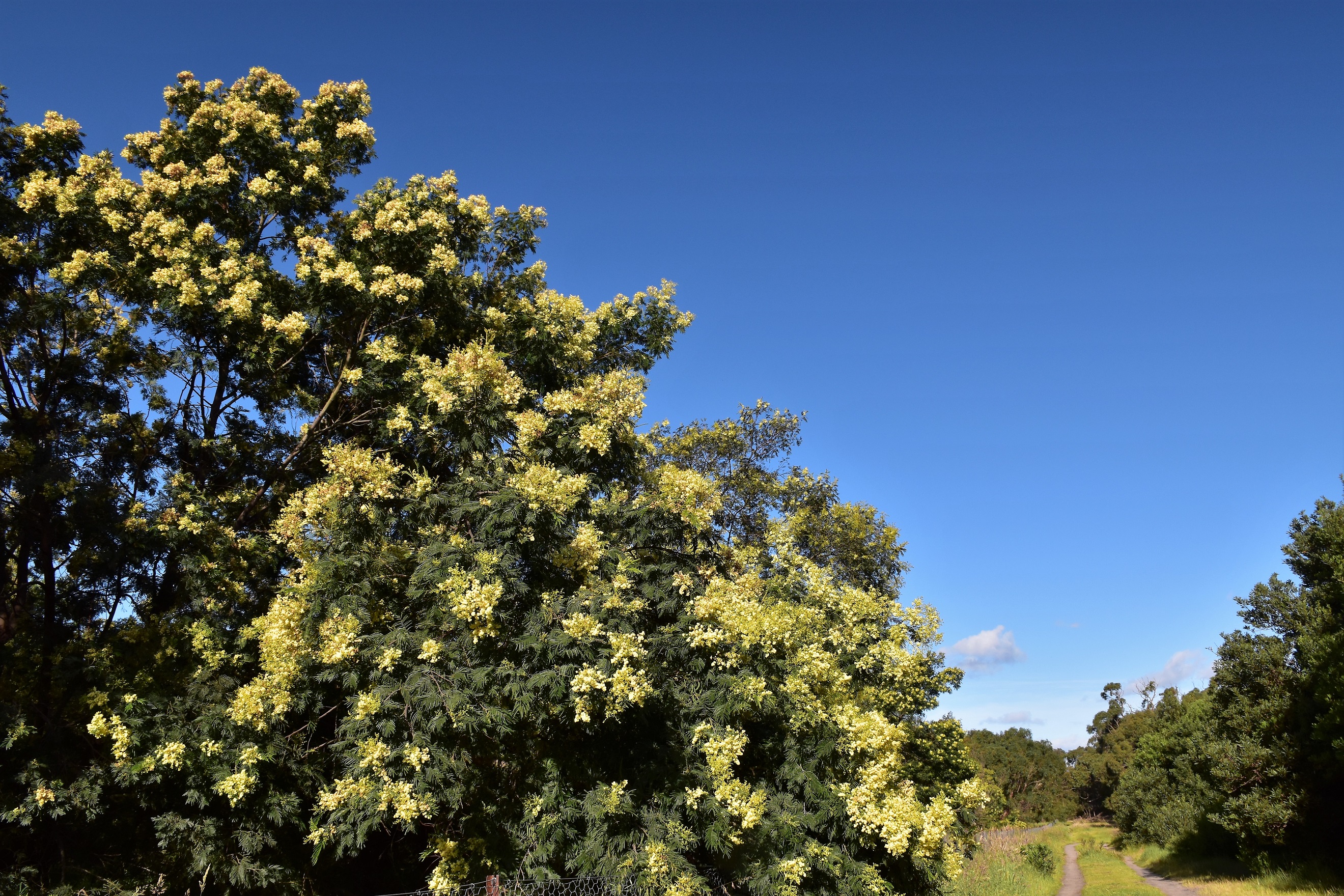
Walking beneath the Rose Arbour I first headed towards Waterlilly Lake. Now you may be shocked to know that the Waterlilly Lake is a small lake with a good growth of waterlilies floating on its surface. While the lake's name did lack a bit of imagination the lake itself was very pretty, helped by the nice early morning sunlight no doubt. After circumnavigation the Waterlilly Lake (that sounds way more impressive feat than it actually is!) I set off up some stairs and then a good sealed path beside the more substantial Anniversary Lake, passing by a small grove of Wollemi Pines as I climbed easily. Just before my sealed path doubled back on itself I had arguably my best view of Anniversary Lake from the side of the track, now with the sun behind me. 

Waterlilly Lake

Now here is something that I didn't think I'd be seeing in Berwick this morning - some small Wollemi Pines.

Anniversary Lake bathed in the early morning light.


I was now climbing up to the interestingly named Hoo Hoo Tower. This tower provides a good lookout over Melbournes extensive south eastern suburbs, although the sprawling suburbs really didn't hold a lot on interest for me this morning - this area is my Corona kingdom and I am well and truly am over it! After a fairly desultory attempt to get a pano photo from the lookout on my phone I grabbed my pack and continued on my mornings adventures. I now shuffled my way around the high area of the small park, after passing by Bens Lookout I skirted around the edge of the park in a clockwise direction until I could drop down and check out the small Basalt Lake.

The Hoo Hoo Tower.

The view over Melbourne's sprawling south eastern suburbs (otherwise known as my Corona Domain - you can see why I was a little stir crazy) from the Hoo Hoo Tower.

Banksia

Heading up towards Ben's Lookout.


Wilson Botanic Park was formally an old basalt quarry that supplied a lot of the Bluestone used in Melbourne's laneways and buildings in the early years. The old quarrying history of the area is probably best seen at the Basalt Lake, the Bluestone walls of the quarry being particularly photogenic I think. Basalt Lake is also home to quite a few birds and has a nice bird hide from which to observe them, that, combined with a nice boardwalk section made this a very pleasant part of my mornings stroll. 

Early morning in Wilson Botanic Park.

Wilson Botanic Park - I'm thinking that an Autumn visit might be interesting.

Basalt Lake - this was the source of a lot of Melbourne's famous Bluestones.

Basalt Lake

Basalt Lake


Leaving Basalt lake I made my way back towards Anniversary Lake, although I was now on the south bank. Reaching the deserted Amphitheatre (all the seats, tables, playgrounds, rotundas, etc were pretty well deserted in these Covid times) my route notes and map had me make a short steep and pointless climb only to direct me to immediately descend down a grassy pad and re-join the same track 50 metres further along - at least it increased my stats because there was no other point for this section? 


Leaving Basalt Lake I followed a nice section of raised boardwalk.

Wilson Botanic Park.
The Amphitheatre.

Anniversary Lake from The Amphitheatre. 


After finding myself back near Anniversary Lake once again I immediately climbed away from the waters edge, this time climbing a long stair case. As I puffed my way up the long staircase I passed by another deserted children's playground before veering slightly to the west across some grass to pick up a gravel track contouring north. The reason I was looking for this fairly nondescript track was that it led me to the remains of the old Detonator Store. There's not much left of the old Detonator Store now days - it's really just a ruin although like the old quarries that are now lakes it's another interesting part of the parks old mining history. Leaving the Detonator Store I dropped back down to the Waterlilly Lake on the main (wider) path before jumping into the ute and heading off for a coffee - take away and alone in the ute in these Covid times.

Wilson Botanic Park.

My notes had me follow this pointless section after passing by The Amphitheatre...

... before I dropped back down to Anniversary Lake...

... before I immediately climbed away again.


The Dirt.
I walked around 4.3 kilometres today and (according to my GPS) I climbed 453 metres on what I'd call an easy stroll. Now climbing 453 metres sounds like a fairly serious little outing however the figure is bullshit! I've noticed that in areas where there are a lot of cliffs and bluffs my GPS altitude figures are pretty well useless, I think it's because if my position on the ground is out be only metre or two then it can place me at the top or the bottom of a cliff and thereby add 20 metres or so each time. I'm guessing that the real metres climbed figure would be closer to 180 metres. The tracks in this little park are all well signposted and maintained and there are some great facilities here. I used the notes and map out of the Woodslane book by Julie Mundy & Debra Heyes called, Melbourne's Best River, Bay & Lakeside Walks along with my GPS topos. Really you are not going to get lost in this little park so it would be easy enough to just head in and explore without notes or a map. 


Relevant Posts.


The remains of the old Detonator Store.

It was an easy walk back down to the ute.

There doesn't appear to be a huge amount of car parking here, although after checking out my map I see that there is a big overflow car park.

Thursday, November 19, 2020

Woodland & Dara Track Walk, The Pines Flora & Fauna Reserve - October 2020

Easy walking along Orchard Track - pretty well sums up the whole walk really.


With Melbourne residents still being restricted to travel within a 25 kilometre radius of home I've been busy scouring the map looking for walking options. One of the local parks near home that I've never really considered walking in is The Pines Flora & Fauna Reserve. This park normally makes the news every year or two the the local kids set fire to it and it threatens the nearby houses, apart from that it's normally well and truly off my radar. Being interested in new walking options I decided to have a bit more of a look at this little park. After trawling the inter web I came up with this little walk on Alltrails, that I figured might be worth a look.

Heading into The Pines Flora & Fauna Reserve. This small park has a good network of well signposted tracks.


Not only has my walking been curtailed for months but I've also not seen any friends for months either so I figured I'd give my old mate DH a call and see if he wanted to join me on this little stroll. If anyone goes far enough back on my blog they might notice that I did a lot of my early walks with Dave, we walked everywhere from Feathertop and the Overland Track in winter to the sun soaked beaches of Hinchinbrook and the Prom. DH has had more than his share of serious health issues recently so it was nice to catch up for a chat and a stroll today. 


It was only a few metres into the walk when we crossed Boggy Creek - which was flowing well after some good overnight rain.


Leaving the car park this afternoon we immediately crossed over Boggy Creek, which was flowing a banka after a lot of overnight rain, and then almost immediately headed left along Orchard Track. A lot of this reserve is reclaimed land in various states of rehabilitation, the land used to belong to the CSIRO I think. Orchard Track headed south keeping fairly close to Boggy Creek for the most part, the Wattles and heath keeping me interested this afternoon. After 15 minutes or so we arrived at the signposted Woodland Track on the left and headed east along this sandy track. 


The Wattle and Heath were flowering.

Orchard Track


As the name suggests Woodland Track headed through an area of the park that featured a little more of a mature Stringybark Forest and with the benefit of hindsight was probably the best walking of this little adventure. After a pleasant twenty minutes ambling along Woodlands Track we emerged from the scrub on what I'm guessing is McClelland Drive Firebreak and headed right for a couple of minutes before ducking back into the scrub and heading west on Dara Track.


Late afternoon in The Pines Flora & Fauna Reserve.

Woodland Track features some of the more mature trees on the walk.

Woodland Track, The Pines Flora & Fauna Reserve.


As for Woodlands Track, Dara Track made for quite pleasant walking as well, the open woodland being sprinkled with colourful Heath and Wattle. We were now heading back to complete the loop part of our stroll as we first turned back down Orchard Track and then completed the circle at Woodland Track. Arriving at the Woodland Track turn off we climbed up onto a small rise beside the track which I'll call Pine Mountain to take in the view although really the view was pretty similar to the view from the bottom of my 3 metre high mountain really... who'd of thought!


Late afternoon in The Pines Flora & Fauna Reserve.

Dara Track, The Pines Flora & Fauna Reserve.

The Wattles were looking good this afternoon.


Continuing on down Orchard Track we now retraced the rest of our outward journey back to the car park. There was an interesting tree along here that I'm not sure of the name, for me it looked like an up side down Banksia (check out the photo, if anyone knows what it is let me know). With the car park coming into view we crossed back over Boggy Creek and our stroll was suddenly over. Arriving back at the utes DH and I took awhile to relax and chill out a bit, we'd both been doing it hard mentally during our months in isolation and this little walk and catch up had been very welcome.


This afternoons little walk did wonders for my mental health.

Heading back along Orchard Track.

I'm thinking that this is some kind of Banksia... although the flowers are pointing up?


The Dirt.
According to. my GPS we walked around 3.1 kilometres and climbed around 23 metres on this very easy stroll. The tracks that we walked this afternoon were all sandy 4wd tracks that were pretty well signposted. There are a couple of picnic tables at the car park if anyone wanted to enjoy a picnic before or after their stroll. This is yet another of my Corona Walks that is pleasant enough however possibly not worth travelling too many kilometres to do, I'll throw in my standard disclaimer though in that if you are a local or find yourself in the area then it's worth checking out. Information for this stroll is a little thin on the ground, as far as I know there is nothing published in print on this walk. As I mentioned earlier Alltrail have covered this stroll although it's in very basic terms (it maybe better if you pay for their premium product?). I just got by with a mud map off the inter-web and my GPS maps this afternoon, this is another spot that you really can't get too bushed in.


Relevant Posts.


Following Boggy Creek back down Orchard Track.

Boggy Creek.

There's plenty of parking along with a few picnic tables just off Ballarto Road.


Sunday, November 15, 2020

Gardiners Creek & Glen Iris Wetlands Walk - October 2020


Reflections (and rain drops) beneath the Hight Street Bridge.


After months of being locked down within a 5 kilometre radius of home, while at the same time not being allowed out of the house for more than an hour or two a day the Corona restrictions have slowly started to loosen a bit in Melbourne (we'll, they are loosening as I type this up however by the time I publish this post all bets are off!). We are now allowed to venture 25 kilometres from home and today was the first opportunity that I'd had since the restrictions eased earlier in the week to actually head out and about a bit. Now it's not all sweetness and light in my Feral world though, 25 kilometres from my humble abode features half of Port Phillip Bay to the west, so that kind of cuts down my walking options a little. Looking away from the water my map features a lot of suburbia, the Mornington Peninsula National Park and the Dandenong Ranges National Park both just out of reach in different directions, so it looks like I'll be featuring a few of these suburban strolls on my blog for awhile, still it's a lot better than being locked inside.

It was a grey old morning when I parked in the small car park off Sinclair Avenue this morning.


Waking early this morning I excitedly dusted the spiders webs off the ute and set off for adventures far afield... unfortunately those adventures will have to wait as I pulled up at Glen Iris as I butted up against my 25 kilometre limit... oh well. Parking near Bourke Road just as the sun made it's watery appearance in the east on this grey morning, I grabbed my pack, re-set the GPS and set off. Two minutes into the walk I decided that I'd better read my notes and discover that I was already freelancing away from the described route - yes, it seem some things never change! After consulting my map I was soon back on track although heading off in the opposite direction to the one that was designated, not that it really mattered as with City Link on one side and Gardiners Creek on the other to guide me I was hardly going to get lost. After circumnavigating the Bourke Road South Wetlands in the wrong direction I soon found myself back at the ute and set off up the Gardiners Creek Trail.


It was about now that I read my notes and realised I was walking the wrong way! 

Gardiners Creek snaking its way towards the Yarra River - I was heading the other way.

I had high tension powerlines above, a freeway beside me and a creek to guide me this morning... and I still struggled!

Bourke Road South Wetlands.


One of the issues that I have with these suburban strolls is that there are normally too many tracks coming and going, so if I want to religiously follow my notes and visit all the described attractions in my notes then I have to constantly read my notes - something that I'm not really that disciplined about. Out in the bush I can generally follow a spur or a river or a track for some distance without having to keep glancing at my notes and map all the time. Passing under Bourke Road this morning all was good for a few minutes as I followed the sealed shared path south to the Nettleton Park Reserve, where arriving at the bridge over Gardiners Creek I left the shared trail and set off through the native bush in Glenburn Bend Park on a less formal gravel path. It was nice to be off the Gardiners Creek Trail for awhile as even at this early hour it was still pretty busy with bike riders and joggers. This short section through Glenburn Bend Park has quite a few tracks heading off into the bush in random directions that access some small wetlands as wells as a bird hide.

Passing beneath Bourke Road on the Gradiners Creek Trail... maybe there is some light at the end of the tunnel although the way I feel at the moment it would probably be a truck heading straight for me!

Gardiners Creek Trail early this morning.

Gardiners Creek Trail.


Meeting the Gardiners Creek Trail again at Brixton Rise I took series of informal and rough paths close to the creek as I made my way upstream only walking the main Gardiners Creek Trail for short stretches. Looking at the amount of introduced deciduous trees along here I'm thinking that Autumn might be the best time of the year to do this walk. Skirting around the early morning dog walkers who were out and about on the T.H.King Reserve Oval I shuffled on a little to the Glen Iris Wetlands. The Gardiners Creek Trail crosses to the east side of the creek here however I stayed on the western side, once again enjoying the quieter and more informal paths through the native bush. The Glen Iris Wetlands section of the walk was arguably the best bit of this stroll, while the over head high tension power lines and the hum of the nearby traffic on City Link were a constant reminder that I was in the middle of a big city, the wetlands did allow me to immerse myself in nature... if only for a short while.

The Grevillea's and the Wattle's are flowering at the moment.

The deciduous trees along the creek are probably best seen in Autumn I think.

I stayed left here along the informal pad beside the creek.

Apart from the dog walkers the ducks were also enjoying the grass in the T.H.King Reserve this morning.


After checking out a bird hide and enjoying the boardwalk over the wetlands I crossed over Gardiners Creek again and re-joined the main shared path - which was now getting fairly busy with bikes. I'd reached the furtherest point of my stroll now and was now heading back down stream towards Burke Road. My return journey mostly followed the Gardiners Creek Trail for the complete distance, the notable side trip being when I skirted around the edge of the Eric Raven Reserve on another informal pad beside the creek which allowed me to get a couple of photos of the old graffiti covered High Street Bridge with some nice reflections of the wattles in the still water below the bridge, probably my favourite photo on this walk.

Gardiners Creek in Glen Iris.

Glen Iris Wetlands.

Glen Iris Wetlands - there is those power lines again!

There a nice little bird hide at Glen Iris Wetlands.

I crossed the wetlands on a long section of boardwalk.

Glen Iris Wetlands.


Re-joining the Gardiners Creek Trail after crossing the creek on the High Street Bridge I now followed the shared path all the way back to the ute. It was now getting close to 8am and the shared path was getting very busy indeed, although while it appears that most of the punters (whether they be bike riders, dog walker, joggers or just walkers) didn't want to leave the sanctuary of the concrete path I found it better to walk parallel to the path through the short grass for a lot of the distance. I'd had very light intermittent rain falling for basically my whole walk this morning and approaching Bourke Road it appeared that the rain was getting a little more persistent so I was reasonably happy to arrive back at the ute still relatively dry this morning. Jumping back in the ute I headed of home, maybe not feeling as euphoric as I normally do after a great walk but still pretty happy to finally get out of the house after months of lockdown.


My walk back towards the ute along the Gardiners Creek Trail was a little busier.

I followed this informal pad between the creek and the Eric Raven Reserve on the way back.

Gardiners Creek, Glen Iris.


Here's another one of the High Street Bridge (yep, I was struggling a bit with the photos this morning).


The Dirt.
According to my GPS I walked 6.4 kilometres and climbed around 65 metres on this easy stroll. This is another of those walks that probably isn't worth travelling too far to do, sure if you are a local or find yourself in the area then it's a nice enough stroll however I wouldn't be travelling big kilometres just to do this walk. With around 60% of the walk along the concrete Gradiners Creek Shared Trail it can get busy too, so go really early or really late if, like me you prefer fewer crowds. Most of the diversions off the Gardiners Creek Trail aren't signposted and some of the tracks a fairly rough and informal so you need to keep an eye on the map. I used the notes and map out of Melbourne's Best River, Bay & Lakeside Walks by Julie Mundy & Debra Heyes along with my GPS maps this morning.


Relevant Posts.


The genteel suburban streets of Glen Iris were never far away.

Back at the ute and time to head home. While the Gardiners Creek Trail was pretty busy on my return walk there were long sections where I was able to walk the grass parallel to the concrete path.


Pelion Hut to Mt Ossa return, Overland Track - April 2010

Mt Oakleigh from the Pelion Hut heli pad. I think the mountain just visible in the mist in the distance is Cradle Mountain... ... the flat t...