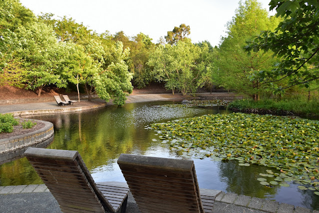
Waterlilly Lake, Wilson Botanic Park.
Walking beneath the Rose Arbor was a nice way to enter the park.
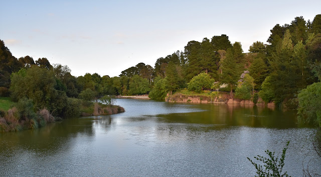
Walking beneath the Rose Arbour I first headed towards Waterlilly Lake. Now you may be shocked to know that the Waterlilly Lake is a small lake with a good growth of waterlilies floating on its surface. While the lake's name did lack a bit of imagination the lake itself was very pretty, helped by the nice early morning sunlight no doubt. After circumnavigation the Waterlilly Lake (that sounds way more impressive feat than it actually is!) I set off up some stairs and then a good sealed path beside the more substantial Anniversary Lake, passing by a small grove of Wollemi Pines as I climbed easily. Just before my sealed path doubled back on itself I had arguably my best view of Anniversary Lake from the side of the track, now with the sun behind me.
Waterlilly Lake
Now here is something that I didn't think I'd be seeing in Berwick this morning - some small Wollemi Pines.
Anniversary Lake bathed in the early morning light.
I was now climbing up to the interestingly named Hoo Hoo Tower. This tower provides a good lookout over Melbournes extensive south eastern suburbs, although the sprawling suburbs really didn't hold a lot on interest for me this morning - this area is my Corona kingdom and I am well and truly am over it! After a fairly desultory attempt to get a pano photo from the lookout on my phone I grabbed my pack and continued on my mornings adventures. I now shuffled my way around the high area of the small park, after passing by Bens Lookout I skirted around the edge of the park in a clockwise direction until I could drop down and check out the small Basalt Lake.
The Hoo Hoo Tower.
The view over Melbourne's sprawling south eastern suburbs (otherwise known as my Corona Domain - you can see why I was a little stir crazy) from the Hoo Hoo Tower.
Banksia
Heading up towards Ben's Lookout.
Wilson Botanic Park was formally an old basalt quarry that supplied a lot of the Bluestone used in Melbourne's laneways and buildings in the early years. The old quarrying history of the area is probably best seen at the Basalt Lake, the Bluestone walls of the quarry being particularly photogenic I think. Basalt Lake is also home to quite a few birds and has a nice bird hide from which to observe them, that, combined with a nice boardwalk section made this a very pleasant part of my mornings stroll.
Early morning in Wilson Botanic Park.
Wilson Botanic Park - I'm thinking that an Autumn visit might be interesting.
Basalt Lake - this was the source of a lot of Melbourne's famous Bluestones.
Basalt Lake
Basalt Lake
Leaving Basalt lake I made my way back towards Anniversary Lake, although I was now on the south bank. Reaching the deserted Amphitheatre (all the seats, tables, playgrounds, rotundas, etc were pretty well deserted in these Covid times) my route notes and map had me make a short steep and pointless climb only to direct me to immediately descend down a grassy pad and re-join the same track 50 metres further along - at least it increased my stats because there was no other point for this section?
Leaving Basalt Lake I followed a nice section of raised boardwalk.
Wilson Botanic Park.
The Amphitheatre.
Anniversary Lake from The Amphitheatre.
After finding myself back near Anniversary Lake once again I immediately climbed away from the waters edge, this time climbing a long stair case. As I puffed my way up the long staircase I passed by another deserted children's playground before veering slightly to the west across some grass to pick up a gravel track contouring north. The reason I was looking for this fairly nondescript track was that it led me to the remains of the old Detonator Store. There's not much left of the old Detonator Store now days - it's really just a ruin although like the old quarries that are now lakes it's another interesting part of the parks old mining history. Leaving the Detonator Store I dropped back down to the Waterlilly Lake on the main (wider) path before jumping into the ute and heading off for a coffee - take away and alone in the ute in these Covid times.
Wilson Botanic Park.
My notes had me follow this pointless section after passing by The Amphitheatre...
... before I dropped back down to Anniversary Lake...
... before I immediately climbed away again.
The Dirt.
I walked around 4.3 kilometres today and (according to my GPS) I climbed 453 metres on what I'd call an easy stroll. Now climbing 453 metres sounds like a fairly serious little outing however the figure is bullshit! I've noticed that in areas where there are a lot of cliffs and bluffs my GPS altitude figures are pretty well useless, I think it's because if my position on the ground is out be only metre or two then it can place me at the top or the bottom of a cliff and thereby add 20 metres or so each time. I'm guessing that the real metres climbed figure would be closer to 180 metres. The tracks in this little park are all well signposted and maintained and there are some great facilities here. I used the notes and map out of the Woodslane book by Julie Mundy & Debra Heyes called, Melbourne's Best River, Bay & Lakeside Walks along with my GPS topos. Really you are not going to get lost in this little park so it would be easy enough to just head in and explore without notes or a map.
Relevant Posts.


No comments:
Post a Comment