 |
| This is pretty much the story of todays stroll, cliffs and beaches. |
Feeling like an easy beach walk on what I figured might be one of the last days of swimming weather for quite a few months, I decided to head down to Angelsea after work this morning and walk from Angelsea to Point Addis and back. So keeping in mind that I’d wanted an easy beach ramble it wasn’t ideal that I was now waist deep in surging sea water with my feet not looking like they were gonna make it onto dry land in my immediate future. Even more concerning was that the waves, wetting the bottom of my pack before they crashed into the unstable cliffs that were towering uncomfortably above me, was that those same waves were now getting very close to the DSLR slung around my neck, fuck me!
 |
| Heading towards the coast along the Angelsea River Inlet. |
Leaving the ute this morning the walk had all started off pretty easily as I made my way along the path beside the Angelsea River Inlet, with the inlet mouth closed to the ocean the water was quite high although I’ve seen it lapping over the path at times so today was no worries. Meandering my way along the inlet to the ocean I was pretty pleased with myself this morning, I’d managed to time the walk exactly as Mr Chapman had suggested, heading off on a falling tide about 2 hours before low tide. So arriving at the beach I was a little surprised to see the waves lapping quite a way up the sand, although with the cliffs a little further away I wasn’t too concerned, thinking that maybe it was a little hard to tell how high the water was on the open sandy beach.
 |
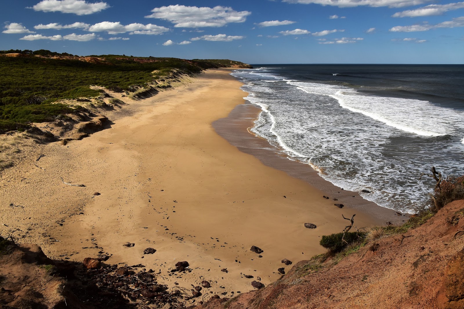
Looking west once I hit the beach.
 |
Point Addis is the green smudge in the distance.
 |
| I'd managed to jag a pretty good day again. |
|
|
Turning to the east I started my long sandy walk to the distant green smudge of Point Addis. The walk passed an old boat ramp and continued around a broken rocky point, the old boat ramp leads up to the Angelsea Caravan Park and is the only exit point from the cliff lined beach for the next four and a half kilometres. Rounding the first un-named rocky point I could see my next obstacle in the form of a much larger, brooding, black headland and it didn’t fill my heart with joy. Even from a few hundred metres away I could see the surf crashing against the sheer cliffs, hmmm! Passing a surfer I asked him if low tide was in 2 hours and he did confirm that fact, but also added that the tides weren’t very big at the moment. Ok, so it looks like Mr Chapman will have to add 1 to 2 hours before a ‘very’ low tide. Future updates to Mr Chapman’s book weren't the first thing on my mind now as I pulled my boots off and stashed them in my pack, I was more concerned with working out how deep the saltwater was going to get, a calculation made a bit harder by the swell rolling in and then bouncing off the cliffs.
 |
Yeah, I don't think I'll be getting around this one with dry feet!
 |
It doesn't look too hard from here.
 |
| Unfortunately the surf was stirring up the sand which meant that I couldn't see any of the many obstacles that my bare feet had to negotiate! |
|
|
Grabbing my pack I slowly waded out into the surging water, pretty quickly another issue soon became apparent. I’d been thinking that the ocean floor would of been sand but actually it consisted of rock slabs with sandy gulches in between, of course with the sand being churned up by the surf I couldn’t actually see what I was about to step onto, after almost going arse over the first time I stepped of a rock shelf I quickly realised that this little watery traverse was going to take a bit longer than I’d anticipated. Still rounding the headland with the occasional wave splashing the bottom of my pack I was thinking that the worst must be over, yeah…nah! Making my way back to where I’d assumed dry land would be all I could see was waves crashing onto sheer cliffs, oh, and the rock shelfs and sand had now given way to rough uneven rocks, my feet weren’t enjoying this unplanned pedicure. Like I said earlier, fuck me!
 |
Rounding the bluff I had a bit of an oh shit moment when I finally saw how far I'd have to wade in the surging water.
 |
| I'm sure that there is some dry sand somewhere up here...? |
|
Apart from trying not to fall over, trying not to cut my feet up too much and trying not to drown, there was another issue that I was a little concerned about. The cliffs along this section of the coast are very high and also very unstable. Normally the go along here is to walk as far from the base of those cliffs as possible but today that would of meant hanging out with the fish in Bass Strait, I was being forced to wade my way along the impact zone at the base of the cliffs a little to close for comfort. It was with more than a little relief that I finally emerged from water onto dry land, thankfully not only were my feet still in one piece but my DSLR had survived without getting wet (although it’s neoprene cover got a few descent splashes on it), the only issue was that the bottom of my pack was now a little damp, still I can live with that.
 |
I've just emerged from the water from around that bluff.
 |
Thankfully my feet were still in one piece and my DSLR was still more or less dry.
 |
| The view ahead looked fairly promising. |
|
|
I mentioned that those cliffs are black before, the black rock is actually coal (until a few years ago Alcoa ran a coal fired power station here to supply electricity to their nearby aluminium smelter). The cliffs aren’t all black, the coal seam runs for along the base of the cliffs varying between a couple of metres and several metres with the top part of the cliffs being sandstone. The different types of rock give these particular cliffs quite a distinctive and photogenic appearance I think. Thankfully once I was past my initial obstacle the walking got pretty easy and straightforward, the shoreline being mostly comprised of firm sand with only the occasional rock slab or loose rock to negotiate. With the day being pretty warm it was nice to be in the shade as I made my way along the base of the cliffs, I figured that at least I’d get an hour or two of good shade before before coping the full force of the sun.
 |
 |
The colours of the cliffs along here are amazing.
 |
| It pays to stay as far as possible from the base of the cliffs. |
|
|
Staying as close as possible to the waterline I slowly made my way along the base of the cliffs towards the next rocky bluff that protruded into Bass Strait. The main reason that progress was slow now wasn’t that the walking was particularly hard it was more that I was meandering my way along the sand enjoying the great scenery. Since passing the lone surfer I hadn’t seen another person on this wild stretch of coastline, a situation that is always guaranteed to lift my mood.
 |
 |
This is pretty epic I reckon.
 |
Stay clear of this one I'm thinking.
|
|
|
Reaching the second small headland it was an easy walk across some rock shelfs to the next long section of beach, this smaller headland being a lot easier to get around with the water high (although by now it was meant to be almost dead low). There is a very rough exit here that climbs up the soft cliffs with the help of some fixed ropes and steps cut into the rock, it looks very dodgy though so I’d only be having a go at it if the situation was critical, I’m guessing that this route might have been an old route up to the Eumeralla Scout Camp or maybe for some intrepid surfers to access the coast?
 |
The second headland has a bit of a emergency exit cut into the cliffs, it would have to be an emergency before I have a go at it though;)
 |
| Point Addis was now looking a little closer. |
|
Rounding this second headland another great coastal vista opened up in front of me. With the cliff line set back a little along here this beach has quite a different feel to the first section of the walk. I suppose the other good thing about this section of beach was that with the cliffs now 50 metres further away I didn’t have to worry about 1000 ton of rock suddenly landing on my head, which would of put a bit of a dampener on my day out. With the cliff now set a lot further back it also meant that I was now walking along in the direct sun, not that it was stinking hot but the the late April mid 20˚ sun still had a little sting in it.
 |
The character of the walk changes after rounding the second headland.
 |
With the cliffs set back further I was in the sun now.
 |
I passed a lone surfer heading towards his secret break.
 |
| But mostly I again had the beach to myself. |
|
|
|
At around 2.5 kilometres this is another fairly long beach and once again it was almost deserted, although I did meet another surfer trudging along the sand in his wet suit, no doubt heading out to his secret break. I was now heading towards what Mr Chapman calls Black Bluff in his book (although Parks Vic call it Red Rocks), with waves crashing high on the jagged, rocky shoreline it meant that there would be no going around this one at sea level. Arriving at the base of the rocky point I carefully picked my way up the rocks (I hadn’t bothered putting my boots back on since my wade near the start of the walk). There is nothing formal or signposted here, but the way forward is pretty obvious really and after a little bit of careful foot placement I arrived on the top of the red clay cliffs with my feet unscathed.
 |
That's Black Bluff ahead of me.
 |
| I picked up a rough pad over this little headland. |
|
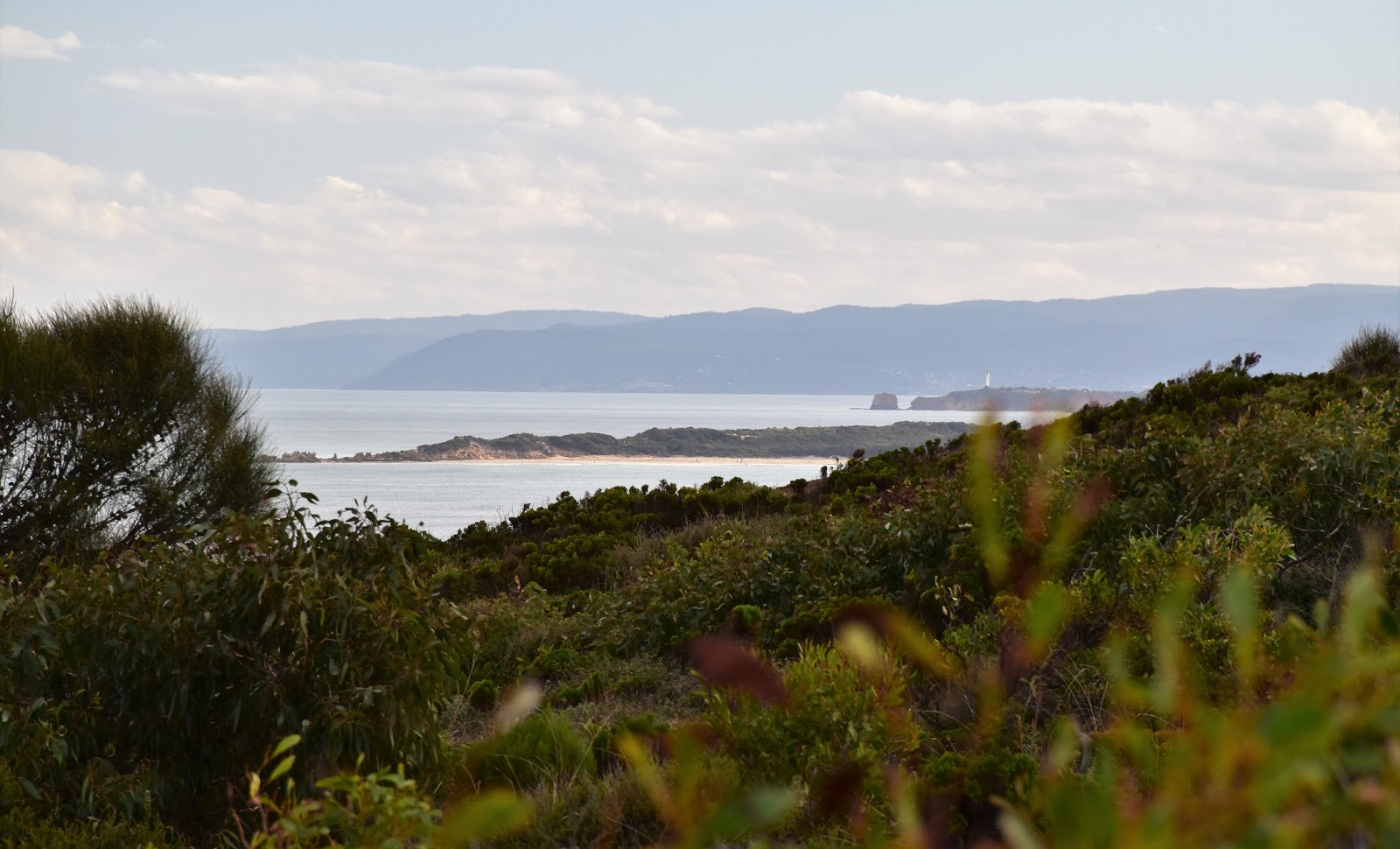
From the top of this little headland I got a good view back along the cliff line receding into the distance back towards Angelsea, now looking quite a long way away really. Ahead of me was another long section of sand framed by Point Addis in the distance, although with the Surf Coast Walk accessing this beach at the western end and the Point Addis Car Park at the eastern end this beach wasn’t deserted. While the beach wasn’t empty it was hardly over run with punters, as I trudged my way along the now softer sand, I shared this beach with 3 or 4 surfers out enjoying the swell. Reaching the end of the beach I climbed up the beach access steps to the lookout on Point Addis, still walking in bare feet this short section of the walk was pretty hard on my feet however the plan was for a swim once I got back down to the beach I was reluctant to stop and pull on my boots for the short section. The lookout at Point Addis not only gives nice views out to Bass Strait and west along the coastline towards Angelsea but gives even better views eastwards towards Adiscott and Bells Beach.
 |
Cape Addis from Black Bluff was now looking a lot closer.
 |
The cliffs are a lot more eroded along this last beach before Point Addis.
 |
Up on the Point Addis Lookout the view stretches east all the way along to Bells Beach.
 |
| The cliffs backing Adiscott Beach draw the eye a bit from Point Addis Lookout. |
|
|
|
After gingerly picking my way back down the gravel beach access path my feet were once again happy to reach the soft sand as I retraced my way back down towards Black Bluff. It was now mid afternoon and to be honest I was trying to stretch the walk out a bit, both for the better light that would come closer to sunset and also for the fact that I didn’t want to be heading home through Melbourne in peak hour (which runs from around 3:30pm to 7:30pm on a Friday in my experience). So anyway with a bit of time up my sleeve I got to the end of the beach, dropped my pack, stripped off and jumped into the surging surf. It’s not something that I’ve really mentioned on the blog (that I can remember anyway) but I was a reasonably good competitive swimmer in my younger years, now I’m not writing that to pump up my own tyres (I’d be telling you about my abnormally large hands if I wanted to do that;). No, the reason I mention the swimming thing is that it probably wouldn’t be a good idea to swim here unless you are a very competent swimmer, big surf, rips, rocks and an un patrolled beach mean that it is pretty dodgy really.
 |
This could very possibly be my last Victorian swim for the season I'm thinking.
 |
The waves breaking beside Black Bluff, the water on the lens is a bit of an occupational hazard when using the water proof camera in the surf, unfortunately.
 |
 |
| When I'm about to get munched by the wave I wasn't worrying too much about getting the horizon level! |
|
|
|
After mucking around for awhile in the surf taking a few photos with the waterproof camera I emerged to drip dry a it in the sun. The walk now changed character completely, from here on I’d leave the sand and climb up onto the heathlands above the cliffs following the long distance Surf Coast Walk. After drying off for awhile I pulled on my clothes and boots and climbed away from the beach, the Surf Coast Walk climbing solidly up onto the cliff tops. After passing a bit of a lookout the track level out and started it’s journey west, unfortunately the soft and unstable cliffs mean that the walking track is generally routed far enough away from the edge that means that ocean views are very few and far between.
 |
After my swim I walked a few metres to Black Bluff and picked up this walking track, part of the Surf Coast Walk.
 |
The SCW climbs fairly easily up onto the cliff tops.
 |
| I got a glimpse down to Aireys Inlet through the trees at one stage. |
|
|
While there are not a lot in the way of costal vistas along this section of the walk, the very well engineered track makes the best of what it’s got, the coastal heathland are the feature of this bit of the stroll I reckon, and late afternoon (or early morning) is probably the best time to enjoy it, judging by the number of Kangaroos grazing just outside the tree line it looks like they agree with me. After passing the turn off to the Eumeralla Scout Camp I arrived at a very new section of track where Parks Vic had re-routed the Surf Coast Walk even further away from the unstable cliff tops, ironically this was about the same spot where I’d been forced to walk close to the base of the cliffs by the water early today.
 |
Athletes hey, they must of got word that the Feral Walker was on his way!
 |
The SCW is fenced for the whole length along here obviously to keep errant walkers away from the unstable cliff tops, you do get a few distant views though.
 |
The dry coastal scrub has it's own beauty.
 |
This old hut beside the track would offer a bit of shelter on a bad day....
 |
....and you could enjoy the art whilst sheltering?
 |
The Surf Coast Walk.
 |
| One final view back to Point Addis. |
|
|
|
|
|
|
The new section of the Surf Coast Walk crosses a shallow gully on a long section of boardwalk before entering the back of the Angelsea Caravan Park and picking up the alignment of the old track again, this new section is signposted so it’s not a problem as far as navigation goes and most people wouldn’t even realise that there has been change. Passing along the boundary of the caravan park I dropped down the old boat ramp that I mentioned in the third paragraph and rejoined my outward route. Now back where I’d started hours ago, the setting sun giving the scene a whole new feeling. Needless to say with the light now arguably at it’s best, the last few hundred metes of today’s stroll didn’t pass any quicker than the rest of the walk, as I did my best to capture the feel of the scene before me.
 |
 |
At one stage the SCW drops steeply to cross a gully on a long section of boardwalk.
 |
The local Kangaroos were out grazing on the heathland.
 |
The SCW.
 |
| Approaching Angelsea the SCW has been re-routed along this raised boardwalk away from the cliff tops. |
|
|
|
|
The Dirt.
I walked 15 kilometres and climbed 130 metres on this medium grade walk. As I mentioned earlier I was using Mr Chapman’s notes out of his Day Walks Victoria book. Mr Chapman suggests starting the walk 1 to 2 hours before low tide which is what I did today, but it appears that you need a fairly large tidal range to get through the first section without having to walk through the surf (around the full moon). I’ve been along here before and managed it with dry feet so it was possible to get around the bluffs so unless the coastal conditions have changed due to erosion then it must of been the lunar cycle that mucked me around a bit today I’m thinking. The beaches along this bit of the Victorian coast are wild and remote so before swimming contemplate your own ability. Point Addis is more or less the halfway point of the stroll and the lookout would make a reasonable place for lunch, although I thought the rock shelf below Black Bluff, just before the Surf Coast Walk leaves the sand, was a better spot for a rest today. As far as I can see there was no drinking water on the walk. There is a toilet at Point Addis.
Relevant Posts.
Angelsea Perimeter Walk~West, 2016.
Angelsea Perimeter Walk~East, 2016.
Point Addis, Great Otway National Park, 2014.


No comments:
Post a Comment