 |
| Looking over towards the Yarra Ranges and Silvan Reservoir this morning. |
With Sam and I staying home over Easter I was looking for a walk close by today. Perusing my archive of unpublished posts it appears that since finishing the AAWT last year I seem to have been bingeing on beach and coast walks. So, this morning I decided to head up to the Dandenong Ranges National Park and revisit the Mt Dandenong walk, as written up by the oracle of all things bushwalking, Mr Chapman. After a quick coffee and toasties stop at Maccas, I pulled into the carpark at Kalorama bright and early, pulling on my boots I was on my way by 8am this morning. Hey, I suppose that there are some positives in having a chronically sore back that only lets me spend 7 hours in bed each night, well that is before the laws of diminishing returns kicks in and the dull ache in my back rules out any real chance of anymore quality good sleep.
 |
Kalorama was pretty quiet this morning.
 |
| The old WW1 monument at Kalorama - we'll call this the start point. |
|
As is pretty common I’ve done this walk before so I knew that I was in for a pretty solid day out today. Leaving the ute I was heading towards the summit of Mt Dandenong first up this morning, the pad along here largely follows the back fence lines of the big houses along Ridge Road. Being on the west side of the summit ridge meant that I was still in the shade this morning. With a temperature in single figures I was getting a taste of things to come as winter approaches, although the constant small but steep rises and falls kept me warm enough. While I was mostly walking in the shade the trees above me were starting to light up a bit as the early morning sun hit them. One of the slightly unusual things about the walk is the number of European deciduous trees that the track passes by, the punters that can afford to live in these expensive spots certainly tend to go for the “old country” look both in architecture and flora.
 |
The start of this walk follows a pad almost along the back fence of some of the big properties on Ridge Road.
 |
Occasionally I got close to the top of the ridge.
 |
Autumn is a pretty good time of the year to do this walk.
 |
| Ridge Road. |
|
|
|
After a bit of zigging and zagging as I followed numerous different tracks I eventually arrived at the still almost deserted Sky High Lookout at Mt Dandenong. This place has had a bit of a makeover in the recent past but I still can’t help thinking of the Brady Bunch when I look at the buildings up here. Still, it isn’t the architecture that draws people up here it’s the view. The cool, still conditions this morning weren’t really optimal for long rang views however, while I could see the high rise buildings in Melbourne’s CBD things were pretty hazy. Unfortunately Mt Macedon had disappeared into the haze but I could make out Kinglake in the medium distance.
 |
The classic 1970's (or is it late 60's?) architecture of Sky High reminds me of The Brady Bunch.
 |
 |
Looking out towards Kinglake....
 |
| ....and down towards the Melbourne CBD. |
|
|
|
With not a lot to look at really I didn’t hang around the summit long this morning, retracing my route a little I picked up Kyeema Track and headed south, still largely contouring along the western side of the summit ridge in the shade. Kyeema Track heads to the memorial for DC-2 Kyeema, a plane which crashed into the side of the mountain here back in 1938, killing all on board. After checking out the memorial cairn I continued on towards my next objective, Melbourne’s commercial television towers, yep it’s certainly a walk full of visual highlights (actually it’s way better than my limited vocabulary can describe). After taking in another couple of great viewing spots looking down over Melbourne’s sprawling Eastern suburbs I arrived at the Channel 10 tower, we’re not talking the Eiffel Tower here, but it was sweet enough in the early morning light.
 |
The memorial marking the site of the Kyeema DC-2 plane crash.
 |
Looking out over Melbourne's sprawling eastern suburbs towards the CBD.
 |
| The Channel 10 transmission tower. |
|
|
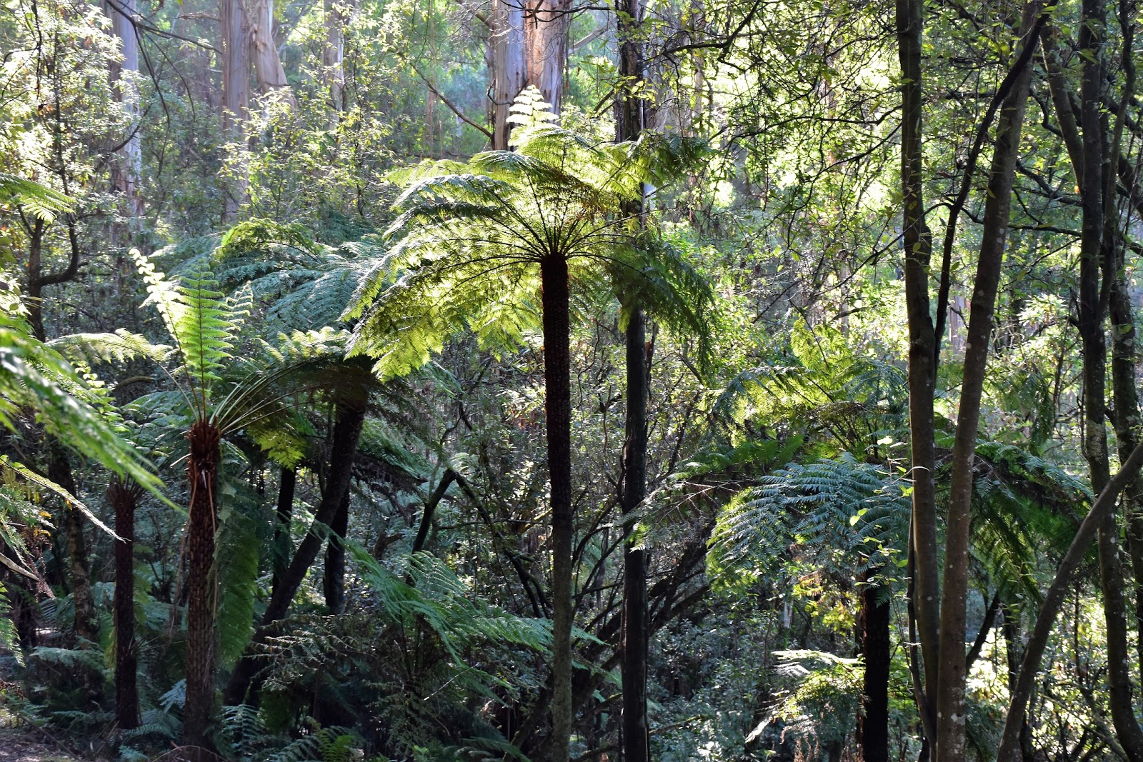
Leaving the Channel 10 Tower my route dropped steeply down the aptly named Zig Zag Track until I met up with Dacite Track and my contouring walk resumed again. Dacite Track and even more so, Dandenong Creek Track make for the best section of walking on this stroll today, the reasonably level tracks passing through long sections of old growth Mountain Ash and Stringybark Forests, crossing numerous damper gullies that were full of large ferns. A couple of hours after leaving the summit I joined the gravel Basin Olinda Road and dropped down towards Dodds Track, I was now as far from the ute as I’d get to today.
 |
Dropping down Zig Zag Track.
 |
Dandenong Creek Track is avery nice walk, even after the long dry spell that we've been having.
 |
 |
 |
The sun was now just starting to creep over the ridge line.
|
|
|
|
|
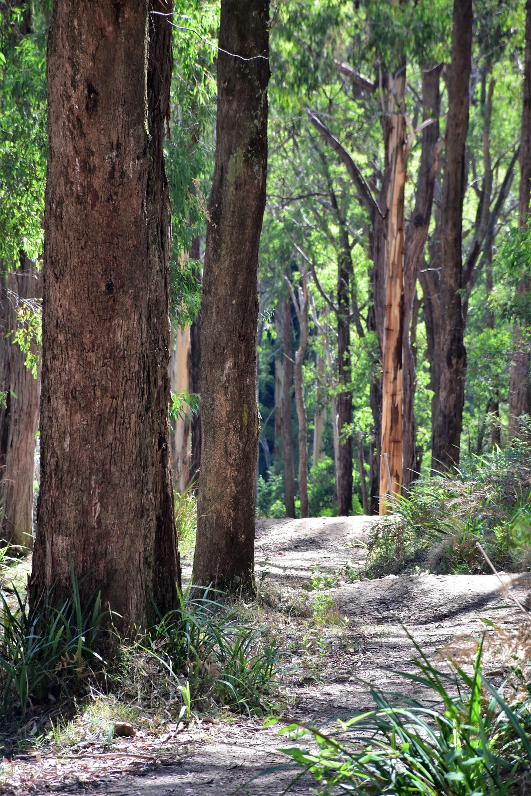
Dodds Track is a seriously steep little descent, the dry, loose surface making me pretty happy that I’d decided to bring my walking poles along this morning. Dropping down here the Mountain Ash forest once again became the predominant tree, always a good thing in my eyes, the huge trunks lit up by the dappled sunlight giving me all the excuses that I needed to stop and rest my knees. Dodds Track might be super steep but it’s also pretty short and after less than 20 minutes I emerged onto Doongalla Road, the walks lowest point.
 |
Nearing Basin Olinda Road the forest dries out a bit.
 |
The short section down Basin Olinda Road is probably the least inspiring section of the walk, it's over pretty quickly though.
 |
Dodds Track is steep and slippery little descent.
 |
| There was plenty to stop and photograph as I dropped down Dodds Track this morning. |
|
|
|
Heading up Doongalla Road I crossed the headwaters of Dandenong Creek on my way to the old Doongalla Homestead Site, many kilometres downstream this creek flows about 100 metres from my house as it makes it’s way into Port Phillip Bay. The old Doongalla Hut Site looks like it would make a very nice spot for a picnic, with plenty of well manicured lawns, colourful trees and plenty of picnic tables scattered around the grounds. While I didn’t partake in a picnic today I did take a bit of a break in the shade on what had now become a pretty warm day. Unusually the large sprawling grounds of the old homestead were virtually deserted today while a kilometre or so away up at Olinda it was wall to wall punters on this Easter Saturday, this magic spot appears to be truly off the radar.
 |
Climbing up Doongalla Road through the grounds of the old homestead.
 |
Apart from the steps there isn't a lot left of the old Doongalla Homestead.
 |
| The old Doongalla Homestead Site makes for a very nice spot for a break. |
|
|
Shouldering my pack I picked up Camelia Track and started the last leg of my journey back to the ute. Camelia Track and then a bit later, Fireline Track rise and fall along the western face of Mt Dnadenong, and I do mean rise and fall! There are a couple very steep little climbs and descents along here, although to be honest for the most part the going is pretty easy. With it well after midday I was now well and truly in the sun, the more open and dry Stringybark forest not giving my a lot of shade this afternoon.
 |
Leaving Doongalla Homestead Site, Camelia Track contours the western face of Mt Dandenong.
 |
I had a couple of electric mountain bikes fly past me along here. Here's a Feral prediction, if these bikes keep getting quicker and more efficient then eventually there is going to be some serious accidents, whether with walkers or just with the riders losing control and coming off. These two bikes were probably doing very close to 50 kilometres an hour up hill, while the riders sat on the seat barely peddling.
 |
| Fireline Track rises and falls a bit as it heads back towards Kalorama. |
|
|
Eventually I started to climb a little more than I was descending and the ridge line started to get a bit closer. After one final view across the flat eastern suburbs I started to shuffle past the occasional house on the outskirts of Kalorama. Meeting a bitumen road the walk was suddenly coming to an end, one minute I was shuffling along a dusty track the next minute the ute appeared parked next to the WW1 memorial where I’d set off from six hours ago. Pulling off my sweaty boots I jumped into the ute, setting off to battle the Easter holiday crowds that had flocked to the mountain, I was pretty happy that I didn’t have far to go to get home.
 |
The forest along Fireline Track is fairly dry.
 |
| Eventually Fireline Track starts climbing a bit more relentlessly, heading back up towards the ridge line at Kalorama. |
|
The Dirt.
According to my GPS I walked 18.1 kilometres and climbed 720 metres on this medium grade stroll. This is walk number 24 in Mr Chapmans Day Walks Victoria book, Chapman’s notes and map are all you really need to complete this walk. If you feel like a coffee or a bite to eat there is a cafe at the start/finish point and then there the cafe at the Mt Dandenong summit. If you feel like a picnic then the old Doongalla Homestead Site is a very nice spot. This is one of the best walks in the Dandenong Ranges National Park I think, but it is a solid day out. Early morning is probably the best time to head out on this one, especially if the day promises to be a warm one, I was well along Dandenong Creek Track by the time I felt the sun for any length of time today.
Relevant Post.
Dandenong Ranges Walk, Dandenong Ranges National Park, 2015.
Ferntree Gully Forest, Dandenong Ranges National Park, 2014.
Mt Evelyn Forest, Dandenong Ranges National Park, 2016.
 |
| I got one last view as I climbed into Kalorama. |
 |
| Climbing the last few metres up Old Mountain Road into Kalorama. |


No comments:
Post a Comment