 |
| The view down to Green Gully from Green Gully Lookout is pretty sweet. The rocky bluffs down in the gorge on the right of the photo are Green Gully Canyon, you'll see some more of them in my next post. |
After a very comfortable night at Birds Nest Hut I woke up to clear skies this morning. Thankfully I’d managed to dry off all my wet gear last night so I was able to pull on dry clothes this morning, there’s not much worse than pulling on cold, wet clothes in my experience. While the sky above was clear and blue it didn’t mean that it was warm, the temperature read out on my watch showing -2˚ which meant that I was wearing all those clothes that I’d dried the night before, and then some! Huddling over my porridge savouring the warmth more than the taste I had a fairly relaxed start to the day, basically waiting for the sun to reach far enough into this valley to hit the hut and warm it up a bit.
 |
It was pretty fresh this morning, not that it seemed to worry the local Wallabies.
 |
| The suns almost made it into the valley, time to head off. |
|
By 9am my little valley was almost in the sun and it was time to head off towards Green Gully Hut. According to my notes most people find today the hardest day of the Green Gully Walk and on paper it did look interesting, with a fair chunk off track and a few steep climbs and descents I was pretty happy to be walking in good weather. After shouldering my pack I walked around 50 metres before stopping to take some photos of the beautiful old stock yards, at this rate I wouldn’t be arriving at Green Gully Hut until midnight.
 |
I walked around 50 metres before stopping to check out the old stock yards.
|
Leaving the old stock yards the 4wd track climbed solidly for 10 minutes before arriving on the crest of a spur, with the 4wd track finishing here and this was the start of the first section of off piste walking on the Green Gully Walk. Over the years I’ve done a lot of off track walking so I wasn’t really that concerned about the navigation involved, but I was a little interested in how thick the scrub would be that I’d have to push through. Starting up the spur though it was very soon obvious that this was going to be very good walking, not only was the scrub thin and light but there was also a district pad to follow, maybe it wasn’t of a benched track standard but there was definitely a bushwalkers pad.
 |
Time to head up the spur.
 |
Hmmm, this sounds serious.
 |
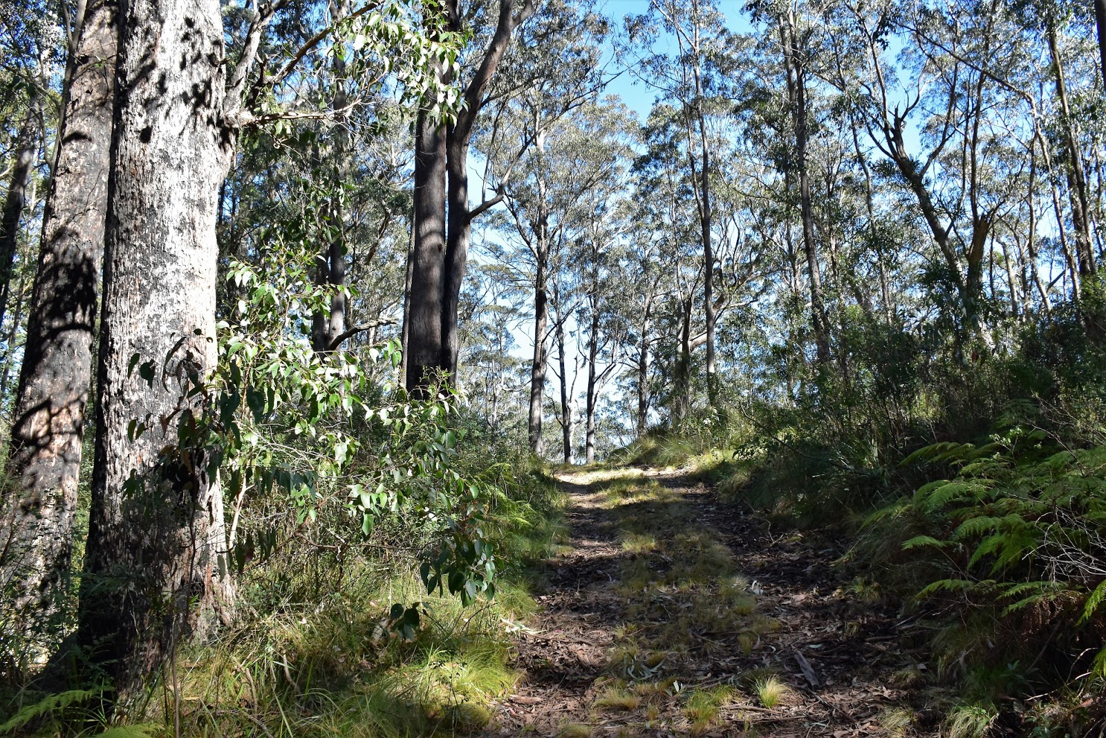
| The open scrub and bushwalking pad made life pretty easy up here. |
|
|
Initially the spur that I was climbing was fairly broad but after climbing for awhile the ridge got more acute. Normally a broad spur would make navigation a little harder but, apart from there being a pad there was also the occasional track marker, not to mention signposts where the spur changed direction, life was pretty sweet. Eventually, with the ridge getting fairly acute, I had to climb a little around a few small rocky outcrops before the spur started it’s final, fairly steep climb up to Birds Nest Trig. After passing through a small grove of she oaks draped in old mans beard, I arrived at the walks high point, Birds Nest Trig, at 1202 metres this is a reasonably high spot by Australian standards, but unfortunately there are no real views on offer.
 |
There was the occasional track marker around.
 |
.....as well as the occasional signpost....
 |
Higher up the spur gets a little more acute.
 |
| Old mans beard draping the she oaks. |
|
|
|
While the trig didn’t have any views it did make a good spot to stop for smoko. Sitting in the sun I pulled out the phone and got a few messages away, happy to let Sam know that all was well. After a bit of a break at the trig I picked up a 4wd track (the high point is also home to a small telecommunication facility so I’m guessing that the 4wd track is for maintenance workers). Heading down the 4wd track I avoided a couple of 4wd tracks heading off to the left, the walking was still on a long spur only now I was generally heading down, occasionally very steeply.
 |
Birds Nest Trig, no views here unfortunately.
 |
Leaving the trig I followed this 4wd track for a couple of hours.
 |
Sometimes the 4wd track dropped fairly steeply.
 |
| All throughout the 4 days of the Green Gully Walk there are reminders of the cattle history in the area. |
|
|
|
With my spur once again getting fairly acute I arrived at the signpost signalling that it was time to drop my pack and go and check out Green Gully Lookout. Thankfully the rocky knoll that is Green Gully Lookout is only 20 metres or so from the track so it wasn’t a big detour. Climbing onto the rocks here gave me a good look at the country that I’d be walking through tomorrow as Green Gully snaked through the rangers below me. My other memory of today was of the beautiful old Grass Trees and it was at Green Gully Lookout that the Grass Trees started to become prolific. Looking down into the gorge I could see the towering rocky bluffs of Green Gully Canyon below me, this would be the pinch point on tomorrows walk up Green Gully.
 |
Dropping my pack to climb onto the knoll which is Green Gully Lookout.
 |
Green Gully
 |
Grass Trees at Green Gully Lookout.
 |
| A little more 4wd track walking heading over to The Rocks Lookout. |
|
|
|
With lunch beckoning I returned to my pack and set off towards my next point of interest, The Rocks Lookout. The side trip out to The Rocks Lookout is a little longer than the one to Green Gully Lookout but it’s still not very far, I’m thinking it’s only a couple hundred metres from memory. The Rocks Lookout is another informal spot on top of a rocky knoll, unlike Green Gully Lookout this lookout is outboard of the main ridge line a little and I think it is the pick of the two spots. Sitting in the sun here, eating my salami and cheese wraps gazing across mountain rangers receding into the distance, life was pretty good.
 |
My lunch spot at The Rocks Lookout.
 |
Looking across Green Gully from The Rocks Lookout.
 |
 |
| Tomorrow's adventure is down there in Green Gully |
|
|
|
With lunch finished and photos taken it was time to start dropping down to Green Gully Hut. Once again the Green Gully Track left the 4wd tracks and headed off piste, this time down a spur. Once off the 4wd track the walking again improved immensely in my opinion, the fairly open vegetation on the spur that I was following allowed me nice views of the surrounding mountains and rocky bluffs. With a reasonable pad to follow down what is a fairly acute spur, navigation was again pretty easy, the main issue going down here was that loose gravel on the ground made the steep sections a little dodgy, nothing too serious but I still had to concentrate a little.
 |
There is a small patch of remnant dry rainforest near The Rocks Lookout, its worth dropping down to check it out and maybe see a Rock Wallaby.
 |
Dry Rainforest
 |
The start of the second section of off piste walking today.
 |
Dropping down the spur Grass Trees were again a feature.
 |
 |
| The open nature of the vegetation allowed for good views as I dropped down the spur. |
|
|
|
|
|
After dropping down a particularly steep pinch the spur eased off a bit, I was now getting close to disappearing into the shadows as the sun dropped behind the mountains that were now towering over me. It was mid afternoon when I did eventually bottom out on the bank of Brumby Creek and to be honest I was a little underwhelmed, sure the descent was over and my knees were happy but the beautiful scenery was also gone and was replaced with an overgrown 4wd track choked with weeds, blackberries and thistles aren’t a Feral favourite. I suppose the weeds are one of the negative legacies of the cattle heritage down here.
 |
 |
 |
The descent down the spur got pretty steep towards the bottom.
 |
| I've just dropped down here, this is the steepest bit on the spur. The gravel surface didn't offer a lot of grip. |
|
|
|
Making my way down Brumby Creek I soon got to Brumby Pass, this spot a a choke point where sheer cliffs close in on both sides. The old cattleman used this natural feature as a corral for their cattle and it’s quite a spectacular spot, passing through the gates that span the gap I stopped to check out the rocky bluffs towering above. Reputably it’s common to see Rock Wallabies resting in the crevices above from this spot, but unfortunately I didn’t manage to see any here today. Five minutes after passing through Brumby Pass I arrived at a large grassy opening on a terrace above the creek and dropped my pack for the last time today at Green Gully Hut. Green Gully Hut is about the same size as Birds Nest Hut and has more or less the same set up, except for one thing……it has a HOT SHOWER! Needless to say I enjoyed my afternoon and evening in this remote spot.
 |
I'm about to head into the shadows.
 |
Arriving down on Brumby Creek.
 |
 |
Brumby Pass
 |
| The afternoon sun reflecting in Brumby Creek looked pretty sweet I thought. |
|
|
|
|
The Dirt.
According to my GPS I walked 14.7 kilometres and climbed 536 metres on todays leg of the Green Gully Walk, while the parks people rate this as the hardest day of the track I’d only call it a medium grade days walking I think. So far on the Green Gully Walk I’ve walked 35 kilometres and climbed 1251 metres over the two days. There’s no water today until almost the end of the day when the track drops down to Brumby Creek, so all your water needs to be carried. About half of todays walk is classed as ‘off track’ however the off track stuff today is pretty good as far as that kind of thing goes, for the most part there is a fairly obvious pad to follow and there always seems to be a signpost or track marker about when you need one. The NSW Parks people have also put information at critical spots to help people stay on the right route.
Relevant Posts.
Green Gully Trail, Day 1, Oxley Wild Rivers National Park, 2018.
The Grand High Tops, Warrumbungle National Park, 1999.
The Pyramids Loop, Girraween National Park, 2017.
 |
And another wonderful days walking has come to it's end.
 |
Green Gully has a shower...
 |
| .....a HOT SHOWER :) |
|
|
 |
| This is the life! |


No comments:
Post a Comment