 |
| Lest we forget... |
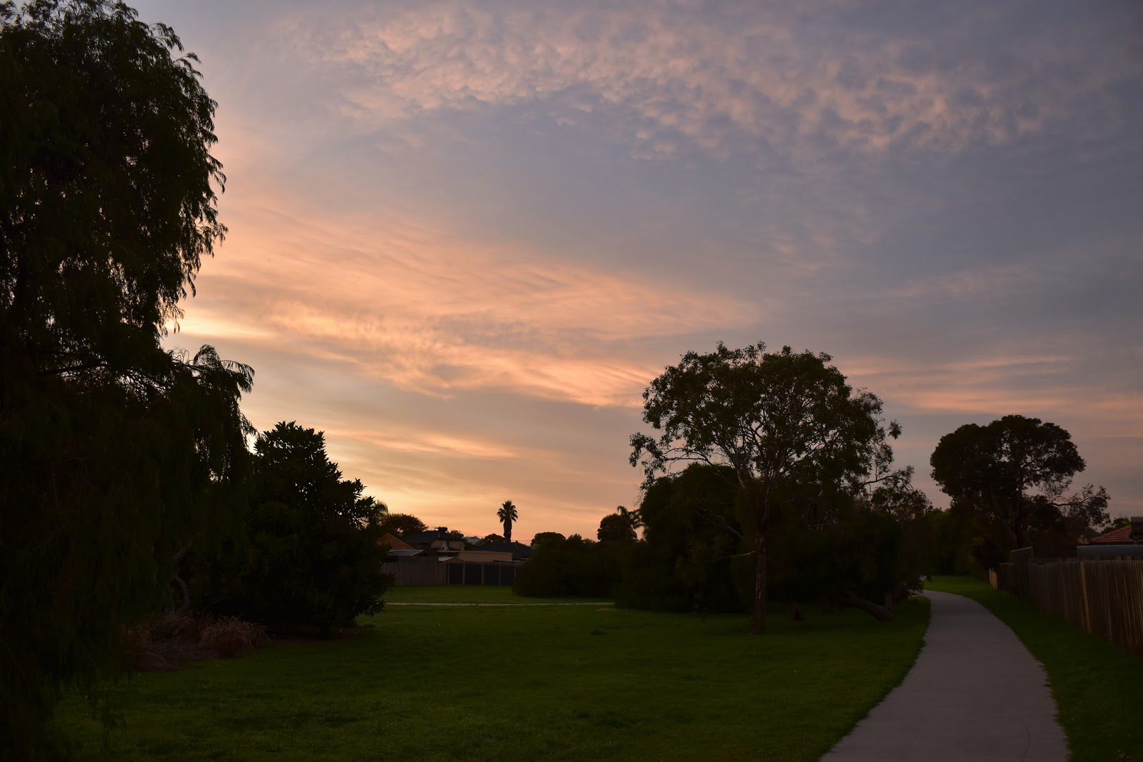
With this bloody virus still hanging around like the Don in the dressing rooms of a Miss Teenage USA pageant, I decided that it was time for another Corona Walk. I would have never thought that I’d ever look forward to jumping on my treadly at 4:30am every morning and heading off to work, however after spending a few days sitting on my ever expanding arse in front of the telly at home then all of a sudden work is suddenly looking a lot more appealing…yes, this can’t be good for my mental health!
 |
The Patterson River Mouth - there was just enough light to take photos when I set off this morning.
|
Now being a Corona Walk that means that I was looking for walk this morning that I wouldn’t need any transport to get too. Today was Anzac Day so my mind turned to doing walk that started and finished at our local War Memorial in Carrum. Our local War Memorial is at a spot called the Beauty Spot which looks down over the Patterson River as it enters Port Phillip Bay, and it is indeed a nice little park. So anyway that’s the long and boring preamble to how I found myself walking through the deserted and still dark streets of Patterson Lakes this morning with the haunting sounds of the Last Post floating on the breeze as people celebrated Anzac Day in their lounge rooms and driveways - fuck I hate this virus!
By the time I arrived down at the War Memorial this morning the eastern sky was starting to lighten up a bit so I was able to get a couple of photos, the Beauty Spot almost deserted now although talking to a couple of the locals they said a handful of people had made it down for an un-official Dawn Service. After re-setting the GPS I set off to see if I could make up a bit of circuit walk. To start with this morning I followed the Patterson River up stream for a few minutes, passing under the Nepean Highway bridge along the way. Being so early in the morning there weren’t a lot of other punters out and about so it wasn’t too hard to get some nice photos of the river bathed in the beautiful pre dawn light, while at the same time maintaining a safe social distance.
 |
Heading along the Patterson River first thing this morning.
 |
The Patterson River
|
|
Arriving at the Coast Guard building I left the river and headed along the deserted Launching Way. While this road was deserted this morning that was only really due to the Corona Virus, normally this road is a very busy little thoroughfare as it provides access to the busiest boat ramp on Port Phillip Bay. After crossing McLeod Road I followed a series of interlinked, mostly linear parks as I made my way south towards Kananook Creek. Shortly after crossing McLeods Road the sun also made its appearance, although unfortunately a fair cloud cover came with it. After passing through McDougall Reserve I arrived at the big Ray Dore Reserve.
 |
Launching Way was deserted this morning - it's not always so quiet though.
 |
 |
| Early morning in McDougall Reserve. |
|
|
Getting through the Ray Dore Reserve meant a bit of a dog leg around the new community centre (well it was new to me - I haven’t been down here for years). Once past the community centre I followed the oval around to cross a service road before picking up a drain easement that ran along the back fences of the local houses. Now that all sounds pretty ordinary however this linear park isn’t the worst spot I’ve ever walked, there are some nice trees along here and with the early morning sun now lighting them up it gave me something to stop and check out. After five minutes or so the parkland suddenly opened up and Kananook Creek was now in front of me.
 |
I tracked around the oval in Ray Dore Reserve.
 |
Suns up.
 |
Heading for Kananook Creek I followed this linear park.
 |
| This suburban park wasn't without it's attractions. |
|
|
|
Kananook Creek originally drained the extensive Carrum Carrum Swamp although the eco system was greatly changed when the Patterson River was cut through. From what I can tell the creek suffered ecologically for quite a few years before finally being rejuvenated when Dandenong Valley Waterways built a pumping station to supply fresh sea water to Patterson Lakes which then flowed out to Port Phillip Bay via Kananook Creek and thus flushed the creek out a bit. All that said there isn’t a lot of flow along Kananook Creek, I’m guessing a bit however I’d be surprised if there was any more than half a metre drop from where I was standing all the way to the creek outlet down in Frankston, seven kilometres away. After arriving at Kananook Creek this morning I ventured out onto the pedestrian bridge near Patterson River Secondary Collage to get a couple of photos of the rising sun before setting off west along Eel Race Road. Now according to my map there is an Eel Race Road on both sides of Kananook Creek so just to be clear I walked the concrete paved road on the north side of the creek.
 |
Kananook Creek
 |
Kananook Creek
 |
I walked Eel Race Road - the one on the north side of Kananook Creek.
 |
Banksia - the banks of Kananook Creek feature some remnant bushland.
 |
| After looking closely at this photo when I got home I noticed the fishing line tangled in the tree below the bird....fuck! |
|
|
|
|
Eel Race Road made for a very pleasant walk this morning, with the suburb still mostly asleep there wasn’t any traffic to worry about and the road allowed plenty of glimpses of the creek. When Valetta Street appeared on my right I turned left, crossed the bridge over Kananook Creek and then immediately picked up the Kananook Creek Walking Trail on my right. The next section of my stroll along the Kananook Creek Walking Trail was more like a traditional bushwalking track as the sandy track meandered along the dunes lining the creek. I was now heading south to the spot where my creek side track crossed the Frankston train line and then almost straight away crossed Kananook Creek again.
 |
 |
Kananook Creek
 |
Kananook Creek walking Trail.
 |
Kananook Creek Walking Trail is more your traditional type of bushwalking track.
 |
Kananook Creek Walking Trail.
 |
| I've just crossed Kananook Creek for the last time. |
|
|
|
|
|
After successfully by-passing the temptations of the Riviera Hotel, (yes, when I look at the Riviera Hotel my mind immediately transports me to the South of France…!) I weaved my way through the gaggle of lycra clad warriors out enjoying the almost deserted Nepean Highway and crossed over to the Seaford Foreshore Reserve. I had choices now, I could of trudged my way north along the beach all the way up to the Patterson River mouth however every man and his bedraggled pooch seem to be out exercising at the moment (remember, this walk was in the middle of our Corona Virus lock down) so I decided to follow the nice path though the foreshore vegetation up to Keast Park. This track, which incidentally runs all the way from Long Island down near Frankston up to Keast Park makes for surprisingly good walking. I say surprisingly as with Nepean Highway only a few metres away through the coastal scrub you wouldn’t normally think that the walking would be that enjoyable.
 |
I crossed the creek for the last time behind the Rivera Hotel. I'm guessing this colourful lock has something to do with flood mitigation?
 |
This was a particularly scenic part of the walk.
 |
Once safely across the Nepean Highway I picked up the foreshore walking track heading north.
 |
This is another section of the stroll along a more typical bushwalking track.
 |
| The walk along the foreshore is surprisingly good. |
|
|
|
|
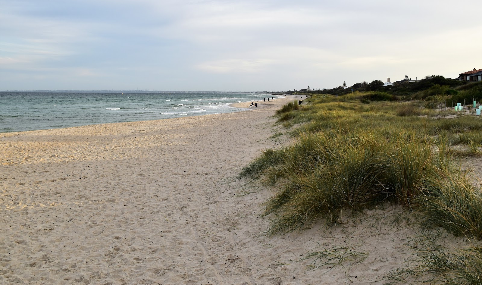
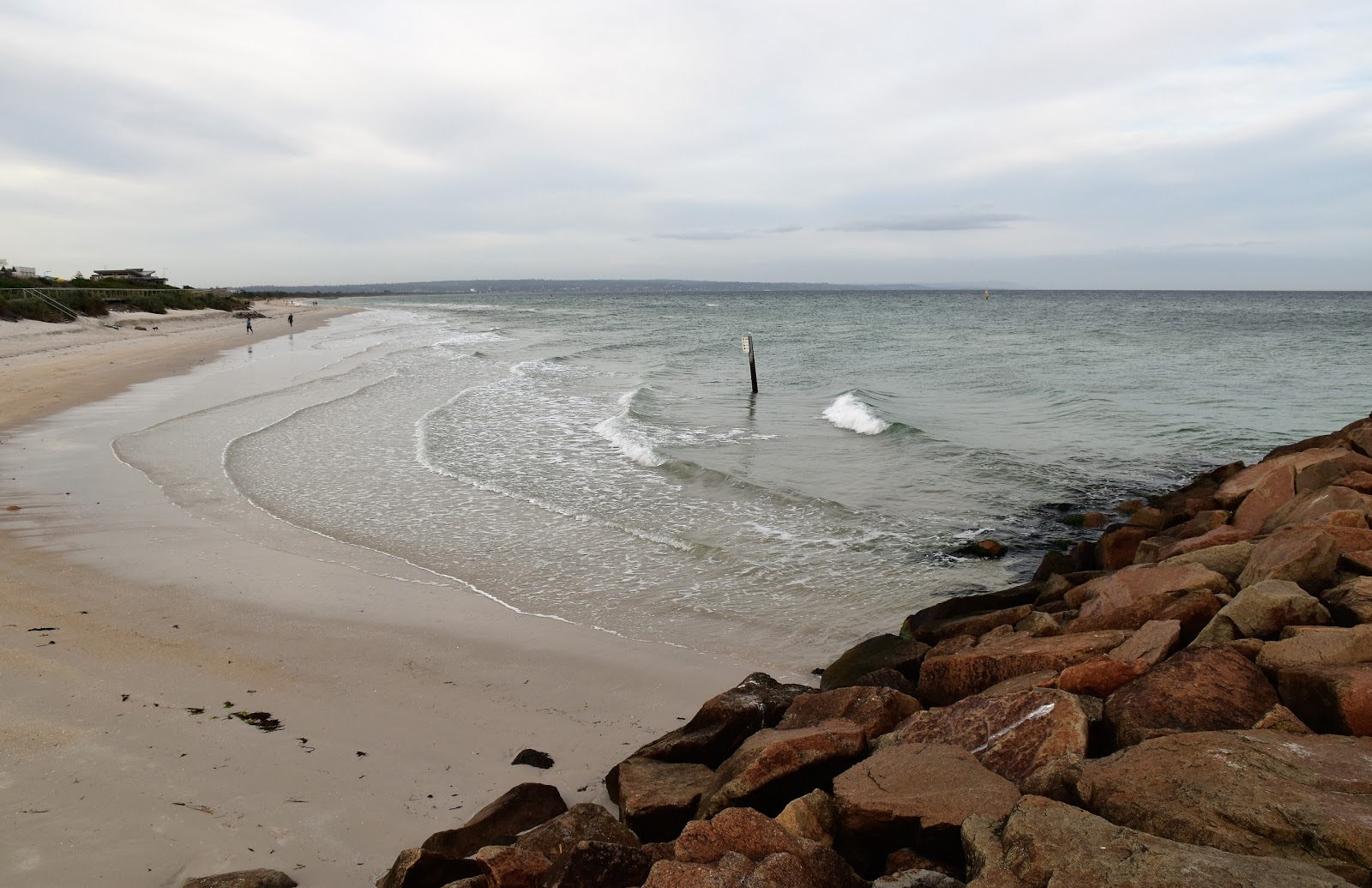
Arriving at Keast Park my choices were now limited to the beach or the footpath beside the Nepean Highway, yes I chose the beach. If anyone walks this route post Corona then there is a nice café here called Crackerjack that is worth a stop for coffee and cake I think. The café named after the movie of the same name and is next to the Carrum Bowling Club which just so happens to be the spot where some of the old movie was filmed. My walk was pretty well coming to it’s end now though, dropping onto the sand I turned north and set off towards the rock wall in the distance that marked the Patterson River mouth. Where as so far today I hadn’t encountered too many other people out and about the beach was fairly busy, even at this early hour (it was still only around 8am). Still I’ve got to say everybody was very respectful of everyone else's personal space and I never really felt like people were getting too close for comfort. With the tide being a fair way out it was pretty easy 15 minute walk up to the river mouth. Unfortunately the overcast skies weren’t helping my photos much now so you’ll have to take my word for it that I’m lucky to live in such a nice place I suppose.
 |
Crackerjack at Keast Reserve.
 |
It was time to hit the beach.
 |
Any navigational difficulties were now over.
 |
| There is a boardwalk for the high tide option along the last few metres of walk. |
|
|
|
The Dirt.
I walked 5.9 kilometres and climbed 42 metres on this easy stroll. As far as I know there are no published walking notes for this stroll. After checking out my Melway along with Google Maps before I left home I used my GPS maps on the stroll, my map might be the best option though. There is parking around Carrum and the train station is a couple of minutes walk from the Beauty Spot. Obviously if anyone is looking for a hardcore wilderness walk then this walk isn't for you, however if anyone lives local then it's worth checking out to stretch the legs a bit. Crackerjack would make a good spot for lunch I guess, there is also a choice of eateries at the start and end of the walk in Carrum too.
Relevant Posts.
Patterson River Walk, 2019.
Mornington to Frankston Walk, 2014.
 |
| Back at the Patterson River Mouth. |
 |
| Looking south towards Mt Eliza and the Mornington Peninsula - pity about the overcast sky. |
 |
| Back on the Patterson River - time to head home for some more quality iso time! |


No comments:
Post a Comment