
I'm thinking that this is a prawn trawler - although that could be a Feral fact!

I started this stroll at the ornate water fountain on the corner of Syme Street and Nelson Place.

Nelson Place, Williamstown.

Nelson Place, Williamstown.
Setting off from Gem Pier it wasn't the rain that I noticed first up this afternoon, nope it was the biting wind that had my attention now. I was now following the shoreline of Hobsons Bay north as I made my way to The Warmies and the wind blowing in off the water was cutting. The Warmies is the spot where the cooling water from the nearby gas power plant is pumped into the Yarra River and is a super popular spot with the local anglers and it marked the northernmost extremity of this stroll. Turning south I set off the explore a few of the groins and spits that jut out into the river here, these thin strips of land are almost like you are on a boat looking at the Westgate Bridge and the ships over at Webb Dock.

Commonwealth Reserve, Williamstown.

Hobsons Bay Yacht Club in the distance.

Looking across Hobsons Bay towards the Melbourne CBD.

I'm thinking that the local birdlife might be use to interacting with people.

I was following this shared path up towards the power station.

The wind was giving me a hard time this afternoon.

This was as far north that I got today.

Westgate Bridge was looking very close indeed.
After exploring the spits I set off back down the waterline towards Williamstown, where as on the walk up here I'd mostly walked the sealed shared path on my way back down to town I freelanced a bit staying closer to the water. Once I'd made it back into the main café strip I spent awhile checking out the various piers and wharfs and their collections of different boats, the prawn trawlers with their array of lighting and Sea Shepard's Steve Irwin drawing me in. It was while I was checking out the boats that I passed an old but fairly nondescript bluestone building on Ann Street, on closer inspection I found out that this old building was the home to Melbourne's first morgue, the old building being in use until 1915.

This bloke is obviously pretty keen on his fishing.

That's Webb Dock in the distance.

I dropped down this track to check out another spit.

This spit had some nice revegetated bush.

That's about as far as I'll be going without waders.

The eastern side of this spit had some nice Mangroves.

The Strand, Williamstown.

Dropping back down to the Hobsons Bay Yacht Club I walked the breakwater for awhile.

Hobsons Bay, Williamstown.

Hobsons Bay, Williamstown.
Moving on from the morgue before they called me in I shuffled my way further down Nelson Place, the deciduous trees adding a splash of colour as their leaves had started to change colour. After passing by the somewhat tacky RMS Titanic pub I was soon at the historic Point Gellibrand Timeball Tower, this black granite tower is where they use to drop timeballs to set the ships chronometers. The Point Gellibrand Timeball Tower is in the Point Gellibrand Coastal Park and this is where my walk left the shores of the more sheltered Hobsons Bay and I started walking the Port Phillip Bay coastline... just in time for that rain that I'd mentioned to arrive with vengeance.

The Strand, Williamstown.

The HMAS Castlemaine is docked at Gem Pier and functions as a Museum nowadays.

Continuing my way south through town I walked past the front door of my accommodation at Gem Pier.

Sea Shepard's Steve Irwin.

Melbourne's first morgue.

The season is changing.
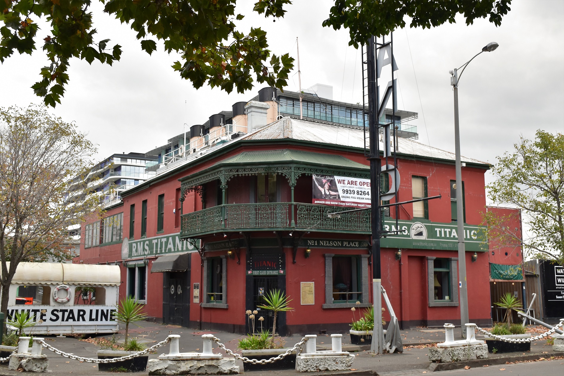
The RMS Titanic Pub - whatever floats your boat I suppose! (see what I did there?)

The historic Timeball Tower at Point Gellibrand Coastal Heritage Park.
To be honest the next coastal section of the walk was a bit of an ordeal as I wandered along in the wind and rain, initially I kept on walking hopping that the squall would quickly blow through however after a few minutes it became pretty obvious that the wind and rain was here for a little while. As I was now on the most exposed section of the walk any cover was a little hard to find here and I was suddenly a little envious of the people motoring passed along Battery Road in their nice dry cars. Eventually I spied a mobile phone tower built on top an old bluestone shed, it wasn't pretty however it did allow me a bit of shelter from the rain that was now coming in pretty well sideways.

Looking out over a fairly wild and woolly Port Phillip Bay while I sheltered beneath a mobile phone tower.

The conditions are picking up a bit - I can make out the building across the bay in St Kilda now.

Port Phillip Bay, Williamstown.
After sheltering behind the tower for 15 minutes while the worst of the squall blasted through I figured that I'd better shuffle off again. My strategy of waiting out the worst of the weather more or less paid off now and was able to continue my walk along the coast without getting too wet. It's not the rain that really worries me that much really it's more the fact that I worry about keeping my DLSR and other assorted electrical gadgets dry that concerns me the most. Instead of continuing on along the coast towards the Williamstown Beach I swung back along the shared path below Fort Gellibrand now towards the Williamstown Railway Station. My afternoons stroll was now coming to its end fairly quickly as I shuffled back towards Nelson Place along Ann Street, ironically enough I was now walking under a weak sun that came complete with a rainbow to cheer my somewhat melancholy mood up a bit. Arriving back at Nelson Place my afternoons walk was over, all that was left was to head back to our accommodation, have a shower and head out dinner... yes, this is the life!

Heading back into town I walked past this old quarry near Fort Gellibrand.

Fort Gellibrand.

Looking across the Point Gellibrand Coastal Heritage Park towards the Timeball Tower.
The Dirt.
According to my GPS I walked around 10.7 kilometres and climbed around 209 metres on this easy stroll. This walk would be suitable for most people although the sections up around The Warmies and down around the Point Gellibrand Coastal Heritage Park are fairly exposed, so if like me Melbourne throws up some wintery weather then be prepared. If anyone reading this waffle is looking for an easy walk in a fairly urban surroundings with a bit of history thrown in then this walk is one to consider. This walk is either along sealed and un-sealed shared paths and across some suburban parkland. Nelson Place has a good selection of cafés if anyone wanted to break the stroll up. On this walk I loosely (very loosely!) followed the notes and map out of Julie Mundy & Debra Heyes book Melbourne's Best River, Bay & Lakeside Walks and used my GPS topos.
Relevant Posts.

Heading back into town the conditions had changed again.

Ann Street, Williamstown.

By the time I arrived back on Nelson Place the afternoon was looking pretty good again.


No comments:
Post a Comment