Australia in Spring.
When I arrived at the car park today the cars were overflowing onto McClelland Drive.
The Langwarrin Flora & Fauna Reserve is a slice of native bush surrounded by Melbourne's ever sprawling south-eastern suburbs and is a little reminder to how this part of the state would of looked back in the day, as well as being a refuge for small populations of native animals. Apart from the natural aspects of the park there is also a fair bit of historical interest here as the park was used as a military training area between the 1880's and the 1970's. Now I've walked the interior of the park on my last couple of visits (where most of the military history is) however on this visit I decided to pretty well walk the perimeter of the park, so after locking the ute I re-set the GPS and set off north along the signposted McClelland Break.
Alright, I'm off then...
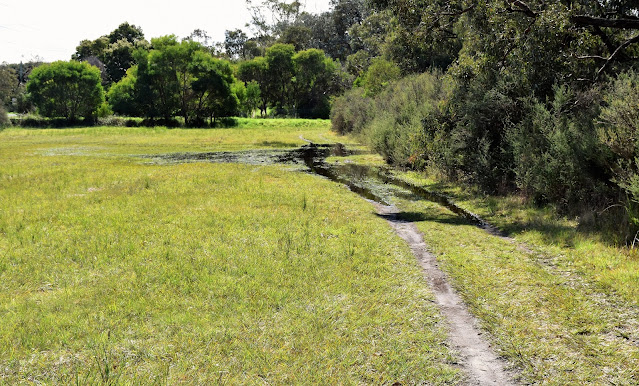
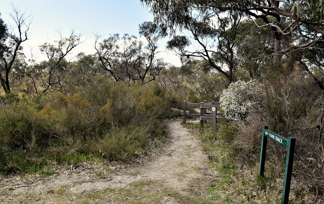
With this being a walk around the perimeter of the park for the most part I was ambling along wide firebreaks today and the McClelland Break was no exception in that regard. Thankfully the fairly grassy track was just far enough away from the nearby McClelland Drive that the sound from the busy road was somewhat muted, and apart from having to negotiate a section of flooding the walking was pretty nice. Reaching Telstra Track (at the fenced Telstra enclosure) I followed the now sandy track east for a few minutes before branching off onto Dunes Track at a corner. Dunes Track heads along a long vegetated dune and is covered in low heathland vegetation which meant that this was a good spot to get a few long range views over the surrounding area. Dunes Track would also be the only section of dedicated walking track that I shuffle along today.
Heading along the grassy McClelland Break.
Sections of the park can get a bit damp in late Winter - early Spring.
Dunes Track made for the best walking of the day.
Dunes Track passes through some nice heathland.
Dunes Track.
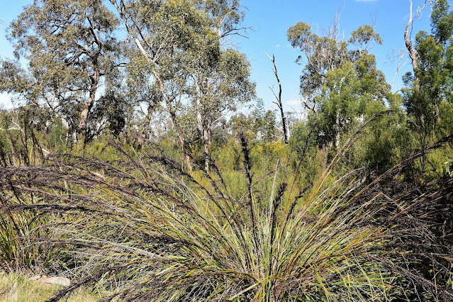
After a nice ten minutes or so on Dunes Track I emerged at the northern border of the park and turned right (east) onto SEC Break which runs beneath some huge high tension powerlines. I now followed the SEC Break all the way down to the eastern end of the park where I picked up Warrandyte Break which paralleled Warrandyte Road (are you sensing a theme here?). The one advantage with walking these firebreaks was that it allowed me to take my eyes off the path a little and spend a little more time checking out the bush, being early Spring the wattle was really adding a splash of colour to the normally drab green bush today.
SEC Break tracked along below the high tension lines.
SEC Track scenery.
Warrandyte Break made for some more relaxed walking as I made my way to the southern end of the park and picked up Robinson Break (which, you guessed it, runs parallel with Robinson Road). Robinson Break took my all the way back up to the top (the western end of the park is slightly higher than the eastern end) of the park. It was a fairly long walk along Robinson Break back up to McClelland Break (well, relatively speaking) so I enlivened the stroll a bit by walking a grassy easement for part of the journey. Once I met the McClelland Break again it was just a matter of walking the grassy track north back to the ute. Thankfully, despite the overflowing car park this little reserve is big enough to absorb most of the punters and I'd only bumped into a handful of other walkers on my stroll today.
Warrandyte Break.
Robinson Break.
Towards the top end of Robinson Break I walked the grassy swathe parallel to the track for awhile.
The Dirt.
According to my GPS I walked around 6.2 kilometres and climbed about 75 metres on this easy stroll. Now it is probably becoming fairly obvious that I'm struggling to write enthusiastically about these suburban strolls however it's all relevant really, I've been super spoilt to visit some amazing places over the years so I'm still trying to get my head around being locked in the suburbs... that said, these small walks have been a mental health blessing over the last 18 months, without being able to access (even a small patch) of native bush I'm really not sure how I would made it through. I think the trick is with these small suburban parks is to look for the details, the colours, the macro sights and smells that can substitute a little for the lack of grand vistas and wilderness that I'd normally gravitate towards. Having walked here a fair bit over the years I didn't really use a map for this stroll, just using my GPS map on the stroll - that said Parks Vic have a free map online if anyone wants to check it out, and Google Maps is also pretty accurate when it come to the park. The numerous tracks criss crossing the park are generally well signposted.
Relevant Posts.


No comments:
Post a Comment