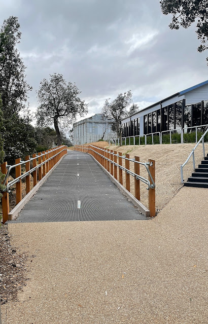
The new shared path heading through Seaford - I'm not sure if this path has been named yet?
These Coffee Vans have been doing a roaring trade over our lockdowns.
I started my ride on the north side of the Gladesville Boulevard Bridge.
My little excursion started a few minutes from home at the spot where the Peninsula Link Trail branches off from the Dandenong Creek Trail at the Patterson River Bridge on Gladesville Boulevard. After successfully resisting the Covid Coffee Van that now works out of the carpark beside the bridge I crossed the river dropped down to pass under Gladesville Boulevard and immediately headed off south along the concrete Peninsula Link Shared Path. Now this post is going to be as boring as bat shit if I go into every left/right turn so I'll give that a miss, if just for my own sanity. I now followed followed a fairly convoluted (although well signposted) route as I made my way through the wilds of Patterson Lakes and across the savannah like Seaford Wetlands - hey, I've been locked down for a couple of years so allow me some poetic license! Leaving Seaford Wetlands I faithfully followed my concrete path to cross over the Frankston Freeway and soon after Peninsula Link Freeway to enter the Pines Flora & Fauna Reserve - a small parcel of native bush that has really been my go to mental health spot over the last two years of lockdowns.
The Peninsula Link Trail meandering its way through Seaford Wetlands.
Crossing the Frankston Freeway.
Between the freeways the I passed through a light industrial area in Seaford.
After crossing Peninsula Link the path headed into the Pines Flora & Fauna Reserve.
The Pines Flora & Fauna Reserve.
The Pines Flora & Fauna Reserve.
The Peninsula Link Shared Trail now made it's way back to the freeway and I started a fairly long, but also fairly gentle climb up to Frankston - Cranbourne Road. This section of the ride stays fairly close to the freeway for most of the distance which makes navigation fairly easy, although the occasional road crossings can require a bit of attention as the trail sometimes randomly criss crosses the freeway at these spots. It wasn't navigation that I was thinking about now though, nope the weather was taking a turn for the worse unfortunately with a very cold wind and some fairly persistent showers blowing in off Port Phillip Bay, hmm. Crossing over the Frankston - Cranbourne Road I stopped and pulled on my rain jacket under some pine trees while I consulted my maps. With the cold rain coming down I decided to abandon a plan to head all the way down to Baxter and instead I dropped down the Baxter Trail and followed the railway line all the way down to Frankston - the gentle decent down to Frankston was a highlight of the ride really, although I had to be a little careful barrelling down the wet track.
The rain got a little more insistent after I crossed over the Frankston - Cranbourne Road.
Time to pull on some wet weather gear I think.
I dropped down the Baxter Trail into Frankston.
The decent down Baxter Trail was quick... and a little slippery.
I'm about to emerge on to the streets of Frankston.
My long downhill run came to an end fairly suddenly when the Baxter Trail emerged onto Playne Street in Frankston. The trail finished here and I was now going to be freelancing a little as I made my way up the bay back home. There has been a lot of civil engineering going on along the Frankston railway line that I knew had included some new bike paths, what I didn't know was exactly where the path started, or if the path ran all the way up to Carrum. After consulting Google Earth before leaving home I'd thought that I could pick up a trail starting a couple of kilometres north of Frankston on Dandenong Road East, so that's where I was heading now as I splashed my way through the wet backstreets of Frankston. With the train line to guide me there was no chance of going to far wrong here, and arriving at the spot that I'd noticed on the satellite photos I did indeed find a shiny new concrete path.
The start of the new trail is beside Dandenong Road East and is a fairly low key affair.
Passing by the Kananook Station - it was around now that I started to suspect that this new trail would take me all the way up to the Patterson River.
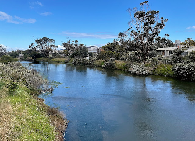
The next question that I had to resolve was how far did this path go. Leaving aside the fact that the path started in a very nondescript area of Frankston with nothing in the way of signage to signal it's existence (that I noticed anyway), the remainder of this path turned out to be well signposted with a street sign style of signage. Thankfully the rain had pretty well stopped by now so all I was contending with was the biting south westerly wind howling in off Port Phillip Bay as I weaved my way up towards Carrum beside the railway line, well the wind and also the fact that I hadn't done a ride of this length for the last couple of years of our lockdown life here in Melbourne so my bum was starting to feel it a bit! It turned out that the new concrete path (I'm not sure if it has a name) ran all the way up to Carrum (and beyond), the crossings of Kananook Creek and then the Patterson River being the scenic highlights. The Patterson River was my jumping off point though, so after crossing the river I picked up another shared path that headed up river along the north bank and rode the last three kilometres of my mini adventure enjoying not only the river views but also the views of the distant Dandenong Ranges.
There has been some serious money spent on this new path.
The new trail crossing Kananook Creek.
After crossing the Patterson River I left the new path and followed the river side path back to complete the circuit.
The Dirt.
According to my GPS I rode around 31.7 kilometres and climbed about 183 metres on what I'd consider an easy bike ride. The trails that I rode today were all sealed except for the last three kilometres along the Patterson River so the ride is pretty well suitable for any type of bike. The Peninsula Link Trail, Baxter Trail and Patterson River Trail are well mapped and signposted although the new trail alongside the Frankston Railway Line isn't as commonly mapped (yet) - although once I found the start of it in Frankston I found it well signposted. To be honest I didn't really need a map on this ride as I've ridden most of these trails numerous times over the years, although I did have my GPS topos and my phone maps if I needed them - and I did do a little research on the new trail before leaving home.
Relevant Posts.


No comments:
Post a Comment