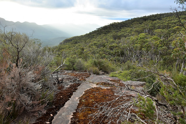
Dropping down towards Middle Gap along the GPT late in the afternoon.
I parked at the intersection of the Mt William Road and the Grampians Tourist Road.
If you want to re-live the horror of an old walk I did along Bovine Creek check out the Relevant Posts link at the bottom of the page.
That is a bloody big deer / moose!
Borough Huts Camp.
I was fairly happy to be off the road and onto a walking track.
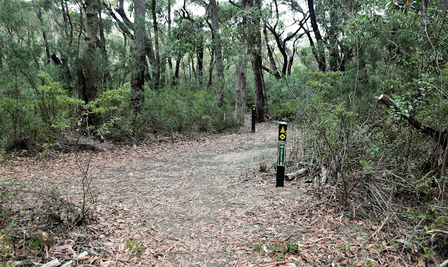
The GPT started off fairly gently.
Climbing towards the Barri Yalug Camp I started to get some views north towards Lake Bellfield.
The Wonderland Range was still in cloud.
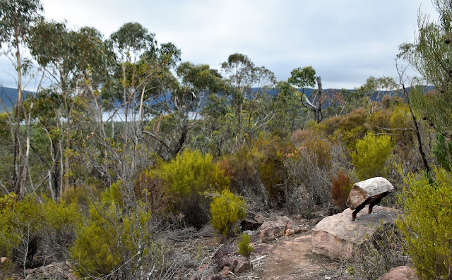
Camp furniture with a view.
There are both wooden platforms and crushed granite tent pads here.
Yes, I was starting to think that I'd be in for a long day.
The GPT crossing Barney Creek.
There was good water in Barney Creek...
... and a serviced tank a few minutes later at Redman Track.
This is where I did my calf muscle...FFS!
This section of the GPT stays close to an historic water flume left over from old gold mining times.
Even beneath overcast skies the scenery was pretty sweet.
After grabbing my pack I once again resumed my climb up the Seven Dials. The GPT was pretty easy along here however after attaining the crest of the Seven Dials and starting to traverse some of the peaks things got fairly rough indeed as the pad followed a fairly torturous route along the tops. While the walking had now got fairly slow and sometimes technical, the views were making up for the hardship. As I progressed south along the Seven Dials the low cloud that had been blanketing the higher mountains around me started to lift so by the time I'd made it to my descent gully off the Seven Dials the Grampians Peaks were all on full display - my eyes being drawn to my days next objective, Redman Bluff on the serrated ridge line of the Mt William Range on the other side of a deep valley.
Looking north towards Halls Gap as I climbed the Seven Dials.
Lake Bellfield.
The Wonderland Range.
The higher peaks of the Seven Dials were almost clear now.
The GPT on the Seven Dials.
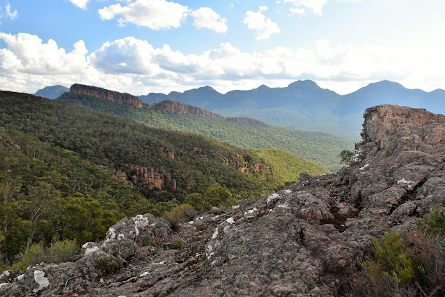
Mt William Range from the Seven Dials.
GPT on the Seven Dials.
Seven Dials.
Still no love over towards the Mt William Range.
The GPT is surprisingly slow going in spots.
In between the peaks on the Seven Dials the GPT passed through these nice saddles.
The GPT track on the Seven Dials.
The Seven Dials.
The GPT.
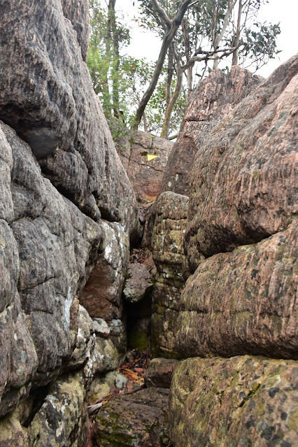
The photo doesn't do this slot justice - I had to squeeze my ample arse through this slot which must of only been 40cm wide.
The Seven Dials.
Things are starting to look a little more promising as far as the weather goes.
The GPT drops off the Seven Dials in another pretty saddle.
After crossing over Seven Dials Track...
... I started the next big climb up to Redman Bluff.
Looking back towards the ridge line of the Seven Dials - it all looks pretty easy from here!
The climb of Redman Bluff is another great rock slab walk.
Lake Bellfield is looking a long way away now.
Looking across the plains towards Ararat.
There is an old cairn line hiding in the scrub on the climb up to Redman Bluff.
The GPT approaching Redman Bluff.
Redman Bluff.
Looking south along the Serra Range from Redman Bluff.
And here's one to prove that I made it.
The GPT drops down the escarpment to Middle Gap.
I still had to climb about 80% of the way up that yet!
Even the Seven Dials were looking a long way away now.
I'd heard about this mythical tarn up here - I guess I'll have to come back in winter to see it with water in it!
Nice walking down the GPT towards Middle Gap.
The Mt William Road at Middle Gap.
Yep, it was time to start climbing again.
There is another serviced water tank beside the Mt William Road at Middle Gap.
Climbing up the GPT towards Duwul Camp in the late afternoon.
After a late afternoon smoko at Duwul Camp I grabbed my pack and set off on the last bit of the climb up to meet the Mt William Road again at the Mt William Carpark. By the time I arrived at the Mt William Carpark it was after 5pm and it was pretty obvious that I'd be doing some walking in the dark tonight. I was pretty keen to get most of the way down off the mountain along the Sheep Hills Track before I lost the light tonight so I didn't muck around at the car park - setting off down the Mt William Road to where the track plunged off the side of the road... except it didn't! Yep, it appears in the 15 or so years since my last visit Parks Vic have re-routed the Sheep Hills Track and it now appears to start up at the Mt William Carpark... fuck. While there was no track dropping off the road I could actually see my intended track around twenty metres below me in a gully so after finding a slightly less scrubby and steep section I dropped down the days only off piste section and after a couple of minutes of rough walking I was on the Sheep Hills Track.
Duwul Camp.
Duwul Camp.
Duwul Camp.
The days climbing was finished when I arrived at the Mt William Carpark.
Don't walk down here looking for the start of the Sheephills Track... it starts at the carpark now.
After a short off piste descent...
...I was on Sheep Hills Track and all was good.
Dropping down Sheep Hills Track in the late afternoon.
Sheep Hills Track.
The scenery was slowing me down a lot now.
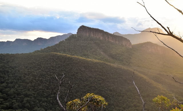
Cathedral Rock.
Sheep Hills Track.
The Cathedral.
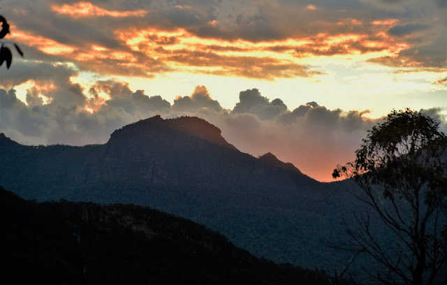
The days last sun going down behind the Serra Range.
It was pretty well dark now.
I had around 5 kilometres to go by the time I started walking by head torch and to be honest it was a nice walk, the forest feeling a little more alive as the sun disappeared. After another couple of kilometres along the Sheep Hills Track I crossed the bridge over Fyans Creek and climbed up onto the Grampians Tourist Road. Thankfully most of the tourists were safely tucked in their accommodation by now so I only had around three vehicles go past me in the dark on my road bash. After an uneventful road walk I arrived back at the ute at around 7:30pm tonight after 11 hours of walking, yes it had been a big day out - luckily I only had a 4 hour drive home now!
I'm going for Sheep Hills Creek for this one although that's a Feral fact.
Night hiking the last couple of kilometres along the Sheep Hills Track.
Fyans Creek is bridged.
Fyans Creek.
The Dirt.
According to my GPS I walked around 28.8 kilometres and climbed about 1334 metres on what I'd call a hard days walking. While I came in around 20% below the times that Parks Vic state the walking was still slow and rough - particularly the traverse along the ridge line of the Seven Dials. While the rough walking did slow me down the scenery was slowing me down more, the GPT traverses some stunningly rugged topography along here. The icing on the cake today was my late afternoon / early evening descent down the Sheep Hills Track, the views along here at sunset being at least the equal to the stunning GPT vistas earlier in the day. This walk would be easily shortened with two vehicles as there are numerous spots to access the tracks, a bike would be another option if you have no friends like me. I used the Spatial Vision Southern Grampians topo along with a map I created on Alltrails and my GPS topos today. Now I've already eluded to it, however don't under estimate this walk if you do it as a day walk - it's a long, slow and hard walk and while I'm old and fat I don't really piss fart around that much - so take a head torch with you and enjoy a stunning day out.
Relevant Posts.
The Seven Dials Circuit, 2015.
The day finished off with another road walk along the Grampians Tourist Road...
... and a 4 hour drive home.
Alltrails came inn slightly below my Garmin - which is pretty normal.














Hi Kevin . You R an animal . This is a Monster walk but as u said v scenic. I remember your trip report of descending Bovine Creek . I’ve looked at it from the end of 7 Dials and there was only bush! Yeh. The bike thingy, lve thought of that as an option but haven’t tried that yet. Great stuff.
ReplyDeleteHi again . I see it says anonymous. But it me , Hans
ReplyDelete