High up on the steep slopes of Walsh's Pyramid.
I was on my way by around 7am this morning.
Walking to the trail head - this was pretty well the only flat walking until I got to the summit.
Parking the ute in the well signposted carpark off Moss Road I was away pretty early this morning, keen to get at least some of the climb done before the day heated up too much. The initial section of the climb is just to the west of the main spur so my cunning early start plan paid off a bit as I walked in shade for awhile. There is no easy introduction on this stroll, pretty much from the get-go I was into it and climbing solidly. After what seemed like a massive climb I arrived at the 1 kilometres sign - fuck, this was going to be a decent workout!
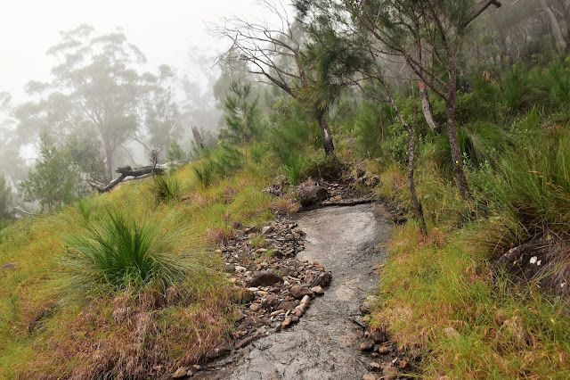
The track is generally well defined and way marked - albeit, rough and steep.
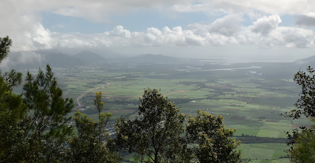
Looking back down to the Sugar Cane fields as I climbed.
It was around now that I realized that I was in for a long and hard day!
Walsh's Pyramid climb.
I did have a stroke of good fortune this morning as I was slogging my way uphill, the clouds would occasionally float through and envelope me in a cool mist - it didn't do much for the views but was a welcome relief from the sun. By the time I got to the halfway point my clothes were ringing wet with sweat (really wringing wet - it was like I'd been swimming in them!). By this stage of the climb I was just walking ticking off the contours on my map, anytime that I got anything resembling a view I'd stop for awhile.
Looking back down towards Gordonvale on one of my may stops.
I'm guessing this is a left over from the fun (?) run that they run up here each year?
The wet slabs needed a bit of care.
The occasional cloud floating through was helping take the edge off the heat a bit.
If anything the second half of the climb is steeper than the first half.
The scenery only ramped up the higher I climbed.
While the climb is steep it is also fairly straightforward as the track is mostly clear, track marked and signposted. The only thing that I had to be a little careful of were the wet rock slabs that I had to climb (there had been a lot of un seasonal rain up here over the last week). The slabs were all easy enough to negotiate however it paid to be careful. Eventually I ran out of contours on my map to tick off and the track levelled off as I walked the last 50 metres across the summit to find some shady Casuarinas to sit under while I took in the views.
More wet slabs.
Pushing through the Banksias near the summit.
Walsh's Pyramid, Wooroonooran National Park.
The views from Walsh's Pyramid into the wilds of Wooroonooran National Park are stunning.
The views from the summit of Walsh's Pyramid are pretty well 360˚ although you'll have to move around a bit to see through the trees. Last time I was up here it had recently been burnt and there was no real vegetation in the way, however there was no real sun protection either (I actually met the ranger as I was heading down, he was up the mountain checking out fuel loads as they are about to start burning again). It had taken me three hours to haul my fat arse up here this morning which I didn't think was too bad (250 - 300 vertical metres an hour is a rough calculation that I use normally on walks). After spending half an hour on the summit I retraced my route back down the mountain, the descent still taking me over two hours.
The view this morning out towards the Coral Sea.
I was engulfed in cloud for awhile on the summit.
The view up to Cairns from the summit.
Starting my descent back to the ute.
I dropped in to check out this nice informal lookout a few minutes down from the summit.
I was hurting a bit by now!
The Dirt.
According to my GPS I walked around 7.3 kilometres and climbed around 852 metres on this hard walk. Interestingly the Alltrails trace had a fair bit less distance but more climbing - once again I think the Alltrails App (on my phone) was more accurate than my GPS. This walk is steep and it also requires some easy scrambling in a couple of spots so keep that in mind. I carried about 3.5 litres of water and finished with less than half a litre this morning. This walk has been written up by numerous walking guide book authors over the years. I used my Alltrails Map and my GPS topos this morning.
Relevant Posts.
The good thing about the descent was that I was facing out towards the view.
Descending Walsh's Pyramid.
The descent was still fairly slow.
Now this was a welcome site!


No comments:
Post a Comment