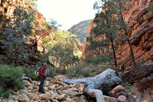
Jo is just cruising... on the climb up to Steadman Ridge (in the back ground).
We enjoyed a fairly cold night down on Balcanoona Creek.
Heading for the sunlight as we made our way along the creek.
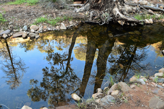
Balcanoona Creek.
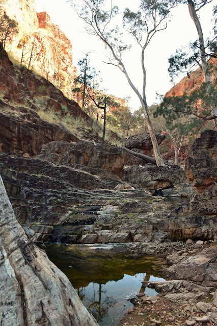
Balcanoona Creek.
We'd be climbing into those hills later today.
Balcanoona Creek.
Things are starting to get a bit rougher now.
Balcanoona Creek.
I was already little concerned with the amount of water around as last time I'd tried to climb into Bunyip Chasm a damp waterfall had stopped any further forward progress. So when we arrived at the entrance to the chasm I wasn't overly surprised to not only see a deep pool of water but also to see water tricking down the rock faces... hmm. We were still pretty keen to see how far up the chasm we could go though, so with a little trepidation and after grabbing the bare essentials (camera and Inreach) we headed up to the first waterfall.
Balcanoona Creek.
Balcanoona Creek.
I was wet from my balls down.... I'd call that a partial success!
Jo negotiated the floating log with more aplomb than a Canadian Lumberjack...
... the transition from the balance beam to the rock climbing wall still needs a bit of work though!
I now slowly and carefully rock hopped my way further into the chasm. After around 50 metres I got to another waterfall similar to the first, although being wet to my waist already I just waded in this time and once again I had a dead tree wedged into the rocks to help me climb the sheer wall. Once over the second waterfall I climbed up to a large amphitheatre, with cliffs towering all around me this is where forward progress ceased today - coincidently at exactly the same spot that stopped me ten years ago. Whereas last time it was light rain that stopped me, today it was the fact that the next big (maybe 10 metre) waterfall was actually flowing and there was no way I was going to climb the wet sloping rock. So with anymore forward progress up Bunyip Chasm once again stymied I slowly waded and rock hoped my way back down the chasm to re-join Jo at the entrance.
I was on my own for awhile now.
Seeing that I was already wet I just waded into this one.
Heading up Bunyip Chasm towards the amphitheatre.
Once again I had to turned back at this amphitheatre.
This waterfall has pushed me back twice now.
Dropping back down through Bunyip Chasm... if you squint you may see Jo at the end of the chasm which kind of puts the size of the walls into perspective.
While Jo was drying her clothes I headed a little further up Balcanoona Creek to check out a potential exit point.
This is Chapmans described exit point.
Basically the go here is to climb a very steep chute and then cross ledges to pass above the waterfall - it is do-able however we decided to try a gully almost opposite Bunyip Chasm in the end.
After dropping back down to the entrance of Bunyip Chasm I ran through the pros and cons of both routes with Jo and we decided to give the gully a go. While the gully was super steep there was only around 3 small sections that required a bit of committed scrambling, although we still had to be careful that as we climbed that we didn't dislodge any of the loose rock. The biggest issue was that we were lugging around 5 litres of water up for our Mt John Roberts Camp. Once we'd climbed out of the gully the walking was just a very steep slog up the spinifex covered slopes.
This was the top of our climbing gully - I had my hands full on the climb so no photos of that bit, although looking at the photo it all looks pretty easy!
Looking back down towards Bunyip Chasm from the top of our climbing gully.
After around 30 minutes of super steep climbing the gradient eased off a bit and the walking was pretty good, while at the same time the scenery was getting better and better as we climbed with Bunyip Chasm now a small slot in the cliffs below us. After arcing around some sheer cliffs, with Jo doing it fairly easily and me not so much as I battled cramps in my groin, we arrived onto the crest of Steadman Ridge and pretty well all the climbing was done. Once on Steadman Ridge we easily made our way south along the gently undulating ridge, and after managing to avoid the worst of the scrub we arrived on the summit of Mt John Roberts a little over an hour before sunset.
Jo was getting to know the Spinifex... at least Bunyip Chasm was receding into the distance a bit.
Balcanoona Creek flows through the gorge which we've just scrambled out of.
It was around now that my lack of fitness started to show!
Jo, on the other hand was scampering up like a mountain goat!
The camping on Mt John Roberts could be best described as rough, there are a few semi cleared spots scattered around however both Jo and I were sleeping on pretty uneven sites. I grabbed the spot that I camped in ten years ago beneath a native pine, although unfortunately a fire has gone through since my last visit and I was now sleeping next to a skeleton of a tree. It's not about perfect pitches up here though, nope it's all about the views. Jo and I enjoyed our hot chocolate as the sun slipped below the mountains and the full moon started to light up Lake Frome and the northern Flinders Ranges.
We arrived on the summit of Mt John Roberts with about an hours sun left - with time to get a bit of gear dry after last nights fairly heavy dew.
I camped in this exact spot around ten years ago - a bushfire has obviously been through since my last visit.
It's all about the views from this camp really.
Mt John Roberts.
The summit is fairly flat although the camping is limited by the rough ground.
Looking down towards Red Hill (middle left) and Wortupa Pound from the summit.
The Dirt.
We walked around 6 kilometres and climbed about 500 metres on what I'd call a hard day's walking. I've calculated these figures off my map as both my GPS and Alltrails either dropped out... or I didn't use them (Bunyip Chasm). Now these stats are fairly misleading I reckon, the walk into Bunyip Chasm is as dicey as most walkers will ever contemplate doing I think - it's pushed me back twice now and I'm not a novice scrambler. The climb out of the Balcanoona Creek Gorge is also a bit of a ball tearer. Having done both the Chapman recommended waterfall route and Adrian Heards gully route I think that the gully route is slightly easier - if only because the scrambling is less exposed. Water was available frequently down in the gorge however everything for camp had to be lugged up. We used notes and maps out of both Chapmans Bushwalking in Australia book as well as Adrian Heard's A Walking Guide to the Northern Flinders Ranges. We also used our GPS topos, an Alltrails map that I knocked up and the third edition of the Illinawortina 1:50,000 topo.
Relevant Posts.
These shots always look more impressive on my phone than they come out in reality!
Jo got a great pitch on the Dan Durstan... my Duplex set up was a little more ragged...as usual!
Last time I was up here I was in the tent sheltering from the rain - tonight was a welcome change.
Sunset from Mt John Roberts... lets see what tomorrow will bring?


I’m really interested in chatting more on this! If you have gps or waypoints a bonus. Jules
ReplyDelete