
Nice walking on the Green Track at Mt Whitfield.

Sam dropped me off in the sunshine today.

The Mt Whitfield Conservation Park has a good network of tracks.

After leaving the carpark I climbed an old, closed road up onto a ridgeline.

Looking back towards the Cairns CBD from the ridge.
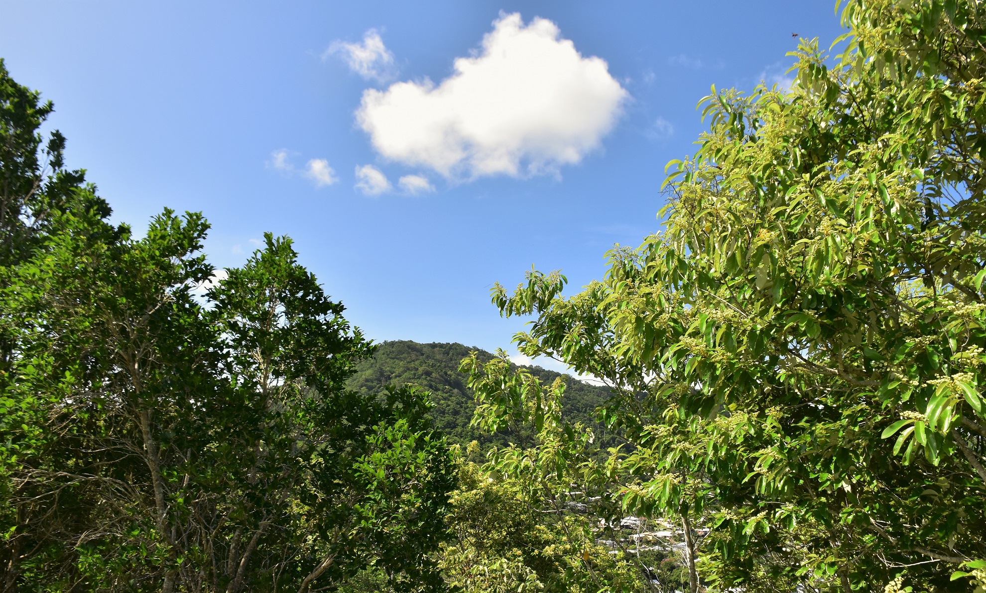
I even got a glimpse of Mt Whitfield through the trees.
So setting off to climb onto the ridge I was soon ringing wet with sweat instead of rain today - at least the photos look better under the blue sky. Initially the Green Arrow Track climbed up an old closed road onto a ridge top (where there are some decent views down towards the Cairns CBD) before entering the Mt Whitfield Conservation Park and being engulfed by the rainforest. The walking track now climbed a long undulating spur all the way to the top of Mt Whitfield. The Green Track is a wonderful walking track, the track builders have created a well graded benched flowing walking track and they need to be commended. After switching from side to side of the sometimes very acute spur I arrived on top of Mt Whitfield after around an hour of great walking.

The Green Track climbs what is sometimes a very acute spur.

Climbing up the Green Track.

This was the best I could do with this bloke unfortunately.

Green Track.

There were a few glimpses west across the bigger mountains of the Kennedy Range.

The old communications tower on Mt Whitfield is quickly being claimed by nature.
At around 350 metres high Mt Whitfield is a fairly substantial hill although there are no views from up here - well unless you count the rainforest as a view. A few minutes after passing across the summit of Mt Whitfield I arrived at the Blue Arrow Track and with the majority of the days climbing now over it was time for afternoon smoko. Suitably fortified after a bit of a break I set off down the southern branch of the Blue Arrow Track and once again I was mostly following the crest of a ridge. A glance at the topo map would have people thinking that the views must be pretty good along here, although at best there were only glimpses through the rainforest canopy - until I got to the lookout (near the start of the Yellow Arrow Track), this lookout gave me a grandstand view down over the Cairns Airport and out over the Coral Sea.
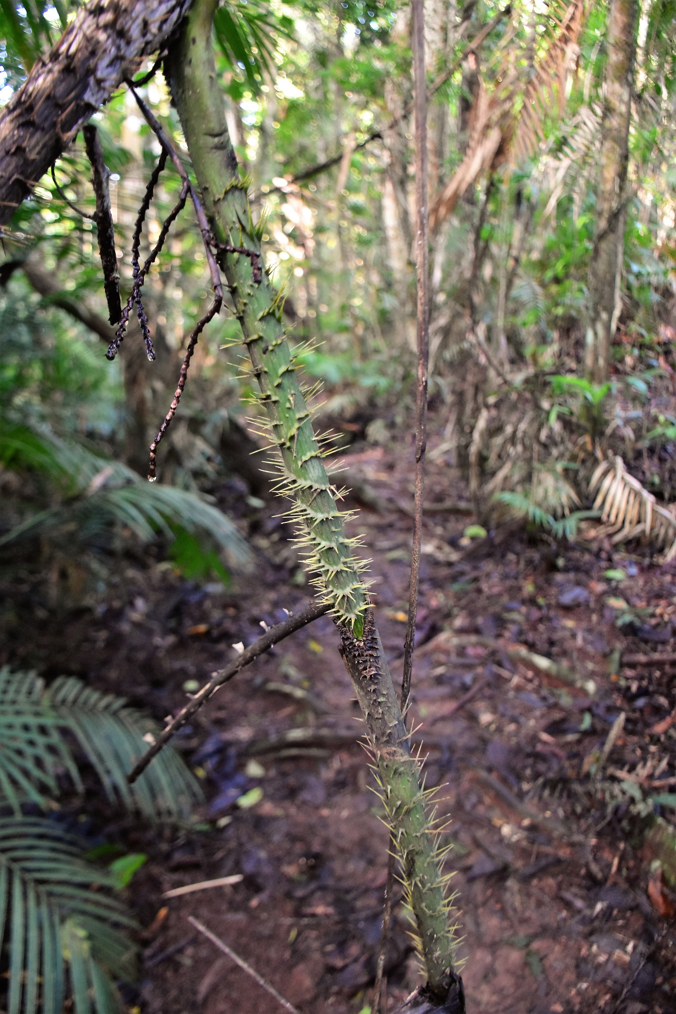
It wouldn't be a walk in the tropics without something that is designed to inflict pain on you!

Dropping down the Blue Track now.

Nice walking in the late afternoon along the Blue Track.

It would get you out of the rain for awhile I guess, however the views were a little limited!
I was now in the more popular section of the park, and with the sealed tracks and steps came numerous walkers out and about in their active wear... and me, looking like a dishevelled sloth in my sweat soaked bushwalking clothes! Shortly after leaving the lookout I swung right onto the western branch of the Red Arrow Track and started dropping down what felt like 200 steps towards the trail head on Collins Avenue. I'd walked the Red Track a couple of days ago in the rain and this sealed path is a nice little walk if you don't have a lot of time, although I certainly enjoyed it more today in the sun. Around 15 minutes after joining the Red Track I emerged from the bush down on Collins Avenue and my days walk was over.

The view down over the airport from the lookout.

Dropping down the Red Track.

The Red Track was the easiest of the tracks that I walked today although it was still fairly steep.
The Dirt.
According to my GPS I walked around 7.2 kilometres and climbed about 401 metres (Alltrails came in a bit less) on what I'd call an easy-medium grade stroll. This was a really good walk, the tracks in the Mt Whitfield Conservation Park are all well engineered and maintained from what I've seen. This was a fairly long walk so it is important to come prepared with water and anything else you might need - once up on the range there is no easy escape. There are a few walking guide book authors who have written up walks here over the years although I don't think anyone has written it up as I did it. I used my Alltrails App along with my GPS topos this afternoon.
Relevant Posts.

Finishing off todays little adventure on the Red Track.


No comments:
Post a Comment