Thursday, October 8, 2020

Penguin to Wings Wildlife Park, Penguin Cradle Trail - April 2010

Hardstaff Creek joining the River Leven.


Having walked the Overland track twice before, including a winter traverse with snow shoes, I decided that I wanted a new challenge. The little used Penguin Cradle Trail sounded like it might satisfy my needs, and I figured that while I was in the neighbourhood I may as well knock off the Overland Track again. Sounds like a plan! The Penguin Cradle Trail links the small town of Penguin in Tasmania with the Cradle Valley and thus links up with the northern end of the Overland Track. Now while the Overland Track is a well maintained walking track that comes complete with lots of walking infrastructure, the Penguin Cradle Trail is almost the opposite. The Penguin Cradle Trail is maintained by a small bushwalking club in northern Tasmania and has little in the way of infrastructure or maintenance...all good then.

I set off from Penguin on the north coast of Tasmania - that's Bass Strait behind me.

Penguin features it's own... Penguin.


So after spending the previous day driving around northern Tasmania, leaving food and supplies at various accommodation options, Sam dropped me off this morning at the track head near the Penguin tip, bright and early. The early start was as much for Sam as it was for me as after dropping me off she had to get back to Devonport to catch the morning ferry back to Melbourne. We had stayed at Wings Wildlife Park the night before so I was able to leave my big overnight pack there and walk the first section with my daypack, always a good thing however I still had a fair walk in front of me today.


Saying goodbye to Sam at the start of the Penguin Cradle Trail. The PCT is a volunteer run track and things are mostly fairly low key. 


After an easy 30 minutes up to the turnoff to The Dial, the Penguin Cradle Trail (PCT) bared its teeth. As I dropped into the valley of Keddies Creek it became obvious that there had been a massive wind storm in the area recently. For the next 2kms I found myself climbing under, over, or around massive tree falls. Frequently I found myself abandoning the official route to make my way down via the route of least resistance through the tangle of trees. As the track markers were nailed to the trees, and a lot of the trees were now lying at right angles randomly around the hill, it paid to keep an eye on the map!


Signage and track marking can be a little hit or miss... although overall things were pretty good.


While my old camera (and its driver) had its limitations in some ways, the macro was good.

Dropping down to Keddies Creek things got fairly rough...

... with plenty of fallen trees.


It was with some relief that I reached Dial Rd and then shortly afterwards the River Leven, the next 3.6 kilometres were along an old abandoned tramway beside the river, this flat and relatively easy walking made a nice change after the gymnastics of dropping down to Keddies Creek. Just before I reached Hardstaff Creek near Foggs Flats I met a fence, this signalled the spot that I had to climb beside the fence to meet a fire track which I then immediately descended back down to the river, and thus avoided some privately owned land.


Once I met the River Leven the walking was pretty easy for awhile.
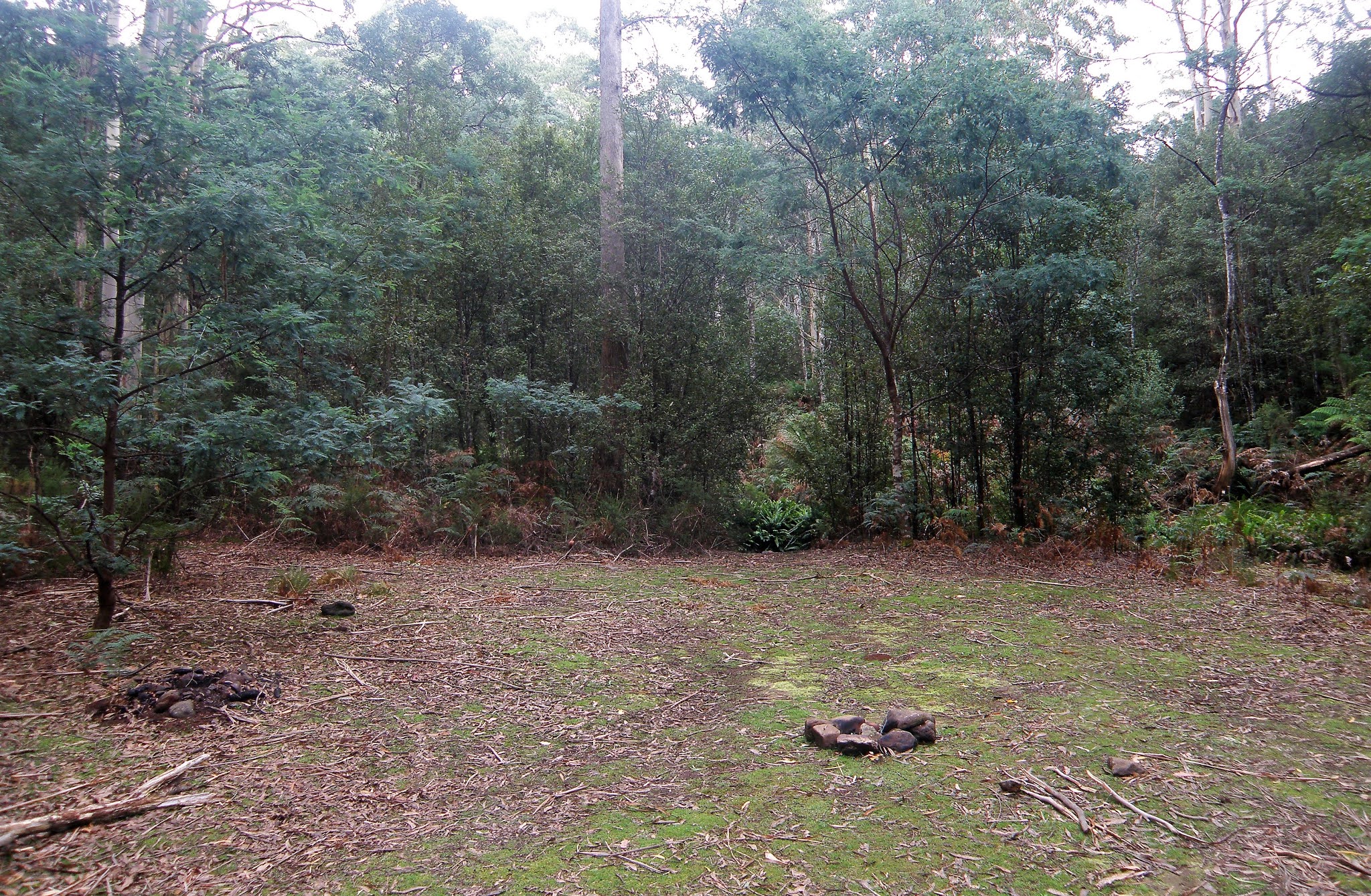

There was a nice campsite near Hardstaff Creek.


I was still feeling pretty fresh (probably due to only carrying a day pack!), so I pushed on past the Hardstaff Creek campsite and decided to have an early lunch at the Mt Lorymer Lookout. The lookout was a solid climb of around 400 metres, however it was well graded track that was clear of scrub and fallen trees so that was a positive thing. The lookout provided views of both Bass Strait and The Dial Range. Off came the gaiters and the boots and lunch was enjoyed taking in the view and calling Sam, as I walk a lot on my own I try to talk or text Sam whenever I get the chance so that she doesn't worry to much (remember this was back in 2010 - well before I had my Inreach). I was lucky from here as not only was I still able to get a signal but Sam also still had coverage from the ferry as it made its way north across Bass Strait. 

Leaving the Hardstaff Creek Camp I started the solid climb up towards Mt Lorymer.


The climb eased off when I met the firetrack running along the ridge... it was for an early lunch.


Looking out over Foggs Flat towards Bass Strait from the Mt Lorymer Lookout.


After my early lunch I had another 150 metres of climbing which then saw me at the high point of the days stroll. Now it was time to veer north (left) off the firetrack that I'd been following up the ridge and start to drop into the valley of Adit Creek. Once again I now found myself having to contend with a massive amount of tree fall. Apart from the downed trees it was beautiful walking along Adit Creek, although the track frequently disappeared under a forest of Ferns. Passing a steep descent sign I did indeed make my way steeply down to Walloa Creek. Walloa Creek was a beautiful spot for a rest and a drink, the first spot on the walk that I'd been confident enough to drink the water without any treatment.


Dropping down to Adit Creek the country got a bit damper again.

I bloody well hate climbing over tree falls so I've got no idea why I'm smiling.

The PCT along Adit Creek was fairly overgrown in spots.

The final descent down to Walloa Creek is steep.


Leaving Walloa Creek I had another 150 metre climb to reach a saddle above a pine plantation. Once again I had a mobile signal so I texted Sam to let her know that all was well before descending a somewhat convoluted route around the pine plantation to reach Winduss Road. Once I emerged from the pine plantation on Winduss Road I had a very short walk east to reach my home for the night at Wings Wildlife Park.


Walloa Creek


Dropping down to Winduss Road through around the edges of the pine plantation wasn't totally without it's highlights.

I've just emerged from the pine forest onto Windruss Road... remember that this is a volunteer maintained track that stretches for around 80 kilometres through some extremely rough and rugged country so it must be a handful to keep it well maintained.


I'd made pretty quick time today so after quick shower in my cabin I was able to head down to the cafe for my second lunch. After satisfying my stomach I went for a walk around the Farm/Zoo, it's a small family operation and they have different levels of accommodation, I took a cabin, but you could camp. After soaking my legs in the River Leven for awhile I retired back to my cabin for an afternoon of reading and listening to the rain which was now drumming on the roof, life was pretty good.

Home for the night.

I stayed in one of these self contained cabins (they may not be there nowadays).

The River Leven flows beside the property.

The River Leven at Wings Wildlife Park.


The Dirt.
I walked 19.8 kilometres and climbed 870 metres on what was a hard days walking (although it was made easier by only carrying a small day pack). The PCT starts next to the Penguin Tip under some power lines - it's not exactly scenically beautiful. I'm thinking that next time I do this walk I'll split it over 2 days and start the walk at the giant Penguin down in town. There was a good campsite Hardstaff Creek near where it met the Levin River, apparently there is also another one near Audit Creek although I can't remember it (it was 10 years ago though). The PCT today was a rough walk in spots, the track marking was reasonable although the frequent blow downs meant that long sections of the track had been obliterated. Apart from the fallen trees things were also pretty muddy dropping down Keddies Creek, and pretty steep dropping into and climbing out of Walloa Creek as well as the final descent down to Windruss Road. Wings Wildlife Park is still there although it looks like the accommodation options have changed a bit, it does look like the same owners still run it though and they were pretty welcoming and helpful to me, so I'd definitely go back again. 

Relevant Posts.


The cabins were fairly basic however they felt luxurious to me... especially as the rain came down!


The wildlife came out after dark.

Sunday, October 4, 2020

Edithvale Wetlands Walk - August 2020

Edithvale Wetlands


This little stroll is another of my Coronas Walks, we are in tenth week of lockdown in Melbourne (ha ha, little did I realise what was still to come!) as I write this and the way things are looking we'll be locked down for another ten I'm thinking. If I add the week that Sam and I were marooned in Perth in January due to bushfires, floods and a cyclone then I guess you could say this year has been a bit sub optimal. Listening to the daily Corona Lottery news conference a couple of days ago and hearing that around 25% of the people with the fucken' virus aren't staying at home in quarantine and are instead heading out and about and spreading the virus around the city hasn't filled me with good cheer either. 

So, with all that cheery news floating around my head I was in a fairly melancholy mood as I slipped out my front door, shuffled passed the ute, (which is slowly being covered in spider webs) and then meandered my way through the empty pre dawn suburban streets. Arriving at Thames Promenade twenty minutes later it was still pretty much dark, although with the first bit of the walk following the wide crushed granite Long Beach Trail that wasn't too much of a problem - and at least social distancing wasn't an issue. After the obligatory crappy start photo I headed north into the gloom... for a few minutes. After a few minutes I picked up the first substantial path heading east through a row of trees, crossed an open paddock and then picked up an informal pad along a small slice on no mans land wedged between the Edithvale Wetlands and the back fences of the suburban houses of Chelsea Heights.


Setting off from Thames Promonade first thing this morning it was pretty well dark still. 

I crossed this paddock to pick up a narrow section of land between the wetlands and the houses.


This first section of the walk was a little frustrating in that while I was always right beside the extensive wetlands there was also always a two metre high fence between me and the wetlands, which kinda took the edge of any decent photos. Still this part of the walk did have a couple of things going for it this morning, the first being that I was now getting a look at nice sunrise lighting up the eastern sky which always helps my Feral mojo. Secondly, this grassy pad was far enough away from any formal paths that it was still deserted so I was able to amble along without glancing around furtively worrying about social distancing. 


Edithvale Wetlands

At least I had the sunrise to keep me interested. 


Edithvale Wetlands - pity about the fence.


Arriving at Edithvale Road I wandered through the deserted car park for the Edithvale Wetlands Discovery Centre before crossing the road and once again disappearing back into the bush beside the wetlands. The good news now was that while the wetlands were still fenced and I was still following it, the fence was only around 1.5 metres high, so now photos were possible. Not only were photos now a viable option but the sun was now making itself known, bathing the swaying reeds in a nice golden light. I haven't mentioned it yet however it was a bit of a strange winters morning in Melbourne with some fairly mild temperatures (we'll relatively - it was around 7˚) along with a fairly strong northerly wind blowing. While I was walking the rough pad beside the fence line there is also a more formal pad along here that runs a little further away from the wetlands. 


Edithvale Discovery Wetlands Centre


The parkland is a little more extensive north of Edithvale Road.

Looking back down to the south along the Edithvale Wetlands.

Edithvale Wetlands


Less than an hour after setting off on my stroll I rounded the northern end of the wetlands and started my return journey south. The easier option now would of been to pick up and follow the Long Beach Trail back to the start of the walk however the sight of big mobs of joggers, dog walkers and bike riders convinced me to stay off the trail for as long as possible. Thankfully I was still able to follow my fence side pad for awhile, I even had a small lookout to stop and check out. Continuing south the good walking continued as I passed through a revegetating wetland area which also allowed for some nice views over the Edithvale Wetlands, before I eventually arrived back at Edithvale Road.


Heading south I checked out this little lookout.


The Long Beach Trail runs on the other side of these wetlands.

Edithvale Wetlands


Safely negotiating Edithvale Road I decided to head into the Edithvale Wetland Bird Hide to check things out. The sign at the carpark informing me that the bird hide was closed however I think that there are two bird hides here and while the flash one might of been closed it looks like the utilitarian structure is open 24/7. The Edithvale-Seaford Environmental Area is an area of International Significance when it comes to bird life and from this bird hide it was easy to see why, as there were hundreds of waterbirds enjoying the early morning sunlight and even a hack like me could manage to photograph them. 


Edithvale Wetlands Bird Hide


There was no shortage of waterbirds here.

Early morning on Edithvale Wetlands.


The good news pretty much finished at the bird hide this morning though. After leaving Edithvale Road I was now limited to walking the Long Beach Trail for the rest of the walk as I made my way back down to Thames Promenade. Now the Long Beach Trail isn't the worst walking in the world it's just a little...I dunno...I suppose you could call it boring. Still while the arrow straight trail lacked in scenic delights it did make for a quick walk back to the end point of my walk I suppose. Arriving back at Thames Promenade I saved the route on my GPS as shuffled off home, walking in the door just before 9am I settled in for some more quality Iso time.


I followed the Long Beach Trail shared path on the last section of my stroll.


The Long Beach Trail is a little further away from the wetland fence.


The Dirt.
I walked 6 kilometres and climbed 15 metres on this very easy stroll this morning. Now while navigation was pretty easy, as for long sections as I just followed the fence line protecting the wetlands, the pad itself was a little rougher than is normal on these suburban strolls. There were a few damp and muddy sections and at other times there was wet grass to push through. No one has published walking notes for this stroll as far as I know although I guess if you trawl the inter-web there might be something floating around the ether somewhere. I just used my GPS maps along with Google Maps this morning and that was more than enough to get me through safely. This is another stroll that is pleasant enough, however unless you are a twitcher then I think the walk is best considered if you are already in the area and not having to travel too far to reach it. There should be parking near the start of the walk at the Chelsea Bicentennial Park.

Relevant Posts.


The end is in sight - time to head home for some more Iso time.

I'm really hoping this is a snap shot in time and not a long lasting thing - wearing a face covering on a 40˚ Melbourne summers day doesn't sound very pleasant!


Thursday, October 1, 2020

Stringybark Creek Walk, Toombullup Historic Reserve - July 2020

Apart from the historic aspect this is mainly a forest walk.


If Ned Kelly was King

He'd make those Robbers swing

He'd send them down

Now what have these old Midnight Oil lyrics got to do with this walk...well not much really except for the fact that I couldn't get this little ear worm out of my head this afternoon as I meandered my way around the Stringybark Creek site. Stringybark Creek being the spot where Ned and his crew had a little altercation with the constabulary back in 1878 which resulted in three dead troopers... and eventually would be the reason that Ned was put to the gallows in Melbourne town. 

Sam and I dropped into Stringybark Creek this afternoon to break a drive up to Beechworth a bit, I've been suffering with a sciatic nerve problem in my back and sitting down for long periods is not really pleasant at the moment. We started this little walk at the Stringybark Creek Camping Area this afternoon and as usual the toughest navigational conundrum was finding the start of the walk. We picked up the old 4wd track heading into the forest on the western side of the large camp and soon enough everything was clear...ish.


Stringybark Creek Camping Area was pretty cold and completely deserted this afternoon.

We picked up the track at the western end of the large camp.


After passing some old gold mining sluicing gullies we dropped down to cross Stringybark Creek on a bridge before climbing a few metres up to the picnic area. This picnic area is a bit of an open air museum, there are numerous information plaques as well as some sculptures all telling the story of Ned and his gangs battle with the troopers. Now remember I said clear...ish, well it appears that things are fairly different on the ground than they must of been when my notes and maps were compiled. Thankfully though there were a few maps around on the information plaques so I was able to fairly painlessly work out where the walking track went now, and once on the defined and well marked track it would be almost impossible to loose it I think.

Dropping down to cross Stringybark Creek the track passed by some old sluicing gullies.

Stringybark Creek Picnic Area tells the story of Ned's adventures.

We followed the signposted loop walk from the picnic area.


The walk now looped around the picnic ground in a big arc, visiting various points of interest along the way. With the mid winter, late afternoon temperature hovering in the low single digits Sam and I didn't linger too long this afternoon, stopping to read the various interpretative signs was about the extent of it. After crossing over Stringybark Creek Road our walk dropped down to follow the ferny Stringybark Creek back up to the picnic ground, this is arguably the best part of the walk I'm thinking.


The loop walk featured a few of these information signs scattered along the route which provided for some poignant reading.

The short loop walk crosses the quiet Stringybark Creek Road a couple of times.


After crossing Stringybark Creek Road for the second time the track dropped down to follow Stringybark Creek back towards the picnic area.

The bush down around the creek was a little lusher.

Toombullup Historic Reserve


There is an interesting old Stringybark tree down by the creek called the Kelly Tree, this big old tree has a replica of Neds armour that is now embedded in the tree. Soon after passing by the Kelly Tree we arrived back at the picnic area and our short little loop was over. Turning away from the picnic area we followed the 4wd track back to the still deserted camping area... it was time to climb back into the ute off to Beechworth. 

   
The Kelly Tree


Meandering our way back up to Stringybark Creek Camping Ground.

It's never too cold for shorts.


The Dirt.
We walked 2.3 kilometres and climbed 28 metres on this very easy stroll. Keep in mind that this walk is up at around 800 metres elevation so in winter things can be decidedly cool, just as they were for us this afternoon. Being such a long drive from Melbourne the large and well appointed camping ground might. be appealing for some, I've pencilled it in as a handy spot to stop on journeys further afield. The picnic area is also a nice spot. Once at the picnic area all is pretty clear as far as the track goes although things are completely different on the ground now than they are described in the notes that I was using in Melanie Ball's Top Walks Victoria book.

Relevant Posts.


The camp was still deserted when we arrived back after our little stroll.

It's pretty chilly up here over winter.


Pelion Hut to Mt Ossa return, Overland Track - April 2010

Mt Oakleigh from the Pelion Hut heli pad. I think the mountain just visible in the mist in the distance is Cradle Mountain... ... the flat t...