Apart from the historic aspect this is mainly a forest walk.
If Ned Kelly was King
He'd make those Robbers swing
He'd send them down
Now what have these old Midnight Oil lyrics got to do with this walk...well not much really except for the fact that I couldn't get this little ear worm out of my head this afternoon as I meandered my way around the Stringybark Creek site. Stringybark Creek being the spot where Ned and his crew had a little altercation with the constabulary back in 1878 which resulted in three dead troopers... and eventually would be the reason that Ned was put to the gallows in Melbourne town.
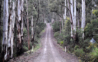
Sam and I dropped into Stringybark Creek this afternoon to break a drive up to Beechworth a bit, I've been suffering with a sciatic nerve problem in my back and sitting down for long periods is not really pleasant at the moment. We started this little walk at the Stringybark Creek Camping Area this afternoon and as usual the toughest navigational conundrum was finding the start of the walk. We picked up the old 4wd track heading into the forest on the western side of the large camp and soon enough everything was clear...ish.
Stringybark Creek Camping Area was pretty cold and completely deserted this afternoon.
We picked up the track at the western end of the large camp.
After passing some old gold mining sluicing gullies we dropped down to cross Stringybark Creek on a bridge before climbing a few metres up to the picnic area. This picnic area is a bit of an open air museum, there are numerous information plaques as well as some sculptures all telling the story of Ned and his gangs battle with the troopers. Now remember I said clear...ish, well it appears that things are fairly different on the ground than they must of been when my notes and maps were compiled. Thankfully though there were a few maps around on the information plaques so I was able to fairly painlessly work out where the walking track went now, and once on the defined and well marked track it would be almost impossible to loose it I think.
Dropping down to cross Stringybark Creek the track passed by some old sluicing gullies.
Stringybark Creek Picnic Area tells the story of Ned's adventures.
We followed the signposted loop walk from the picnic area.
The walk now looped around the picnic ground in a big arc, visiting various points of interest along the way. With the mid winter, late afternoon temperature hovering in the low single digits Sam and I didn't linger too long this afternoon, stopping to read the various interpretative signs was about the extent of it. After crossing over Stringybark Creek Road our walk dropped down to follow the ferny Stringybark Creek back up to the picnic ground, this is arguably the best part of the walk I'm thinking.
The loop walk featured a few of these information signs scattered along the route which provided for some poignant reading.
The short loop walk crosses the quiet Stringybark Creek Road a couple of times.
After crossing Stringybark Creek Road for the second time the track dropped down to follow Stringybark Creek back towards the picnic area.
The bush down around the creek was a little lusher.
Toombullup Historic Reserve
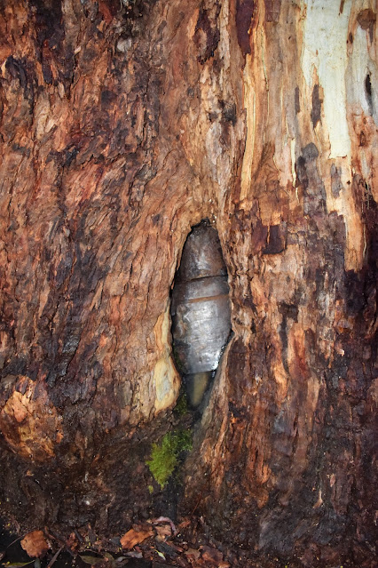
There is an interesting old Stringybark tree down by the creek called the Kelly Tree, this big old tree has a replica of Neds armour that is now embedded in the tree. Soon after passing by the Kelly Tree we arrived back at the picnic area and our short little loop was over. Turning away from the picnic area we followed the 4wd track back to the still deserted camping area... it was time to climb back into the ute off to Beechworth.
The Kelly Tree
Meandering our way back up to Stringybark Creek Camping Ground.
It's never too cold for shorts.
The Dirt.
We walked 2.3 kilometres and climbed 28 metres on this very easy stroll. Keep in mind that this walk is up at around 800 metres elevation so in winter things can be decidedly cool, just as they were for us this afternoon. Being such a long drive from Melbourne the large and well appointed camping ground might. be appealing for some, I've pencilled it in as a handy spot to stop on journeys further afield. The picnic area is also a nice spot. Once at the picnic area all is pretty clear as far as the track goes although things are completely different on the ground now than they are described in the notes that I was using in Melanie Ball's Top Walks Victoria book.
Relevant Posts.
The camp was still deserted when we arrived back after our little stroll.
It's pretty chilly up here over winter.


No comments:
Post a Comment