Well its probably time to write up my recent trek in Peru, I've already written up a crazy guy journal so tradition dictates that I post an overview on my blog. We didn't walk the classic Inca Trail on our way to Machu Picchu, instead we choose a slightly harder route that meant we could visit the stunning ruins at Choquequirao. The trek we did crossed some very steep river valleys which meant a fair bit of climbing and descending, it also crossed a few high passes, culminating in the crossing of Yanama Pass at around 4660 metres, the highest I've ever trekked. I was walking this trek with my friends Rita and Petra, as well as my new friends Rose, Deb and Greg. Petra had floated the idea of the trek to me the year previously, selling it by telling me that we could get to Machu Picchu and avoid the crowds on the classic trail, it sounded all good to me! On this walk we had a local guide Pepe walk with us and most of our gear was transported by horses, another first for me.
 |
| Looking into the mountains from the main street in Cachora |
Day 1 Chiquisca 9 kilometres 50m ascent
Our first days trekking actually started with a long bus ride, as with most bus journeys in Peru
it was slightly terrifying, at one stage while traversing a narrow dirt track above a bottomless abyss the driver got out to inspect a section that had been washed into the void leaving a section of road that only a motorbike could travel I thought, going to the edge he stamped his feet a couple of times, looked at the bus, looked at the drop and smiled, and then away we went, geo engineering Peruvian style! We actually started walking half an hour from the 2800 metre Capuliyoc Pass, so after climbing around 50 metres we ticked off our first high point of the trek. From the pass we spent the rest of the day descending an almost endless series of switch backs towards the bottom of the deep valley that the Rio Apurimac has scoured out. The descent was a fairly easy start to our trek, the track never getting too steep, the constant views taking our minds off the sandflys that snacked on us whenever we stopped. We arrived still pretty fresh at our camp at Chiquisca a couple of hours before sunset, infact for the only time on the trek we got in before our pack horses.
 |
| The end of the road and the start of our trek. |
 |
Capuliyoc Pass
 |
| The start of the long descent down to the Apurimac River. |
|
Day 2 Marampata 10 kilometres 19 kilometres total 1350m ascent 1400m ascent total
Today we had a fair climb in front of us but first we had to drop another 400 metres down to Playa Rosalina on the Rio Apurimac. Playa Rosalina was a dusty and hot spot, my hopes of a swim in the Apurimac were dashed when I saw the churning angry water up close, there was no way I was taking a dip in there. Once across the new bridge over the Apurimac our first big climb of the trek commenced, 1400 metres is a fair climb at the best of times but with the equatorial sun on our backs it ramped up the degree of difficulty a bit more. We spread out along the track, each of us walking at our own pace, and with plenty of stops we had all arrived at the small settlement of Marampata by mid afternoon. I spent the rest of the afternoon reading and taking in the views across the deep valley, we could trace our route back to the start of our trek from here, and in the other direction we could just make out Choquequirao on a forested ridge in the distance.
 |
The Apurimac River at Playa Rosalina, that's the old bridge in the foreground.
 |
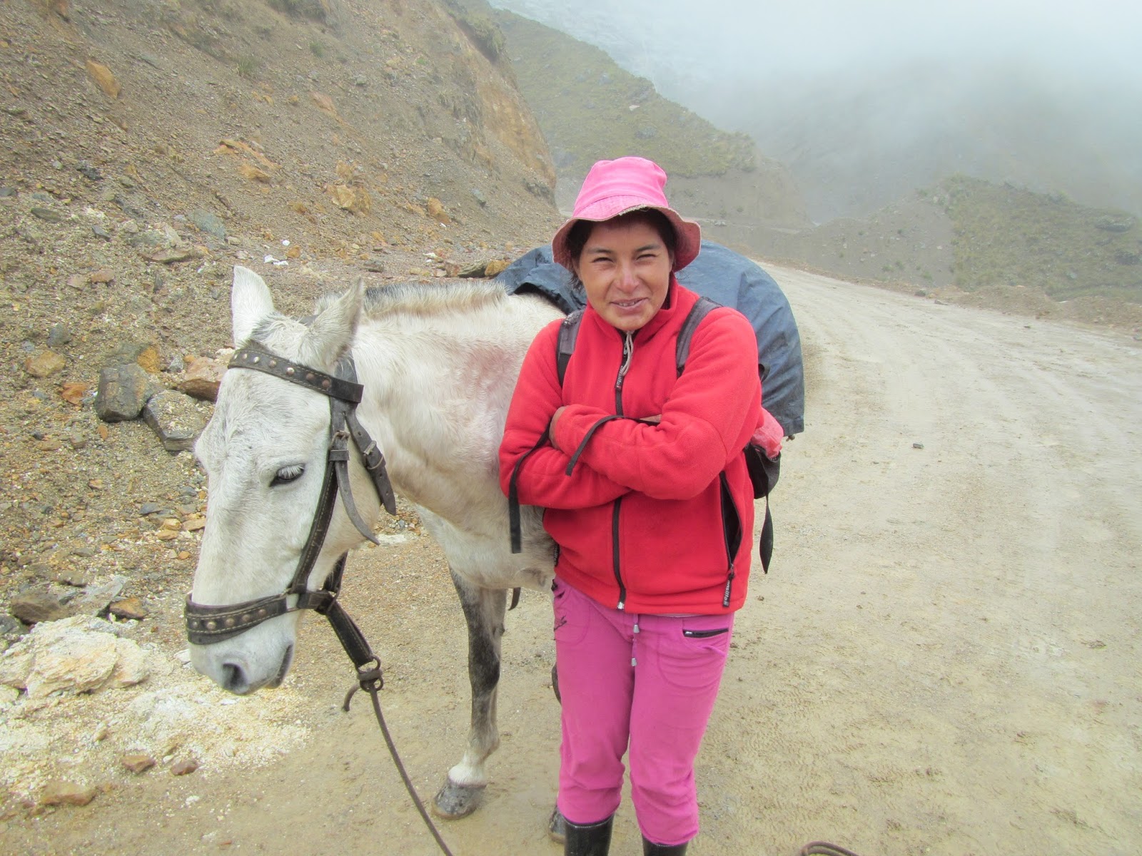
Our small group, Greg, myself, Cathy (our emergency horse wrangler), Petra, Rose, Deb and Rita.
 |
Our very comfortable camp at Marampata.
 |
| The young mum was teaching her toddler how to walk with the aid of the scarf around her chest and under her arms, mum then held the scarf up to support the toddler. |
|
|
|
Day 3 Choquequirao 10 kilometres 29 kilometres total 700m ascent 2100m ascent total
We had a very easy day today in theory, we only had to move camp a few kilometres and then spend the day exploring the stunning Choquequirao Inca Ruins. For the first time on our trek we had some misty drizzle this morning, the track traversed high above some huge drops although the mist meant that it never felt to exposed as we couldn't see the bottom. By mid morning we had arrived at Choquequrao. Unlike Machu Picchu a lot of Choquequirao hasn't been cleared from the jungle which in a way added to its charm, its thought that Choquequirao may be larger than Machu Picchu once the jungle reveals its secrets. We spent time around the Lower and Upper Plaza's and then headed down to check out the stunning Llama Terraces. The Llama Terraces are another one of those things that we don't have all the answers for, these terraces are unique in that they have white stones inserted into the walls of the terraces to make the shape of llama's, no one is one hundred percent sure of the significance of the pattern. The stones on the Llama Terraces are also placed vertically rather than the normal horizontally, maybe to make it easier to insert the white stones. To get to the lookout for The Llama Terraces involved an incredibly steep descent and then, you wouldn't believe it, but an incredibly steep climb back up to the main site. After another short side trip, this time to check out The Truncated Hilltop and its view we re grouped and headed back to camp on what had been a fairly full on day.
 |
These kilometre markers were a feature of the Choquequirao section of the trek.
 |
The Lower Plaza at Choquequirao.
 |
 |
| The incredibly steep but equally stunning Llama Terraces. |
|
|
|
Day 4 Choquequirao 5 kilometres 34 kilometres total 200m ascent 2300m ascent total
Today we had another whole day to explore Choquequirao, I didn't mention it yesterday but we had the whole site to ourselves and today we again didn't have to share with any others. Today we dropped down to Paqchayoc which is perched high above the precipitous Rio Sunchumayo, it is thought that this site might have been a religious or ceremonial site. After a break on the terraces we descended the incredibly steep steps to the bottom of the terraces and checked out Casa de la Caida de Agua (House of the Waterfall) and then made our way along a rough pad to waterfall on the Rio Sunchumayo from which the house got its name. Pepe was particularly pleased to go here as he'd never been to the falls before. Eventually we all headed back to camp in the early afternoon where we spent the rest of the day eating, drinking, reading and resting up for tomorrow which promised to be a fairly tough days walking.
 |
Petra, sitting on the terraces at Paqchayoc above the abyss that the Sunchumayo River flows through.
 |
Descending one of the extremely steep Inca staircase's.
 |
| Pepe at the waterfall near Paqchayoc. |
|
|
Day 5 Maizel 15 kilometres 49 kilometres total 1700m ascent 4000m ascent total
A 1700 metre climb in one day is not to be sneezed at, but what that figure doesn't take into account was the 1000+ metres we had descend as well, today was a solid day. It was misty and drizzling when we left our camp at Choquequirao and the conditions didn't improve while we initially climbed higher into the cloud forest above Choquequirao, however as we started our descent to the Rio Blanco the sun soon made an appearance and the temperature headed north. By the time we arrived at terraces at Pincha Unuyoc we were getting fairly warm, the ruins provided an opportunity for us to dunk our heads under some cool clear water, and also allowed us the chance to look down into the chasm that the Rio Blanco was flowing through which would be our lunch stop. After seemingly hundreds of switch backs we arrived hot and dusty at the Rio Blanco, after a quick feed some of us took the opportunity to immerse ourselves in the freezing river before the massive climb ahead of us. The climb was indeed a bit of a 'ball buster', the only slightly positive aspect was that we had a little shade in the steep sided valley as we climbed. About an hour before dark we filtered into Maizel, a tired but happy group of trekkers.
 |
We had a little rain overnight.
 |
On today's trek down to the Rio Blanco we passed through the ruins of Pincha Unuyoc.
 |
That's our lunch stop at the bottom of the valley, how hard could it be hey!
 |
| We've made it down, time for lunch and a swim. |
|
|
|
Day 6 Yanama 15 kilometres 64 kilometres total 1000m ascent 5000m ascent total
Like yesterday we awoke to drizzle and mist, unlike yesterday it stayed that way for most of the day. First up today we had a bit more climbing to do, leaving Maizel the sometimes muddy track continued climbing through the cloud forest before we eventually broke out into more open grasslands around the old La Victoria Mine entrance, the vegatation may have opened up but the cloud was closing in, leaving the old mine we climbed in worsening rain. I was glad to see the shelter materialise out of the mist on San Juan Pass, our lunch table already set for us, this guided trekking is hardcore! At 4170 metres San Juan Pass was the second highest on our trek, however due the weather we only got fleeting views of the mountains around us. Leaving the pass we trekked the best section of track for the whole walk, the descent to Yanama was sometimes benched into the side of shear cliffs and as we dropped down towards the valley floor the weather started to clear and we got some great views, the country took on a rural feel as we dropped down to Yanama, complete with lush green grass and dry stone fences. Yanama was the biggest settlement that we'd been through since leaving Cachora at the start of the walk, however we quickly located our bright yellow tents at our camp, on this trek we always camped in the yards of locals who normally provided a toilet, sometimes a cold shower, and occasionally a small shop.
 |
We were thankful for some shelter on San Juan Pass.
 |
The section of track from San Juan Pass to Yanama was the best of the trek in my opinion.
 |
| Sections of the track were cut into shear cliffs. |
|
|
 |
| Yanama is coming into view as we descend off San Juan Pass. |
Day 7 Totora 15 kilometres 79 kilometres total 1200m ascent 6200m ascent total
With Yanama sitting at around 3500 metres we had a reasonably cool night and it was still pretty cool when we set off on todays walk. Today was the crux of the whole trek as we had to climb Yanama pass, which at 4660 metres would be the highest spot on the walk. Yanama is now connected to the outside world by a rough dirt road and over the course of the day we spent a fair bit of time walking it, in-between the road sections a walking track short-cut some of the big switch backs, inevitably this meant that the gradient would ramp up a bit. The climb up to the pass was actually a lot easier than I expected, yeah I would get a little short of breath if I went too hard, but if I just chugged along I was fine and I suffered no ill affects from the altitude. The scenary was very rural initially but as we climbed we got into some barren windswept puna, as we started through the alpine grassland the weather, which had been deteriating as we climbed, finally closed right in. Unfortunately we didn't get any far reaching views from Yanama Pass today, we managed a couple of quick snaps in the swirling mist but we really didn't hang around too long. Leaving the pass we started our long descent to Tortora, initially we dropped down steeply short cutting the road, the rain was now getting heavier and we were happy to eventually see our lunch tent materialise out of the mist. After our late lunch we continued on in worsening weather, at the same time we were losing height quickly, by the time we arrived at our camp in Tortora it was pissing down, but that was all right because it made for a good excuse to crawl into the sleeping bag and relax a little before dinner.
 |
Leaving Yanama, these little blokes had us trekkers sussed out!
 |
Climbing up towards Yanama Pass.
 |
Hey hey, that's the highest this walker has ever been, well without an aeroplane anyway.
 |
Yanama Pass.
 |
| Cathy looks a little cold, time to head down. |
 |
| The weather got worse the more we descended today. |
|
|
|
|
Day 8 Lucmabamba 12 kilometres 91 kilometres total 100m ascent 6300m ascent total
With no high passes today we awoke, somewhat ironically, to a clear day. After breakfast we had a little presentation for our horse wranglers and cooks to show our appreciation for the effort that they had made to make our walk comfortable and enjoyable. Then, after buying a couple of Guinea Pigs for our dinner we set off on todays trek, the track today was basically an easy down hill walk. Our first stop today was in the small town of Coolpapampa where, after checking out the town ship we headed steeply down towards the hot springs. Not having had a warm shower for more than a week I was quite keen for a swim in the 'hot springs', unfortunately whoever thought to call these hot springs must of worked in a marketing department, the springs were tepid at best, oh well after a week without a warm wash even tepid water was pleasant enough. After drying off we headed off down the valley of the Rio Santa Teresa, the good news was that we were now on a walking track with the dirt road on the other side of the steep valley, the benched track made its way down the valley passing a couple of big waterfalls on the way After a brief stop at Winnay Poccas for morning tea we headed a little further down stream to an oroya (flying fox) that we used to cross the Rio Santa Teresa for lunch. After what would be our last lunch in our lunch tent we caught a bus down the dirt road to our nights stop in Lucmabamba, our nights camp. We stayed at a coffee plantation in Lucmabamba and we were lucky enough to be shown around the farm, even being able to pick, roast, grind and drink our own coffee, sweet!
 |
Buying tonight's dinner.
 |
Having a quick soak in the 'hot' springs at Coolpapampa.
 |
One of the locals at Winay Poccos looking for a free feed.
 |
Crossing the Rio Santa Teresa on an 'oroya'.
 |
Picking our own coffee beans at Lucmabamba. The banana plants provide shade from the equatorial sun for the coffee plants.
 |
Roasting our beans.
 |
All hands on deck for dinner.
 |
| The guinea pig actually tasted pretty good, and no its not like chicken. |
|
|
|
|
|
|
|
Day 9 Aguas Calientes 12 kilometres 103 kilometres total 300m ascent 6600 ascent total
Today was our last day of trekking and in hindsight it was the least enjoyable day on the trek, maybe it was a result of us heading into 'civilisation' at Aguas Calientes, but I felt the end of our trek was a bit of an anti climax. Initially today we started out with another bus journey down to Santa Teresa and then up the valley of the massive Rio Urubamba to where the bridge over the Rio Aobamba had been washed away. When the bus could go no further we put our packs on for the last time on the trek and set off towards Aguas Calientes. Our first objective for the day was the La Hydroelectrica Railway Station which we arrived at fairly quickly, well at least we did when we walked in the right direction, we started off initially up the wrong valley. Once past the ramshackle station we just had to follow the railway all the way to Aguas Calientes, it made for an easy but not overly scenic (we had been pretty spoilt though) finish to the trek. Eventually Aguas Calientes came into view, of course after 9 days of trekking our hotel would be situated in Aguas Calientes Heights, so we also got to trek from one end of town to the other before we could head to our rooms for a hot shower. Speaking of rooms and hot showers the first thing I did on getting into the room was to turn on the tele to catch up on what had been happening in the real world in the last week and a half, instead of BBC news coming on though I got 'Keeping Up With the Kardashians', yeah I was back in civilisation now! After a quick shower I caught up with Rita and Petra and we spent the rest of the afternoon checking out the sights in town, before Pepe took us to another great restaurant for our last night with him.
 |
The start of our last days trekking, crossing the Rio Aobamba.
 |
We walked past he discharge tunnel for the Hydro Electric scheme.
 |
La Hidroelictrica Railway Station.
 |
| Aguas Calientes has just come into view. |
|
|
|
Day 10 Machu Picchu
We were up bright and early today and on one of the first buses to grind its way up the switch backs to Machu Picchu. Being Easter we were expecting massive crowds at the ruins so were anxious to get there early to avoid the worst of them, from what I can understand international tourist have to apply for a limited number of permits but I think the locals don't have the same constraints, hence the large crowds over Easter. We started with a two hour guided tour before being let loose on our own, I will eventually get around to doing a post on Machu Picchu so I wont go into to many details here as this post would end up longer than 'War and Peace'. Needless to say we had a great day, the ruins themselves were every bit as stunning as you've been led to believe. We spent around six hours at Machu Picchu but you could easily spend a couple of days wandering around the site checking out all the nooks and crannies. There are no toilets inside the Machu Picchu site so you have to leave the site to use the restrooms so monitor your water intake carefully as its not a two minute walk to get out the entrance gate. After using the rest rooms we headed back down to Aguas Calientes for a relaxing late lunch before we caught the 4pm train back to Ollantaytambo, itself a very scenic journey. From Ollantaytambo it was another terrifying bus trip back to Cusco where our travels together as a group came to an end next morning.
 |
The money shot.
|
The Dirt.
Well what did I make of my Inca Rivers Trek, well first up it was a fairly hard walk, we trekked into and out of some incredibly deep and steep river valleys as wells over some seriously high passes. The track itself was reasonably well benched and graded, don't forget that pack horses carried a lot of our gear so the track had to accommodate them as well. What you don't hear about before leaving is the sandflys, while not anywhere near New Zealand standards they are still pretty ferocious. The Inca Rivers Trek was a little different from my usual multi day walks in that it wasn't strictly a wilderness walk, we camped in small villages along the way and short sections of the walk crossed rural farmland. We walked with
World Expeditions and they provided a safe and enjoyable experience as normal, they're not the cheapest but they don't cut any corners. I used the standard Lonely Planet Peru guide, as well the Trailblazer guide book which had notes and mud maps for our slightly off the beaten path trek. I was lucky to share the experience of trekking in Peru with a great guide in Pepe, and also and wonderful group in Deb, Greg, Rose, Rita and Petra, not to mention our wonderful cooks and horse wranglers who endured a lot to make us spoilt gringos comfortable. If you want to check out a magazine style report with a lot more photo's you can see my
Crazy Guy report here.
 |
| Aguas Calientes. |


Hike the legendary Inca Trail To Machu Picchu on an unforgettable 4-day journey through the heart of the Andes. Follow ancient paths once walked by the Incas, passing breathtaking mountain landscapes, lush cloud forests, and fascinating archaeological sites. Reach the iconic Sun Gate for your first awe-inspiring view of Machu Picchu. Perfect for adventurers and history enthusiasts, this world-renowned trek offers a unique blend of culture, nature, and history. Call us at +51 994601060 to book your adventure!
ReplyDelete