As I'm typing this the weather forecast for the upcoming Sunday is for local snow showers down to 700 metres, so I thought I'd write about some warmer times. This will be the last post from our trip over to Western Australia in 2009. For those train spotters out there who may be thinking hang on the Cape to Cape track runs from Cape Naturalist all the way to Cape Leeuwin we'll you'd be right, unfortunately our walk didn't go as planned and we only got as far as Gracetown on this attempt. As is fairly normal Perth was a bit on the warm side in December, and I wasn't really expecting it to be much cooler a couple of hundred kilometres down the coast so I figure we'd be in for a bit of a testing walk, in the end it wasn't the heat that foiled us however.
 |
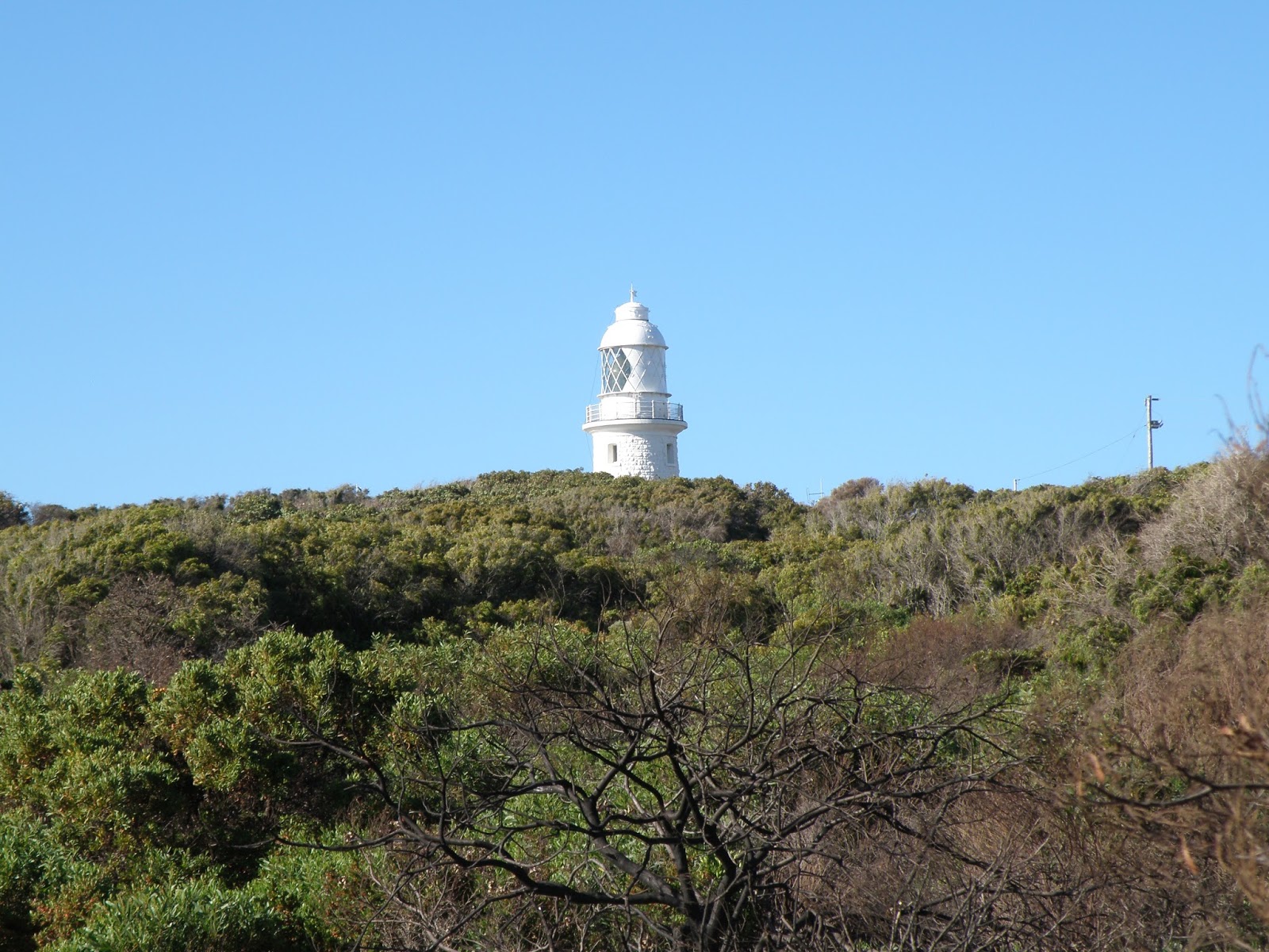
The start photo at Cape Naturaliste.
 |
| Cape Naturaliste lighthouse. |
|
Mt Duckworth Camp 11 kilometres
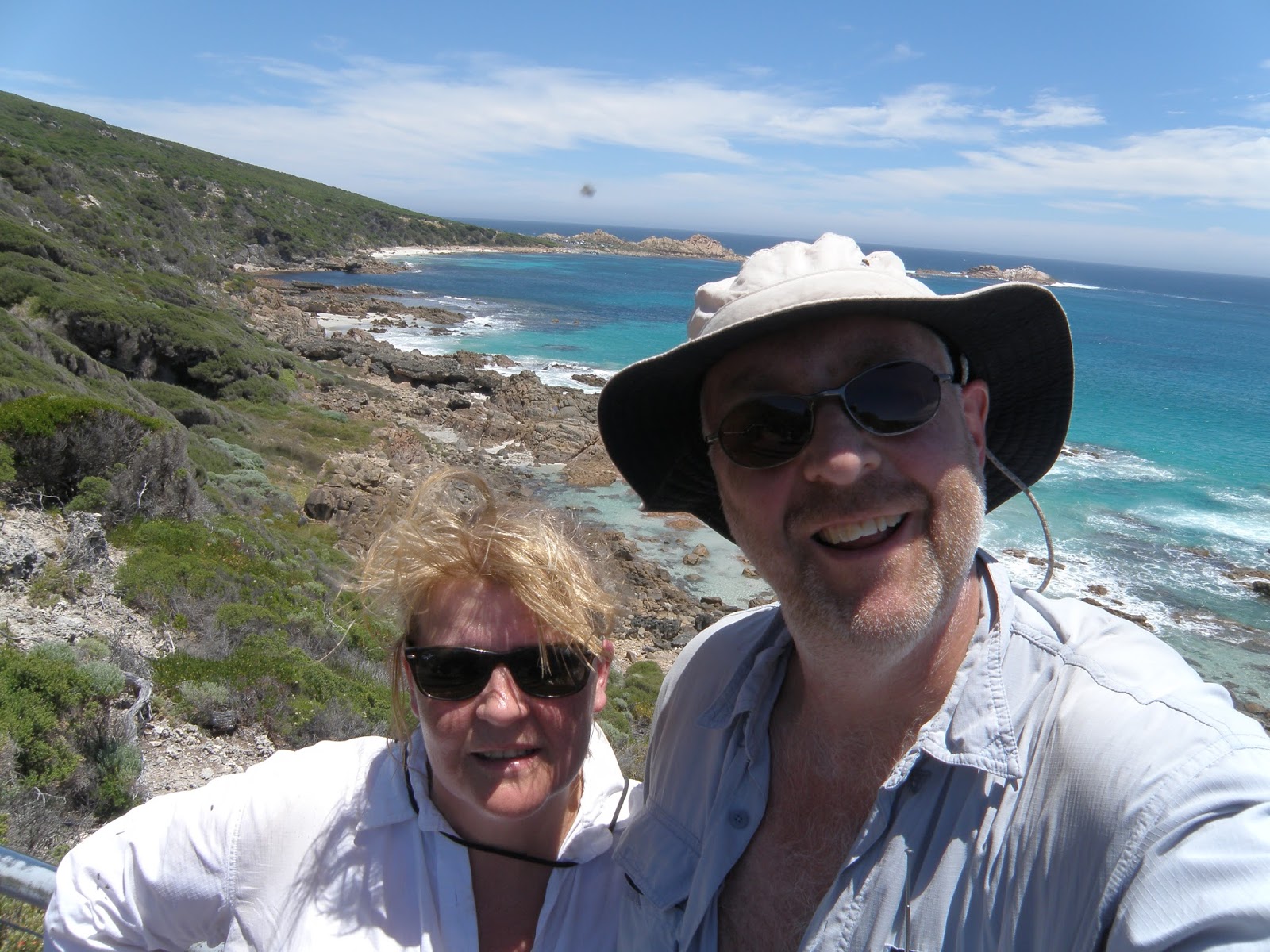
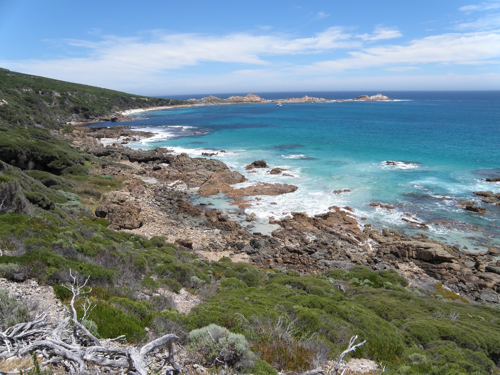
We had a fairly short day on our first day on the track which was just as well as we didn't actually start walking until around 3 in the afternoon. Jumping out of our taxi at Cape Naturalist we soon located the start of the track and signed on, with it being fairly late in the day and with no daylight saving in WA we had to keep moving if we were going to make it to camp before dark. Initially the track is a paved wheel chair friendly type of track so it made for some quick and easy walking, the stunning views however slowed us down a bit as we stopped frequently to take photos and gaze out over the turquoise Indian Ocean.
 |
Easy walking towards Sugarloaf Rock.
 |
| Sugarloaf Rock. |
|
Eventually the paved path ended near the Sugarloaf Rock lookout, Sugarloaf Rock is a rocky out crop just off shore which is home to red-tail tropic birds in summer, unfortunately we didn't spot any on this walk, maybe next time. We now followed a rough sandy track along the tops of the cliffs, the track was still pretty cruisey although we had to be careful of the limestone outcrops in the soft sand as it would be very easy to trip up. With Yallingup visible in the distance we dropped down to our first beach of the walk Kabbijgup or as the local surfers know it as 'Three Bears', the walk along the sand was less than a kilometre but the combination of the soft sand and the late afternoon heat made it a bit of a slog.
 |
The soft sandy cliff top track.
 |
Kabbijgup Beach.
 |
| Sam walking across some of the typical limestone outcrops. |
|
|
Climbing up the steep wooden staircase at the southern end of Kabbijgup we stopped for a couple of minutes to watch the surfers for the last time today. The track from here initially follows along pretty close to the edge of the limestone cliffs, once again mainly soft sand interspersed with limestone outcrops. With the late afternoon sun slowly sinking deeper into the Indian Ocean the track slowly started to head a little further inland through some sandy tea tree country, I was now keeping a bit of an eye out for the Mt Duckworth camp as I wasn't to sure what to expect in relation to signposting. Just as the light was disappearing we got to an open section in the tea trees (does that make sense?) and spied a picnic table, this no doubt must be the camp. While I set up the tent Sam went and checked the water tank which thankfully had some water in it, at least we wouldn't have to ration tonight. After dinner we were into the tent early to avoid the worst of the mosquitoes, spending a warm evening reading before drifting off with the sound of the waves crashing in the distance.
 |
Looking back up to the north in the late afternoon sun.
 |
Yallingup is in view, tomorrows breakfast destination.
 |
| Sunset into the Indian Ocean from near the Mt Duckworth camp. |
|
|
Moses Rock Camp 23 kilometres 34 kilometres total
Awakening fairly early in the rapidly heating tent we emerged blinking into the bright sunshine, with no daylight saving the sun comes up very early in WA in summer. We were packed up and on our way into Yallingup before 7AM, a time that I'm normally just thinking of climbing out of the tent, we got to the shops in Yallingup that early that we had to wait for the local cafe to open so we could have breakfast. Whilst hanging out in the local park waiting to eat we were able to make use of the beach showers to have a cold shower and freshen up a bit, this was definitely not a wilderness walk. After partaking in a long and relaxing breakfast we headed off to the south again.
 |
Mt Duckworth Campsite.
 |
| Rabbits surf break at Yallingup. |
|
The track from Yallingup to Smiths Beach was an easy gravelled jogging track, we were happy enough with this as it allowed us to take in the stunning views without worrying about tripping over. We must have looked like a foreign species to all the beach goers as we trudged along Smiths Beach in our walking gear, although the surfers on the Super Tubes break didn't seem to notice us. At the end of Smiths Beach we walked up onto the road in front of the Canal Rocks Resort, which once again provide another spot for a drink and something to eat. Pulling ourselves away from the air-conditioned shop we now climbed up a scenic stretch of the track on the way down to Canal Rocks, there's meant to be a spring along his section but I didn't find it.
 |
Smiths Beach is coming into view.
 |
Climbing up through the rocks at the south end of Smiths Beach.

|
 |
| Canal Rocks |
|
|
|
It was now early afternoon and it was getting seriously hot, by the time we'd passed Canal Rocks and dropped down onto the stunningly beautiful Indjidup Beach we were ready for a swim. Swimming in this part of the country is always a bit of a calculated risk as this is prime territory for great white sharks, I figure that I had more chance of dying from heat stress today than a shark bite. So on finding a great spot we settled in for awhile to do a bit of swimming and wait out the worst of the heat. By late afternoon the worst of the sting had gone out of the sun so it was time to set off again, it was soon obvious that we had made the right decision waiting out the heat for awhile as the track now followed an old four wheel drive track through the dunes behind the beach, it was hot enough now let alone what it would of been like in the heat of the day.
 |
Injidup Beach.
 |
Great White Shark bait.
 |
| The large dunes at the southern end of Injidup Beach. |
|
|
Dropping down to the sea again at Quininup Beach we could see that the weather had changed a bit, the cloud had come in and the wind had picked up, it looked like there was a bit of a weather front coming through and the good news was the temperatures had dropped a lot. Quininup Brook provided an excuse to strip off and wash the sand and salt off before we got to camp that night, after a fresh water rinse we slogged up an incredibly steep and soft dune back up to the cliff tops, in the process I seemed to work up enough sweat to negate any positive effect of my wash in the brooke. It was getting pretty late now as we headed off towards Moses Lookout, the late afternoon light made for some good photos and at the same time seemed to bring the local fauna out, we arrived at the lookout just as the sun was setting in a fiery red sunset. Now we were walking in the twilight and this was where our walk effectively finished, while pushing through an overgrown section of track Sam tripped on the limestone outcrop in the soft sand, fell and landed with her forearm taking the brunt of her weight, unfortunately instead of soft sand her forearm landed on some more limestone. After getting her back on her feet we decided to head the short distance to the Moses Rock camp and re asses the situation, after getting the tent up I cooked dinner and fed Sam a few pain killers, it was beyond my first aid skills to diagnose whether it was a break or just a bruise but she slept alright during the night, we would make a decision in the morning.
 |
Quininup Beach.
 |
Everything is still good as we head towards Moses Rock Lookout.
 |
Sunset from Moses Rock Lookout.
 |
| The last photo I took on this attempt on the Cape to Cape. |
|
|
|
Gracetown 7 kilometres 41 kilometres total
We'll you have probably worked it out by now but we had to bale out, we woke up and Sam's arm was bruised and swollen. After packing up we set off towards Gracetown, the plan was to get there and then grab a taxi into Margaret River where we could get a doctor to have a look at Sam's arm. There are no photos of today as I was just concerned about getting Sam out, I remember lots of great scenery and a narly staircase as we climbed out of Biljedup Brook which was a bit of a trial for Sam. Arriving at the car park for Cullens Beach I met a surfer out checking out the Gallows surf break, mentioning to him that we were heading to the Margaret River Hospital he kindly offered to drive us, and that was how the walk ended, in the back of a four wheel drive. The good news was that after getting Sam's arm x-rayed it was confirmed that there was no break but only bad bruising, after hitching down to Augusta I picked up the car and returning to Margaret River picked up Sam and headed back to Perth for a few days for her to recover.

|
 |
| He doesn't look to happy with me. |
|
The Dirt.
The full Cape to Cape Track runs from Cape Naturaliste to Cape Leeuwin in the bottom south west corner of Western Australia. The track is not a hardcore wilderness style walk as it passes through a few small coastal settlements on its journey. We attempted the walk in summer and it was hard going, the reflected heat off the sand was fairly intense and this was amplified once the track headed off the beaches into the dunes. Having travelled in the south west of WA in winter I'm not sure that would be too enjoyable either, probably the best times to walk this track would be Autumn and Spring, if walking in the cooler months I'd class this walk as a medium walk. I used the Cape to Cape Guidebook by Jane Scott and Ray Forma, it can be purchased online from
the Friends of the Cape to Cape website and is an excellent guide book. The website is also the best source of all the latest information about the track. The Cape to Cape is unfinished business for me, hopefully I'll get a chance to head back to Western Australia in the next two or three years and finish the track.


No comments:
Post a Comment