 |
| I drank a lot of this stuff in my younger years, remember long necks? |
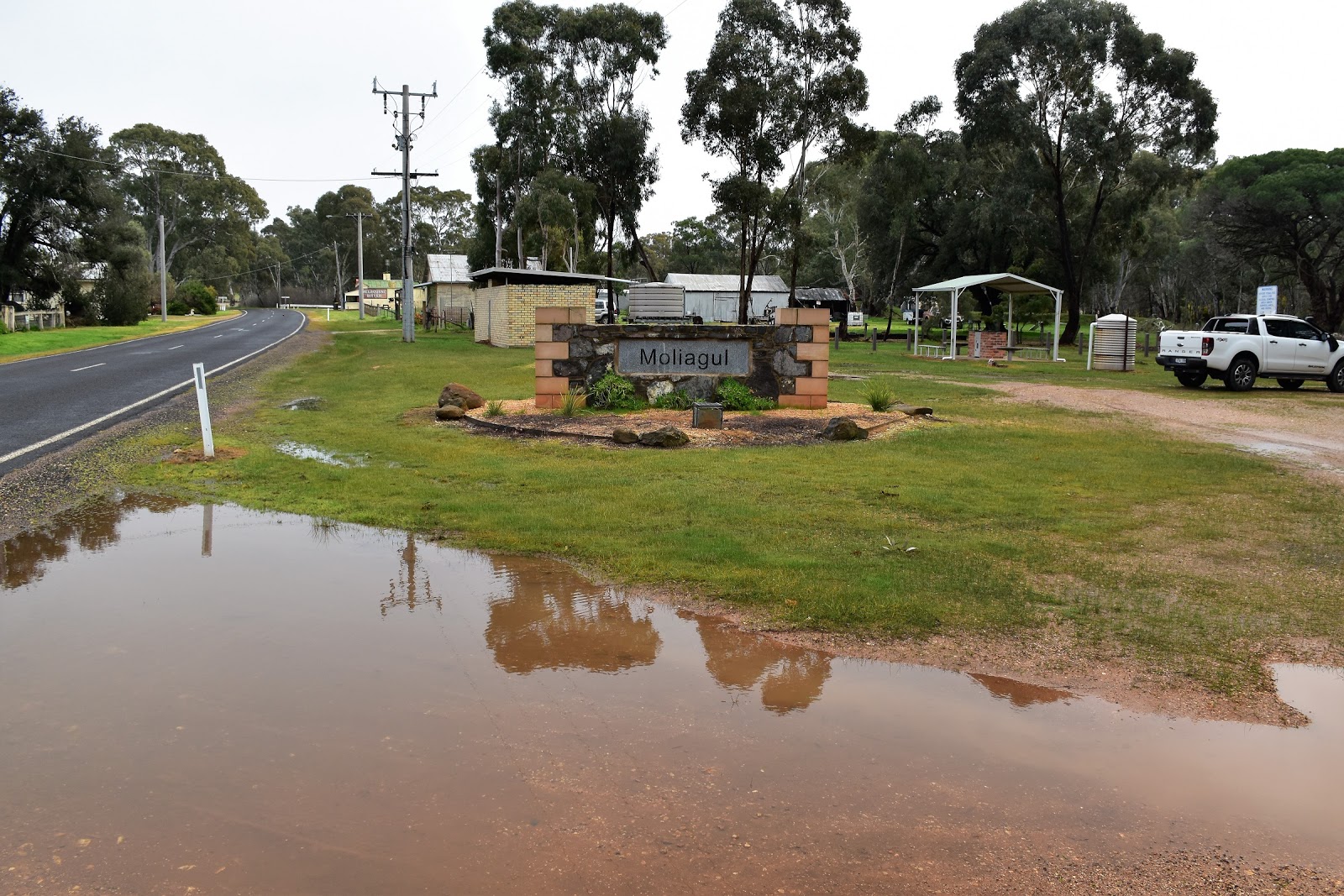
I had a cunning plan today, with crap weather forecast for Melbourne I decided to head north of the Great Dividing Range and go for a stroll, the theory being that normally the weather is a little less inclement the further north you travel. Now that all sounds pretty good in theory but in reality things didn't exactly work out as I'd planned. Driving up through the Black Forest beneath Mount Macedon I watched as the ambient temperature dropped to 3˚, although it wasn't the temperature that was concerning me as much as it was the constant rain, hmmm. Thankfully Moliagul is a fair way further north than Mount Macedon and an hour and a half later after I pulled up at the small picnic area in Moliagul I set off for today's stroll under grey, but dry skies.
 |
Another cold start to my walk.
 |
| The small picnic area in Moliagul is very well set up. |
|
Back in 1856 there were 50,000 gold miners in the dry forests around here, but nowadays Moliagul is virtually a ghost town. Moliagul has a couple of claims to fame and leaving the ute I immediately came to the first of it's claims to fame. Ten metres after leaving the ute I arrived at a memorial to arguably Moliagul's most famous son, one John Flynn. Reverend Flynn was born in Moliagul back in 1880 and later in life went on to form the Flying Doctor Service, a service that still provides comfort for people in remote areas of Australia today. After taking the obligatory photo of the John Flynn Memorial I set off into the scrub.
 |
Moliagul's most famous son, the Reverend John Flynn.
 |
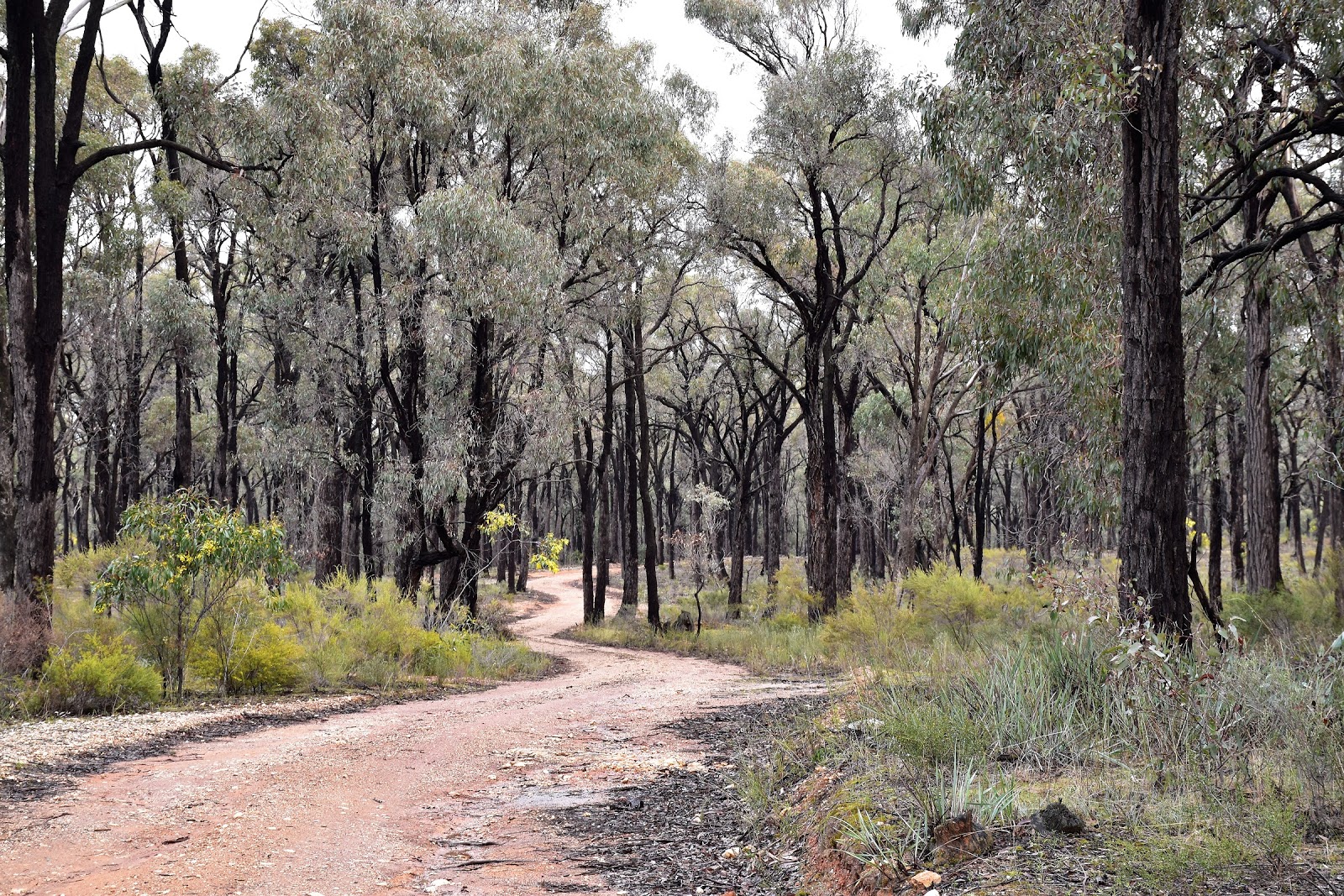
| After a couple of minutes walk along Monument Road I headed into the scrub along this track. |
|
Now I was using notes and a mud map today that are virtually twenty years old out of one of Tyrone Thomas' old tomes, so today was always going to be a bit of an exploratory walk (I'm actually reconsidering my no route map policy, especially on these walks that either don't have any notes or have information that is out of date or out of print - we'll see). So anyway after finding a likely looking track heading bush I set off towards my first point of interest, Queens Dam. Now my old notes said that numerous minor vehicle tracks diverge and rejoin in the forest, so be sure to you maintain a south-west bearing, well things haven't got any clearer on the ground in the twenty years or so since Mr Thomas wandered through the forest. Within 200 metres of entering the open forest I was making my way through a labyrinth of un signposted tracks, but with more luck than skill I somewhat surprisingly found myself at the fairly nondescript Queens Dam.
 |
Now you'd think following a track like this would be pretty easy but there are a lot of similar tracks branching off into the scrub at fairly regular intervals.
 |
| Queens Dam |
|
The open box and ironbark forest would make for some fairly easy off track walking through here, however with the area being littered with abandoned mine shafts it's not the safest place to go wandering around off piste. Leaving Queens Dam I almost immediately met a more substantial track, Queens Mine Track. Now with me not being 100% confident of my exact position in the forest (Queens Dam was a lot less impressive than the grand name might suggest) I decided to follow Queens Mine Track for awhile, figuring that if I wasn't at Queens Dam then the Queens Mine Track was likely to take me there and besides the track was more or less heading in the direction that I wanted to go. With some rural land starting to materialise through the trees it become clear that I was heading too far south west, after close consultation with my map and GPS I picked up a lesser track that was heading west and set off towards my next point of interest.
 |
The old mining operations have left their scars in the surrounding bush.
 |
It wasn't all ironbark forest today.
 |
| After following the more major dirt road from Queens Dam I picked up the lesser track on the right when I started to see some rural land ahead of me through the trees. |
|
|
Now I mentioned in the second paragraph that Moliagul has a couple of claims to fame and I was about to find the second one. Way back in 1869 a Cornish digger was kicking around the forest trying to scratch out a living from the dirt when his pick hit something hard just under the surface. The digger was John Deason and the hard object his pick had hit became known as the Welcome Stranger gold nugget, a gold nugget that weighed over 100kg. The gold nugget had to be hidden for awhile while Deason and his friend Richard Oates organised a group of friends to get it to the local Dunolly bank where it was cut up by a blacksmith so it could be weighed. Judging by the amount of mine shafts in the immediate area it seems every second gold prospector in Australia has tried their luck here. There is a small monument celebrating the discovery of the nugget, along with a picnic ground here but I didn't linger too long, instead heading off on a short interpretative walk. Unfortunately someone had felt the need to destroy all the information signs on the interpretative walk, so this little loop became a bit of an exercise in detective work trying to decipher what the significance of each site in the regenerating forest represented.
 |
The area surrounding the Welcome Stranger Picnic Ground is pockmarked with old mine shafts.
 |
Some of them resemble open graves....
 |
And some of them are dug in the middle of old roads.
 |
The second reason for Moliagul's fame.
 |
 |
There is an interpretative walk at the picnic ground.
 |
| Although unfortunately someone has seen the need to destroy all the signposts. |
|
|
|
|
|
|
After the little interpretative walk I left the picnic ground via the access road, heading north to where the road turns to bitumen I did a dog leg to the left instead and picked up another dirt track, Wayman Road. I was now heading north through more box and ironbark forest, although my main memories of this section were of the flowering wattle trees, the bright yellow flowers adding a lot of colour to the drab greys and greens of the Aussie bush today. My notes suggested that Wayman Road my be a little hard to follow as other tracks intersected as I made my way north, however unlike the earlier part of my stroll over to Queens Dam and the Welcome Stranger Picnic Ground this section was pretty straight forward really, I just stayed on the more major track and continued on in a generally northerly direction, eventually emerging from the scrub onto the sealed Bealiba Road exactly where my map suggested that I should.
 |
Hey, hey, leaving the Welcome Stranger Picnic Ground via the access road the sun came out for the first time today.
 |
Wayman Road made for easy and fairly straight forward walking.
 |
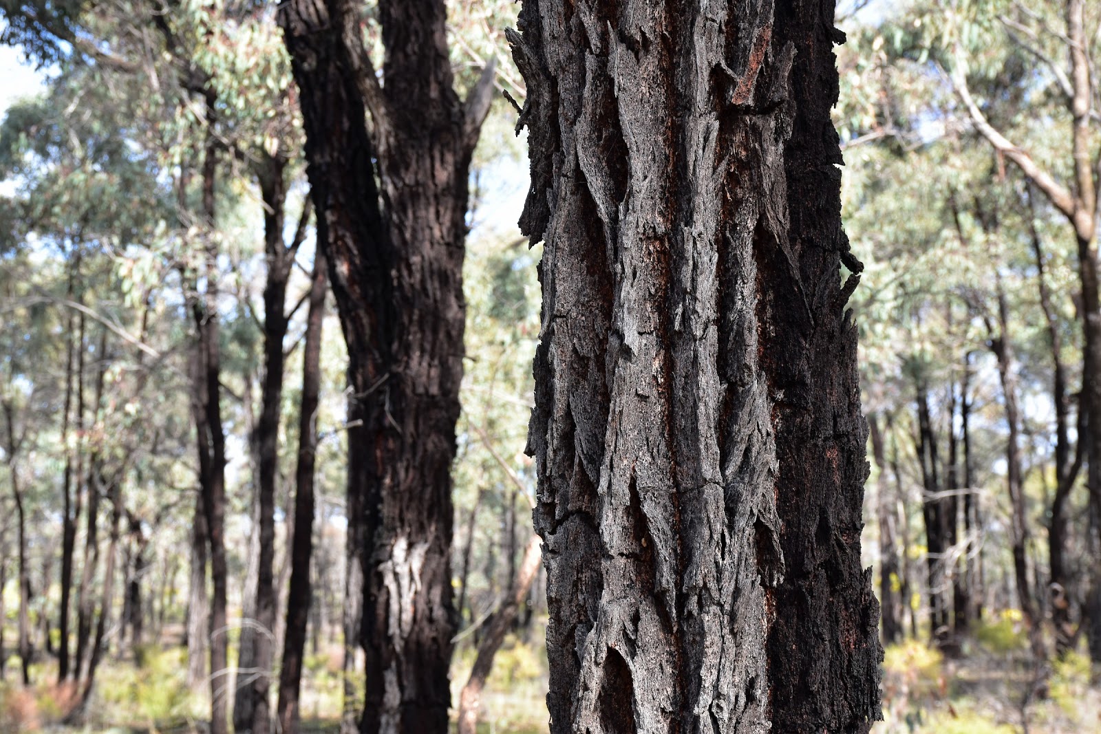
| Ironbark |
|
|
Turning east I followed Bealiba Road for around fifty metres before short cutting a corner and crossing the St Arnaud - Bendigo Road. I was now looking for a rough track heading up the side of Mount Moliagul, my notes said that the track headed bush opposite a rustic hut on the St Arnaud - Bendigo Road but the rustic hut has now been reclaimed by nature and isn't there anymore. To pick up the correct track to the summit I now headed into the bush at first track leading in a northerly direction at the edge of an open paddock which is to the west of the intersection of Bealiba Road and St Arnaud - Bendigo Road (clear as mud hey, this is why I'm considering uploading a decent map). Leaving the sealed St Arnaud - Bendigo Road my old track climbed fairly gently initially, heading straight on after a few hundred metres avoiding other tracks heading to the left and the right I soon started to climb a bit more seriously.
 |
This is the track you are looking for to climb Mount Moliagul, leaving the St Arnaud - Bendigo Road.
 |
Avoid tracks to the left and the right here.
 |
 |
| The old track heading up the spur hasn't seen much traffic lately by the look of it. |
|
|
|
With my route now climbing steadily the spur started to get a little bit more pronounced, now that was good news as it meant that there would be no navigational challenges now, I could just follow the high ground to the summit of Mount Moliagul. Now if all this sounds a bit daunting it's not really that hard, the telecommunication towers on the summit are seen frequently through the open forest so it would be pretty hard to go too far wrong up here. This old track heads up past some very deep mine shafts as it climbs, so deep that I struggled safely to see the bottom of some of them. The higher up this spur I got the better the walking became, the open grassy spur slowly turning rocky and steep for the last little pinch to the summit. My notes said that the last half a kilometre would be off track but there is actually a rough rocky track all the way to the summit nowadays.
 |
The summit of Mount Moliagul is visible on the climb sometimes, making navigation fairly easy.
 |
There were a lot of very deep mine shafts just beside the old track, the square corners on this indicate that it was dug by European diggers and not the Chinese diggers.
 |
Higher up the open grassy spur made for great walking.
 |
| Contrary to what my notes said there is now a rough rocky track all the way up the spur to the summit. |
|
|
|
The summit of Mount Moliagul is marred a little by all the towers but it is possible to move around a bit and get a photo without them. On a nicer day it would also be possible to find a quieter spot to have a picnic up here, although the only creatures doing any eating today were the local roos and wobblies snacking on the green grass. I didn't linger on the open top of Mount Moliagul too long this afternoon, with a cutting wind and a temperature well and truly in single digits I just stayed long enough to get a couple of photos before shouldering my pack and starting down the access road. Heading in a south westerly direction down the summit access road the views to the north and south continued for a fair way, at the same time though the weather was starting to close in on me, hmmm. Just as the track levelled out at the bottom of the descent the rain caught up with me, with a forest of wattles stretching into the distance I was keen to get a few photos here but unfortunately the overhead conditions limited my photographic ambitions a little.
 |
Mount Moliagul
 |
The view to the north from Mount Moliagul.
 |
And the view west.
 |
| Dropping down the summit access road the rural views continued, but the rain was catching me. |
|
|
|
After passing through the access gate I headed north for a very short section to meet Rheola Road (well after heading south for a little while before I consulted my map;), once I met up with Rheola Road it was just a matter of turning right and following it back into Moliagul in the light rain. Thankfully by the time I arrived back at the old town the precipitation had more or less stopped and I was able to wander around the ghost town checking out a few of the old buildings. With the rain starting again I climbed into the ute and set off to find a coffee after what had been a nice and interesting walk.
 |
I don't think I've ever seen so many wattles.
 |
Conditions were fairly damp and overcast as I walked the last couple of kilometres back to the ute.
 |
 |
| Just before I arrived back at Moliagul the rain cleared, giving me one last view of Mount Moliagul. |
|
|
|
The Dirt.
I walked 14.8 kilometres at an average speed of 3.8 kph today. With 337 metres of climbing and a fair bit of navigational work I'd rate this as a medium grade walk. As I mentioned this walk has been written up by Tyrone Thomas in his 1998 edition of 60 Walks in Central Victoria's Gold Fields and Spa Country. Parks Vic don't have much information online unfortunately so if you can't get your hands on a copy of the old guide book then a Vic Map might be your best bet. There are a lot of tracks criss crossing this section of Victoria and the overwhelming majority of them aren't named or mapped, even with a GPS it pays to keep an eye on things so that you know roughly where you are, all that said though the open country and numerous tracks mean that you can generally get to where you need to be without too much trouble. If you like your history, open dry forests and a hill climb then maybe this is a stroll that you may consider.
Relevant Posts.
 |
| Wandering around Moliagul I checked out some of the old buildings, this one is a private residence that is being renovated, I can see a B&B in the future. |
 |
| The old Moliagul School was built in 1872 and closed down in 1970, it's now used as a hall. |
 |
| What do they say? Always buy the cheapest house on the street.......a renovators delight at Moliagul. |
 |
| This was the second hotel built on this site, the first one was built in 1854 and burnt down, this one was built in 1880. |
The walk starts from the intersection of Dunolly - Moliagul Road and Monument Road. Heading south into the bush along the first track to the south, off Monument Road.


No comments:
Post a Comment