 |
| Early morning, Tarra-Bulga National Park. |
The Strzelecki Ranges don't get a lot of love in bushwalking guide books or blogs, with Wilsons Promontory on one side and the Australian Alps on the other, this mountain range is often overlooked when planning a walk. Over the years I've poked around the Strzelecki's a bit, driving the Grand Ridge Road a few times and walking at Mount Worth, Morwell National Park and Tarra-Bulga National Park. The 2009 Black Saturday Bushfires decimated large areas of the Strzelecki Ranges and part of the response to help get the local communities back on their feet was some government money for a community organised long distance walking track, the Grand Strzelecki Track. Basically the Grand Strzelecki Track links Morwell National Park with Tarra-Bulga National Park before heading out from Tarra-Bulga on a series of one and two day loops. It was one of these loops that I decided to check out today, the Mount Tassie Loop.
 |
| It was another chilly start to the day. |
At 754 metres Mount Tassie is the highest mountain in the Strzelecki Ranges and with overnight snow predicted down to around 600 metres I was hoping for a little of the white stuff to liven up my photos a bit. There was a reason that I was hoping for something to spice up the walk a bit, you see a large percentage of this walk is away from the protection of the national park and heads through timber harvesting areas and I wasn't overly confident that those sections would be full of scenic highlights. Arriving at the Tarra-Bulga National Park visitor centre at Balook nice and early with the ambient temperature hovering around 0˚ the possibility of snow was still there, although I'd seen no evidence on any of the hills on my drive up from Traralgon. Re-setting the GPS I shouldered the pack and set off quickly (we'll relatively quickly). For anyone who is thinking of doing this walk the track you're looking for is Link Track and it heads into the bush up behind the BBQ shelter, once you're on it all becomes clear, but it's not an obvious spot.
 |
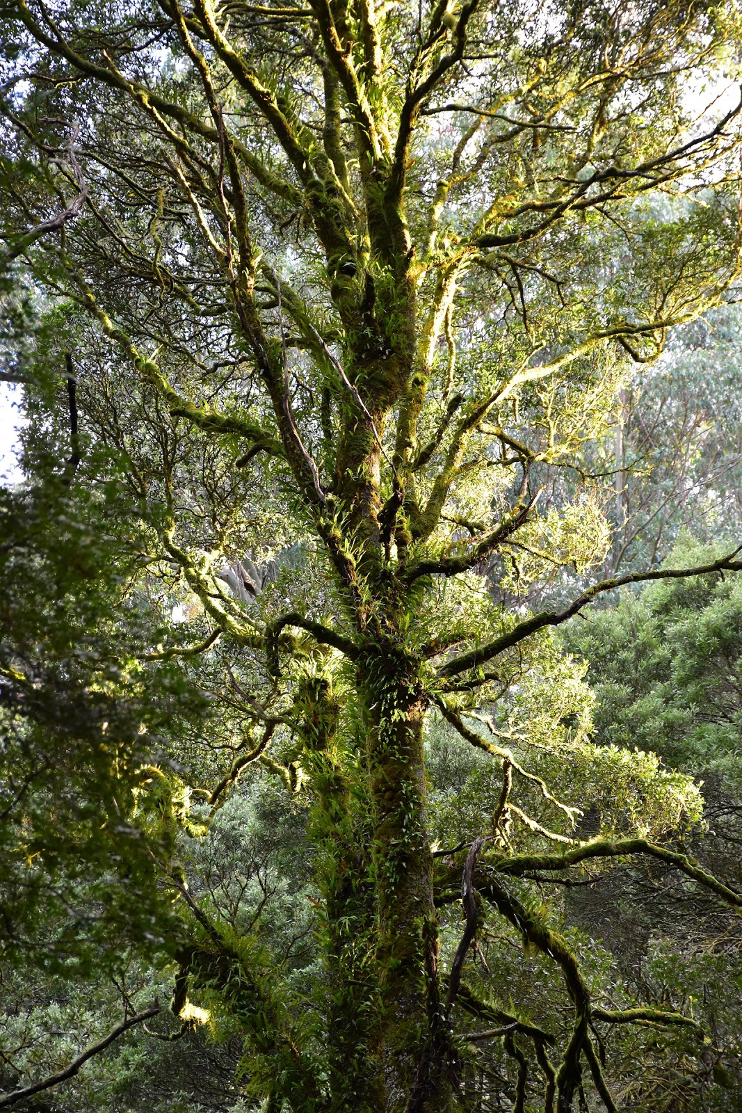
| The mist was still rising as I made my way along Link Track this morning. |
The sun was shining and the mist was lifting as I made my way along Link Track, life was pretty good. After a couple of hundred metres along Link Track I emerged from the wall of green, a dog leg to the left soon had me heading back into the wall of green as I turned off the Grand Ridge Road onto Telecom Track. Once again I was enveloped by the Cool Temperate Rainforest, Telecom Track gently climbed up towards Drysdale Road, it's surface very muddy and slippery after all the recent rain we've had. Now when I say track and road for the most part these old tracks are either long ago closed to vehicles or open to just management vehicles so the walking is pretty good, the only exception being a very short stretch along the Grand Ridge Road and a slightly longer section along the very quiet Callignee South Road. The soft and muddy walking finished for awhile when I turned hard left onto Drysdale Road.
 |
After a few metres walking up the Grand Ridge Road I headed up a fairly muddy Telecom Track.
 |
Telecom Track is still within the embrace of the national park.
 |
| On meeting Drysdale Road I turned hard left....I'd return from the right later in the day. |
|
|
It was along Drysdale Road that I left the protection of the national park and entered plantation land, it was also along Drysdale Road that I saw my only small patch of snow for the day, hmmm so much for that theory, it looks like my photos will have to stand alone without any enhancement from the white fluffy stuff. Not unexpectedly seeing I was now walking through plantation land, the large mountain ash and lush rain forest largely disappeared for a while, now that wasn't all because of logging though, the Black Saturday Fires had also decimated the flora through here. There was one advantage of the forest having been thinned down and that was that the long reaching views had opened up a bit, we're not talking South-West Tasmania here though, I had views over the receding ridges of plantation country, the coal fired power stations down in the Latrobe Valley and the telecommunication towers crowning Mount Tassie.
 |
| Drysdale Road heads out of Tarra-Bulga National Park and into plantation forest. |
Reaching the old Morningside Grange Homestead Site I had today's most notable wildlife encounter as a Hairy Nosed Wombat made a dash for cover, I even managed to get a blurry photo which was more than I could do with the numerous Lyrebirds that I saw today. Apart from a few small bits of broken glass on the ground there is no real evidence of the old homestead, but the open cleared area now makes for a reasonable camp site if you're doing an overnighter. Drysdale Road drops 300 metres fairly quickly as it heads down to meet up with West Face Track and while nowhere near the slipperiest track that I'd walk today it still paid to be fairly careful on the descent, my hiking poles were certainly appreciated. The views along here are fairly constant but it was the view across to Mount Tassie that drew my eye the most, no doubt because I'd soon be climbing it.
 |
Old mate the wombat wasn't keen on a photo.
 |
The clearing that is all that is left of the old Morningside Grange Homestead Site.
 |
Drysdale Road dropped fairly steeply but made for nice walking.
 |
That's Mount Tassie in the distance.
 |
| It was still pretty chilly as I descended down Drysdale Road. |
|
|
|
|
Turning right onto West Face Track the majority of today's descending was now over. As the name suggests West Face Track contours the west face of the Mount Tassie massif, the terrain along this track is reputably some of the steepest in the Strzelecki Ranges and I was indeed frequently gazing out over the Traralgon Creek Valley. As I gently climbed up West Face Track the route passed a series of small waterfalls, the first waterfall, Forget-me-not Falls even features a picnic table that is almost situated under the falls it's that close. A little further along I arrived at the short side trip to the next waterfall, West Face Falls, this little waterfall required a slightly rougher walk to view and probably wouldn't be suitable for walkers that don't share my cat like reflexes(?), both the waterfalls are well signposted but require following a taped route for a short distance.
 |
Forget-me-not Falls.
 |
West Face Track contoured (well climbed gently to be truly accurate) around the west face of Mount Tassie.
 |
The taped route to West Face Falls.
 |
West Face Falls.
 |
 |
| West Face Track |
|
|
|
|
|
Leaving West Face Falls I continued the long, gentle climb up West Face Track the track passing in and out of numerous damp gullies that featured some remnant old growth vegetation. After checking out another small un-named waterfall cascading down the mountain I continued on for for another fifteen minutes or so. I was now looking for Pine Trial Track and this track was fairly critical to today's walk, miss it and I'd be walking a long way out of the way. Like most of the track junctions though Pine Trail Track would be almost impossible to miss, the numerous track markers, signs and reflective tape making it very obvious. Pine Trial Track climbed fairly steeply up to meet Traralgon-Balook Road at an old quarry, the communication towers crowning Mount Tassie now very close at hand.
 |
West Face Track meanders in and out of numerous damp gullies which hold onto some remanent old growth forest.
 |
 |
Some of the gullies featured their own water features.
 |
 |
| The junction of West Face and Pine Trial Tracks is probably the most crucial track junction on today's walk, miss it and you'll have a lot longer walk. |
|
|
|
|
Crossing the sealed road I picked up a management track climbing very steeply, something didn't quite feel right though and glancing to my left I could see a grassy track climbing up a gully. Wandering over to check out the old track I noticed a marker post lying on the ground, a short distance away was a signpost also lying in the grass, maybe it was just a coincidence but this was one of the few places that has public vehicle access and this was the only place that I noticed any vandalism. Now on the correct route (the management track will get you to the top as well, it's steeper and less scenic though from what I saw). The grassy track that I was climbing slowly arced around to the south crossing open grassy slopes before arriving at a small wind break with a couple of picnic tables and the bushfire memorial. With a bit of shelter this made for a nice spot for a bit of a break although it's not the official summit, the actual high point is at the southern end of the Mount Tassie plateau. From up here the views were extensive as you would expect, the steam from the cooling towers at the power stations down in the Latrobe Valley being a slightly different view than that of which I normally get on a bushwalk.
 |
Crossing the Traralgon-Balook Road at the old quarry, my route climbed a few metres up the management trail before branching left onto a grassy pad, the signs are currently laying in the grass here.
 |
This is the slightly more scenic track to the summit.
 |
The view down towards the Latrobe Valley from Mount Tassie.
 |
The Black Saturday memorial on Mount Tassie.
|
|
|
|
With a bit of sleet coming through I decided to head off again, picking up another grassy track that parallels the main access track for the towers. Passing just to the east of the main summit I left the open grassy slopes behind and once again entered revegetated bush, dropping down to meet Callignee South Road. The Callignee fire was one of the most severe of the Black Saturday fires, wiping out the town and taking lives, the fire started very near to here and burnt all the way down into the Latrobe Valley. Heading east along Callignee South Road I was walking through country owned by HVP Plantations and they have spent quite a bit of money, not only maintaining the track but also putting up a plethora of information signs that explain not only the timber industry but also ecology and indigenous, as well as early European settler history. On my short walk along Callignee Road I entered a belt of old growth forest which is the home to some old mountain ash stumps (the ye-olde loggers selectively logged, not like the devastation of a clear felled coupe), these old stumps are absolutely massive and it boggles the mind a bit thinking how tall those old mountain ash trees must have been.
 |
Leaving the lookout you need to walk fifty metres down this management track to pick up a grassy track heading off to the right.
 |
The plateau like top of Mount Tassie. I got a little sleet while I was walking across here.
 |
Heading along Callignee South Road towards that belt of old growth trees.
 |
| There are a couple of these massive old stumps beside Calligne South Road, these old mountain ash must have been huge trees. |
|
|
|
After the fifteen minute road bash along Callignee South Road I headed off south east along the Duff Sawmill Heritage Trail. As I mentioned earlier this is HVP Plantation land and to be fair they have done a superb job in maintaining this beautiful track. The Duff Sawmill Heritage Trail passes through blackwood forests, large sections of cool temperate rainforest as well as old growth eucalyptus. The trail winds it's way up and down through numerous shallow gullies and while the red clay surface was very slippery it was also probably the best section of today's long ramble. Eventually my meandering route emerged onto Cable Track before crossing the sealed Traralgon-Balook Road and headed up to meet Drysdale Road again. Now in theory my walk was now coming to it's end, after heading south along Drysdale Road for fifteen minutes I met up with Telecom Track and started to retrace my mornings route.
 |
Believe it or not this was probably the most enjoyable section of today's walk.
 |
The old growth forest along the Duff Sawmill Heritage Trail was impressive....to say the least!
 |
 |
The Duff Sawmill Heritage Trail, here it's passing under the old tree, is also the slipperiest section of track today.
 |
 |
| Duff Sawmill Heritage Trail |
|
|
|
|
|
Being fairly early in the day still, I decided to head down to the famous suspension bridge rather than head straight back to the car park via Link Track. I'd been here a few months ago walking Scenic Track, but misty rain had limited my photo opportunities a little. Wandering down the access road I picked up the un-signposted track that starts in the rustic picnic shelter, yep you have to pass through the shelter to find the start of this short section of track, it's worth finding though as the track meanders it's way down a very damp gully to eventually meet Scenic Track at the suspension bridge. I was slightly surprised not to find any other walkers here, this spot is a very easy walk from either the visitor centre or the picnic area where my trail started. After snapping a few photos of the old bridge and the surrounding wall of green I started my short climb up Ash Track back to the ute. Now if you ever want to see a Lyrebird in the wild then I think Ash Track has to be one of the best spots I've visited. Like my visit earlier this year, on this visit I once again had the pleasure of watching these beautiful birds scratching around in the dirt, I even had a male jump up on a branch to show off his tail feathers, do you think I could get a photo though..... A few minutes after my last lyrebird encounter I arrived back at the almost deserted car park and headed off on the two and a half hour drive home.
 |
Climbing back up towards Drysdale Road.
 |
It doesn't feel right but head through the picnic shelter to pick up the great track down to the suspension bridge.
 |
The short walk down the rainforest gully to the suspense bridge is not only easy but the forest is primordial.
 |
| The famous Corrigan Suspension Bridge in Tarra-Bulga National Park. |
|
|
|
The Dirt.
OK, I walked 22.4 kilometres on today's outing at an average speed of 3.6 kph. With 747 metres of climbing I'd rate this as a hard walk I suppose, although only because of the distance and climbing involved, the tracks are generally all pretty good (although can be slippery so take walking poles if you have them) and with a couple of exceptions, are extremely well signposted and marked. The biggest navigational challenge when I did the walk was the final section up Mount Tassie after crossing Traralgon-Balook Road, you won't get lost here though as the tops are easily visible. I used the excellent topo map produced by the Grand Strzelecki Track people, the map can be purchased from their
web site. The web site is also a handy resource for any other information that you may need if you are considering walking the Grand Strzelecki Track. Now as you have probably picked up on this isn't a wilderness style of walk, but as I've mentioned before variety is a good thing in my eyes and this is a walk that offers a lot of variety, from old growth forest to far reaching views, open grassy tops to regenerating plantations, there is plenty of variety on offer here. Now what about my snow plan, we'll after the walk I was talking to an old timer in Balook and he mentioned that it had snowed up here...yesterday, story of my life really :)
Relevant Posts.
 |
| I spotted numerous lyrebirds today, but this was the best I could do capturing one with the camera, the tail feathers are sticking up behind the log. |
 |
| Another nice walk coming to it's conclusion. |


No comments:
Post a Comment